地図を見る
| 地図 | タイトル | 年 | 前回の更新  |
ステータス |
|---|---|---|---|---|
|
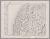
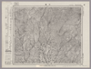
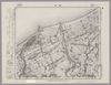
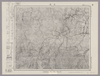
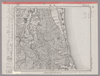
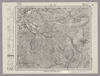
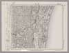
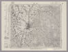
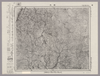
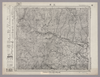
Image from the Map Collections courtesy Stanford University Libraries, licensed under a Creative Commons Attribution-Noncommercial 3.0 Unported License. © Stanford University. 【図幅名】 弥彦 【測量時期】 明治44年測図/昭和6年修正/昭和28年応急修正 【発行時期】 昭和33年6月発行 【記号】 長岡2号(共11面) 【測量機関】 国土地理院 【備考】 応急修正版
リンク: 出所・参照情報
|
4ヶ月 前 | 4個の基準点 | |
|
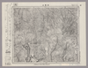
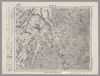
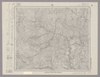
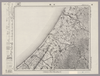
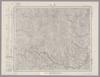
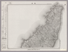
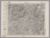
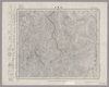
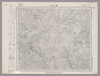
Image from the Map Collections courtesy Stanford University Libraries, licensed under a Creative Commons Attribution-Noncommercial 3.0 Unported License. © Stanford University. 【図幅名】 新津 【測量時期】 明治44年測図/昭和6年要部修正 【発行時期】 昭和9年6月発行 【記号】 新潟14号(共16面) 【測量機関】 大日本帝国陸地測量部 【備考】
リンク: 出所・参照情報
|
4ヶ月 前 | 4個の基準点 | |
|
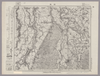
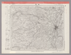
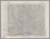
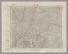
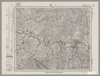
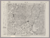
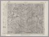
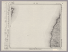
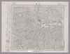
Image from the Map Collections courtesy Stanford University Libraries, licensed under a Creative Commons Attribution-Noncommercial 3.0 Unported License. © Stanford University. 【図幅名】 津川 【測量時期】 明治44年測図/昭和6年修正、測図の縮図 【発行時期】 昭和9年7月発行 【記号】 新潟10号(共16面) 【測量機関】 大日本帝国陸地測量部 【備考】
リンク: 出所・参照情報
|
4ヶ月 前 | 4個の基準点 | |
|
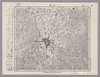
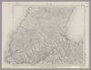
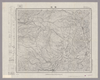
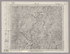
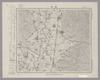
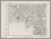
Image from the Map Collections courtesy Stanford University Libraries, licensed under a Creative Commons Attribution-Noncommercial 3.0 Unported License. © Stanford University. 【図幅名】 大日岳 【測量時期】 大正2年測図/昭和6年要部修正 【発行時期】 【記号】 新潟6号 【測量機関】 参謀本部 【備考】 秘
リンク: 出所・参照情報
|
4ヶ月 前 | 4個の基準点 | |
|
Image from the Map Collections courtesy Stanford University Libraries, licensed under a Creative Commons Attribution-Noncommercial 3.0 Unported License. © Stanford University. 【図幅名】 熱塩 【測量時期】 大正2年測図/昭和6年要部修正、測図の縮図 【発行時期】 昭和9年4月発行 【記号】 新潟2号 【測量機関】 大日本帝国陸地測量部 【備考】
リンク: 出所・参照情報
|
4ヶ月 前 | 4個の基準点 | |
|
Image from the Map Collections courtesy Stanford University Libraries, licensed under a Creative Commons Attribution-Noncommercial 3.0 Unported License. © Stanford University. 【図幅名】 吾妻山 【測量時期】 明治41年測図/昭和6年要部修正 【発行時期】 昭和8年1月発行 【記号】 福島14号(共18面) 【測量機関】 大日本帝国陸地測量部 【備考】
リンク: 出所・参照情報
|
4ヶ月 前 | 4個の基準点 | |
|
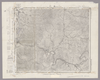
Image from the Map Collections courtesy Stanford University Libraries, licensed under a Creative Commons Attribution-Noncommercial 3.0 Unported License. © Stanford University. 【図幅名】 福島 【測量時期】 明治41年測図/大正14年鉄道補入/昭和6年要部修正 【発行時期】 昭和21年11月発行 【記号】 福島10号(共18面) 【測量機関】 内務省地理調査所 【備考】
リンク: 出所・参照情報
|
4ヶ月 前 | 4個の基準点 | |
|
Image from the Map Collections courtesy Stanford University Libraries, licensed under a Creative Commons Attribution-Noncommercial 3.0 Unported License. © Stanford University. 【図幅名】 舳倉島 【測量時期】 明治43年測図/昭和4年修正 【発行時期】 昭和11年6月発行 【記号】 輪島1号(共3面) 【測量機関】 大日本帝国陸地測量部 【備考】
リンク: 出所・参照情報
|
4ヶ月 前 | 4個の基準点 | |
|
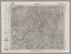
Image from the Map Collections courtesy Stanford University Libraries, licensed under a Creative Commons Attribution-Noncommercial 3.0 Unported License. © Stanford University. 【図幅名】 保原 【測量時期】 明治41年測図/昭和8年要部修正 【発行時期】 昭和11年3月発行 【記号】 福島6号(共18面) 【測量機関】 大日本帝国陸地測量部 【備考】
リンク: 出所・参照情報
|
4ヶ月 前 | 4個の基準点 | |
|
Image from the Map Collections courtesy Stanford University Libraries, licensed under a Creative Commons Attribution-Noncommercial 3.0 Unported License. © Stanford University. 【図幅名】 河原田 【測量時期】 大正2年測図/昭和9年修正 【発行時期】 【記号】 長岡9号 【測量機関】 参謀本部 【備考】 秘
リンク: 出所・参照情報
|
4ヶ月 前 | 4個の基準点 | |
|
Image from the Map Collections courtesy Stanford University Libraries, licensed under a Creative Commons Attribution-Noncommercial 3.0 Unported License. © Stanford University. 【図幅名】 岩首 【測量時期】 大正2年測図/昭和9年修正 【発行時期】 昭和10年10月発行 【記号】 長岡5号(共11面) 【測量機関】 大日本帝国陸地測量部 【備考】
リンク: 出所・参照情報
|
4ヶ月 前 | 4個の基準点 | |
|
Image from the Map Collections courtesy Stanford University Libraries, licensed under a Creative Commons Attribution-Noncommercial 3.0 Unported License. © Stanford University. 【図幅名】 内野 【測量時期】 明治44年測図/昭和6年修正 【発行時期】 昭和8年1月発行 【記号】 長岡1号(共11面) 【測量機関】 大日本帝国陸地測量部 【備考】
リンク: 出所・参照情報
|
4ヶ月 前 | 4個の基準点 | |
|
Image from the Map Collections courtesy Stanford University Libraries, licensed under a Creative Commons Attribution-Noncommercial 3.0 Unported License. © Stanford University. 【図幅名】 新潟 【測量時期】 明治44年測図/昭和6年要部修正 【発行時期】 昭和9年6月発行 【記号】 新潟13号(共16面) 【測量機関】 大日本帝国陸地測量部 【備考】
リンク: 出所・参照情報
|
4ヶ月 前 | 13個の基準点 | |
|
Image from the Map Collections courtesy Stanford University Libraries, licensed under a Creative Commons Attribution-Noncommercial 3.0 Unported License. © Stanford University. 【図幅名】 新発田 【測量時期】 明治44年測図/昭和6年修正 【発行時期】 【記号】 新潟9号(共16面) 【測量機関】 参謀本部 【備考】 秘
リンク: 出所・参照情報
|
4ヶ月 前 | 4個の基準点 | |
|
Image from the Map Collections courtesy Stanford University Libraries, licensed under a Creative Commons Attribution-Noncommercial 3.0 Unported License. © Stanford University. 【図幅名】 飯豊山 【測量時期】 大正2年測図/昭和6年要部修正 【発行時期】 昭和8年11月発行 【記号】 新潟5号(共16面) 【測量機関】 大日本帝国陸地測量部 【備考】
リンク: 出所・参照情報
|
4ヶ月 前 | 4個の基準点 | |
|
Image from the Map Collections courtesy Stanford University Libraries, licensed under a Creative Commons Attribution-Noncommercial 3.0 Unported License. © Stanford University. 【図幅名】 米沢 【測量時期】 明治41年測図/昭和6年要部修正/昭和27年応急修正 【発行時期】 昭和28年3月発行 【記号】 福島13号(共18面) 【測量機関】 国土地理院 【備考】 応急修正版
リンク: 出所・参照情報
|
4ヶ月 前 | 4個の基準点 | |
|
Image from the Map Collections courtesy Stanford University Libraries, licensed under a Creative Commons Attribution-Noncommercial 3.0 Unported License. © Stanford University. 【図幅名】 玉庭 【測量時期】 大正2年測図/昭和6年要部修正 【発行時期】 昭和8年10月発行 【記号】 新潟1号(共16面) 【測量機関】 大日本帝国陸地測量部 【備考】
リンク: 出所・参照情報
|
4ヶ月 前 | 4個の基準点 | |
|
Image from the Map Collections courtesy Stanford University Libraries, licensed under a Creative Commons Attribution-Noncommercial 3.0 Unported License. © Stanford University. 【図幅名】 関 【測量時期】 明治41年測図/昭和6年要部修正 【発行時期】 昭和8年1月発行 【記号】 福島9号(共18面) 【測量機関】 大日本帝国陸地測量部 【備考】
リンク: 出所・参照情報
|
4ヶ月 前 | 4個の基準点 | |
|
Image from the Map Collections courtesy Stanford University Libraries, licensed under a Creative Commons Attribution-Noncommercial 3.0 Unported License. © Stanford University. 【図幅名】 桑折 【測量時期】 明治41年測図/昭和6年部分修正/昭和8年部分修正 【発行時期】 昭和10年11月発行 【記号】 福島5号(共18面) 【測量機関】 大日本帝国陸地測量部 【備考】
リンク: 出所・参照情報
|
4ヶ月 前 | 4個の基準点 | |
|
Image from the Map Collections courtesy Stanford University Libraries, licensed under a Creative Commons Attribution-Noncommercial 3.0 Unported License. © Stanford University. 【図幅名】 相川 【測量時期】 大正2年測図/昭和9年修正 【発行時期】 【記号】 相川12号(共3面) 【測量機関】 参謀本部 【備考】 秘
リンク: 出所・参照情報
|
4ヶ月 前 | 4個の基準点 | |
|
Image from the Map Collections courtesy Stanford University Libraries, licensed under a Creative Commons Attribution-Noncommercial 3.0 Unported License. © Stanford University. 【図幅名】 角田 【測量時期】 明治41年測図/昭和8年修正/昭和27年応急修正 【発行時期】 昭和35年7月発行 【記号】 福島1号(共18面) 【測量機関】 国土地理院 【備考】 応急修正版
リンク: 出所・参照情報
|
4ヶ月 前 | 4個の基準点 | |
|
Image from the Map Collections courtesy Stanford University Libraries, licensed under a Creative Commons Attribution-Noncommercial 3.0 Unported License. © Stanford University. 【図幅名】 水津 【測量時期】 大正2年測図/昭和9年修正/昭和28年応急修正 【発行時期】 昭和32年5月発行 【記号】 相川8号(共3面) 【測量機関】 国土地理院 【備考】 応急修正版
リンク: 出所・参照情報
|
4ヶ月 前 | 4個の基準点 | |
|
Image from the Map Collections courtesy Stanford University Libraries, licensed under a Creative Commons Attribution-Noncommercial 3.0 Unported License. © Stanford University. 【図幅名】 中条 【測量時期】 明治44年測図/昭和6年修正 【発行時期】 昭和8年6月発行 【記号】 村上12号(共12面) 【測量機関】 大日本帝国陸地測量部 【備考】
リンク: 出所・参照情報
|
4ヶ月 前 | 4個の基準点 | |
|
Image from the Map Collections courtesy Stanford University Libraries, licensed under a Creative Commons Attribution-Noncommercial 3.0 Unported License. © Stanford University. 【図幅名】 小国 【測量時期】 大正2年測図/昭和6年要部修正 【発行時期】 昭和8年6月発行 【記号】 村上8号(共12面) 【測量機関】 大日本帝国陸地測量部 【備考】
リンク: 出所・参照情報
|
4ヶ月 前 | 4個の基準点 | |
|
Image from the Map Collections courtesy Stanford University Libraries, licensed under a Creative Commons Attribution-Noncommercial 3.0 Unported License. © Stanford University. 【図幅名】 上ノ山 【測量時期】 明治44年測図/昭和6年要部修正 【発行時期】 昭和8年2月発行 【記号】 仙台12号(共16面) 【測量機関】 大日本帝国陸地測量部 【備考】
リンク: 出所・参照情報
|
4ヶ月 前 | 4個の基準点 | |
|
Image from the Map Collections courtesy Stanford University Libraries, licensed under a Creative Commons Attribution-Noncommercial 3.0 Unported License. © Stanford University. 【図幅名】 手ノ予 【測量時期】 大正2年測図/昭和6年部分修正 【発行時期】 昭和8年1月発行 【記号】 村上4号(共12面) 【測量機関】 大日本帝国陸地測量部 【備考】
リンク: 出所・参照情報
|
4ヶ月 前 | 4個の基準点 | |
|
Image from the Map Collections courtesy Stanford University Libraries, licensed under a Creative Commons Attribution-Noncommercial 3.0 Unported License. © Stanford University. 【図幅名】 赤湯 【測量時期】 明治43年測図/昭和6年修正 【発行時期】 昭和9年5月発行 【記号】 仙台16号(共16面) 【測量機関】 大日本帝国陸地測量部 【備考】
リンク: 出所・参照情報
|
4ヶ月 前 | 4個の基準点 | |
|
Image from the Map Collections courtesy Stanford University Libraries, licensed under a Creative Commons Attribution-Noncommercial 3.0 Unported License. © Stanford University. 【図幅名】 白石 【測量時期】 昭和8年測図 【発行時期】 【記号】 仙台8号(共16面) 【測量機関】 内務省地理調査所 【備考】
リンク: 出所・参照情報
|
4ヶ月 前 | 4個の基準点 | |
|
Image from the Map Collections courtesy Stanford University Libraries, licensed under a Creative Commons Attribution-Noncommercial 3.0 Unported License. © Stanford University. 【図幅名】 岩沼 【測量時期】 明治40年測図/昭和3年修正/昭和4年鉄道補入 【発行時期】 昭和6年11月発行 【記号】 仙台4号(共16面) 【測量機関】 大日本帝国陸地測量部 【備考】
リンク: 出所・参照情報
|
4ヶ月 前 | 4個の基準点 | |
|
Image from the Map Collections courtesy Stanford University Libraries, licensed under a Creative Commons Attribution-Noncommercial 3.0 Unported License. © Stanford University. 【図幅名】 鷲崎 【測量時期】 大正2年測図/昭和9年修正 【発行時期】 【記号】 相川11号 【測量機関】 参謀本部 【備考】 秘
リンク: 出所・参照情報
|
4ヶ月 前 | 4個の基準点 | |
|
Image from the Map Collections courtesy Stanford University Libraries, licensed under a Creative Commons Attribution-Noncommercial 3.0 Unported License. © Stanford University. 【図幅名】 塩野町 【測量時期】 大正2年測図/昭和6年要部修正 【発行時期】 昭和8年3月発行 【記号】 村上7号(共12面) 【測量機関】 大日本帝国陸地測量部 【備考】
リンク: 出所・参照情報
|
4ヶ月 前 | 4個の基準点 | |
|
Image from the Map Collections courtesy Stanford University Libraries, licensed under a Creative Commons Attribution-Noncommercial 3.0 Unported License. © Stanford University. 【図幅名】 荒砥 【測量時期】 明治43年測図/昭和6年要部修正 【発行時期】 昭和8年4月発行 【記号】 仙台15号(共16面) 【測量機関】 大日本帝国陸地測量部 【備考】
リンク: 出所・参照情報
|
4ヶ月 前 | 4個の基準点 | |
|
Image from the Map Collections courtesy Stanford University Libraries, licensed under a Creative Commons Attribution-Noncommercial 3.0 Unported License. © Stanford University. 【図幅名】 山形 【測量時期】 明治36年測図/昭和6年修正 【発行時期】 昭和22年3月発行 【記号】 仙台11号(共16面) 【測量機関】 内務省地理調査所 【備考】
リンク: 出所・参照情報
|
4ヶ月 前 | 4個の基準点 | |
|
Image from the Map Collections courtesy Stanford University Libraries, licensed under a Creative Commons Attribution-Noncommercial 3.0 Unported License. © Stanford University. 【図幅名】 朝日岳 【測量時期】 大正2年測図/昭和6年部分修正 【発行時期】 昭和8年9月発行 【記号】 村上3号(共12面) 【測量機関】 大日本帝国陸地測量部 【備考】
リンク: 出所・参照情報
|
4ヶ月 前 | 4個の基準点 | |
|
Image from the Map Collections courtesy Stanford University Libraries, licensed under a Creative Commons Attribution-Noncommercial 3.0 Unported License. © Stanford University. 【図幅名】 網地嶋 【測量時期】 大正2年測図/昭和8年要部修正 【発行時期】 昭和10年11月発行 【記号】 石巻11号(共9面) 【測量機関】 大日本帝国陸地測量部 【備考】
リンク: 出所・参照情報
|
4ヶ月 前 | 4個の基準点 | |
|
Image from the Map Collections courtesy Stanford University Libraries, licensed under a Creative Commons Attribution-Noncommercial 3.0 Unported License. © Stanford University. 【図幅名】 粟島 【測量時期】 大正2年測図/昭和9年修正 【発行時期】 昭和11年8月発行 【記号】 村上14号(共12面) 【測量機関】 大日本帝国陸地測量部 【備考】
リンク: 出所・参照情報
|
4ヶ月 前 | 4個の基準点 | |
|
Image from the Map Collections courtesy Stanford University Libraries, licensed under a Creative Commons Attribution-Noncommercial 3.0 Unported License. © Stanford University. 【図幅名】 勝木 【測量時期】 大正2年測図/昭和9年部分修正 【発行時期】 昭和11年9月発行 【記号】 村上6号(共12面) 【測量機関】 大日本帝国陸地測量部 【備考】
リンク: 出所・参照情報
|
4ヶ月 前 | 4個の基準点 | |
|
Image from the Map Collections courtesy Stanford University Libraries, licensed under a Creative Commons Attribution-Noncommercial 3.0 Unported License. © Stanford University. 【図幅名】 笹川 【測量時期】 大正2年測図/昭和9年修正 【発行時期】 昭和11年4月発行 【記号】 村上10号(共12面) 【測量機関】 大日本帝国陸地測量部 【備考】
リンク: 出所・参照情報
|
4ヶ月 前 | 4個の基準点 | |
|
Image from the Map Collections courtesy Stanford University Libraries, licensed under a Creative Commons Attribution-Noncommercial 3.0 Unported License. © Stanford University. 【図幅名】 大鳥池 【測量時期】 大正2年測図/昭和6年部分修正 【発行時期】 昭和8年9月発行 【記号】 村上2号(共12面) 【測量機関】 大日本帝国陸地測量部 【備考】
リンク: 出所・参照情報
|
4ヶ月 前 | 4個の基準点 | |
|
Image from the Map Collections courtesy Stanford University Libraries, licensed under a Creative Commons Attribution-Noncommercial 3.0 Unported License. © Stanford University. 【図幅名】 楯岡 【測量時期】 明治34年測図/昭和6年修正 【発行時期】 昭和9年6月発行 【記号】 仙台10号(共16面) 【測量機関】 大日本帝国陸地測量部 【備考】
リンク: 出所・参照情報
|
4ヶ月 前 | 4個の基準点 | |
|
Image from the Map Collections courtesy Stanford University Libraries, licensed under a Creative Commons Attribution-Noncommercial 3.0 Unported License. © Stanford University. 【図幅名】 左沢 【測量時期】 明治43年測図/昭和6年要部修正 【発行時期】 昭和8年7月発行 【記号】 仙台14号(共16面) 【測量機関】 大日本帝国陸地測量部 【備考】
リンク: 出所・参照情報
|
4ヶ月 前 | 4個の基準点 | |
|
Image from the Map Collections courtesy Stanford University Libraries, licensed under a Creative Commons Attribution-Noncommercial 3.0 Unported License. © Stanford University. 【図幅名】 関山峠 【測量時期】 明治34年測図/昭和6年修正 【発行時期】 昭和7年2月発行 【記号】 仙台6号(共16面) 【測量機関】 大日本帝国陸地測量部 【備考】
リンク: 出所・参照情報
|
4ヶ月 前 | 4個の基準点 | |
|
Image from the Map Collections courtesy Stanford University Libraries, licensed under a Creative Commons Attribution-Noncommercial 3.0 Unported License. © Stanford University. 【図幅名】 吉岡 【測量時期】 明治34年測図/昭和3年修正 【発行時期】 昭和6年10月発行 【記号】 仙台2号(共16面) 【測量機関】 大日本帝国陸地測量部 【備考】
リンク: 出所・参照情報
|
4ヶ月 前 | 4個の基準点 | |
|
Image from the Map Collections courtesy Stanford University Libraries, licensed under a Creative Commons Attribution-Noncommercial 3.0 Unported License. © Stanford University. 【図幅名】 石巻 【測量時期】 大正2年測図/昭和8年要部修正 【発行時期】 昭和11年1月発行 【記号】 石巻10号(共9面) 【測量機関】 大日本帝国陸地測量部 【備考】
リンク: 出所・参照情報
|
4ヶ月 前 | 4個の基準点 | |
|
Image from the Map Collections courtesy Stanford University Libraries, licensed under a Creative Commons Attribution-Noncommercial 3.0 Unported License. © Stanford University. 【図幅名】 寄磯 【測量時期】 大正2年測図/昭和8年要部修正 【発行時期】 昭和10年10月発行 【記号】 石巻6号(共9面) 【測量機関】 大日本帝国陸地測量部 【備考】
リンク: 出所・参照情報
|
4ヶ月 前 | 4個の基準点 | |
|
Image from the Map Collections courtesy Stanford University Libraries, licensed under a Creative Commons Attribution-Noncommercial 3.0 Unported License. © Stanford University. 【図幅名】 温海 【測量時期】 大正2年測図/昭和9年部分修正 【発行時期】 昭和11年7月発行 【記号】 村上5号(共12面) 【測量機関】 大日本帝国陸地測量部 【備考】
リンク: 出所・参照情報
|
4ヶ月 前 | 4個の基準点 | |
|
Image from the Map Collections courtesy Stanford University Libraries, licensed under a Creative Commons Attribution-Noncommercial 3.0 Unported License. © Stanford University. 【図幅名】 月山 【測量時期】 明治43年測図/昭和6年要部修正 【発行時期】 昭和8年3月発行 【記号】 仙台13号(共16面) 【測量機関】 大日本帝国陸地測量部 【備考】
リンク: 出所・参照情報
|
4ヶ月 前 | 4個の基準点 | |
|
Image from the Map Collections courtesy Stanford University Libraries, licensed under a Creative Commons Attribution-Noncommercial 3.0 Unported License. © Stanford University. 【図幅名】 湯殿山 【測量時期】 大正2年測図/昭和9年修正 【発行時期】 昭和11年6月発行 【記号】 村上1号(共12面) 【測量機関】 大日本帝国陸地測量部 【備考】
リンク: 出所・参照情報
|
4ヶ月 前 | 4個の基準点 | |
|
Image from the Map Collections courtesy Stanford University Libraries, licensed under a Creative Commons Attribution-Noncommercial 3.0 Unported License. © Stanford University. 【図幅名】 薬来山 【測量時期】 明治34年測図/昭和6年修正 【発行時期】 昭和8年1月発行 【記号】 仙台5号(共16面) 【測量機関】 大日本帝国陸地測量部 【備考】
リンク: 出所・参照情報
|
4ヶ月 前 | 4個の基準点 | |
|
Image from the Map Collections courtesy Stanford University Libraries, licensed under a Creative Commons Attribution-Noncommercial 3.0 Unported License. © Stanford University. 【図幅名】 尾花沢 【測量時期】 明治34年測図/昭和6年修正 【発行時期】 昭和8年12月発行 【記号】 仙台9号(共16面) 【測量機関】 大日本帝国陸地測量部 【備考】
リンク: 出所・参照情報
|
4ヶ月 前 | 4個の基準点 |