地図を見る
| 地図 | タイトル | 年 | 前回の更新  |
ステータス |
|---|---|---|---|---|
|
Image from the Map Collections courtesy Tohoku University. © 2023, the Committee for the Creation of the Gaihozu Digital Archives. 【図幅名】 山海關 【測量時期】 - 【発行時期】 昭和10年発行 【記号】 承徳5号 【測量機関】 大日本帝國陸地測量部
リンク: 出所・参照情報
|
1935 | 4ヶ月 前 | 4個の基準点 |
|
Image from the Map Collections courtesy Tohoku University. © 2023, the Committee for the Creation of the Gaihozu Digital Archives. 【図幅名】 腰溝 【測量時期】 - 【発行時期】 昭和10年発行 【記号】 承徳4号 【測量機関】 大日本帝國陸地測量部
リンク: 出所・参照情報
|
1935 | 4ヶ月 前 | 4個の基準点 |
|
Image from the Map Collections courtesy Tohoku University. © 2023, the Committee for the Creation of the Gaihozu Digital Archives. 【図幅名】 蟒牛營子 【測量時期】 - 【発行時期】 昭和10年発行 【記号】 承徳3号 【測量機関】 大日本帝國陸地測量部
リンク: 出所・参照情報
|
1935 | 4ヶ月 前 | 4個の基準点 |
|
Image from the Map Collections courtesy Tohoku University. © 2023, the Committee for the Creation of the Gaihozu Digital Archives. 【図幅名】 大城子 【測量時期】 - 【発行時期】 昭和10年発行 【記号】 承徳2号 【測量機関】 大日本帝國陸地測量部
リンク: 出所・参照情報
|
1935 | 4ヶ月 前 | 4個の基準点 |
|
Image from the Map Collections courtesy Tohoku University. © 2023, the Committee for the Creation of the Gaihozu Digital Archives. 【図幅名】 葉柏壽 【測量時期】 - 【発行時期】 昭和10年発行 【記号】 承徳1号 【測量機関】 大日本帝國陸地測量部
リンク: 出所・参照情報
|
1935 | 4ヶ月 前 | 4個の基準点 |
|
Image from the Map Collections courtesy Tohoku University. © 2023, the Committee for the Creation of the Gaihozu Digital Archives. 【図幅名】 新城 【測量時期】 明治43年測圖/昭和8年方眼描入/昭和10年要部修正測圖メイジネンソクハカリsネンホウガンエガイsネンヨウブシュウセイソクズ 【発行時期】 昭和11年発行 【記号】 西七行北四段承徳25号 【測量機関】 支那駐屯軍司令部・陸地測量部・参謀本部ササトモチュウトングンシレイブ
リンク: 出所・参照情報
|
1936 | 4ヶ月 前 | 4個の基準点 |
|
Image from the Map Collections courtesy Tohoku University. © 2023, the Committee for the Creation of the Gaihozu Digital Archives. 【図幅名】 遵化 【測量時期】 明治42年測圖/昭和8年方眼描入/昭和10年要部修正測圖メイジネンソクハカリsネンホウガンエガイsネンヨウブシュウセイソクズ 【発行時期】 昭和11年発行 【記号】 西七行北四段承徳20号 【測量機関】 支那駐屯軍司令部・陸地測量部・参謀本部ササトモチュウトングンシレイブ
リンク: 出所・参照情報
|
1936 | 4ヶ月 前 | 4個の基準点 |
|
Image from the Map Collections courtesy Tohoku University. © 2023, the Committee for the Creation of the Gaihozu Digital Archives. 【図幅名】 建昌營 【測量時期】 明治43年測圖/昭和8年方眼描入/昭和10年要部修正測圖メイジネンソクハカリsネンホウガンエガイsネンヨウブシュウセイソクズ 【発行時期】 昭和11年発行 【記号】 西七行北四段承徳15号 【測量機関】 支那駐屯軍司令部・陸地測量部・参謀本部ササトモチュウトングンシレイブ
リンク: 出所・参照情報
|
1936 | 4ヶ月 前 | 4個の基準点 |
|
Image from the Map Collections courtesy Tohoku University. © 2023, the Committee for the Creation of the Gaihozu Digital Archives. 【図幅名】 抬頭營 【測量時期】 明治43年測圖/昭和8年方眼描入/昭和10年要部修正測圖メイジネンソクハカリsネンホウガンエガイsネンヨウブシュウセイソクズ 【発行時期】 昭和11年発行 【記号】 西七行北四段承徳10号ニシ7ギョウキタ 【測量機関】 支那駐屯軍司令部・陸地測量部・参謀本部ササトモチュウトングンシレイブ
リンク: 出所・参照情報
|
1936 | 4ヶ月 前 | 4個の基準点 |
|
Image from the Map Collections courtesy Tohoku University. © 2023, the Committee for the Creation of the Gaihozu Digital Archives. 【図幅名】 山海關 【測量時期】 明治42年測圖/昭和8年方眼描入/昭和10年要部修正測圖メイジネンソクハカリsネンホウガンエガイsネンヨウブシュウセイソクズ 【発行時期】 昭和11年発行 【記号】 西七行北四段承徳5号 【測量機関】 支那駐屯軍司令部・陸地測量部・参謀本部ササトモチュウトングンシレイブ
リンク: 出所・参照情報
|
1936 | 4ヶ月 前 | 4個の基準点 |
|
Image from the Map Collections courtesy Tohoku University. © 2023, the Committee for the Creation of the Gaihozu Digital Archives. 【図幅名】 邉墻山 【測量時期】 - 【発行時期】 昭和10年発行 【記号】 赤峰25号 【測量機関】 大日本帝國陸地測量部
リンク: 出所・参照情報
|
1935 | 4ヶ月 前 | 4個の基準点 |
|
Image from the Map Collections courtesy Tohoku University. © 2023, the Committee for the Creation of the Gaihozu Digital Archives. 【図幅名】 新秡 【測量時期】 - 【発行時期】 昭和10年発行 【記号】 赤峰24号 【測量機関】 大日本帝國陸地測量部
リンク: 出所・参照情報
|
1935 | 4ヶ月 前 | 4個の基準点 |
|
Image from the Map Collections courtesy Tohoku University. © 2023, the Committee for the Creation of the Gaihozu Digital Archives. 【図幅名】 三玉號 【測量時期】 - 【発行時期】 昭和10年発行 【記号】 赤峰23号 【測量機関】 大日本帝國陸地測量部
リンク: 出所・参照情報
|
1935 | 4ヶ月 前 | 4個の基準点 |
|
Image from the Map Collections courtesy Tohoku University. © 2023, the Committee for the Creation of the Gaihozu Digital Archives. 【図幅名】 木頭溝門 【測量時期】 - 【発行時期】 - 【記号】 赤峰22号 【測量機関】 -
リンク: 出所・参照情報
|
4ヶ月 前 | 4個の基準点 | |
|
Image from the Map Collections courtesy Tohoku University. © 2023, the Committee for the Creation of the Gaihozu Digital Archives. 【図幅名】 萬合永 【測量時期】 - 【発行時期】 昭和10年発行 【記号】 赤峰21号 【測量機関】 大日本帝國陸地測量部
リンク: 出所・参照情報
|
1935 | 4ヶ月 前 | 4個の基準点 |
|
Image from the Map Collections courtesy Tohoku University. © 2023, the Committee for the Creation of the Gaihozu Digital Archives. 【図幅名】 粮捕 【測量時期】 - 【発行時期】 昭和10年発行 【記号】 赤峰20号 【測量機関】 大日本帝國陸地測量部
リンク: 出所・参照情報
|
1935 | 4ヶ月 前 | 4個の基準点 |
|
Image from the Map Collections courtesy Tohoku University. © 2023, the Committee for the Creation of the Gaihozu Digital Archives. 【図幅名】 老府 【測量時期】 - 【発行時期】 昭和10年発行 【記号】 赤峰19号 【測量機関】 大日本帝國陸地測量部
リンク: 出所・参照情報
|
1935 | 4ヶ月 前 | 4個の基準点 |
|
Image from the Map Collections courtesy Tohoku University. © 2023, the Committee for the Creation of the Gaihozu Digital Archives. 【図幅名】 大廟 【測量時期】 - 【発行時期】 昭和10年発行 【記号】 赤峰18号 【測量機関】 大日本帝國陸地測量部
リンク: 出所・参照情報
|
1935 | 4ヶ月 前 | 4個の基準点 |
|
Image from the Map Collections courtesy Tohoku University. © 2023, the Committee for the Creation of the Gaihozu Digital Archives. 【図幅名】 義方公 【測量時期】 - 【発行時期】 昭和10年発行 【記号】 赤峰17号 【測量機関】 大日本帝國陸地測量部
リンク: 出所・参照情報
|
1935 | 4ヶ月 前 | 4個の基準点 |
|
Image from the Map Collections courtesy Tohoku University. © 2023, the Committee for the Creation of the Gaihozu Digital Archives. 【図幅名】 土城子 【測量時期】 - 【発行時期】 昭和10年発行 【記号】 赤峰16号 【測量機関】 大日本帝國陸地測量部
リンク: 出所・参照情報
|
1935 | 4ヶ月 前 | 4個の基準点 |
|
Image from the Map Collections courtesy Tohoku University. © 2023, the Committee for the Creation of the Gaihozu Digital Archives. 【図幅名】 公爺府 【測量時期】 - 【発行時期】 昭和10年発行 【記号】 赤峰15号 【測量機関】 大日本帝國陸地測量部
リンク: 出所・参照情報
|
1935 | 4ヶ月 前 | 4個の基準点 |
|
Image from the Map Collections courtesy Tohoku University. © 2023, the Committee for the Creation of the Gaihozu Digital Archives. 【図幅名】 花鏡溝門 【測量時期】 - 【発行時期】 昭和10年発行 【記号】 赤峰14号 【測量機関】 大日本帝國陸地測量部
リンク: 出所・参照情報
|
1935 | 4ヶ月 前 | 4個の基準点 |
|
Image from the Map Collections courtesy Tohoku University. © 2023, the Committee for the Creation of the Gaihozu Digital Archives. 【図幅名】 山咀子 【測量時期】 - 【発行時期】 昭和10年発行 【記号】 赤峰13号 【測量機関】 大日本帝國陸地測量部
リンク: 出所・参照情報
|
1935 | 4ヶ月 前 | 4個の基準点 |
|
Image from the Map Collections courtesy Tohoku University. © 2023, the Committee for the Creation of the Gaihozu Digital Archives. 【図幅名】 烏丹城南部 【測量時期】 - 【発行時期】 昭和10年発行 【記号】 赤峰12号 【測量機関】 大日本帝國陸地測量部
リンク: 出所・参照情報
|
1935 | 4ヶ月 前 | 4個の基準点 |
|
Image from the Map Collections courtesy Tohoku University. © 2023, the Committee for the Creation of the Gaihozu Digital Archives. 【図幅名】 烏丹城北部 【測量時期】 - 【発行時期】 昭和10年発行 【記号】 赤峰11号 【測量機関】 大日本帝國陸地測量部
リンク: 出所・参照情報
|
1935 | 4ヶ月 前 | 4個の基準点 |
|
Image from the Map Collections courtesy Tohoku University. © 2023, the Committee for the Creation of the Gaihozu Digital Archives. 【図幅名】 石橋頭 【測量時期】 - 【発行時期】 昭和10年発行 【記号】 赤峰10号 【測量機関】 大日本帝國陸地測量部
リンク: 出所・参照情報
|
1935 | 4ヶ月 前 | 4個の基準点 |
|
Image from the Map Collections courtesy Tohoku University. © 2023, the Committee for the Creation of the Gaihozu Digital Archives. 【図幅名】 赤峰 【測量時期】 - 【発行時期】 昭和10年発行 【記号】 赤峰9号 【測量機関】 大日本帝國陸地測量部
リンク: 出所・参照情報
|
1935 | 4ヶ月 前 | 4個の基準点 |
|
Image from the Map Collections courtesy Tohoku University. © 2023, the Committee for the Creation of the Gaihozu Digital Archives. 【図幅名】 元寳隆 【測量時期】 - 【発行時期】 昭和10年発行 【記号】 赤峰8号 【測量機関】 大日本帝國陸地測量部
リンク: 出所・参照情報
|
1935 | 4ヶ月 前 | 4個の基準点 |
|
Image from the Map Collections courtesy Tohoku University. © 2023, the Committee for the Creation of the Gaihozu Digital Archives. 【図幅名】 史記營子 【測量時期】 - 【発行時期】 昭和10年発行 【記号】 赤峰7号 【測量機関】 大日本帝國陸地測量部
リンク: 出所・参照情報
|
1935 | 4ヶ月 前 | 4個の基準点 |
|
Image from the Map Collections courtesy Tohoku University. © 2023, the Committee for the Creation of the Gaihozu Digital Archives. 【図幅名】 董營子 【測量時期】 - 【発行時期】 昭和10年発行 【記号】 赤峰6号 【測量機関】 大日本帝國陸地測量部
リンク: 出所・参照情報
|
1935 | 4ヶ月 前 | 4個の基準点 |
|
Image from the Map Collections courtesy Tohoku University. © 2023, the Committee for the Creation of the Gaihozu Digital Archives. 【図幅名】 建平 【測量時期】 - 【発行時期】 昭和10年発行 【記号】 赤峰5号 【測量機関】 大日本帝國陸地測量部
リンク: 出所・参照情報
|
1935 | 4ヶ月 前 | 4個の基準点 |
|
Image from the Map Collections courtesy Tohoku University. © 2023, the Committee for the Creation of the Gaihozu Digital Archives. 【図幅名】 莱園子 【測量時期】 - 【発行時期】 昭和10年発行 【記号】 赤峰4号 【測量機関】 大日本帝國陸地測量部
リンク: 出所・参照情報
|
1935 | 4ヶ月 前 | 4個の基準点 |
|
Image from the Map Collections courtesy Tohoku University. © 2023, the Committee for the Creation of the Gaihozu Digital Archives. 【図幅名】 小哈拉道口 【測量時期】 - 【発行時期】 昭和10年発行 【記号】 赤峰3号 【測量機関】 大日本帝國陸地測量部
リンク: 出所・参照情報
|
1935 | 4ヶ月 前 | 4個の基準点 |
|
Image from the Map Collections courtesy Tohoku University. © 2023, the Committee for the Creation of the Gaihozu Digital Archives. 【図幅名】 土子拉西府 【測量時期】 - 【発行時期】 昭和10年発行 【記号】 赤峰2号 【測量機関】 大日本帝國陸地測量部
リンク: 出所・参照情報
|
1935 | 4ヶ月 前 | 4個の基準点 |
|
Image from the Map Collections courtesy Tohoku University. © 2023, the Committee for the Creation of the Gaihozu Digital Archives. 【図幅名】 チヨフト 【測量時期】 - 【発行時期】 昭和10年発行 【記号】 赤峰1号 【測量機関】 大日本帝國陸地測量部
リンク: 出所・参照情報
|
1935 | 4ヶ月 前 | 4個の基準点 |
|
Image from the Map Collections courtesy Tohoku University. © 2023, the Committee for the Creation of the Gaihozu Digital Archives. 【図幅名】 前屯衛 【測量時期】 - 【発行時期】 昭和10年発行 【記号】 錦州25号 【測量機関】 大日本帝國陸地測量部
リンク: 出所・参照情報
|
1935 | 4ヶ月 前 | 4個の基準点 |
|
Image from the Map Collections courtesy Tohoku University. © 2023, the Committee for the Creation of the Gaihozu Digital Archives. 【図幅名】 綏中縣 【測量時期】 - 【発行時期】 昭和10年発行 【記号】 錦州24号 【測量機関】 大日本帝國陸地測量部
リンク: 出所・参照情報
|
1935 | 4ヶ月 前 | 4個の基準点 |
|
Image from the Map Collections courtesy Tohoku University. © 2023, the Committee for the Creation of the Gaihozu Digital Archives. 【図幅名】 薬王廟 【測量時期】 - 【発行時期】 昭和10年発行 【記号】 錦州23号 【測量機関】 大日本帝國陸地測量部
リンク: 出所・参照情報
|
1935 | 4ヶ月 前 | 4個の基準点 |
|
Image from the Map Collections courtesy Tohoku University. © 2023, the Committee for the Creation of the Gaihozu Digital Archives. 【図幅名】 木頭城子 【測量時期】 - 【発行時期】 昭和10年発行 【記号】 錦州22号 【測量機関】 大日本帝國陸地測量部
リンク: 出所・参照情報
|
1935 | 4ヶ月 前 | 4個の基準点 |
|
Image from the Map Collections courtesy Tohoku University. © 2023, the Committee for the Creation of the Gaihozu Digital Archives. 【図幅名】 朝陽 【測量時期】 - 【発行時期】 昭和10年発行 【記号】 錦州21号 【測量機関】 大日本帝國陸地測量部
リンク: 出所・参照情報
|
1935 | 4ヶ月 前 | 4個の基準点 |
|
Image from the Map Collections courtesy Tohoku University. © 2023, the Committee for the Creation of the Gaihozu Digital Archives. 【図幅名】 寧遠州 【測量時期】 - 【発行時期】 昭和7年発行 【記号】 錦州19号 【測量機関】 大日本帝國陸地測量部
リンク: 出所・参照情報
|
1932 | 4ヶ月 前 | 4個の基準点 |
|
Image from the Map Collections courtesy Tohoku University. © 2023, the Committee for the Creation of the Gaihozu Digital Archives. 【図幅名】 高槁 【測量時期】 - 【発行時期】 昭和7年発行 【記号】 錦州18号 【測量機関】 大日本帝國陸地測量部
リンク: 出所・参照情報
|
1932 | 4ヶ月 前 | 4個の基準点 |
|
Image from the Map Collections courtesy Tohoku University. © 2023, the Committee for the Creation of the Gaihozu Digital Archives. 【図幅名】 虹螺縣 【測量時期】 - 【発行時期】 昭和7年発行 【記号】 錦州17号 【測量機関】 大日本帝國陸地測量部
リンク: 出所・参照情報
|
1932 | 4ヶ月 前 | 4個の基準点 |
|
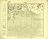
Image from the Map Collections courtesy Tohoku University. © 2023, the Committee for the Creation of the Gaihozu Digital Archives. 【図幅名】 劉龍臺 【測量時期】 - 【発行時期】 昭和8年発行 【記号】 錦州16号 【測量機関】 大日本帝國陸地測量部
リンク: 出所・参照情報
|
1933 | 4ヶ月 前 | 4個の基準点 |
|
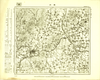
Image from the Map Collections courtesy Tohoku University. © 2023, the Committee for the Creation of the Gaihozu Digital Archives. 【図幅名】 杏西關 【測量時期】 - 【発行時期】 昭和7年発行 【記号】 錦州13号 【測量機関】 大日本帝國陸地測量部
リンク: 出所・参照情報
|
1932 | 4ヶ月 前 | 4個の基準点 |
|
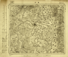
Image from the Map Collections courtesy Tohoku University. © 2023, the Committee for the Creation of the Gaihozu Digital Archives. 【図幅名】 錦州 【測量時期】 - 【発行時期】 昭和7年発行 【記号】 錦州12号 【測量機関】 大日本帝國陸地測量部
リンク: 出所・参照情報
|
1932 | 4ヶ月 前 | 4個の基準点 |
|
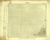
Image from the Map Collections courtesy Tohoku University. © 2023, the Committee for the Creation of the Gaihozu Digital Archives. 【図幅名】 義州 【測量時期】 - 【発行時期】 昭和8年発行 【記号】 錦州11号 【測量機関】 大日本帝國陸地測量部
リンク: 出所・参照情報
|
1933 | 4ヶ月 前 | 4個の基準点 |
|
Image from the Map Collections courtesy Tohoku University. © 2023, the Committee for the Creation of the Gaihozu Digital Archives. 【図幅名】 西陽台 【測量時期】 - 【発行時期】 昭和7年発行 【記号】 錦州10号 【測量機関】 大日本帝國陸地測量部
リンク: 出所・参照情報
|
1932 | 4ヶ月 前 | 4個の基準点 |
|
Image from the Map Collections courtesy Tohoku University. © 2023, the Committee for the Creation of the Gaihozu Digital Archives. 【図幅名】 二界溝 【測量時期】 - 【発行時期】 昭和7年発行 【記号】 錦州8号 【測量機関】 大日本帝國陸地測量部
リンク: 出所・参照情報
|
1932 | 4ヶ月 前 | 4個の基準点 |
|
Image from the Map Collections courtesy Tohoku University. © 2023, the Committee for the Creation of the Gaihozu Digital Archives. 【図幅名】 杜家台 【測量時期】 - 【発行時期】 - 【記号】 錦州7号 【測量機関】 -
リンク: 出所・参照情報
|
4ヶ月 前 | 4個の基準点 |


