地図を見る
| 地図 | タイトル | 年 | 前回の更新  |
ステータス |
|---|---|---|---|---|
|
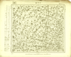
Image from the Map Collections courtesy Tohoku University. © 2023, the Committee for the Creation of the Gaihozu Digital Archives. 【図幅名】 沙河堡 【測量時期】 - 【発行時期】 昭和7年発行 【記号】 遼陽16号 【測量機関】 大日本帝國陸地測量部
リンク: 出所・参照情報
|
1932 | 4ヶ月 前 | 4個の基準点 |
|
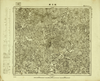
Image from the Map Collections courtesy Tohoku University. © 2023, the Committee for the Creation of the Gaihozu Digital Archives. 【図幅名】 龍王廟 【測量時期】 - 【発行時期】 昭和7年発行 【記号】 遼陽15号 【測量機関】 大日本帝國陸地測量部
リンク: 出所・参照情報
|
1932 | 4ヶ月 前 | 4個の基準点 |
|
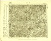
Image from the Map Collections courtesy Tohoku University. © 2023, the Committee for the Creation of the Gaihozu Digital Archives. 【図幅名】 雪裡站 【測量時期】 - 【発行時期】 - 【記号】 遼陽14号 【測量機関】 -
リンク: 出所・参照情報
|
4ヶ月 前 | 4個の基準点 | |
|
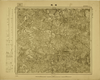
Image from the Map Collections courtesy Tohoku University. © 2023, the Committee for the Creation of the Gaihozu Digital Archives. 【図幅名】 橋頭 【測量時期】 - 【発行時期】 昭和7年発行 【記号】 遼陽12号 【測量機関】 大日本帝國陸地測量部
リンク: 出所・参照情報
|
1932 | 4ヶ月 前 | 4個の基準点 |
|
Image from the Map Collections courtesy Tohoku University. © 2023, the Committee for the Creation of the Gaihozu Digital Archives. 【図幅名】 本渓湖 【測量時期】 - 【発行時期】 昭和7年発行 【記号】 遼陽11号 【測量機関】 大日本帝國陸地測量部
リンク: 出所・参照情報
|
1932 | 4ヶ月 前 | 4個の基準点 |
|
Image from the Map Collections courtesy Tohoku University. © 2023, the Committee for the Creation of the Gaihozu Digital Archives. 【図幅名】 新義州 【測量時期】 - 【発行時期】 昭和7年発行 【記号】 遼陽10号 【測量機関】 大日本帝國陸地測量部
リンク: 出所・参照情報
|
1932 | 4ヶ月 前 | 4個の基準点 |
|
Image from the Map Collections courtesy Tohoku University. © 2023, the Committee for the Creation of the Gaihozu Digital Archives. 【図幅名】 鳳凰城 【測量時期】 - 【発行時期】 昭和7年発行 【記号】 遼陽9号 【測量機関】 大日本帝國陸地測量部
リンク: 出所・参照情報
|
1932 | 4ヶ月 前 | 4個の基準点 |
|
Image from the Map Collections courtesy Tohoku University. © 2023, the Committee for the Creation of the Gaihozu Digital Archives. 【図幅名】 賽馬集 【測量時期】 - 【発行時期】 昭和7年発行 【記号】 遼陽8号 【測量機関】 大日本帝國陸地測量部
リンク: 出所・参照情報
|
1932 | 4ヶ月 前 | 4個の基準点 |
|
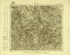
Image from the Map Collections courtesy Tohoku University. © 2023, the Committee for the Creation of the Gaihozu Digital Archives. 【図幅名】 域廠 【測量時期】 - 【発行時期】 昭和7年発行 【記号】 遼陽7号 【測量機関】 大日本帝國陸地測量部
リンク: 出所・参照情報
|
1932 | 4ヶ月 前 | 4個の基準点 |
|
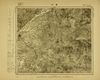
Image from the Map Collections courtesy Tohoku University. © 2023, the Committee for the Creation of the Gaihozu Digital Archives. 【図幅名】 義州 【測量時期】 - 【発行時期】 昭和7年発行 【記号】 遼陽5号 【測量機関】 大日本帝國陸地測量部
リンク: 出所・参照情報
|
1932 | 4ヶ月 前 | 4個の基準点 |
|
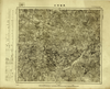
Image from the Map Collections courtesy Tohoku University. © 2023, the Committee for the Creation of the Gaihozu Digital Archives. 【図幅名】 長甸河口 【測量時期】 - 【発行時期】 昭和7年発行 【記号】 遼陽4号 【測量機関】 大日本帝國陸地測量部
リンク: 出所・参照情報
|
1932 | 4ヶ月 前 | 4個の基準点 |
|
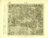
Image from the Map Collections courtesy Tohoku University. © 2023, the Committee for the Creation of the Gaihozu Digital Archives. 【図幅名】 寛甸 【測量時期】 - 【発行時期】 昭和8年発行 【記号】 遼陽3号 【測量機関】 大日本帝國陸地測量部
リンク: 出所・参照情報
|
1933 | 4ヶ月 前 | 4個の基準点 |
|
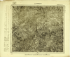
Image from the Map Collections courtesy Tohoku University. © 2023, the Committee for the Creation of the Gaihozu Digital Archives. 【図幅名】 草帽頂山 【測量時期】 - 【発行時期】 昭和8年発行 【記号】 遼陽2号 【測量機関】 大日本帝國陸地測量部
リンク: 出所・参照情報
|
1933 | 4ヶ月 前 | 4個の基準点 |
|
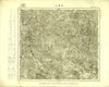
Image from the Map Collections courtesy Tohoku University. © 2023, the Committee for the Creation of the Gaihozu Digital Archives. 【図幅名】 平頂山 【測量時期】 - 【発行時期】 昭和8年発行 【記号】 遼陽1号 【測量機関】 大日本帝國陸地測量部
リンク: 出所・参照情報
|
1933 | 4ヶ月 前 | 4個の基準点 |
|
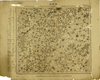
Image from the Map Collections courtesy Tohoku University. © 2023, the Committee for the Creation of the Gaihozu Digital Archives. 【図幅名】 新民府 【測量時期】 - 【発行時期】 昭和7年発行 【記号】 奉天25号 【測量機関】 大日本帝國陸地測量部
リンク: 出所・参照情報
|
1932 | 4ヶ月 前 | 4個の基準点 |
|
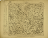
Image from the Map Collections courtesy Tohoku University. © 2023, the Committee for the Creation of the Gaihozu Digital Archives. 【図幅名】 彰武台門 【測量時期】 - 【発行時期】 昭和7年発行 【記号】 奉天24号 【測量機関】 大日本帝國陸地測量部
リンク: 出所・参照情報
|
1932 | 4ヶ月 前 | 4個の基準点 |

|
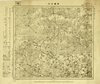
Image from the Map Collections courtesy Tohoku University. © 2023, the Committee for the Creation of the Gaihozu Digital Archives. 【図幅名】 秀水河子 【測量時期】 - 【発行時期】 昭和8年発行 【記号】 奉天23号 【測量機関】 大日本帝國陸地測量部
リンク: 出所・参照情報
|
1933 | 4ヶ月 前 | 4個の基準点 |
|
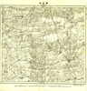
Image from the Map Collections courtesy Tohoku University. © 2023, the Committee for the Creation of the Gaihozu Digital Archives. 【図幅名】 賓圖王府 【測量時期】 - 【発行時期】 昭和8年発行 【記号】 奉天22号 【測量機関】 大日本帝國陸地測量部
リンク: 出所・参照情報
|
1933 | 4ヶ月 前 | 4個の基準点 |
|
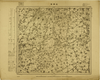
Image from the Map Collections courtesy Tohoku University. © 2023, the Committee for the Creation of the Gaihozu Digital Archives. 【図幅名】 博王府 【測量時期】 - 【発行時期】 - 【記号】 奉天21号 【測量機関】 -
リンク: 出所・参照情報
|
4ヶ月 前 | 4個の基準点 | |
|
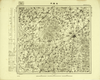
Image from the Map Collections courtesy Tohoku University. © 2023, the Committee for the Creation of the Gaihozu Digital Archives. 【図幅名】 石佛寺 【測量時期】 - 【発行時期】 昭和7年発行 【記号】 奉天19号 【測量機関】 大日本帝國陸地測量部
リンク: 出所・参照情報
|
1932 | 4ヶ月 前 | 4個の基準点 |
|
Image from the Map Collections courtesy Tohoku University. © 2023, the Committee for the Creation of the Gaihozu Digital Archives. 【図幅名】 法庫門 【測量時期】 - 【発行時期】 昭和7年発行 【記号】 奉天18号 【測量機関】 大日本帝國陸地測量部
リンク: 出所・参照情報
|
1932 | 4ヶ月 前 | 4個の基準点 |
|
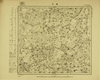
Image from the Map Collections courtesy Tohoku University. © 2023, the Committee for the Creation of the Gaihozu Digital Archives. 【図幅名】 康平ヤスタイラ 【測量時期】 - 【発行時期】 昭和7年発行 【記号】 奉天17号 【測量機関】 大日本帝國陸地測量部
リンク: 出所・参照情報
|
1932 | 4ヶ月 前 | 4個の基準点 |
|
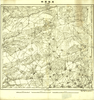
Image from the Map Collections courtesy Tohoku University. © 2023, the Committee for the Creation of the Gaihozu Digital Archives. 【図幅名】 遼陽窩棚 【測量時期】 - 【発行時期】 - 【記号】 奉天16号 【測量機関】 -
リンク: 出所・参照情報
|
4ヶ月 前 | 4個の基準点 | |
|
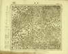
Image from the Map Collections courtesy Tohoku University. © 2023, the Committee for the Creation of the Gaihozu Digital Archives. 【図幅名】 撫順 【測量時期】 - 【発行時期】 昭和7年発行 【記号】 奉天15号 【測量機関】 大日本帝國陸地測量部
リンク: 出所・参照情報
|
1932 | 4ヶ月 前 | 4個の基準点 |
|
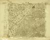
Image from the Map Collections courtesy Tohoku University. © 2023, the Committee for the Creation of the Gaihozu Digital Archives. 【図幅名】 鐡嶺 【測量時期】 - 【発行時期】 - 【記号】 奉天14号 【測量機関】 大日本帝國陸地測量部
リンク: 出所・参照情報
|
4ヶ月 前 | 4個の基準点 | |
|
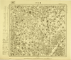
Image from the Map Collections courtesy Tohoku University. © 2023, the Committee for the Creation of the Gaihozu Digital Archives. 【図幅名】 通江口 【測量時期】 - 【発行時期】 昭和7年発行 【記号】 奉天13号 【測量機関】 大日本帝國陸地測量部
リンク: 出所・参照情報
|
1932 | 4ヶ月 前 | 4個の基準点 |
|
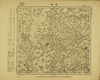
Image from the Map Collections courtesy Tohoku University. © 2023, the Committee for the Creation of the Gaihozu Digital Archives. 【図幅名】 昌圖 【測量時期】 - 【発行時期】 昭和7年発行 【記号】 奉天12号 【測量機関】 大日本帝國陸地測量部
リンク: 出所・参照情報
|
1932 | 4ヶ月 前 | 4個の基準点 |
|
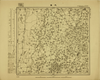
Image from the Map Collections courtesy Tohoku University. © 2023, the Committee for the Creation of the Gaihozu Digital Archives. 【図幅名】 大窪 【測量時期】 - 【発行時期】 昭和7年発行 【記号】 奉天11号 【測量機関】 大日本帝國陸地測量部
リンク: 出所・参照情報
|
1932 | 4ヶ月 前 | 4個の基準点 |
|
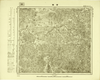
Image from the Map Collections courtesy Tohoku University. © 2023, the Committee for the Creation of the Gaihozu Digital Archives. 【図幅名】 營盤 【測量時期】 - 【発行時期】 昭和7年発行 【記号】 奉天10号 【測量機関】 大日本帝國陸地測量部
リンク: 出所・参照情報
|
1932 | 4ヶ月 前 | 4個の基準点 |
|
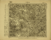
Image from the Map Collections courtesy Tohoku University. © 2023, the Committee for the Creation of the Gaihozu Digital Archives. 【図幅名】 大甸子 【測量時期】 - 【発行時期】 昭和7年発行 【記号】 奉天9号 【測量機関】 大日本帝國陸地測量部
リンク: 出所・参照情報
|
1932 | 4ヶ月 前 | 4個の基準点 |
|
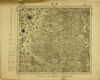
Image from the Map Collections courtesy Tohoku University. © 2023, the Committee for the Creation of the Gaihozu Digital Archives. 【図幅名】 開原 【測量時期】 - 【発行時期】 昭和7年発行 【記号】 奉天8号 【測量機関】 大日本帝國陸地測量部
リンク: 出所・参照情報
|
1932 | 4ヶ月 前 | 4個の基準点 |
|
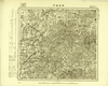
Image from the Map Collections courtesy Tohoku University. © 2023, the Committee for the Creation of the Gaihozu Digital Archives. 【図幅名】 威遠堡門 【測量時期】 - 【発行時期】 昭和7年発行 【記号】 奉天7号 【測量機関】 大日本帝國陸地測量部
リンク: 出所・参照情報
|
1932 | 4ヶ月 前 | 4個の基準点 |
|
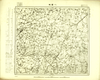
Image from the Map Collections courtesy Tohoku University. © 2023, the Committee for the Creation of the Gaihozu Digital Archives. 【図幅名】 八面城 【測量時期】 - 【発行時期】 昭和7年発行 【記号】 奉天6号 【測量機関】 大日本帝國陸地測量部
リンク: 出所・参照情報
|
1932 | 4ヶ月 前 | 4個の基準点 |
|
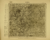
Image from the Map Collections courtesy Tohoku University. © 2023, the Committee for the Creation of the Gaihozu Digital Archives. 【図幅名】 永陵街 【測量時期】 - 【発行時期】 昭和8年発行 【記号】 奉天5号 【測量機関】 大日本帝國陸地測量部
リンク: 出所・参照情報
|
1933 | 4ヶ月 前 | 4個の基準点 |
|
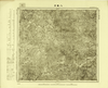
Image from the Map Collections courtesy Tohoku University. © 2023, the Committee for the Creation of the Gaihozu Digital Archives. 【図幅名】 八家子 【測量時期】 - 【発行時期】 昭和8年発行 【記号】 奉天4号 【測量機関】 大日本帝國陸地測量部
リンク: 出所・参照情報
|
1933 | 4ヶ月 前 | 4個の基準点 |
|
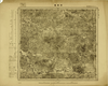
Image from the Map Collections courtesy Tohoku University. © 2023, the Committee for the Creation of the Gaihozu Digital Archives. 【図幅名】 李家臺 【測量時期】 - 【発行時期】 昭和8年発行 【記号】 奉天3号 【測量機関】 大日本帝國陸地測量部
リンク: 出所・参照情報
|
1933 | 4ヶ月 前 | 4個の基準点 |
|
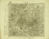
Image from the Map Collections courtesy Tohoku University. © 2023, the Committee for the Creation of the Gaihozu Digital Archives. 【図幅名】 掏鹿 【測量時期】 - 【発行時期】 昭和7年発行 【記号】 奉天2号 【測量機関】 大日本帝國陸地測量部
リンク: 出所・参照情報
|
1932 | 4ヶ月 前 | 4個の基準点 |
|
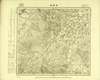
Image from the Map Collections courtesy Tohoku University. © 2023, the Committee for the Creation of the Gaihozu Digital Archives. 【図幅名】 赫爾蘇 【測量時期】 - 【発行時期】 昭和7年発行 【記号】 奉天1号 【測量機関】 大日本帝國陸地測量部
リンク: 出所・参照情報
|
1932 | 4ヶ月 前 | 4個の基準点 |
|
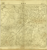
Image from the Map Collections courtesy Tohoku University. © 2023, the Committee for the Creation of the Gaihozu Digital Archives. 【図幅名】 赫爾蘇 【測量時期】 - 【発行時期】 - 【記号】 五段奉天1号 【測量機関】 -
リンク: 出所・参照情報
|
4ヶ月 前 | 4個の基準点 | |
|
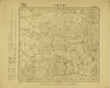
Image from the Map Collections courtesy Tohoku University. © 2023, the Committee for the Creation of the Gaihozu Digital Archives. 【図幅名】 説戸營子 【測量時期】 - 【発行時期】 昭和7年発行 【記号】 奉化25号 【測量機関】 大日本帝國陸地測量部
リンク: 出所・参照情報
|
1932 | 4ヶ月 前 | 4個の基準点 |
|
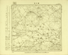
Image from the Map Collections courtesy Tohoku University. © 2023, the Committee for the Creation of the Gaihozu Digital Archives. 【図幅名】 歸力屯 【測量時期】 - 【発行時期】 昭和7年発行 【記号】 奉化24号 【測量機関】 大日本帝國陸地測量部
リンク: 出所・参照情報
|
1932 | 4ヶ月 前 | 4個の基準点 |
|
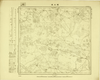
Image from the Map Collections courtesy Tohoku University. © 2023, the Committee for the Creation of the Gaihozu Digital Archives. 【図幅名】 煙土通 【測量時期】 - 【発行時期】 昭和7年発行 【記号】 奉化23号 【測量機関】 大日本帝國陸地測量部
リンク: 出所・参照情報
|
1932 | 4ヶ月 前 | 4個の基準点 |
|
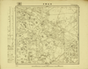
Image from the Map Collections courtesy Tohoku University. © 2023, the Committee for the Creation of the Gaihozu Digital Archives. 【図幅名】 他拉營子 【測量時期】 - 【発行時期】 昭和7年発行 【記号】 奉化22号 【測量機関】 大日本帝國陸地測量部
リンク: 出所・参照情報
|
1932 | 4ヶ月 前 | 4個の基準点 |
|
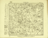
Image from the Map Collections courtesy Tohoku University. © 2023, the Committee for the Creation of the Gaihozu Digital Archives. 【図幅名】 告化營子 【測量時期】 - 【発行時期】 昭和7年発行 【記号】 奉化21号 【測量機関】 大日本帝國陸地測量部
リンク: 出所・参照情報
|
1932 | 4ヶ月 前 | 4個の基準点 |
|
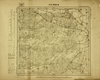
Image from the Map Collections courtesy Tohoku University. © 2023, the Committee for the Creation of the Gaihozu Digital Archives. 【図幅名】 温都嚕王府 【測量時期】 - 【発行時期】 昭和7年発行 【記号】 奉化20号 【測量機関】 大日本帝國陸地測量部
リンク: 出所・参照情報
|
1932 | 4ヶ月 前 | 4個の基準点 |
|
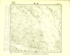
Image from the Map Collections courtesy Tohoku University. © 2023, the Committee for the Creation of the Gaihozu Digital Archives. 【図幅名】 茂林 【測量時期】 - 【発行時期】 昭和11年発行 【記号】 奉化19号 【測量機関】 大日本帝國陸地測量部dr
リンク: 出所・参照情報
|
1936 | 4ヶ月 前 | 4個の基準点 |
|
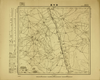
Image from the Map Collections courtesy Tohoku University. © 2023, the Committee for the Creation of the Gaihozu Digital Archives. 【図幅名】 白云昌 【測量時期】 - 【発行時期】 昭和10年発行 【記号】 奉化18号 【測量機関】 大日本帝國陸地測量部
リンク: 出所・参照情報
|
1935 | 4ヶ月 前 | 4個の基準点 |
|
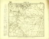
Image from the Map Collections courtesy Tohoku University. © 2023, the Committee for the Creation of the Gaihozu Digital Archives. 【図幅名】 後巴彦昭 【測量時期】 - 【発行時期】 昭和7年発行 【記号】 奉化17号 【測量機関】 大日本帝國陸地測量部
リンク: 出所・参照情報
|
1932 | 4ヶ月 前 | 4個の基準点 |
|
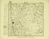
Image from the Map Collections courtesy Tohoku University. © 2023, the Committee for the Creation of the Gaihozu Digital Archives. 【図幅名】 開通 【測量時期】 - 【発行時期】 昭和7年発行 【記号】 奉化16号 【測量機関】 大日本帝國陸地測量部
リンク: 出所・参照情報
|
1932 | 4ヶ月 前 | 4個の基準点 |
|
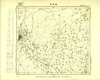
Image from the Map Collections courtesy Tohoku University. © 2023, the Committee for the Creation of the Gaihozu Digital Archives. 【図幅名】 鄭家屯 【測量時期】 - 【発行時期】 昭和10年発行sネンハッコウ 【記号】 奉化15号 【測量機関】 大日本帝國陸地測量部
リンク: 出所・参照情報
|
1935 | 4ヶ月 前 | 4個の基準点 |


