地図を見る
| 地図 | タイトル | 年  |
前回の更新 | ステータス |
|---|---|---|---|---|
|
【最初期発行】 この地図の作成に当たっては、国土地理院長の承認を得て、同院発行の20万分の1地勢図及び5万分の1地形図を使用した。(承認番号 平30情使、 第1148号) ( 1枚のレイヤー)
リンク: 出所・参照情報
|
1910 | 2年以上 前 | 4個の基準点 |
|
【最初期発行】 この地図の作成に当たっては、国土地理院長の承認を得て、同院発行の20万分の1地勢図及び5万分の1地形図を使用した。(承認番号 平30情使、 第1148号)
リンク: 出所・参照情報
|
1910 | 5年以上 前 | 4個の基準点 |
|
【Courtesy of the C. V. Starr East Asian Library University of California, Berkeley】 East Asian Library call number: Eb201.
リンク: 出所・参照情報
|
1910 | 約6年 前 | 整形を解除する |
|
【最初期発行】 この地図の作成に当たっては、国土地理院長の承認を得て、同院発行の20万分の1地勢図及び5万分の1地形図を使用した。(承認番号 平30情使、 第1148号)
リンク: 出所・参照情報
|
1910 | 3年弱 前 | 4個の基準点 |
|
【Courtesy of the C. V. Starr East Asian Library University of California, Berkeley】 In Japanese. Relief shown by hachures. Includes list of addresses and legend.
リンク: 出所・参照情報
|
1910 | 3年以上 前 | 4個の基準点 |
|
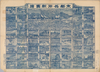
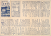
【Courtesy of the C. V. Starr East Asian Library University of California, Berkeley】 Japanese date Meiji 43 1910. In color. Folded. Title on envelope: Saikin jissoku Kyōto shinchizu = The new map of Kyoto. In Japanese. Oriented with north to the left. Relief shown by hachures. 4 insets: Kyōto fukin meisho chizu; Kyōto-fu kannai chizu, Nara-shi zenzu; Fushimi-chō zenzu. Includes text, views of tourist attractions and list of addresses local products and postages on verso. Includes distance chart and legend.
リンク: 出所・参照情報
|
1910 | 4年弱 前 | 4個の基準点 |
|
【Courtesy of the C. V. Starr East Asian Library University of California, Berkeley】 Col. map folded to 21 x 14 cm. Lithograph. In Japanese and English. Relief shown by form lines. Includes 1 inset and legend in English. East Asian Library call number Ha294.
リンク: 出所・参照情報
|
1910 | 約6年 前 | 整形を解除する |
|
【最初期発行】 この地図の作成に当たっては、国土地理院長の承認を得て、同院発行の20万分の1地勢図及び5万分の1地形図を使用した。(承認番号 平30情使、 第1148号)
リンク: 出所・参照情報
|
1910 | 5年以上 前 | 4個の基準点 |
|
【Courtesy of the C. V. Starr East Asian Library University of California, Berkeley】 Col. map folded in cover 21 x 13 cm. Woodblock print. In Japanese. Bird's-eye view. Includes Waka poem. East Asian Library call number Hb45.
リンク: 出所・参照情報
|
1910 | 約6年 前 | 整形を解除する |
|
【最初期発行】 この地図の作成に当たっては、国土地理院長の承認を得て、同院発行の20万分の1地勢図及び5万分の1地形図を使用した。(承認番号 平30情使、 第1148号)
リンク: 出所・参照情報
|
1910 | 5年以上 前 | 4個の基準点 |
|
【Courtesy of the C. V. Starr East Asian Library University of California, Berkeley】 In Japanese. Oriented with north to the upper left. Relief shown by contours.
リンク: 出所・参照情報
|
1910 | 約6年 前 | 整形を解除する |
|
【最初期発行】 この地図の作成に当たっては、国土地理院長の承認を得て、同院発行の20万分の1地勢図及び5万分の1地形図を使用した。(承認番号 平30情使、 第1148号) ( 1枚のレイヤー)
リンク: 出所・参照情報
|
1910 | 2年以上 前 | 4個の基準点 |
|
【最初期発行】 この地図の作成に当たっては、国土地理院長の承認を得て、同院発行の20万分の1地勢図及び5万分の1地形図を使用した。(承認番号 平30情使、 第1148号) ( 1枚のレイヤー)
リンク: 出所・参照情報
|
1910 | 2年以上 前 | 4個の基準点 |
|
【Courtesy of the C. V. Starr East Asian Library University of California, Berkeley】 Japanese date Meiji 43 1910. In color. Folded. In Japanese Oriented with north to the left. Relief shown by hachures. 6 insets: Kyōto-fu Kan̕nai chizu.--Kyōto fukin meishō chizu.--Takao oyobi Saga Hozu meishō chizu.--Nara shigai zenzu.--Ōtsu shigai zenzu.--Hieizan fukinzu. Includes distance chart and legend. Includes text views of tourist attractions on verso.
リンク: 出所・参照情報
|
1910 | 約6年 前 | 整形を解除する |
|
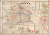
【Courtesy of the C. V. Starr East Asian Library University of California, Berkeley】 Title on envelope: New map of Kobe. In Japanese and English. Oriented with north to the upper right. Releif shown by hachures. Includes 1 inset, index, and legend.
リンク: 出所・参照情報
|
1911 | 約6年 前 | 整形を解除する |
|
【最初期発行】 この地図の作成に当たっては、国土地理院長の承認を得て、同院発行の20万分の1地勢図及び5万分の1地形図を使用した。(承認番号 平30情使、 第1148号)
リンク: 出所・参照情報
|
1911 | 5年以上 前 | 4個の基準点 |
|
【Courtesy of the C. V. Starr East Asian Library University of California, Berkeley】 1 map : col. ; 73 x 50 cm., folded to 20 x 14 cm. In Japanese. Oriented with north to the upper left. Relief shown by hachures. Includes 1 inset and legend. "Tokyo Nichinichi Shinbun daiichimannisengohyakuyonjuhachigo furoku." Shows distance of sea routes. East Asian Library call number: Ba 11 SPEC-Map.
リンク: 出所・参照情報
|
1911 | 約6年 前 | 整形を解除する |
|
【最初期発行】 この地図の作成に当たっては、国土地理院長の承認を得て、同院発行の20万分の1地勢図及び5万分の1地形図を使用した。(承認番号 平30情使、 第1148号)
リンク: 出所・参照情報
|
1911 | 5年以上 前 | 4個の基準点 |
|
【Courtesy of the C. V. Starr East Asian Library University of California, Berkeley】 Col. map folded to 20 x 11 cm. Copperplate print. Relief shown by hachures. Includes 2 insets, distance chart and legend. Includes guide of tourist attractions with views and advertisements on verso. In Japanese. East Asian Library copy: Portions of map are missing. East Asian Library call number Ha244.
リンク: 出所・参照情報
|
1911 | 約6年 前 | 整形を解除する |
|
【最初期発行】 この地図の作成に当たっては、国土地理院長の承認を得て、同院発行の20万分の1地勢図及び5万分の1地形図を使用した。(承認番号 平30情使、 第1148号)
リンク: 出所・参照情報
|
1911 | 5年以上 前 | 4個の基準点 |
|
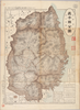
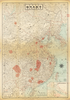
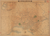
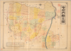
Owned by 立命館大学アート・リサーチセンター 【成立・出版年】 明治 頃1868~1911
リンク: 出所・参照情報
|
1911 | 約6年 前 | 整形を解除する |
|
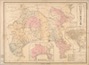
【Courtesy of the C. V. Starr East Asian Library University of California, Berkeley】 Cover title. Title on map: Shiga-ken zenzu. Relief shown by hachures. Includes 3 insets and legend. Includes text on districts and list of addresses on verso. Drawn by Warajikai. In Japanese.
リンク: 出所・参照情報
|
1911 | 3年以上 前 | 4個の基準点 |
|
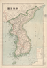
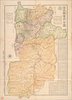
【Courtesy of the C. V. Starr East Asian Library University of California, Berkeley】 Title on map: Chosen zenzu. Cover title. In Japanese. Relief shown by hachures. Includes legend. Shows distance of sea routes. Col. map folded in cover 15 x 8 cm. East Asian Library call number Bc25.
リンク: 出所・参照情報
|
1911 | 3年以上 前 | 4個の基準点 |
|
【Courtesy of the C. V. Starr East Asian Library University of California, Berkeley】 Title on envelope: Nara-ken kannai zenzu = The new map of Nara-ken : fu Nara shigai zenzu. In Japanese. Relief shown by hachures. Includes list of addresses and legend. Includes 1 map on verso: Nara-shi zenzu.
リンク: 出所・参照情報
|
1911 | 約6年 前 | 整形を解除する |
|
【Courtesy of the C. V. Starr East Asian Library University of California, Berkeley】 Cover title. Title on map: Shiga-ken zenzu. Relief shown by hachures. Includes 3 insets and legend. Includes text on districts and list of addresses on verso. Drawn by Warajikai. In Japanese.
リンク: 出所・参照情報
|
1911 | 約6年 前 | 整形を解除する |
|
【Courtesy of the C. V. Starr East Asian Library University of California, Berkeley】 Lithograph. In Japanese. Oriented with north to the left. Relief shown pictorially. Includes distance chart and legend. Shows views of tourist attractions on verso.
リンク: 出所・参照情報
|
1911 | 約6年 前 | 整形を解除する |
|
【Courtesy of the C. V. Starr East Asian Library University of California, Berkeley】 In Japanese. Relief shown by hachures. Includes 2 insets and list of population. Includes text and distance chart.
リンク: 出所・参照情報
|
1911 | 約6年 前 | 整形を解除する |
|
【Courtesy of the C. V. Starr East Asian Library University of California, Berkeley】 Lithograph. In Japanese. Oriented with north to the left. Relief shown pictorially. Includes distance chart and legend. Shows views of tourist attractions on verso.
リンク: 出所・参照情報
|
1911 | 約6年 前 | 整形を解除する |
|
【Courtesy of the C. V. Starr East Asian Library University of California, Berkeley】 Lithograph. In Japanese. Oriented with north to the upper right. Includes 1 inset: Tokyo Kangyo Hakurankai no zu. Includes legend.
リンク: 出所・参照情報
|
1911 | 約6年 前 | 整形を解除する |
|
【最初期発行】 この地図の作成に当たっては、国土地理院長の承認を得て、同院発行の20万分の1地勢図及び5万分の1地形図を使用した。(承認番号 平30情使、 第1148号)
リンク: 出所・参照情報
|
1912 | 5年以上 前 | 4個の基準点 |
|
【Courtesy of the C. V. Starr East Asian Library University of California, Berkeley】 Col. map folded to 20 x 14 cm. Lithograph. In Japanese. Oriented with north to the bottom. Relief shown pictorially. Includes text and index. East Asian Library call number Ha219.
リンク: 出所・参照情報
|
1912 | 約6年 前 | 整形を解除する |
|
【最初期発行】 この地図の作成に当たっては、国土地理院長の承認を得て、同院発行の20万分の1地勢図及び5万分の1地形図を使用した。(承認番号 平30情使、 第1148号)
リンク: 出所・参照情報
|
1912 | 5年以上 前 | 4個の基準点 |
|
【Courtesy of the C. V. Starr East Asian Library University of California, Berkeley】 In Japanese. Relief shown by hachures. Includes 2 insets, address and distance chart, and legend. Includes guide and views of tourist attractions on verso.
リンク: 出所・参照情報
|
1912 | 約6年 前 | 整形を解除する |
|
【最初期発行】 この地図の作成に当たっては、国土地理院長の承認を得て、同院発行の20万分の1地勢図及び5万分の1地形図を使用した。(承認番号 平30情使、 第1148号)
リンク: 出所・参照情報
|
1912 | 5年以上 前 | 4個の基準点 |
|
【Courtesy of the C. V. Starr East Asian Library University of California, Berkeley】 Col. map folded in envelope 20 x 11 cm. In Japanese. Relief shown by hachures. Includes 2 insets and legend. Oriented with north towards upper left. Includes guide to tourist attractions with views and address chart on verso. East Asian Library call number Ha228.
リンク: 出所・参照情報
|
1912 | 約6年 前 | 整形を解除する |
|
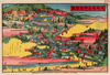
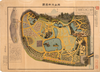
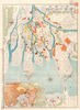
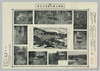
【Courtesy of the C. V. Starr East Asian Library University of California, Berkeley】 In Japanese. Bird's-eye view. Title on map: Sōshū Daiyūzan reikyō no zenzu. Shows 10 photographs of parts of the temple. Folded to 17 x 27 cm.
リンク: 出所・参照情報
|
1912 | 約6年 前 | 整形を解除する |
|
【Courtesy of the C. V. Starr East Asian Library University of California, Berkeley】 Col. map folded to 20 x 11 cm. In Japanese. Relief shown by hachures. Oriented with north towards lower left. Includes legend. East Asian Library call number Ha249.
リンク: 出所・参照情報
|
1912 | 約6年 前 | 整形を解除する |

|
gisday2019
|
1912 | 4年以上 前 | 8個の基準点 |
|
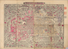
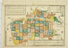
【Courtesy of the C. V. Starr East Asian Library University of California, Berkeley】 Cover title. Title on map: Kyoto-fu zenzu. In Japanese. Oriented with north to the upper right. Relief shown by hachures. Includes 8 insets and legend. Includes list of addresses and text on districts on verso. Drawn by Warajikai.
リンク: 出所・参照情報
|
1912 | 約6年 前 | 整形を解除する |
|
gisday2019
|
1912 | 5年以上 前 | 整形を解除する |
|
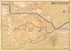
【Courtesy of the C. V. Starr East Asian Library University of California, Berkeley】 Title on envelope: Nakakawachi-gun zenzu : meisho oyobi riteihyo tsuki. In Japanese. Relief shown by hachures. Oriented with north to the left. Includes legend. Includes distance chart on verso.
リンク: 出所・参照情報
|
1912 | 約6年 前 | 整形を解除する |
|
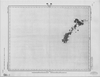
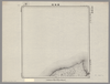
Image from the Map Collections courtesy Stanford University Libraries. This item is in the public domain. There are no restrictions on use.
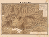
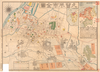
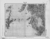
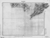
【図幅名】 國端崎【測量時期】 大正元年測圖 【発行時期】 【記号】 千島列島一号 【測量機関】 参謀本部 【その他】千島列島 陸地測量部 ( 1枚のレイヤー)
|
1912 | 1年以上 前 | 5個の基準点 |
|
【Courtesy of the C. V. Starr East Asian Library University of California, Berkeley】 Cover title. Title on map: Kyoto-fu zenzu. In Japanese. Oriented with north to the upper right. Relief shown by hachures. Includes 8 insets and legend. Includes list of addresses and text on districts on verso. Drawn by Warajikai.
リンク: 出所・参照情報
|
1912 | 約6年 前 | 整形を解除する |
|
【Courtesy of the C. V. Starr East Asian Library University of California, Berkeley】 Folded in cover 20 x 14 cm. Lithograph. In Japanese. Oriented with north to the lower right. Bird's-eye view. Includes 2 insets and festival calendar. East Asian Library call number Hb35.
リンク: 出所・参照情報
|
1912 | 約6年 前 | 整形を解除する |
|
【最初期発行】 この地図の作成に当たっては、国土地理院長の承認を得て、同院発行の20万分の1地勢図及び5万分の1地形図を使用した。(承認番号 平30情使、 第1148号)
リンク: 出所・参照情報
|
1913 | 5年以上 前 | 4個の基準点 |
|
【Courtesy of the C. V. Starr East Asian Library University of California, Berkeley】 Lithograph, col. In Japanese. Oriented with north to the upper right. Three insets: Osaka fukinzu; Sakai-shi; Chikko ryakuzu. Includes legend. Includes address chart and advertisement on verso. "Osaka Mainichi Shinbun 10630-go furoku". Folded in envelope 28 x 14 cm. East Asian Library call number: G126.
リンク: 出所・参照情報
|
1913 | 約6年 前 | 整形を解除する |
|
【最初期発行】 この地図の作成に当たっては、国土地理院長の承認を得て、同院発行の20万分の1地勢図及び5万分の1地形図を使用した。(承認番号 平30情使、 第1148号)
リンク: 出所・参照情報
|
1913 | 5年以上 前 | 4個の基準点 |