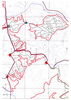
地図を見る
| 地図 | タイトル | 年 | 前回の更新 | ステータス  |
|---|---|---|---|---|
|
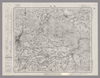
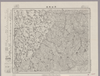
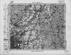
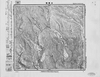
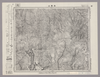
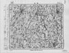
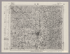
Image from the Map Collections courtesy Stanford University Libraries, licensed under a Creative Commons Attribution-Noncommercial 3.0 Unported License. © Stanford University. 【図幅名】 岐阜 【測量時期】 明治42年測図の縮図/明治39年測図/昭和7年第5回修正、測図の縮図 【発行時期】 昭和10年7月発行 【記号】 岐阜4号(共16面) 【測量機関】 大日本帝国陸地測量部 【備考】
リンク: 出所・参照情報
|
約2年 前 | 4個の基準点 | |
|
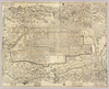
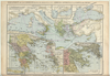
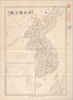
【Courtesy of the C. V. Starr East Asian Library University of California, Berkeley】 Col. copperplate print. In Japanese. Oriented with north to the left. Relief shown pictorially. Folded to 20 x 14 cm. East Asian Library call number: F85.
リンク: 出所・参照情報
|
1887 | 3年以上 前 | 4個の基準点 |
|
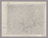
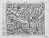
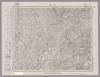
Image from the Map Collections courtesy Stanford University Libraries, licensed under a Creative Commons Attribution-Noncommercial 3.0 Unported License. © Stanford University. 【図幅名】 金山 【測量時期】 明治44年測図/昭和8年要部修正 【発行時期】 昭和11年6月発行 【記号】 飯田15号(共16面) 【測量機関】 大日本帝国陸地測量部 【備考】
リンク: 出所・参照情報
|
約2年 前 | 4個の基準点 | |
|
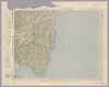
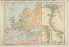
Image from the Map Collections courtesy Stanford University Libraries, licensed under a Creative Commons Attribution-Noncommercial 3.0 Unported License. © Stanford University.
リンク: 出所・参照情報
|
6年以上 前 | 4個の基準点 | |
|
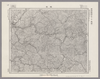
Image from the Map Collections courtesy Stanford University Libraries, licensed under a Creative Commons Attribution-Noncommercial 3.0 Unported License. © Stanford University. 【図幅名】 高田東部 【測量時期】 明治44年測図/昭和5年修正 【発行時期】 【記号】 高田10号(共15面) 【測量機関】 参謀本部 【備考】 秘 ( 1枚のレイヤー)
リンク: 出所・参照情報
|
約2年 前 | 4個の基準点 | |
|
この地図の作成に当たっては、国土地理院長の承認を得て、同院発行の20万分の1地勢図及び5万分の1地形図を使用した。(承認番号 平30情使、 第1148号) ( 1枚のレイヤー)
リンク: 出所・参照情報
|
1947 | 約2年 前 | 4個の基準点 |
|
この地図の作成に当たっては、国土地理院長の承認を得て、同院発行の20万分の1地勢図及び5万分の1地形図を使用した。(承認番号 平30情使、 第1148号)
リンク: 出所・参照情報
|
1946 | 5年以上 前 | 4個の基準点 |
|
Image from the Map Collections courtesy Stanford University Libraries, licensed under a Creative Commons Attribution-Noncommercial 3.0 Unported License. © Stanford University. 【図幅名】 甲浦 【測量時期】 明治40年測圖/昭和8年修正測圖 【発行時期】 【記号】 剣山十一号 【測量機関】 参謀本部 【備考】 祕
リンク: 出所・参照情報
|
5年以上 前 | 4個の基準点 | |
|
この地図の作成に当たっては、国土地理院長の承認を得て、同院発行の20万分の1地勢図及び5万分の1地形図を使用した。(承認番号 平30情使、 第1148号)
リンク: 出所・参照情報
|
1946 | 5年以上 前 | 4個の基準点 |
|
リンク: 出所・参照情報
|
2018 | 6年以上 前 | 3個の基準点 |
|
Image from the Map Collections courtesy Stanford University Libraries, licensed under a Creative Commons Attribution-Noncommercial 3.0 Unported License. © Stanford University. 【図幅名】 彦根東部 【測量時期】 明治24年測図/大正9年修正/昭和7年鉄道補入 【発行時期】 昭和8年6月発行 【記号】 名古屋9号(共16面) 【測量機関】 大日本帝国陸地測量部 【備考】 ( 1枚のレイヤー)
リンク: 出所・参照情報
|
約2年 前 | 4個の基準点 | |
|
( 1枚のレイヤー)
リンク: 出所・参照情報
|
2020 | 3年以上 前 | 5個の基準点 |
|
この地図の作成に当たっては、国土地理院長の承認を得て、同院発行の20万分の1地勢図及び5万分の1地形図を使用した。(承認番号 平30情使、 第1148号)
リンク: 出所・参照情報
|
1946 | 5年以上 前 | 4個の基準点 |

|
Image from the Map Collections courtesy Stanford University Libraries, licensed under a Creative Commons Attribution-Noncommercial 3.0 Unported License. © Stanford University. 【図幅名】 常葉 【測量時期】 明治41年測図/昭和8年要部修正 【発行時期】 昭和21年11月発行 【記号】 福島8号(共18面) 【測量機関】 内務省地理調査所 【備考】
リンク: 出所・参照情報
|
約2年 前 | 4個の基準点 | |
|
|
2022 | 2年弱 前 | 4個の基準点 |
|
【Courtesy of the C. V. Starr East Asian Library University of California, Berkeley】 Mounted cover title. Wood block print. In Japanese. Relief shown pictorially. Includes texts on main temples and shrines and legend. Engraved by Inoue Jihe. East Asian Library call number: F28.
リンク: 出所・参照情報
|
1831 | 3年以上 前 | 4個の基準点 |
|
リンク: 出所・参照情報
|
2020 | 約1年 前 | 8個の基準点 |
|
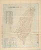
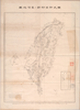
【Courtesy of the C. V. Starr East Asian Library University of California, Berkeley】 Title on envelope: Shinpan shizu Dai Nippon Teikoku Taiwanto zenzu. In Japanese. Relief shown by form lines. Includes list of ferries' fare table and legend. Col. map folded in envelope 20 x 13 cm. East Asian Library call number Bd7.
リンク: 出所・参照情報
|
1897 | 3年以上 前 | 4個の基準点 |
|
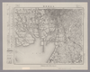
Image from the Map Collections courtesy Stanford University Libraries, licensed under a Creative Commons Attribution-Noncommercial 3.0 Unported License. © Stanford University. 【図幅名】 福知山 【測量時期】 明治26年測図/大正9年修正/昭和2年鉄道補入/昭和25年応急修正 【発行時期】 昭和35年5月発行 【記号】 京都及大阪13号(共16面) 【測量機関】 国土地理院 【備考】 応急修正版
リンク: 出所・参照情報
|
約2年 前 | 4個の基準点 | |
|
【Courtesy of the C. V. Starr East Asian Library University of California, Berkeley】 Lithograph. In Japanese. Relief shown by hachures. Col. map folded in cover 20 x 14 cm. East Asian Library call number Bd4.
リンク: 出所・参照情報
|
1895 | 3年以上 前 | 4個の基準点 |
|
Image from the Map Collections courtesy Stanford University Libraries, licensed under a Creative Commons Attribution-Noncommercial 3.0 Unported License. © Stanford University. 【図幅名】 大屋市場 【測量時期】 明治31年測圖/昭和7年要部修正測圖 【発行時期】 【記号】 姫路五号 【測量機関】 参謀本部 【備考】 祕
リンク: 出所・参照情報
|
3ヶ月 前 | 4個の基準点 | |
|
Image from the Map Collections courtesy Stanford University Libraries, licensed under a Creative Commons Attribution-Noncommercial 3.0 Unported License. © Stanford University. 【図幅名】 吾妻山 【測量時期】 明治41年測図/昭和6年要部修正 【発行時期】 昭和8年1月発行 【記号】 福島14号(共18面) 【測量機関】 大日本帝国陸地測量部 【備考】
リンク: 出所・参照情報
|
約2年 前 | 4個の基準点 | |
|
|
2022 | 2年弱 前 | 7個の基準点 |
|
|
2022 | 2年弱 前 | 7個の基準点 |
|
Image from the Map Collections courtesy Stanford University Libraries, licensed under a Creative Commons Attribution-Noncommercial 3.0 Unported License. © Stanford University. 【図幅名】 綾部 【測量時期】 明治26年測図/大正9年修正 【発行時期】 大正14年6月発行 【記号】 舞鶴要塞近傍6号(共10面) 【測量機関】 参謀本部 【備考】 京都及大阪9号(共16面)軍事極秘
リンク: 出所・参照情報
|
約2年 前 | 4個の基準点 | |
|
この地図の作成に当たっては、国土地理院長の承認を得て、同院発行の20万分の1地勢図及び5万分の1地形図を使用した。(承認番号 平30情使、 第1148号) ( 1枚のレイヤー)
リンク: 出所・参照情報
|
1947 | 約2年 前 | 4個の基準点 |
|
|
8ヶ月 前 | 4個の基準点 | |
|
リンク: 出所・参照情報
|
2020 | 1年以上 前 | 6個の基準点 |
|
Image from the Map Collections courtesy Stanford University Libraries, licensed under a Creative Commons Attribution-Noncommercial 3.0 Unported License. © Stanford University. 【図幅名】 名古屋南部 【測量時期】 明治24年測図/昭和12年測図の縮図/昭和13年第4回修正、測図の縮図 【発行時期】 昭和17年5月発行 【記号】 名古屋2号 【測量機関】 大日本帝国陸地測量部 【備考】
リンク: 出所・参照情報
|
約2年 前 | 4個の基準点 | |
|
|
2022 | 1年以上 前 | 8個の基準点 |
|
( 1枚のレイヤー)
リンク: 出所・参照情報
|
1924 | 約1年 前 | 4個の基準点 |
|
|
2018 | 6年以上 前 | 4個の基準点 |
|
|
2022 | 2年弱 前 | 6個の基準点 |
|
Image from the Map Collections courtesy Stanford University Libraries, licensed under a Creative Commons Attribution-Noncommercial 3.0 Unported License. © Stanford University. 【図幅名】 大須 【測量時期】 大正2年測図/昭和8年要部修正 【発行時期】 昭和10年10月発行 【記号】 石巻5号(共9面) 【測量機関】 大日本帝国陸地測量部 【備考】
リンク: 出所・参照情報
|
約2年 前 | 4個の基準点 | |
|
Image from the Map Collections courtesy Stanford University Libraries, licensed under a Creative Commons Attribution-Noncommercial 3.0 Unported License. © Stanford University. 【図幅名】 駒越 【測量時期】 明治19年測図の縮図/昭和15年第2回修正、測図の縮図 【発行時期】 昭和16年7月発行 【記号】 静岡7号 【測量機関】 大日本帝国陸地測量部 【備考】
リンク: 出所・参照情報
|
約2年 前 | 4個の基準点 | |
|
Image from the Map Collections courtesy Stanford University Libraries, licensed under a Creative Commons Attribution-Noncommercial 3.0 Unported License. © Stanford University. 【図幅名】 徳山 【測量時期】 明治32年測図/昭和2年修正/昭和7年鉄道補入/昭和24年資料修正 【発行時期】 昭和24年3月発行 【記号】 山口4号(共15面) 【測量機関】 地理調査所 【備考】
リンク: 出所・参照情報
|
約2年 前 | 4個の基準点 | |
|
|
2019 | 5年以上 前 | 6個の基準点 |
|
Image from the Map Collections courtesy Stanford University Libraries, licensed under a Creative Commons Attribution-Noncommercial 3.0 Unported License. © Stanford University. 【図幅名】 郡山 【測量時期】 明治41年測図/昭和6年要部修正 【発行時期】 昭和8年9月発行 【記号】 福島12号(共18面) 【測量機関】 大日本帝国陸地測量部 【備考】
リンク: 出所・参照情報
|
約2年 前 | 4個の基準点 | |
|
Image from the Map Collections courtesy Stanford University Libraries, licensed under a Creative Commons Attribution-Noncommercial 3.0 Unported License. © Stanford University. 【図幅名】 和気 【測量時期】 明治28年測図/大正14年第2回修正 【発行時期】 昭和2年12月発行 【記号】 姫路16号(共16面) 【測量機関】 大日本帝国陸地測量部 【備考】
リンク: 出所・参照情報
|
3ヶ月 前 | 4個の基準点 | |
|
【Courtesy of the C. V. Starr East Asian Library University of California, Berkeley】 In Japanese. Oriented with north to the upper left. Relief shown by hachures. Includes 1 inset and legend. "Jiji Shinpo daiyonsen-kyugo furoku." Folded to 20 x 14 cm. East Asian call number Bc14.
リンク: 出所・参照情報
|
1894 | 3年以上 前 | 4個の基準点 |
|
|
2022 | 2年弱 前 | 4個の基準点 |
|
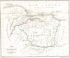
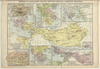
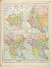
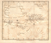
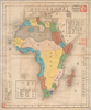
【Courtesy of the C. V. Starr East Asian Library University of California, Berkeley】 Col. copperplate print. In Japanese. Relief shown by hachures. Includes legend. Drawn by Noda Tatsusuke. Folded in cover 16 x 11 cm. Title added by hand: Bankoku chishiryaku ansha yakuzu : Afurika no bu. East Asian Library call number: A37.
リンク: 出所・参照情報
|
1878 | 3年以上 前 | 4個の基準点 |
|
|
2022 | 2年弱 前 | 3個の基準点 |
|
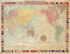
【Courtesy of the C. V. Starr East Asian Library University of California, Berkeley】 Mounted cover title. Col. copperplate print. In Japanese. Relief shown by hachures. Shows distance sea routes. Includes text on earth, list of populations, national flags, and legend. Folded in cover 13x 9 cm. East Asian Library call number: A19.
リンク: 出所・参照情報
|
1868 | 3年以上 前 | 4個の基準点 |
|
Image from the Map Collections courtesy Stanford University Libraries, licensed under a Creative Commons Attribution-Noncommercial 3.0 Unported License. © Stanford University. 【図幅名】 掛塚 【測量時期】 明治22年測図縮図/昭和13年第2回修正、測図の縮図 【発行時期】 昭和15年3月発行 【記号】 伊良湖岬1号(共3面) 【測量機関】 大日本帝国陸地測量部 【備考】
リンク: 出所・参照情報
|
約2年 前 | 4個の基準点 | |
|
【最初期発行】 この地図の作成に当たっては、国土地理院長の承認を得て、同院発行の20万分の1地勢図及び5万分の1地形図を使用した。(承認番号 平30情使、 第1148号) ( 1枚のレイヤー)
リンク: 出所・参照情報
|
1910 | 約2年 前 | 4個の基準点 |
|
Image from the Map Collections courtesy Stanford University Libraries, licensed under a Creative Commons Attribution-Noncommercial 3.0 Unported License. © Stanford University. 【図幅名】 泉 【測量時期】 大正11年測図の縮図/昭和10年修正、測図の縮図 【発行時期】 昭和21年11月発行 【記号】 厳原9号北部(共7面) 【測量機関】 地理調査所 【備考】
リンク: 出所・参照情報
|
約4年 前 | 4個の基準点 | |
|
この地図の作成に当たっては、国土地理院長の承認を得て、同院発行の20万分の1地勢図及び5万分の1地形図を使用した。(承認番号 平30情使、 第1148号)
リンク: 出所・参照情報
|
1946 | 5年以上 前 | 4個の基準点 |
|
Image from the Map Collections courtesy Stanford University Libraries, licensed under a Creative Commons Attribution-Noncommercial 3.0 Unported License. © Stanford University. 【図幅名】 手ノ予 【測量時期】 大正2年測図/昭和6年部分修正 【発行時期】 昭和8年1月発行 【記号】 村上4号(共12面) 【測量機関】 大日本帝国陸地測量部 【備考】
リンク: 出所・参照情報
|
約2年 前 | 4個の基準点 | |
|
この地図の作成に当たっては、国土地理院長の承認を得て、同院発行の20万分の1地勢図及び5万分の1地形図を使用した。(承認番号 平30情使、 第1148号)
リンク: 出所・参照情報
|
1947 | 5年以上 前 | 4個の基準点 |