地図を見る
| 地図 | タイトル | 年 | 前回の更新 | ステータス  |
|---|---|---|---|---|
|
|
2022 | 2年弱 前 | 4個の基準点 |
|
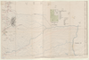
208
|
2022 | 1年以上 前 | 3個の基準点 |
|
Image from the Map Collections courtesy Stanford University Libraries, licensed under a Creative Commons Attribution-Noncommercial 3.0 Unported License. © Stanford University. 【図幅名】 今治東部 【測量時期】 明治31年測図/昭和3年修正 【発行時期】 昭和6年6月発行 【記号】 岡山及丸亀16号(共16面) 【測量機関】 大日本帝国陸地測量部 【備考】 ( 1枚のレイヤー)
リンク: 出所・参照情報
|
3ヶ月 前 | 4個の基準点 | |
|
|
2022 | 2年弱 前 | 6個の基準点 |
|
Image from the Map Collections courtesy Stanford University Libraries, licensed under a Creative Commons Attribution-Noncommercial 3.0 Unported License. © Stanford University. 【図幅名】 日田 【測量時期】 明治33年測圖/昭和2年要部修正測圖/昭和6年部分修正測圖/昭和7年鐡道補入 【発行時期】 【記号】 熊本一号 【測量機関】 参謀本部 【備考】 祕
リンク: 出所・参照情報
|
約4年 前 | 4個の基準点 | |
|
Image from the Map Collections courtesy Stanford University Libraries, licensed under a Creative Commons Attribution-Noncommercial 3.0 Unported License. © Stanford University. 【図幅名】 虻島 【測量時期】 明治43年測図/昭和9年修正 【発行時期】 昭和12年11月発行 【記号】 富山15号(共11面) 【測量機関】 大日本帝国陸地測量部 【備考】
リンク: 出所・参照情報
|
約2年 前 | 4個の基準点 | |
|
Image from the Map Collections courtesy Stanford University Libraries, licensed under a Creative Commons Attribution-Noncommercial 3.0 Unported License. © Stanford University. 【図幅名】 背振山 【測量時期】 明治33年測圖之縮圖/昭和11年第三回修正測圖及修正測圖之縮圖/昭和13年測圖之縮圖 【発行時期】 【記号】 小倉十二号 【測量機関】 参謀本部 【備考】 祕
リンク: 出所・参照情報
|
約4年 前 | 4個の基準点 | |
|
Image from the Map Collections courtesy Stanford University Libraries, licensed under a Creative Commons Attribution-Noncommercial 3.0 Unported License. © Stanford University. 【図幅名】 能代 【測量時期】 大正1年測図/昭和14年修正 【発行時期】 昭和16年12月発行 【記号】 弘前15号 【測量機関】 大日本帝国陸地測量部 【備考】 仮製版
リンク: 出所・参照情報
|
5年以上 前 | 4個の基準点 | |
|
|
2022 | 2年弱 前 | 5個の基準点 |
|
Image from the Map Collections courtesy Stanford University Libraries, licensed under a Creative Commons Attribution-Noncommercial 3.0 Unported License. © Stanford University. 【図幅名】 イドンナップ岳 【測量時期】 大正9年測圖 【発行時期】 【記号】 浦河五号 【測量機関】 参謀本部 【備考】 祕 ( 1枚のレイヤー)
リンク: 出所・参照情報
|
約2年 前 | 4個の基準点 | |
|
リンク: 出所・参照情報
|
2020 | 3年弱 前 | 5個の基準点 |
|
|
2018 | 6年以上 前 | 3個の基準点 |
|
Image from the Map Collections courtesy Stanford University Libraries, licensed under a Creative Commons Attribution-Noncommercial 3.0 Unported License. © Stanford University. 【図幅名】 佐賀 【測量時期】 明治33年及大正3年測圖之縮圖/大正15年修正測圖之縮圖 【発行時期】 【記号】 熊本九号 【測量機関】 参謀本部 【備考】 祕
リンク: 出所・参照情報
|
約4年 前 | 4個の基準点 | |
|
|
2022 | 2年弱 前 | 5個の基準点 |
|
リンク: 出所・参照情報
|
2020 | 1年以上 前 | 3個の基準点 |
|
Image from the Map Collections courtesy Stanford University Libraries, licensed under a Creative Commons Attribution-Noncommercial 3.0 Unported License. © Stanford University. 【図幅名】 一戸 【測量時期】 大正3年測圖/大正14年部分修正測圖 【発行時期】 【記号】 八戸十一号 【測量機関】 参謀本部 【備考】 祕
リンク: 出所・参照情報
|
約2年 前 | 4個の基準点 | |
|
Image from the Map Collections courtesy Stanford University Libraries, licensed under a Creative Commons Attribution-Noncommercial 3.0 Unported License. © Stanford University. 【図幅名】 大牟田 【測量時期】 明治34年測圖/大正15年第二回修正測圖/昭和6年鐡道補入 【発行時期】 【記号】 熊本十号 【測量機関】 参謀本部 【備考】 祕
リンク: 出所・参照情報
|
約4年 前 | 4個の基準点 | |
|
Owned by 立命館大学アート・リサーチセンター 【成立・出版年】 天保081837
リンク: 出所・参照情報
|
1837 | 4年以上 前 | 79個の基準点 |
|
Image from the Map Collections courtesy Stanford University Libraries, licensed under a Creative Commons Attribution-Noncommercial 3.0 Unported License. © Stanford University. 【図幅名】 伊島 【測量時期】 明治40年測図/昭和9年修正 【発行時期】 昭和11年6月発行 【記号】 由良要塞近傍8号(共10面) 【測量機関】 陸地測量部 【備考】 剣山1号(共12面) 軍事極秘
リンク: 出所・参照情報
|
5年以上 前 | 4個の基準点 | |
|
Image from the Map Collections courtesy Stanford University Libraries, licensed under a Creative Commons Attribution-Noncommercial 3.0 Unported License. © Stanford University. 【図幅名】 田子 【測量時期】 大正3年測図/昭和8年修正 【発行時期】 昭和11年1月発行 【記号】 八戸14号(共15面) 【測量機関】 大日本帝国陸地測量部 【備考】
リンク: 出所・参照情報
|
約2年 前 | 4個の基準点 | |
|
Image from the Map Collections courtesy Stanford University Libraries, licensed under a Creative Commons Attribution-Noncommercial 3.0 Unported License. © Stanford University. 【図幅名】 佐賀関 【測量時期】 明治36年測図/昭和2年第2回修正 【発行時期】 昭和21年9月発行 【記号】 大分1号(共16面) 【測量機関】 内務省地理調査所 【備考】
リンク: 出所・参照情報
|
約4年 前 | 4個の基準点 | |
|
この地図の作成に当たっては、国土地理院長の承認を得て、同院発行の20万分の1地勢図及び5万分の1地形図を使用した。(承認番号 平30情使、 第1148号)
リンク: 出所・参照情報
|
1947 | 約4年 前 | 4個の基準点 |
|
リンク: 出所・参照情報
|
2020 | 4年弱 前 | 8個の基準点 |
|
リンク: 出所・参照情報
|
2020 | 約1年 前 | 4個の基準点 |
|
【Courtesy of the C. V. Starr East Asian Library University of California, Berkeley】 Japanese date Bunsei 5 1822. In color. Folded. Printed 2 sides.Cover title. Wood block print. In Japanese. Orientation varies. Covers Nagasaki to Morioka. Includes lists of messenger fees on verso. Includes legend.
リンク: 出所・参照情報
|
1822 | 3年以上 前 | 5個の基準点 |
|
【Courtesy of the C. V. Starr East Asian Library University of California, Berkeley】 Folded in cover 22 x 16 cm. Includes list of shrines, and legend. East Asian Library call number Hb107.2.
リンク: 出所・参照情報
|
1907 | 5年以上 前 | 12個の基準点 |
|
Image from the Map Collections courtesy Stanford University Libraries, licensed under a Creative Commons Attribution-Noncommercial 3.0 Unported License. © Stanford University. 【図幅名】 盧辺 【測量時期】 大正12年測図の縮図/昭和10年修正、測図の縮図 【発行時期】 昭和21年11月発行 【記号】 唐津2号(共8面) 【測量機関】 内務省地理調査所 【備考】
リンク: 出所・参照情報
|
5年以上 前 | 4個の基準点 | |
|
Image from the Map Collections courtesy Stanford University Libraries, licensed under a Creative Commons Attribution-Noncommercial 3.0 Unported License. © Stanford University. 【図幅名】 五百石 【測量時期】 明治44年測図/昭和5年修正 【発行時期】 昭和8年3月発行 【記号】 高山9号(共16面) 【測量機関】 大日本帝国陸地測量部 【備考】
リンク: 出所・参照情報
|
5年以上 前 | 4個の基準点 | |
|
Image from the Map Collections courtesy Stanford University Libraries, licensed under a Creative Commons Attribution-Noncommercial 3.0 Unported License. © Stanford University. 【図幅名】 宇部東部 【測量時期】 明治32年測圖/昭和2年修正測圖 【発行時期】 【記号】 中津九号 【測量機関】 参謀本部 【備考】 祕
リンク: 出所・参照情報
|
約2年 前 | 4個の基準点 | |
|
|
2018 | 6年以上 前 | 5個の基準点 |
|
|
8ヶ月 前 | 3個の基準点 | |
|
|
8ヶ月 前 | 18個の基準点 | |
|
( 1枚のレイヤー)
|
2020 | 3年以上 前 | 10個の基準点 |
|
Image from the Map Collections courtesy Stanford University Libraries, licensed under a Creative Commons Attribution-Noncommercial 3.0 Unported License. © Stanford University. 【図幅名】 宇治山田 【測量時期】 明治25年測図の縮図/昭和12年第2回修正、測図の縮図 【発行時期】 昭和15年4月発行 【記号】 宇治山田6号(共14面) 【測量機関】 大日本帝国陸地測量部 【備考】
リンク: 出所・参照情報
|
約2年 前 | 4個の基準点 | |
|
国立国会図書館デジタルコレクション インターネット公開(保護期間満了) ( 3枚のレイヤー)
リンク: 出所・参照情報
|
1850 | 4年弱 前 | 26個の基準点 |
|
|
8ヶ月 前 | 5個の基準点 | |
|
Image from the Map Collections courtesy Stanford University Libraries, licensed under a Creative Commons Attribution-Noncommercial 3.0 Unported License. © Stanford University. 【図幅名】 駿河大宮 【測量時期】 明治20年測図/昭和3年第2回修正 【発行時期】 昭和5年5月発行 【記号】 静岡5号(共15面) 【測量機関】 大日本帝国陸地測量部 【備考】
リンク: 出所・参照情報
|
約2年 前 | 4個の基準点 | |
|
Image from the Map Collections courtesy Stanford University Libraries, licensed under a Creative Commons Attribution-Noncommercial 3.0 Unported License. © Stanford University. 【図幅名】 平沼 【測量時期】 大正3年測圖/昭和19年部分修正測圖 【発行時期】 【記号】 野辺地十一号 【測量機関】 参謀本部 【備考】 祕
リンク: 出所・参照情報
|
約2年 前 | 4個の基準点 | |
|
【Courtesy of the C. V. Starr East Asian Library University of California, Berkeley】 In Japanese and English. Oriented with north to the upper right. Relief shown by hachures and spot heights. Watersheds and major streams delineated. Existing and projected railroads in red. Includes two insets, preface and legend. Includes list of railway tracks pasted to map. Folded to 30 x 21 cm.
リンク: 出所・参照情報
|
1894 | 3年以上 前 | 5個の基準点 |
|
Image from the Map Collections courtesy Stanford University Libraries, licensed under a Creative Commons Attribution-Noncommercial 3.0 Unported License. © Stanford University. 【図幅名】 二神島 【測量時期】 大正12年測図の縮図/昭和10年修正、測図の縮図 【発行時期】 昭和21年11月発行 【記号】 唐津7号(共8面) 【測量機関】 内務省地理調査所 【備考】
リンク: 出所・参照情報
|
約4年 前 | 4個の基準点 | |
|
shelfmark: Maps 149.e.221
License: Public Domain
江戸後期写 *寛政6序刊図写。 Manuscript, early 19th century. Acquired 22 July 1868. Ex-Siebold. Copy of a map published in 1794.
リンク: 出所・参照情報
|
約3年 前 | 15個の基準点 | |
|
Map from Suikeichuzu
|
3年以上 前 | 5個の基準点 | |
|
【Courtesy of the C. V. Starr East Asian Library University of California, Berkeley】 1 atlas 2 v. : 76 col. maps ; 26 cm. Wood block print. In Japanese. Preface by Saito Ken and afterword by Yamazaki Giko. Date of publication on preface and afterword. Orientation varies. Covers Matsumae to Tsushima. Engraved by Shogetsudo. Includes Dai Nihon yochi zenzu and Gokai Bunkoku chikyu zenzu. East Asian Library call number: Ca 24.5 Rare-Map.
リンク: 出所・参照情報
|
1834 | 3年以上 前 | 4個の基準点 |
|
Image from the Map Collections courtesy Stanford University Libraries, licensed under a Creative Commons Attribution-Noncommercial 3.0 Unported License. © Stanford University. 【図幅名】 魚生浦 【測量時期】 明治33年測図/昭和13年測図の縮図/昭和11年修正、測図の縮図 【発行時期】 昭和21年11月発行 【記号】 福江3号(共5面) 【測量機関】 地理調査所 【備考】
リンク: 出所・参照情報
|
約4年 前 | 4個の基準点 | |
|
【Courtesy of the C. V. Starr East Asian Library University of California, Berkeley】 1 map : col. ; 145 x 130 cm., folded in cover 40 x 24 cm. Mounted cover title. Copperplate print. In Japanese. Relief shown by hachures. Includes 3 insets and legend. East Asian Library call number Cb 2.
リンク: 出所・参照情報
|
1871 | 3年以上 前 | 5個の基準点 |
|
Image from the Map Collections courtesy Stanford University Libraries, licensed under a Creative Commons Attribution-Noncommercial 3.0 Unported License. © Stanford University. 【図幅名】 津田 【測量時期】 明治32年測図/昭和2年修正 【発行時期】 【記号】 広島14号(共16面) 【測量機関】 参謀本部 【備考】 秘
リンク: 出所・参照情報
|
約2年 前 | 4個の基準点 | |
|
( 1枚のレイヤー)
|
2020 | 3年以上 前 | 5個の基準点 |
|
Image from the Map Collections courtesy Stanford University Libraries, licensed under a Creative Commons Attribution-Noncommercial 3.0 Unported License. © Stanford University. 【図幅名】 生花苗 【測量時期】 大正9年測図/昭和5年鉄道補入 【発行時期】 昭和7年6月発行 【記号】 広尾9号(共9面) 【測量機関】 大日本帝国陸地測量部 【備考】 ( 1枚のレイヤー)
リンク: 出所・参照情報
|
約2年 前 | 4個の基準点 | |
|
国立国会図書館デジタルコレクション インターネット公開(保護期間満了) ( 3枚のレイヤー)
リンク: 出所・参照情報
|
1850 | 4年弱 前 | 33個の基準点 |
|
|
5年以上 前 | 6個の基準点 |