地図を見る
| 地図 | タイトル | 年 | 前回の更新  |
ステータス |
|---|---|---|---|---|
|
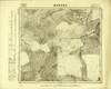
Image from the Map Collections courtesy Tohoku University. © 2023, the Committee for the Creation of the Gaihozu Digital Archives. 【図幅名】 三道花爺府嶺 【測量時期】 - 【発行時期】 昭和8年発行 【記号】 海龍城9号 【測量機関】 大日本帝國陸地測量部
リンク: 出所・参照情報
|
1933 | 4ヶ月 前 | 4個の基準点 |
|
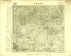
Image from the Map Collections courtesy Tohoku University. © 2023, the Committee for the Creation of the Gaihozu Digital Archives. 【図幅名】 濛江大甸子 【測量時期】 - 【発行時期】 昭和8年発行 【記号】 海龍城8号 【測量機関】 大日本帝國陸地測量部
リンク: 出所・参照情報
|
1933 | 4ヶ月 前 | 4個の基準点 |
|
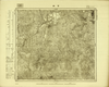
Image from the Map Collections courtesy Tohoku University. © 2023, the Committee for the Creation of the Gaihozu Digital Archives. 【図幅名】 官街 【測量時期】 - 【発行時期】 昭和8年発行 【記号】 海龍城7号 【測量機関】 大日本帝國陸地測量部
リンク: 出所・参照情報
|
1933 | 4ヶ月 前 | 4個の基準点 |
|
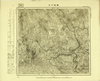
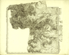
Image from the Map Collections courtesy Tohoku University. © 2023, the Committee for the Creation of the Gaihozu Digital Archives. 【図幅名】 横道河子 【測量時期】 - 【発行時期】 昭和8年発行 【記号】 海龍城6号 【測量機関】 大日本帝國陸地測量部
リンク: 出所・参照情報
|
1933 | 4ヶ月 前 | 4個の基準点 |
|
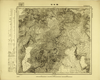
Image from the Map Collections courtesy Tohoku University. © 2023, the Committee for the Creation of the Gaihozu Digital Archives. 【図幅名】 閙枝子溝門 【測量時期】 昭和12年測量sネンソクリョウ 【発行時期】 昭和15年発行sネンハッコウ 【記号】 海龍城5号 【測量機関】 大日本帝國陸地測量部
リンク: 出所・参照情報
|
1940 | 4ヶ月 前 | 4個の基準点 |
|
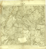
Image from the Map Collections courtesy Tohoku University. © 2023, the Committee for the Creation of the Gaihozu Digital Archives. 【図幅名】 ?牛哨 【測量時期】 - 【発行時期】 昭和8年発行 【記号】 海龍城4号 【測量機関】 大日本帝國陸地測量部
リンク: 出所・参照情報
|
1933 | 4ヶ月 前 | 4個の基準点 |
|
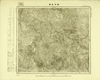
Image from the Map Collections courtesy Tohoku University. © 2023, the Committee for the Creation of the Gaihozu Digital Archives. 【図幅名】 大平川 【測量時期】 - 【発行時期】 昭和8年発行 【記号】 海龍城3号 【測量機関】 大日本帝國陸地測量部
リンク: 出所・参照情報
|
1933 | 4ヶ月 前 | 4個の基準点 |
|
Image from the Map Collections courtesy Tohoku University. © 2023, the Committee for the Creation of the Gaihozu Digital Archives. 【図幅名】 陳木匠溝 【測量時期】 - 【発行時期】 昭和8年発行 【記号】 海龍城2号 【測量機関】 大日本帝國陸地測量部
リンク: 出所・参照情報
|
1933 | 4ヶ月 前 | 4個の基準点 |
|
Image from the Map Collections courtesy Tohoku University. © 2023, the Committee for the Creation of the Gaihozu Digital Archives. 【図幅名】 漂河口子 【測量時期】 - 【発行時期】 昭和8年発行 【記号】 海龍城1号 【測量機関】 大日本帝國陸地測量部
リンク: 出所・参照情報
|
1933 | 4ヶ月 前 | 4個の基準点 |
|
Image from the Map Collections courtesy Tohoku University. © 2023, the Committee for the Creation of the Gaihozu Digital Archives. 【図幅名】 類家燒鍋 【測量時期】 昭和13年測量sネンソクリョウ 【発行時期】 昭和15年発行sネンハッコウ 【記号】 西四行北五段海龍8号ニシ4ギョウキタ 【測量機関】 大日本帝國陸地測量部
リンク: 出所・参照情報
|
1940 | 4ヶ月 前 | 4個の基準点 |
|
Image from the Map Collections courtesy Tohoku University. © 2023, the Committee for the Creation of the Gaihozu Digital Archives. 【図幅名】 大平川 【測量時期】 昭和13年測量sネンソクリョウ 【発行時期】 昭和15年発行sネンハッコウ 【記号】 西四行北五段海龍3号ニシ4ギョウキタ 【測量機関】 大日本帝國陸地測量部
リンク: 出所・参照情報
|
1940 | 4ヶ月 前 | 4個の基準点 |
|
Image from the Map Collections courtesy Tohoku University. © 2023, the Committee for the Creation of the Gaihozu Digital Archives. 【図幅名】 伊通 【測量時期】 - 【発行時期】 昭和7年発行 【記号】 新京25号 【測量機関】 大日本帝國陸地測量部
リンク: 出所・参照情報
|
1932 | 4ヶ月 前 | 4個の基準点 |
|
Image from the Map Collections courtesy Tohoku University. © 2023, the Committee for the Creation of the Gaihozu Digital Archives. 【図幅名】 新京 【測量時期】 - 【発行時期】 昭和7年発行 【記号】 新京24号 【測量機関】 大日本帝國陸地測量部
リンク: 出所・参照情報
|
1932 | 4ヶ月 前 | 4個の基準点 |
|
Image from the Map Collections courtesy Tohoku University. © 2023, the Committee for the Creation of the Gaihozu Digital Archives. 【図幅名】 小合隆 【測量時期】 - 【発行時期】 昭和7年発行 【記号】 新京23号 【測量機関】 大日本帝國陸地測量部
リンク: 出所・参照情報
|
1932 | 4ヶ月 前 | 4個の基準点 |
|
Image from the Map Collections courtesy Tohoku University. © 2023, the Committee for the Creation of the Gaihozu Digital Archives. 【図幅名】 農安 【測量時期】 - 【発行時期】 昭和7年発行 【記号】 新京22号 【測量機関】 大日本帝國陸地測量部
リンク: 出所・参照情報
|
1932 | 4ヶ月 前 | 4個の基準点 |
|
Image from the Map Collections courtesy Tohoku University. © 2023, the Committee for the Creation of the Gaihozu Digital Archives. 【図幅名】 南郭爾羅斯公爺府 【測量時期】 - 【発行時期】 昭和7年発行 【記号】 新京21号 【測量機関】 大日本帝國陸地測量部
リンク: 出所・参照情報
|
1932 | 4ヶ月 前 | 4個の基準点 |
|
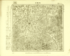
Image from the Map Collections courtesy Tohoku University. © 2023, the Committee for the Creation of the Gaihozu Digital Archives. 【図幅名】 双陽河 【測量時期】 - 【発行時期】 昭和7年発行 【記号】 新京20号 【測量機関】 大日本帝國陸地測量部
リンク: 出所・参照情報
|
1932 | 4ヶ月 前 | 4個の基準点 |
|
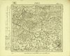
Image from the Map Collections courtesy Tohoku University. © 2023, the Committee for the Creation of the Gaihozu Digital Archives. 【図幅名】 岔路河 【測量時期】 - 【発行時期】 昭和7年発行 【記号】 新京19号 【測量機関】 大日本帝國陸地測量部
リンク: 出所・参照情報
|
1932 | 4ヶ月 前 | 4個の基準点 |
|
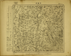
Image from the Map Collections courtesy Tohoku University. © 2023, the Committee for the Creation of the Gaihozu Digital Archives. 【図幅名】 卡倫街 【測量時期】 - 【発行時期】 昭和7年発行 【記号】 新京18号 【測量機関】 大日本帝國陸地測量部
リンク: 出所・参照情報
|
1932 | 4ヶ月 前 | 4個の基準点 |
|
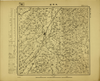
Image from the Map Collections courtesy Tohoku University. © 2023, the Committee for the Creation of the Gaihozu Digital Archives. 【図幅名】 太平荘 【測量時期】 - 【発行時期】 昭和7年発行 【記号】 新京17号 【測量機関】 大日本帝國陸地測量部
リンク: 出所・参照情報
|
1932 | 4ヶ月 前 | 4個の基準点 |
|
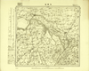
Image from the Map Collections courtesy Tohoku University. © 2023, the Committee for the Creation of the Gaihozu Digital Archives. 【図幅名】 五家站 【測量時期】 - 【発行時期】 昭和7年発行 【記号】 新京16号 【測量機関】 大日本帝國陸地測量部
リンク: 出所・参照情報
|
1932 | 4ヶ月 前 | 4個の基準点 |
|
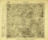
Image from the Map Collections courtesy Tohoku University. © 2023, the Committee for the Creation of the Gaihozu Digital Archives. 【図幅名】 双河鎮街 【測量時期】 - 【発行時期】 昭和7年発行 【記号】 新京15号 【測量機関】 大日本帝國陸地測量部
リンク: 出所・参照情報
|
1932 | 4ヶ月 前 | 4個の基準点 |
|
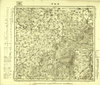
Image from the Map Collections courtesy Tohoku University. © 2023, the Committee for the Creation of the Gaihozu Digital Archives. 【図幅名】 大水河 【測量時期】 - 【発行時期】 昭和7年発行 【記号】 新京14号 【測量機関】 大日本帝國陸地測量部
リンク: 出所・参照情報
|
1932 | 4ヶ月 前 | 4個の基準点 |
|
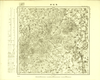
Image from the Map Collections courtesy Tohoku University. © 2023, the Committee for the Creation of the Gaihozu Digital Archives. 【図幅名】 鳥拉街 【測量時期】 - 【発行時期】 昭和7年発行 【記号】 新京13号 【測量機関】 大日本帝國陸地測量部
リンク: 出所・参照情報
|
1932 | 4ヶ月 前 | 4個の基準点 |
|
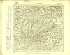
Image from the Map Collections courtesy Tohoku University. © 2023, the Committee for the Creation of the Gaihozu Digital Archives. 【図幅名】 秀水甸子 【測量時期】 - 【発行時期】 昭和7年発行 【記号】 新京12号 【測量機関】 大日本帝國陸地測量部
リンク: 出所・参照情報
|
1932 | 4ヶ月 前 | 4個の基準点 |
|
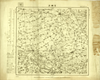
Image from the Map Collections courtesy Tohoku University. © 2023, the Committee for the Creation of the Gaihozu Digital Archives. 【図幅名】 弓棚子 【測量時期】 - 【発行時期】 昭和7年発行 【記号】 新京11号 【測量機関】 大日本帝國陸地測量部
リンク: 出所・参照情報
|
1932 | 4ヶ月 前 | 4個の基準点 |
|
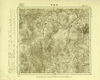
Image from the Map Collections courtesy Tohoku University. © 2023, the Committee for the Creation of the Gaihozu Digital Archives. 【図幅名】 旺起屯 【測量時期】 - 【発行時期】 昭和7年発行 【記号】 新京10号 【測量機関】 大日本帝國陸地測量部
リンク: 出所・参照情報
|
1932 | 4ヶ月 前 | 4個の基準点 |
|
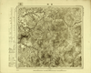
Image from the Map Collections courtesy Tohoku University. © 2023, the Committee for the Creation of the Gaihozu Digital Archives. 【図幅名】 吉林 【測量時期】 - 【発行時期】 昭和7年発行 【記号】 新京9号 【測量機関】 大日本帝國陸地測量部
リンク: 出所・参照情報
|
1932 | 4ヶ月 前 | 4個の基準点 |
|
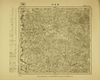
Image from the Map Collections courtesy Tohoku University. © 2023, the Committee for the Creation of the Gaihozu Digital Archives. 【図幅名】 渓浪河 【測量時期】 - 【発行時期】 昭和7年発行 【記号】 新京8号 【測量機関】 大日本帝國陸地測量部
リンク: 出所・参照情報
|
1932 | 4ヶ月 前 | 4個の基準点 |
|
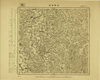
Image from the Map Collections courtesy Tohoku University. © 2023, the Committee for the Creation of the Gaihozu Digital Archives. 【図幅名】 法特哈站 【測量時期】 - 【発行時期】 昭和8年発行 【記号】 新京7号 【測量機関】 大日本帝國陸地測量部
リンク: 出所・参照情報
|
1933 | 4ヶ月 前 | 4個の基準点 |
|
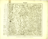
Image from the Map Collections courtesy Tohoku University. © 2023, the Committee for the Creation of the Gaihozu Digital Archives. 【図幅名】 楡樹縣 【測量時期】 - 【発行時期】 昭和8年発行 【記号】 新京6号 【測量機関】 大日本帝國陸地測量部
リンク: 出所・参照情報
|
1933 | 4ヶ月 前 | 4個の基準点 |
|
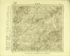
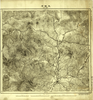
Image from the Map Collections courtesy Tohoku University. © 2023, the Committee for the Creation of the Gaihozu Digital Archives. 【図幅名】 杉松街 【測量時期】 - 【発行時期】 昭和7年発行 【記号】 新京5号 【測量機関】 大日本帝國陸地測量部
リンク: 出所・参照情報
|
1932 | 4ヶ月 前 | 4個の基準点 |
|
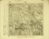
Image from the Map Collections courtesy Tohoku University. © 2023, the Committee for the Creation of the Gaihozu Digital Archives. 【図幅名】 大蛟河 【測量時期】 - 【発行時期】 昭和7年発行 【記号】 新京4号 【測量機関】 大日本帝國陸地測量部
リンク: 出所・参照情報
|
1932 | 4ヶ月 前 | 4個の基準点 |
|
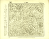
Image from the Map Collections courtesy Tohoku University. © 2023, the Committee for the Creation of the Gaihozu Digital Archives. 【図幅名】 小城子 【測量時期】 - 【発行時期】 昭和7年発行 【記号】 新京3号 【測量機関】 大日本帝國陸地測量部
リンク: 出所・参照情報
|
1932 | 4ヶ月 前 | 4個の基準点 |
|
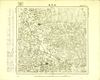
Image from the Map Collections courtesy Tohoku University. © 2023, the Committee for the Creation of the Gaihozu Digital Archives. 【図幅名】 向陽山 【測量時期】 - 【発行時期】 昭和8年発行 【記号】 新京2号 【測量機関】 大日本帝國陸地測量部
リンク: 出所・参照情報
|
1933 | 4ヶ月 前 | 4個の基準点 |
|
Image from the Map Collections courtesy Tohoku University. © 2023, the Committee for the Creation of the Gaihozu Digital Archives. 【図幅名】 山河屯 【測量時期】 - 【発行時期】 昭和8年発行 【記号】 新京1号 【測量機関】 大日本帝國陸地測量部
リンク: 出所・参照情報
|
1933 | 4ヶ月 前 | 4個の基準点 |
|
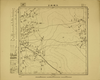
Image from the Map Collections courtesy Tohoku University. © 2023, the Committee for the Creation of the Gaihozu Digital Archives. 【図幅名】 大樹林子 【測量時期】 - 【発行時期】 昭和10年発行 【記号】 海倫24号 【測量機関】 大日本帝國陸地測量部
リンク: 出所・参照情報
|
1935 | 4ヶ月 前 | 4個の基準点 |
|
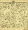
Image from the Map Collections courtesy Tohoku University. © 2023, the Committee for the Creation of the Gaihozu Digital Archives. 【図幅名】 社裡站 【測量時期】 - 【発行時期】 昭和8年発行 【記号】 哈爾賓25号 【測量機関】 大日本帝國陸地測量部
リンク: 出所・参照情報
|
1933 | 4ヶ月 前 | 4個の基準点 |
|
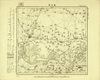
Image from the Map Collections courtesy Tohoku University. © 2023, the Committee for the Creation of the Gaihozu Digital Archives. 【図幅名】 肇州縣 【測量時期】 - 【発行時期】 昭和8年発行 【記号】 哈爾賓24号 【測量機関】 大日本帝國陸地測量部
リンク: 出所・参照情報
|
1933 | 4ヶ月 前 | 4個の基準点 |
|
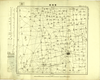
Image from the Map Collections courtesy Tohoku University. © 2023, the Committee for the Creation of the Gaihozu Digital Archives. 【図幅名】 豐楽鎮 【測量時期】 - 【発行時期】 昭和8年発行 【記号】 哈爾賓23号 【測量機関】 大日本帝國陸地測量部
リンク: 出所・参照情報
|
1933 | 4ヶ月 前 | 4個の基準点 |
|
Image from the Map Collections courtesy Tohoku University. © 2023, the Committee for the Creation of the Gaihozu Digital Archives. 【図幅名】 昇平鎭 【測量時期】 - 【発行時期】 昭和7年発行 【記号】 哈爾賓22号 【測量機関】 大日本帝國陸地測量部
リンク: 出所・参照情報
|
1932 | 4ヶ月 前 | 4個の基準点 |
|
Image from the Map Collections courtesy Tohoku University. © 2023, the Committee for the Creation of the Gaihozu Digital Archives. 【図幅名】 安達站 【測量時期】 - 【発行時期】 昭和10年発行 【記号】 哈爾賓21号 【測量機関】 大日本帝國陸地測量部
リンク: 出所・参照情報
|
1935 | 4ヶ月 前 | 4個の基準点 |
|
Image from the Map Collections courtesy Tohoku University. © 2023, the Committee for the Creation of the Gaihozu Digital Archives. 【図幅名】 集廠子 【測量時期】 - 【発行時期】 昭和7年発行 【記号】 哈爾賓20号 【測量機関】 大日本帝國陸地測量部
リンク: 出所・参照情報
|
1932 | 4ヶ月 前 | 4個の基準点 |
|
Image from the Map Collections courtesy Tohoku University. © 2023, the Committee for the Creation of the Gaihozu Digital Archives. 【図幅名】 三站 【測量時期】 - 【発行時期】 昭和7年発行 【記号】 哈爾賓19号 【測量機関】 大日本帝國陸地測量部
リンク: 出所・参照情報
|
1932 | 4ヶ月 前 | 4個の基準点 |
|
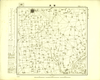
Image from the Map Collections courtesy Tohoku University. © 2023, the Committee for the Creation of the Gaihozu Digital Archives. 【図幅名】 肇東 【測量時期】 - 【発行時期】 昭和7年発行 【記号】 哈爾賓18号 【測量機関】 大日本帝國陸地測量部
リンク: 出所・参照情報
|
1932 | 4ヶ月 前 | 4個の基準点 |
|
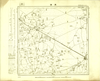
Image from the Map Collections courtesy Tohoku University. © 2023, the Committee for the Creation of the Gaihozu Digital Archives. 【図幅名】 満溝 【測量時期】 - 【発行時期】 昭和7年発行 【記号】 哈爾賓17号 【測量機関】 大日本帝國陸地測量部
リンク: 出所・参照情報
|
1932 | 4ヶ月 前 | 4個の基準点 |
|
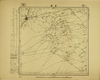
Image from the Map Collections courtesy Tohoku University. © 2023, the Committee for the Creation of the Gaihozu Digital Archives. 【図幅名】 安達 【測量時期】 - 【発行時期】 昭和10年発行 【記号】 哈爾賓16号 【測量機関】 大日本帝國陸地測量部
リンク: 出所・参照情報
|
1935 | 4ヶ月 前 | 4個の基準点 |
|
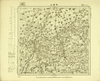
Image from the Map Collections courtesy Tohoku University. © 2023, the Committee for the Creation of the Gaihozu Digital Archives. 【図幅名】 珠爾山 【測量時期】 - 【発行時期】 昭和7年発行 【記号】 哈爾賓15号 【測量機関】 大日本帝國陸地測量部
リンク: 出所・参照情報
|
1932 | 4ヶ月 前 | 4個の基準点 |
|
Image from the Map Collections courtesy Tohoku University. © 2023, the Committee for the Creation of the Gaihozu Digital Archives. 【図幅名】 雙城堡 【測量時期】 - 【発行時期】 昭和7年発行 【記号】 哈爾賓14号 【測量機関】 大日本帝國陸地測量部
リンク: 出所・参照情報
|
1932 | 4ヶ月 前 | 4個の基準点 |
|
Image from the Map Collections courtesy Tohoku University. © 2023, the Committee for the Creation of the Gaihozu Digital Archives. 【図幅名】 對青山 【測量時期】 - 【発行時期】 昭和7年発行 【記号】 哈爾賓13号 【測量機関】 大日本帝國陸地測量部
リンク: 出所・参照情報
|
1932 | 4ヶ月 前 | 4個の基準点 |


