地図を見る
| 地図 | タイトル | 年 | 前回の更新 | ステータス  |
|---|---|---|---|---|
|
リンク: 出所・参照情報
|
2020 | 3年弱 前 | 5個の基準点 |
|
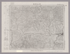
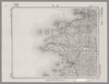
Image from the Map Collections courtesy Stanford University Libraries, licensed under a Creative Commons Attribution-Noncommercial 3.0 Unported License. © Stanford University. 【図幅名】 佐賀関 【測量時期】 明治36年測図/昭和2年第2回修正 【発行時期】 昭和21年9月発行 【記号】 大分1号(共16面) 【測量機関】 内務省地理調査所 【備考】
リンク: 出所・参照情報
|
23日 前 | 4個の基準点 | |
|
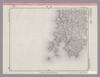
Image from the Map Collections courtesy Stanford University Libraries, licensed under a Creative Commons Attribution-Noncommercial 3.0 Unported License. © Stanford University. 【図幅名】 大牟田 【測量時期】 明治34年測圖/大正15年第二回修正測圖/昭和6年鐡道補入 【発行時期】 【記号】 熊本十号 【測量機関】 参謀本部 【備考】 祕
リンク: 出所・参照情報
|
23日 前 | 4個の基準点 | |
|
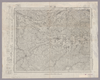
Image from the Map Collections courtesy Stanford University Libraries, licensed under a Creative Commons Attribution-Noncommercial 3.0 Unported License. © Stanford University. 【図幅名】 宇部東部 【測量時期】 明治32年測圖/昭和2年修正測圖 【発行時期】 【記号】 中津九号 【測量機関】 参謀本部 【備考】 祕
リンク: 出所・参照情報
|
約1ヶ月 前 | 4個の基準点 | |
|
Image from the Map Collections courtesy Stanford University Libraries, licensed under a Creative Commons Attribution-Noncommercial 3.0 Unported License. © Stanford University. 【図幅名】 松山南部 【測量時期】 明治36年測図/昭和3年修正、測図の縮図/昭和7年鉄道補入、測図の縮図 【発行時期】 昭和8年11月発行 【記号】 松山2号(共15面) 【測量機関】 大日本帝国陸地測量部 【備考】 ( 1枚のレイヤー)
リンク: 出所・参照情報
|
2ヶ月 前 | 4個の基準点 | |
|
|
2022 | 約2年 前 | 4個の基準点 |
|
|
2022 | 約2年 前 | 5個の基準点 |
|
( 1枚のレイヤー)
リンク: 出所・参照情報
|
1924 | 1年以上 前 | 4個の基準点 |
|
Image from the Map Collections courtesy Stanford University Libraries, licensed under a Creative Commons Attribution-Noncommercial 3.0 Unported License. © Stanford University. 【図幅名】 高見山 【測量時期】 明治25年測圖/昭和3年要部修正測圖/昭和6年部分修正測圖 【発行時期】 【記号】 宇治山田十四号 【測量機関】 参謀本部 【備考】 祕
リンク: 出所・参照情報
|
2ヶ月 前 | 4個の基準点 | |
|
|
2019 | 5年以上 前 | 4個の基準点 |
|
Image from the Map Collections courtesy Stanford University Libraries, licensed under a Creative Commons Attribution-Noncommercial 3.0 Unported License. © Stanford University. 【図幅名】 御前崎 【測量時期】 明治22年測図/大正5年第2回修正/昭和2年鉄道補入 【発行時期】 昭和3年9月発行 【記号】 神子元島13号(共2面) 【測量機関】 大日本帝国陸地測量部 【備考】
リンク: 出所・参照情報
|
2ヶ月 前 | 4個の基準点 | |
|
【最初期発行】 この地図の作成に当たっては、国土地理院長の承認を得て、同院発行の20万分の1地勢図及び5万分の1地形図を使用した。(承認番号 平30情使、 第1148号)
リンク: 出所・参照情報
|
1916 | 3年弱 前 | 4個の基準点 |
|
この地図の作成に当たっては、国土地理院長の承認を得て、同院発行の20万分の1地勢図及び5万分の1地形図を使用した。(承認番号 平30情使、 第1148号)
リンク: 出所・参照情報
|
1947 | 5年以上 前 | 4個の基準点 |
|
この地図の作成に当たっては、国土地理院長の承認を得て、同院発行の20万分の1地勢図及び5万分の1地形図を使用した。(承認番号 平30情使、 第1148号)
リンク: 出所・参照情報
|
1949 | 5年以上 前 | 4個の基準点 |
|
Image from the Map Collections courtesy Stanford University Libraries, licensed under a Creative Commons Attribution-Noncommercial 3.0 Unported License. © Stanford University. 【図幅名】 彦根東部 【測量時期】 明治24年測図/大正9年修正/昭和7年鉄道補入 【発行時期】 昭和8年6月発行 【記号】 名古屋9号(共16面) 【測量機関】 大日本帝国陸地測量部 【備考】 ( 1枚のレイヤー)
リンク: 出所・参照情報
|
3ヶ月 前 | 4個の基準点 | |
|
|
11ヶ月 前 | 4個の基準点 | |
|
Image from the Map Collections courtesy Stanford University Libraries, licensed under a Creative Commons Attribution-Noncommercial 3.0 Unported License. © Stanford University. 【図幅名】 津山西部 【測量時期】 明治31年測量/昭和7年要部修正、測図の縮図 【発行時期】 昭和9年7月発行 【記号】 高梁2号(共16面) 【測量機関】 大日本帝国陸地測量部 【備考】
リンク: 出所・参照情報
|
6ヶ月 前 | 4個の基準点 | |
|
リンク: 出所・参照情報
|
2021 | 1年以上 前 | 9個の基準点 |
|
この地図の作成に当たっては、国土地理院長の承認を得て、同院発行の20万分の1地勢図及び5万分の1地形図を使用した。(承認番号 平30情使、 第1148号)
リンク: 出所・参照情報
|
1946 | 5年以上 前 | 4個の基準点 |
|
|
2022 | 約2年 前 | 7個の基準点 |
|
この地図の作成に当たっては、国土地理院長の承認を得て、同院発行の20万分の1地勢図及び5万分の1地形図を使用した。(承認番号 平30情使、 第1148号)
リンク: 出所・参照情報
|
1946 | 5年以上 前 | 4個の基準点 |
|
Image from the Map Collections courtesy Stanford University Libraries, licensed under a Creative Commons Attribution-Noncommercial 3.0 Unported License. © Stanford University. 【図幅名】 上野 【測量時期】 明治25年測図の縮図/昭和12年第2回修正 【発行時期】 【記号】 名古屋16号 【測量機関】 参謀本部 【備考】 秘
リンク: 出所・参照情報
|
2ヶ月 前 | 4個の基準点 | |
|
Image from the Map Collections courtesy Stanford University Libraries, licensed under a Creative Commons Attribution-Noncommercial 3.0 Unported License. © Stanford University. 【図幅名】 住吉 【測量時期】 明治21年測量、測図の縮図/昭和15年第2回修正、測図の縮図 【発行時期】 【記号】 静岡12号(共15面) 【測量機関】 参謀本部 【備考】 秘
リンク: 出所・参照情報
|
約2ヶ月 前 | 4個の基準点 | |
|
Image from the Map Collections courtesy Stanford University Libraries, licensed under a Creative Commons Attribution-Noncommercial 3.0 Unported License. © Stanford University. 【図幅名】 三次 【測量時期】 明治31年測図/昭和7年修正 【発行時期】 昭和10年6月発行 【記号】 浜田4号(共15面) 【測量機関】 大日本帝国陸地測量部 【備考】
リンク: 出所・参照情報
|
2年以上 前 | 4個の基準点 | |
|
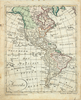
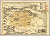
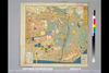
【Courtesy of the C. V. Starr East Asian Library University of California, Berkeley】 1 map ; 34 x 150 cm., folded in cover 19 x 10 cm. Mounted cover title. Copperplate print. In Japanese. Relief shown pictorially. Includes legend. Shows distances of roads and sea routes. East Asian Library call number: Cb75.
リンク: 出所・参照情報
|
1881 | 3年以上 前 | 4個の基準点 |
|
|
2022 | 約2年 前 | 5個の基準点 |
|
Image from the Map Collections courtesy Stanford University Libraries, licensed under a Creative Commons Attribution-Noncommercial 3.0 Unported License. © Stanford University. 【図幅名】 尾道 【測量時期】 明治31年測図/大正14年修正/昭和7年鉄道補入 【発行時期】 昭和8年6月発行 【記号】 岡山及丸亀14号(共16面) 【測量機関】 大日本帝国陸地測量部 【備考】
リンク: 出所・参照情報
|
2ヶ月 前 | 4個の基準点 | |
|
Image from the Map Collections courtesy Stanford University Libraries, licensed under a Creative Commons Attribution-Noncommercial 3.0 Unported License. © Stanford University. 【図幅名】 志度 【測量時期】 明治29年測図/明治30年測図の縮図/昭和3年修正、測図の縮図/昭和7年鉄道補入、測図の縮図 【発行時期】 【記号】 徳島15号(共14面) 【測量機関】 参謀本部 【備考】 秘
リンク: 出所・参照情報
|
約1ヶ月 前 | 4個の基準点 | |
|
Image from the Map Collections courtesy Stanford University Libraries, licensed under a Creative Commons Attribution-Noncommercial 3.0 Unported License. © Stanford University. 【図幅名】 海南 【測量時期】 明治43年測図の縮図/明治44年測図/昭和9年第2回修正、測図の縮図 【発行時期】 昭和16年7月発行 【記号】 由良要塞近傍5号(共10面) 【測量機関】 参謀本部 【備考】 和歌山16号(共16面) 軍事極秘
リンク: 出所・参照情報
|
2年以上 前 | 4個の基準点 | |
|
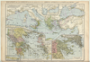
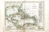
【Courtesy of the C. V. Starr East Asian Library University of California, Berkeley】 In Japanese. Oriented with north to the left. Relief shown pictorially. Includes distance chart, a fare table and a view of a temple. Folded to 27 x 13 cm. Col. East Asian Library call number: F131.
リンク: 出所・参照情報
|
1902 | 約4年 前 | 18個の基準点 |
|
Image from the Map Collections courtesy Stanford University Libraries, licensed under a Creative Commons Attribution-Noncommercial 3.0 Unported License. © Stanford University. 【図幅名】 郷ノ浦 【測量時期】 大正12年測図の縮図/昭和10年修正、測図の縮図 【発行時期】 昭和21年11月発行 【記号】 唐津6号(共8面) 【測量機関】 地理調査所 【備考】
リンク: 出所・参照情報
|
約1ヶ月 前 | 4個の基準点 | |
|
Image from the Map Collections courtesy Stanford University Libraries, licensed under a Creative Commons Attribution-Noncommercial 3.0 Unported License. © Stanford University. 【図幅名】 富岡 【測量時期】 明治40年測図/昭和4年修正/昭和9年要部修正 【発行時期】 昭和15年8月発行 【記号】 長野3号(共16面) 【測量機関】 大日本帝国陸地測量部 【備考】
リンク: 出所・参照情報
|
2ヶ月 前 | 4個の基準点 | |
|
国立国会図書館デジタルコレクション インターネット公開(保護期間満了) ( 2枚のレイヤー)
リンク: 出所・参照情報
|
1853 | 4年弱 前 | 33個の基準点 |
|
Image from the Map Collections courtesy Stanford University Libraries, licensed under a Creative Commons Attribution-Noncommercial 3.0 Unported License. © Stanford University. 【図幅名】 小千谷 【測量時期】 明治44年測図/昭和4年鉄道補入 【発行時期】 昭和6年6月発行 【記号】 高田1号(共15面) 【測量機関】 大日本帝国陸地測量部 【備考】
リンク: 出所・参照情報
|
2ヶ月 前 | 4個の基準点 | |
|
shelfmark: Or.75.f.9
License: Public Domain
元禄1 *ケンペル旧蔵。 Xylograph. Ex-Kaempfer. Gardner, #570.
リンク: 出所・参照情報
|
1688 | 1年以上 前 | 3個の基準点 |
|
リンク: 出所・参照情報
|
2020 | 2年弱 前 | 11個の基準点 |
|
文化14年、早島町大橋家蔵
|
1817 | 3ヶ月 前 | 4個の基準点 |
|
【Courtesy of the C. V. Starr East Asian Library University of California, Berkeley】 1 map : hand col. ; on sheet 83 x 126 cm., folded in cover 21 x 17 cm. Wood block print. In Japanese. Title from: Nihon chizushi / Akioka Takejiro. p. 147. Covers Matsumae to Tsushima and Ryukyu and Hachijojima. Preface by Shibano Ritsuzan in 1775. Oriented with north to the upper right. Shows longitude and latitude. Includes legend, explanation of tides, Ogasawara and Izu Shichito and text by the author. East Asian Library call number Ca-12.
リンク: 出所・参照情報
|
1779 | 4年弱 前 | 5個の基準点 |
|
Image from the Map Collections courtesy Stanford University Libraries, licensed under a Creative Commons Attribution-Noncommercial 3.0 Unported License. © Stanford University. 【図幅名】 阿蘇山 【測量時期】 明治35年測圖/昭和7年第二回修正測圖 【発行時期】 【記号】 大分十五号 【測量機関】 参謀本部 【備考】 祕
リンク: 出所・参照情報
|
30日 前 | 4個の基準点 | |
|
|
2020 | 約4年 前 | 4個の基準点 |
|
【Courtesy of the C. V. Starr East Asian Library University of California, Berkeley】 1 atlas 2 v. : 76 col. maps ; 26 cm. Wood block print. In Japanese. Preface by Saito Ken and afterword by Yamazaki Giko. Date of publication on preface and afterword. Orientation varies. Covers Matsumae to Tsushima. Engraved by Shogetsudo. Includes Dai Nihon yochi zenzu and Gokai Bunkoku chikyu zenzu. East Asian Library call number: Ca 24.5 Rare-Map.
リンク: 出所・参照情報
|
1834 | 3年以上 前 | 4個の基準点 |
|
【Courtesy of the C. V. Starr East Asian Library University of California, Berkeley】 Japanese date Meiji 8 1875. In color. Folded. Mounted cover title. Wood block print. In Japanese. Relief shown by hachures. Orientation varies. 1 inset: Ryūkyū Shotō. Shows distance of sea routes. Includes legend.
リンク: 出所・参照情報
|
1875 | 4年弱 前 | 5個の基準点 |
|
|
2023 | 1年以上 前 | 8個の基準点 |
|
Image from the Map Collections courtesy Stanford University Libraries, licensed under a Creative Commons Attribution-Noncommercial 3.0 Unported License. © Stanford University. 【図幅名】 宮原 【測量時期】 明治36年測圖/昭和2年要部修正測圖 【発行時期】 昭和4年発行 【記号】 大分十四号 【測量機関】 大日本帝國陸地測量部 【備考】
リンク: 出所・参照情報
|
23日 前 | 4個の基準点 | |
|
国立国会図書館デジタルコレクション
インターネット公開(保護期間満了) ( 4枚のレイヤー)
リンク: 出所・参照情報
|
1849 | 2年以上 前 | 62個の基準点 |
|
shelfmark: Maps 145.d.279
License: Public Domain
嘉永3 *多色刷り。『江戸切絵図集成』第四巻所収の嘉永3訂・図に該当。外題「駿河台小川町絵図」。初版図の刊年が嘉永3となっているが、本図の刊記は「嘉永二己酉年新刻/安政七庚申年改」。英数字・片仮名書き入れ多し。 Xylograph. Acquired 22 July 1868. Ex-Siebold. Edo kiriezu shusei 4: 40-45
リンク: 出所・参照情報
|
1850 | 約4年 前 | 9個の基準点 |
|
Image from the Map Collections courtesy Stanford University Libraries, licensed under a Creative Commons Attribution-Noncommercial 3.0 Unported License. © Stanford University. 【図幅名】 諌早 【測量時期】 明治33年測圖及測圖之縮圖/大正15年修正測圖及修正測圖之縮圖 【発行時期】 【記号】 熊本十五号 【測量機関】 参謀本部 【備考】 祕
リンク: 出所・参照情報
|
30日 前 | 4個の基準点 | |
|
Image from the Map Collections courtesy Stanford University Libraries, licensed under a Creative Commons Attribution-Noncommercial 3.0 Unported License. © Stanford University. 【図幅名】 長州 【測量時期】 明治33年測圖/大正15年第二回修正測圖/昭和7年部分修正測圖 【発行時期】 昭和9年発行 【記号】 熊本十一号 【測量機関】 大日本帝國陸地測量部 【備考】
リンク: 出所・参照情報
|
30日 前 | 4個の基準点 | |
|
shelfmark: Maps 62980.14
License: Public Domain
文化5 *多色刷り。刊記「浪華書籍師/藤屋弥兵衛・吉文字屋市左衛門」。外題「大日本細見指全図(改正増選)」。 Xylograph.
リンク: 出所・参照情報
|
1808 | 3年以上 前 | 25個の基準点 |
|
Image from the Map Collections courtesy Stanford University Libraries, licensed under a Creative Commons Attribution-Noncommercial 3.0 Unported License. © Stanford University. 【図幅名】 【測量時期】 【発行時期】 【記号】 【測量機関】 【備考】
リンク: 出所・参照情報
|
23日 前 | 4個の基準点 |