戦前旧版地形図 Last modified almost 7 years ago. Depicts : 1910 Links: Source / Biblio Ref
3 maps (3 maps rectified 100%)
Download KML |
|
|
旧版地形図(1/5万)
戦前旧版地形図 Last modified almost 7 years ago. Depicts : 1910 Links: Source / Biblio Ref 3 maps (3 maps rectified 100%) Download KML | |

| Map | Title | Year | Last Updated | Status |
|---|---|---|---|---|
|
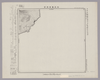
Image from the Map Collections courtesy Stanford University Libraries, licensed under a Creative Commons Attribution-Noncommercial 3.0 Unported License. © Stanford University. 【図幅名】 積丹岬 【測量時期】 大正6年測図 【発行時期】 大正7年8月発行 【記号】 岩内9号北部(共15面) 【測量機関】 大日本帝国陸地測量部 【備考】 (In 2 layers)
Links: Source / Biblio Ref
|
5 months ago | 4 control points | |
|
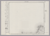
Image from the Map Collections courtesy Stanford University Libraries, licensed under a Creative Commons Attribution-Noncommercial 3.0 Unported License. © Stanford University. 【図幅名】 宗谷岬 【測量時期】 大正12年測図 【発行時期】 大正14年2月発行 【記号】 聲問近傍3号(共7面) 【測量機関】 陸地測量部・参謀本部 【備考】 宗谷3号(共7面) 仮製版 軍事極秘 (In 2 layers)
Links: Source / Biblio Ref
|
5 months ago | 4 control points | |
|
|
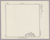
Image from the Map Collections courtesy Stanford University Libraries, licensed under a Creative Commons Attribution-Noncommercial 3.0 Unported License. © Stanford University. 【図幅名】 利尻島東南部 【測量時期】 大正12年測圖 【発行時期】 【記号】 天塩十号 【測量機関】 参謀本部 【備考】 祕 假製版 (In 2 layers)
Links: Source / Biblio Ref
|
5 months ago | 4 control points |
 WMS Capabilities URL
 Tiles (Google/OSM scheme)