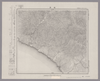
Image from the Map Collections courtesy Stanford University Libraries, licensed under a Creative Commons Attribution-Noncommercial 3.0 Unported License. © Stanford University. 【図幅名】 幌泉 【測量時期】 大正9年測圖 【発行時期】 【記号】 広尾十六号 【測量機関】 参謀本部 【備考】 祕 アップロード者: autobot. ( 1枚のレイヤー) 最終更新日時 8年以上 前. 4個の基準点.
リンク: 出所・参照情報 | KMLをダウンロードする |
 WMS CapabilitiesのURL
 タイル(Google・OSMのフォーマット)
 基準点をCSVでダウンロードする