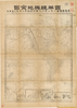
【Courtesy of the C. V. Starr East Asian Library University of California, Berkeley】 Lithograph. In Japanese. Relief shown by hachures. Shows distance of sea routes. Includes 3 insets, charts of mountains and rivers, and legend. Engraved by Hosoi Matsuo. Kaishin Shinbun daiissennihyakurokugo furoku. 1 map ; 57 x 42 cm., folded in cover 19 x 13 cm. East Asian Library call number A46-1. Uploaded by ima. Depicts: 1887 Last modified over 7 years ago. Unrectified.
Tags
Links: Source / Biblio Ref |
 WMS Capabilities URL
 Tiles (Google/OSM scheme)
 Download control points as CSV