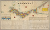
【Courtesy of the C. V. Starr East Asian Library University of California, Berkeley】 1 map : col. ; 33 x 79 cm., folded in cover 19 x 13 cm. Copperplate print. In Japanese. Oriented with north to the upper right. Includes lists of prefectures, mountains and rivers. Relief shown pictorially. Includes views of 2 ports, distance chart and legend. Engraved by Minaguchi Garyuken Seifu. East Asian Library call number: Cb21. Uploaded by ima. Depicts: 1868 Last modified over 5 years ago. 4 control points.
Tags
Links: Source / Biblio Ref | Download KML |
 WMS Capabilities URL
 Tiles (Google/OSM scheme)
 Download control points as CSV