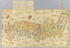
【Courtesy of the C. V. Starr East Asian Library University of California, Berkeley】 1 map : hand col. ; 61 x 109 cm., folded to 17 x 15 cm., in envelope 31 x 21 cm. Wood block print. In Japanese. Covers Matsumae to Tsushima, Iojima, Ryukyu, and Hachijojima. Title added by hand. Shows distance of sea routes. Includes legend. East Asian Library call number Ca_21. Uploaded by ima. Depicts: 1730 Last modified over 5 years ago. 5 control points.
Tags
Links: Source / Biblio Ref | Download KML |
 WMS Capabilities URL
 Tiles (Google/OSM scheme)
 Download control points as CSV