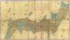
【Courtesy of the C. V. Starr East Asian Library University of California, Berkeley】 1 map : col. ; 101 x 183 cm., folded to 27 x 19 cm. Title added by hand. Wood block print. In Japanese. Oriented with north to the upper right. Covers Matsumae to Okinoerabujima, Tsushima and Ogasawara. Shows the distance of sea routes and Kuroshio. Includes legend. Alternate Title: Dai Nihon kokugun yochi rotei zenzu. East Asian Library call number Ca 34. Uploaded by ima. Depicts: 1852 Last modified over 5 years ago. 5 control points.
Tags
Links: Source / Biblio Ref | Download KML |
 WMS Capabilities URL
 Tiles (Google/OSM scheme)
 Download control points as CSV