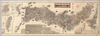
【Courtesy of the C. V. Starr East Asian Library University of California, Berkeley】 Japanese date Meiji 33 1900. In color. Folded. Lithograph. In Japanese. Oriented with north to the upper right. Relief shown by hachures. Includes 5 insets: Hokkaidō zenzu.--Nihon shinryōchi Taiwan zenzu.--Chōsen zenzu ... et al. Includes list of district names, distance chart, and legend. Includes charts of mountains, rivers and lakes. Includes distances of roads and sea routes. Uploaded by ima. Depicts: 1900 Last modified over 5 years ago. 5 control points.
Tags
Links: Source / Biblio Ref | Download KML |
 WMS Capabilities URL
 Tiles (Google/OSM scheme)
 Download control points as CSV