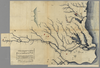
shelfmark: Maps 149.e.264 License: Public Domain 江戸後期写 *下総・下野・常陸を中心とした河川の図 Manuscript, early 19th century; shows mostly the provinces of Shimosa, Shimotsuke and Hitachi Uploaded by autobot. Last modified over 6 years ago. Unrectified.
Tags
Links: Source / Biblio Ref |
 WMS Capabilities URL
 Tiles (Google/OSM scheme)
 Download control points as CSV