Japanese Map Warper

Log In Create Account
English (en)
Home > Maps > Map 4137
Bl 01 0178 iznpghcu 山城州大絵図 Yamashiro no kuni oezu Large illustrated map of the province of Yamashiro
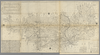
shelfmark: Maps 149.e.276 License: Public Domain 安永7 *二色刷り。(刊記書肆)京都書林、矢野長兵衛・石田治兵衛・林権兵衛・小川多左衛門・北村四郎右衛門・正本屋吉兵衛。 Xylograph. Acquired 22 July 1868. Ex-Siebold. Each of the three copies of this map in the BL see Maps *63150.5 & Maps *63100.10, below has a different colophon with a different list of publishers, showing that they were printed at different times; the three colophons, however, all bear the same date. Beans 24. Uploaded by autobot. Depicts: 1778 Last modified over 4 years ago. Unrectified.
Tags British Library 大英図書館
Links: Source / Biblio Ref
Share |
Kml logo 20x25 Export

Metadata

Title
山城州大絵図 Yamashiro no kuni oezu [Large illustrated map of the province of Yamashiro]

Description
shelfmark: Maps 149.e.2(76) License: Public Domain 安永7 *二色刷り。(刊記書肆)京都書林、矢野長兵衛・石田治兵衛・林権兵衛・小川多左衛門・北村四郎右衛門・正本屋吉兵衛。 Xylograph. Acquired 22 July 1868. Ex-Siebold. Each of the three copies of this map in the BL (see Maps *63150.(5) & Maps *63100.(10), below) has a different colophon with a different list of publishers, showing that they were printed at different times; the three colophons, however, all bear the same date. Beans 24.

Tags: British Library 大英図書館

is_map

Source / Bibliographic Ref URL
https://www.bl.uk/

Publisher
正本屋吉兵衛等

Author(s)
下河辺拾水画 Shimokobe Shusui (d.1798)

Scale

Published Date

Reprint Date

修正を提案する