|
『寶珠山』五万分一地形圖
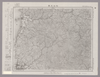
Image from the Map Collections courtesy Stanford University Libraries. This item is in the public domain. There are no restrictions on use. 【図幅名】 寶珠山【測量時期】 大正4年測圖 【発行時期】昭和11年 【記号】 捨子古丹島一号 【測量機関】 参謀本部 【その他】千島列島 陸地測量部 Uploaded by dandan1024. (In 1 layer) Depicts: 1936 Last modified over 3 years ago. 4 control points. Tags Links: Source / Biblio Ref | Download KML | |
 WMS Capabilities URL
 Tiles (Google/OSM scheme)
 Download control points as CSV
Mosaic List for Map 5383
| Mosaic | Title | Year | Last Updated | Number of Maps | Percentage Complete |
|---|---|---|---|---|---|
|
五万分一地形圖
Compiled by shapez. Download KML |
4 months ago | 53 maps |
100% (53 maps) |
Displaying 1 layer per page