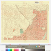
Uploaded by Keiji_Yano. (In 1 layer) Depicts: 1924 Last modified over 2 years ago. 4 control points.
Links: Source / Biblio Ref | Download KML |

|
東京市火災動態地図(上野)
Uploaded by Keiji_Yano. (In 1 layer) Depicts: 1924 Last modified over 2 years ago. 4 control points. Links: Source / Biblio Ref | Download KML | |
Title
東京市火災動態地図(上野)
Description
is_map
Source / Bibliographic Ref URL
https://archive.library.metro.tokyo.lg.jp/da/detail?tilcod=0000000008-00000943
Publisher
文部省震災予防調査会
Author(s)
文部省震災予防調査会/編
Scale
1:10000 4色刷
Published Date
Reprint Date