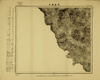
Image from the Map Collections courtesy Tohoku University. © 2023, the Committee for the Creation of the Gaihozu Digital Archives. 【図幅名】 黒達營子 【測量時期】 - 【発行時期】 昭和10年発行 【記号】 宣化13号 【測量機関】 大日本帝國陸地測量部 Uploaded by autobot. Depicts: 1935 Last modified 4 months ago. 4 control points.
Tags
Links: Source / Biblio Ref | Download KML |
 Export
 WMS Capabilities URL
 Tiles (Google/OSM scheme)
 Download control points as CSV