Browse Maps
| map | Title  |
Year | Last Updated | Status |
|---|---|---|---|---|
|
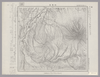
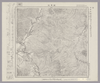
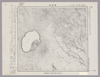
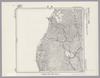
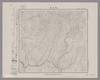
Image from the Map Collections courtesy Stanford University Libraries, licensed under a Creative Commons Attribution-Noncommercial 3.0 Unported License. © Stanford University. 【図幅名】 斜里岳 【測量時期】 大正13年測図/昭和7年鉄道補入 【発行時期】 昭和8年9月発行 【記号】 斜里6号(共16面) 【測量機関】 大日本帝国陸地測量部 【備考】 仮製版 (In 1 layer)
Links: Source / Biblio Ref
|
about 2 years ago | 4 control points | |
|
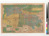
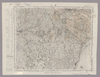
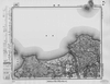
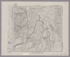
Image from the Map Collections courtesy Stanford University Libraries, licensed under a Creative Commons Attribution-Noncommercial 3.0 Unported License. © Stanford University. 【図幅名】 斜里 【測量時期】 大正13年測圖/昭和19年部分修正測圖 【発行時期】 【記号】 斜里五号 【測量機関】 参謀本部 【備考】 軍事祕密(戦地ニ限リ極祕) (In 1 layer)
Links: Source / Biblio Ref
|
about 2 years ago | 4 control points | |
|
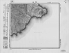
【最初期発行】 この地図の作成に当たっては、国土地理院長の承認を得て、同院発行の20万分の1地勢図及び5万分の1地形図を使用した。(承認番号 平30情使、 第1148号)
Links: Source / Biblio Ref
|
1929 | over 5 years ago | 4 control points |

|
|
1823 | over 5 years ago | 3 control points |
|
gis day テスト
|
2019 | over 5 years ago | 3 control points |

|
|
1813 | over 6 years ago | 4 control points |

|
|
over 6 years ago | 4 control points | |

|
|
1813 | about 7 years ago | 15 control points |
|
|
1813 | over 6 years ago | 4 control points |

|
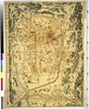
立命館ARC 成立・出版年: 文化10 出版地: 京都
|
2019 | over 5 years ago | 3 control points |

|
gisday2019
|
1863 | about 4 years ago | 3 control points |
|
|
1863 | about 7 years ago | 8 control points |

|
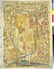
Owned by 立命館大学アート・リサーチセンター 【成立・出版年】 文久031863
Links: Source / Biblio Ref
|
1863 | almost 3 years ago | 27 control points |

|
|
2017 | almost 7 years ago | 9 control points |

|
|
2018 | over 6 years ago | 6 control points |
|
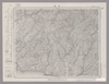
Image from the Map Collections courtesy Stanford University Libraries, licensed under a Creative Commons Attribution-Noncommercial 3.0 Unported License. © Stanford University. 【図幅名】 敦賀 【測量時期】 明治25年測図/明治42年測図の縮図/昭和7年第2回修正、測図の縮図 【発行時期】 昭和9年11月発行 【記号】 岐阜15号(共16面) 【測量機関】 大日本帝国陸地測量部 【備考】 (In 1 layer)
Links: Source / Biblio Ref
|
about 2 years ago | 4 control points | |
|
この地図の作成に当たっては、国土地理院長の承認を得て、同院発行の20万分の1地勢図及び5万分の1地形図を使用した。(承認番号 平30情使、 第1148号)
Links: Source / Biblio Ref
|
1947 | over 5 years ago | 4 control points |
|
Image from the Map Collections courtesy Stanford University Libraries, licensed under a Creative Commons Attribution-Noncommercial 3.0 Unported License. © Stanford University. 【図幅名】 敏音知 【測量時期】 大正12年測図/昭和3年鉄道補入 【発行時期】 昭和5年3月発行 【記号】 枝幸15号(共12面) 【測量機関】 大日本帝国陸地測量部 【備考】 仮製版
Links: Source / Biblio Ref
|
about 2 years ago | 4 control points | |
|
説明
|
1944 | about 4 years ago | 4 control points |
|
Links: Source / Biblio Ref
|
1851 | about 6 years ago | 4 control points |

|
|
1944 | 3 months ago | 4 control points |

|
Links: Source / Biblio Ref
|
1944 | over 6 years ago | 64 control points |
|
shelfmark: Maps 63090.5
License: Public Domain
文化8 *多色刷り。外題欠。序題「新刻日本輿地路程全図」。安永乙未序。(刊記書肆)東都、須原茂兵衛/浪華、松邑九兵衛・柳原喜兵衛・吉田善蔵・赤松九兵衛・浅野弥兵衛/京師、井上治兵衛鐫字。 Xylograph. Purchased from Martinus Nijhof, The Hague, 8 November 1893.
Links: Source / Biblio Ref
|
1811 | about 3 years ago | 18 control points |
|
shelfmark: Maps 38.b.168
License: Public Domain
天保13 *多色刷り。刊記「浪花書林/石川屋和助」。英字書き入れ多し。 Xylograph.
Links: Source / Biblio Ref
|
1842 | about 3 years ago | 3 control points |

|
|
1868 | over 6 years ago | 5 control points |
|
GISDay2019 Mapwarper
TEST 01
|
2019 | over 5 years ago | 3 control points |

|
gisday2019
|
1912 | over 4 years ago | 8 control points |

|
|
2017 | about 7 years ago | 3 control points |
|
Image from the Map Collections courtesy Stanford University Libraries, licensed under a Creative Commons Attribution-Noncommercial 3.0 Unported License. © Stanford University. 【図幅名】 播州赤穂 【測量時期】 明治28年測図/大正5年第2回修正/昭和24年応急修正 【発行時期】 昭和35年9月発行 【記号】 姫路12号(共16面) 【測量機関】 国土地理院 【備考】 応急修正版
Links: Source / Biblio Ref
|
about 2 years ago | 4 control points | |
|
Image from the Map Collections courtesy Stanford University Libraries, licensed under a Creative Commons Attribution-Noncommercial 3.0 Unported License. © Stanford University. 【図幅名】 【測量時期】 【発行時期】 【記号】 【測量機関】 【備考】 (In 1 layer)
Links: Source / Biblio Ref
|
about 2 years ago | 4 control points | |
|
Image from the Map Collections courtesy Stanford University Libraries, licensed under a Creative Commons Attribution-Noncommercial 3.0 Unported License. © Stanford University. 【図幅名】 摩周湖 【測量時期】 大正13年測圖/昭和7年鐡道補入 【発行時期】 【記号】 斜里七号 【測量機関】 参謀本部 【備考】 祕 假製版 (In 1 layer)
Links: Source / Biblio Ref
|
about 2 years ago | 4 control points | |
|
Image from the Map Collections courtesy Stanford University Libraries, licensed under a Creative Commons Attribution-Noncommercial 3.0 Unported License. © Stanford University. 【図幅名】 掛川 【測量時期】 明治22年測図/大正5年第2回修正/昭和5年鉄道補入 【発行時期】 昭和7年2月発行 【記号】 静岡16号(共15面) 【測量機関】 大日本帝国陸地測量部 【備考】
Links: Source / Biblio Ref
|
about 2 years ago | 4 control points | |
|
Image from the Map Collections courtesy Stanford University Libraries, licensed under a Creative Commons Attribution-Noncommercial 3.0 Unported License. © Stanford University. 【図幅名】 掛塚 【測量時期】 明治22年測図縮図/昭和13年第2回修正、測図の縮図 【発行時期】 昭和15年3月発行 【記号】 伊良湖岬1号(共3面) 【測量機関】 大日本帝国陸地測量部 【備考】
Links: Source / Biblio Ref
|
about 2 years ago | 4 control points | |
|
Image from the Map Collections courtesy Stanford University Libraries, licensed under a Creative Commons Attribution-Noncommercial 3.0 Unported License. © Stanford University.
Links: Source / Biblio Ref
|
over 6 years ago | 4 control points | |
|
Image from the Map Collections courtesy Stanford University Libraries, licensed under a Creative Commons Attribution-Noncommercial 3.0 Unported License. © Stanford University. 【図幅名】 抜海 【測量時期】 昭和29年測図 【発行時期】 昭和31年11月発行 【記号】 天塩5号 【測量機関】 地理調査所 【備考】 (In 1 layer)
Links: Source / Biblio Ref
|
about 2 years ago | 4 control points | |
|
この地図の作成に当たっては、国土地理院長の承認を得て、同院発行の20万分の1地勢図及び5万分の1地形図を使用した。(承認番号 平30情使、 第1148号)
Links: Source / Biblio Ref
|
1946 | about 4 years ago | 4 control points |
|
Image from the Map Collections courtesy Stanford University Libraries, licensed under a Creative Commons Attribution-Noncommercial 3.0 Unported License. © Stanford University. 【図幅名】 手結 【測量時期】 明治40年測図の縮図/昭和8年修正、測図の縮図 【発行時期】 昭和11年5月発行 【記号】 高知3号(共16面) 【測量機関】 大日本帝国陸地測量部 【備考】
Links: Source / Biblio Ref
|
about 2 years ago | 4 control points | |
|
Image from the Map Collections courtesy Stanford University Libraries, licensed under a Creative Commons Attribution-Noncommercial 3.0 Unported License. © Stanford University. 【図幅名】 手打 【測量時期】 明治34年測図/昭和11年修正 【発行時期】 【記号】 甑島7号(共4面) 【測量機関】 参謀本部 【備考】 秘
Links: Source / Biblio Ref
|
about 4 years ago | 4 control points | |
|
Image from the Map Collections courtesy Stanford University Libraries, licensed under a Creative Commons Attribution-Noncommercial 3.0 Unported License. © Stanford University. 【図幅名】 青瀬 【測量時期】 明治34年測図/昭和11年修正 【発行時期】 【記号】 甑島6号 【測量機関】 参謀本部 【備考】 秘
Links: Source / Biblio Ref
|
about 4 years ago | 4 control points | |
|
Image from the Map Collections courtesy Stanford University Libraries, licensed under a Creative Commons Attribution-Noncommercial 3.0 Unported License. © Stanford University. 【図幅名】 手ノ予 【測量時期】 大正2年測図/昭和6年部分修正 【発行時期】 昭和8年1月発行 【記号】 村上4号(共12面) 【測量機関】 大日本帝国陸地測量部 【備考】
Links: Source / Biblio Ref
|
about 2 years ago | 4 control points | |
|
Image from the Map Collections courtesy Stanford University Libraries, licensed under a Creative Commons Attribution-Noncommercial 3.0 Unported License. © Stanford University. 【図幅名】 戸隠 【測量時期】 大正1年測図/昭和6年修正 【発行時期】 【記号】 高田16号(共15面) 【測量機関】 参謀本部 【備考】 秘
Links: Source / Biblio Ref
|
about 2 years ago | 4 control points | |
|
Image from the Map Collections courtesy Stanford University Libraries, licensed under a Creative Commons Attribution-Noncommercial 3.0 Unported License. © Stanford University. 【図幅名】 戸賀 【測量時期】 大正1年測図/昭和14年修正 【発行時期】 昭和16年1月発行 【記号】 男鹿島5号(共2面) 【測量機関】 大日本帝国陸地測量部 【備考】
Links: Source / Biblio Ref
|
over 5 years ago | 4 control points | |
|
この地図の作成に当たっては、国土地理院長の承認を得て、同院発行の20万分の1地勢図及び5万分の1地形図を使用した。(承認番号 平30情使、 第1148号) (In 1 layer)
Links: Source / Biblio Ref
|
1947 | about 2 years ago | 4 control points |
|
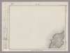
Image from the Map Collections courtesy Stanford University Libraries, licensed under a Creative Commons Attribution-Noncommercial 3.0 Unported License. © Stanford University. 【図幅名】 慶良間列島南部 【測量時期】 大正10年測圖 【発行時期】 昭和11年発行 【記号】 沖縄郡島十八号 【測量機関】 陸地測量部・参謀本部 【備考】 軍事極祕(戦地ニ在りテハ軍事祕密トス)
Links: Source / Biblio Ref
|
3 months ago | 4 control points | |
|
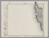
Image from the Map Collections courtesy Stanford University Libraries, licensed under a Creative Commons Attribution-Noncommercial 3.0 Unported License. © Stanford University. 【図幅名】 愛別 【測量時期】 大正8年測図/昭和3年鉄道補入 【発行時期】 昭和6年10月発行 【記号】 旭川5号(共16面) 【測量機関】 大日本帝国陸地測量部 【備考】 (In 1 layer)
Links: Source / Biblio Ref
|
about 2 years ago | 4 control points | |
|
Image from the Map Collections courtesy Stanford University Libraries, licensed under a Creative Commons Attribution-Noncommercial 3.0 Unported License. © Stanford University. 【図幅名】 岩村 【測量時期】 明治44年測圖/昭和8年要部修正測圖 【発行時期】 【記号】 飯田十二号 【測量機関】 参謀本部 【備考】 祕
Links: Source / Biblio Ref
|
about 2 years ago | 4 control points | |
|
Image from the Map Collections courtesy Stanford University Libraries, licensed under a Creative Commons Attribution-Noncommercial 3.0 Unported License. © Stanford University. 【図幅名】 恵比島 【測量時期】 大正8年測図/昭和6年鉄道補入 【発行時期】 昭和7年7月発行 【記号】 留萌1号(共11面) 【測量機関】 大日本帝国陸地測量部 【備考】 (In 1 layer)
Links: Source / Biblio Ref
|
about 2 years ago | 4 control points | |
|
この地図の作成に当たっては、国土地理院長の承認を得て、同院発行の20万分の1地勢図及び5万分の1地形図を使用した。(承認番号 平30情使、 第1148号)
Links: Source / Biblio Ref
|
1952 | over 5 years ago | 4 control points |
|
Image from the Map Collections courtesy Stanford University Libraries, licensed under a Creative Commons Attribution-Noncommercial 3.0 Unported License. © Stanford University. 【図幅名】 恵庭 【測量時期】 大正5年測圖及測圖之縮圖/昭和10年修正測圖及修正測圖之縮圖 【発行時期】 【記号】 札幌七号 【測量機関】 参謀本部 【備考】 祕 (In 1 layer)
Links: Source / Biblio Ref
|
about 2 years ago | 4 control points | |
|
この地図の作成に当たっては、国土地理院長の承認を得て、同院発行の20万分の1地勢図及び5万分の1地形図を使用した。(承認番号 平30情使、 第1148号)
Links: Source / Biblio Ref
|
1946 | over 5 years ago | 4 control points |