Browse Maps
| map | Title  |
Year | Last Updated | Status |
|---|---|---|---|---|
|
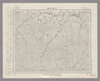
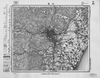
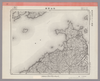
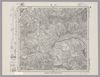
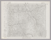
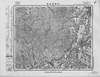
Image from the Map Collections courtesy Stanford University Libraries, licensed under a Creative Commons Attribution-Noncommercial 3.0 Unported License. © Stanford University. 【図幅名】 宇治山田 【測量時期】 明治25年測図の縮図/昭和12年第2回修正、測図の縮図 【発行時期】 昭和15年4月発行 【記号】 宇治山田6号(共14面) 【測量機関】 大日本帝国陸地測量部 【備考】
Links: Source / Biblio Ref
|
about 2 years ago | 4 control points | |
|
【最初期発行】 この地図の作成に当たっては、国土地理院長の承認を得て、同院発行の20万分の1地勢図及び5万分の1地形図を使用した。(承認番号 平30情使、 第1148号)
Links: Source / Biblio Ref
|
1917 | about 2 years ago | 4 control points |
|
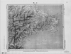
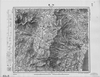
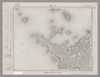
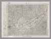
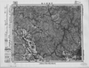
Image from the Map Collections courtesy Stanford University Libraries, licensed under a Creative Commons Attribution-Noncommercial 3.0 Unported License. © Stanford University. 【図幅名】 伊予鹿島 【測量時期】 明治37年測図/昭和8年修正/昭和20年部分修正 【発行時期】 昭和23年2月発行 【記号】 宇和島11号(共13面) 【測量機関】 地理調査所 【備考】 (In 1 layer)
Links: Source / Biblio Ref
|
5 months ago | 4 control points | |
|
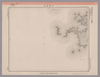
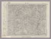
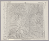
Image from the Map Collections courtesy Stanford University Libraries, licensed under a Creative Commons Attribution-Noncommercial 3.0 Unported License. © Stanford University. 【図幅名】 伊予高山 【測量時期】 明治37年測図/昭和8年修正/昭和20年部分修正 【発行時期】 昭和23年2月発行 【記号】 宇和島9号(共13面) 【測量機関】 地理調査所 【備考】 (In 1 layer)
Links: Source / Biblio Ref
|
about 2 years ago | 4 control points | |
|
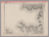
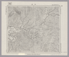
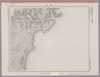
Image from the Map Collections courtesy Stanford University Libraries, licensed under a Creative Commons Attribution-Noncommercial 3.0 Unported License. © Stanford University. 【図幅名】 伊予長浜 【測量時期】 明治37年測図/昭和8年修正 【発行時期】 昭和11年5月発行 【記号】 松山11号(共15面) 【測量機関】 大日本帝国陸地測量部 【備考】 (In 1 layer)
Links: Source / Biblio Ref
|
about 2 years ago | 4 control points | |
|
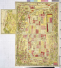
shelfmark: Maps 149.e.230
License: Public Domain
江戸後期写 Manuscript, early 19th century. Acquired 22 July 1868. Ex-Siebold.
Links: Source / Biblio Ref
|
about 1 year ago | 4 control points | |
|
Image from the Map Collections courtesy Stanford University Libraries, licensed under a Creative Commons Attribution-Noncommercial 3.0 Unported License. © Stanford University. 【図幅名】 伊予三崎 【測量時期】 明治37年測図/昭和9年第2回修正、測図の縮図/昭和28年応急修正 【発行時期】 昭和36年8月発行 【記号】 松山16号(共15面) 【測量機関】 国土地理院 【備考】 応急修正版 (In 1 layer)
Links: Source / Biblio Ref
|
about 2 years ago | 4 control points | |
|
Image from the Map Collections courtesy Stanford University Libraries, licensed under a Creative Commons Attribution-Noncommercial 3.0 Unported License. © Stanford University. 【図幅名】 三島 【測量時期】 明治39年測図/昭和3年修正 【発行時期】 昭和7年1月発行 【記号】 高知5号(共16面) 【測量機関】 大日本帝国陸地測量部 【備考】 (In 1 layer)
Links: Source / Biblio Ref
|
about 2 years ago | 4 control points | |
|
この地図の作成に当たっては、国土地理院長の承認を得て、同院発行の20万分の1地勢図及び5万分の1地形図を使用した。(承認番号 平30情使、 第1148号)
Links: Source / Biblio Ref
|
1948 | over 5 years ago | 4 control points |
|
Image from the Map Collections courtesy Stanford University Libraries. This item is in the public domain. There are no restrictions on use.
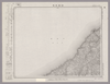
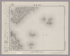
【図幅名】 仙波崎【測量時期】 大正3年測圖 【発行時期】大正13年 【記号】 幌筵島十号其一 【測量機関】 参謀本部 【その他】千島列島 陸地測量部 (In 1 layer)
Links: Source / Biblio Ref
|
1924 | over 1 year ago | 4 control points |
|
Image from the Map Collections courtesy Stanford University Libraries, licensed under a Creative Commons Attribution-Noncommercial 3.0 Unported License. © Stanford University. 【図幅名】 仙崎 【測量時期】 明治30年測図/昭和2年要部修正/昭和7年鉄道補入 【発行時期】 昭和17年12月発行 【記号】 山口14号 【測量機関】 大日本帝国陸地測量部 【備考】
Links: Source / Biblio Ref
|
about 2 years ago | 4 control points | |
|
Image from the Map Collections courtesy Stanford University Libraries, licensed under a Creative Commons Attribution-Noncommercial 3.0 Unported License. © Stanford University.
Links: Source / Biblio Ref
|
over 6 years ago | 4 control points | |
|
この地図の作成に当たっては、国土地理院長の承認を得て、同院発行の20万分の1地勢図及び5万分の1地形図を使用した。(承認番号 平30情使、 第1148号)
Links: Source / Biblio Ref
|
1950 | over 5 years ago | 4 control points |
|
【最初期発行】 この地図の作成に当たっては、国土地理院長の承認を得て、同院発行の20万分の1地勢図及び5万分の1地形図を使用した。(承認番号 平30情使、 第1148号) (In 1 layer)
Links: Source / Biblio Ref
|
1921 | about 2 years ago | 4 control points |
|
Image from the Map Collections courtesy Stanford University Libraries, licensed under a Creative Commons Attribution-Noncommercial 3.0 Unported License. © Stanford University. 【図幅名】 付知 【測量時期】 明治44年測図/昭和8年要部修正 【発行時期】 昭和11年2月発行 【記号】 飯田11号(共16面) 【測量機関】 大日本帝国陸地測量部 【備考】
Links: Source / Biblio Ref
|
about 2 years ago | 4 control points | |
|
Image from the Map Collections courtesy Stanford University Libraries, licensed under a Creative Commons Attribution-Noncommercial 3.0 Unported License. © Stanford University. 【図幅名】 令金 【測量時期】 大正6年測図/昭和8年鉄道補入 【発行時期】 昭和10年3月発行 【記号】 室蘭14号(共14面) 【測量機関】 大日本帝国陸地測量部 【備考】 (In 1 layer)
Links: Source / Biblio Ref
|
about 2 years ago | 4 control points | |
|
Image from the Map Collections courtesy Stanford University Libraries, licensed under a Creative Commons Attribution-Noncommercial 3.0 Unported License. © Stanford University. 【図幅名】 今治西部 【測量時期】 明治31年測図/昭和3年修正 【発行時期】 昭和6年6月発行 【記号】 広島4号(共16面) 【測量機関】 大日本帝国陸地測量部 【備考】 (In 1 layer)
Links: Source / Biblio Ref
|
about 2 years ago | 4 control points | |
|
Image from the Map Collections courtesy Stanford University Libraries, licensed under a Creative Commons Attribution-Noncommercial 3.0 Unported License. © Stanford University. 【図幅名】 今治東部 【測量時期】 明治31年測図/昭和3年修正 【発行時期】 昭和6年6月発行 【記号】 岡山及丸亀16号(共16面) 【測量機関】 大日本帝国陸地測量部 【備考】 (In 1 layer)
Links: Source / Biblio Ref
|
4 months ago | 4 control points | |
|
Image from the Map Collections courtesy Stanford University Libraries, licensed under a Creative Commons Attribution-Noncommercial 3.0 Unported License. © Stanford University. 【図幅名】 今庄 【測量時期】 明治25年測図/明治42年測図の縮図/昭和7年第2回修正、測図の縮図 【発行時期】 昭和9年12月発行 【記号】 岐阜14号(共16面) 【測量機関】 大日本帝国陸地測量部 【備考】 (In 1 layer)
Links: Source / Biblio Ref
|
about 2 years ago | 4 control points | |
|
Image from the Map Collections courtesy Stanford University Libraries, licensed under a Creative Commons Attribution-Noncommercial 3.0 Unported License. © Stanford University. 【図幅名】 今市 【測量時期】 明治32年測図/昭和9年修正、測図の縮図 【発行時期】 昭和12年3月発行 【記号】 大社4号(共3面) 【測量機関】 大日本帝国陸地測量部 【備考】
Links: Source / Biblio Ref
|
about 2 years ago | 4 control points | |
|
Image from the Map Collections courtesy Stanford University Libraries, licensed under a Creative Commons Attribution-Noncommercial 3.0 Unported License. © Stanford University. 【図幅名】 仁木 【測量時期】 大正6年測圖 【発行時期】 【記号】 岩内二号 【測量機関】 参謀本部 【備考】 祕 (In 1 layer)
Links: Source / Biblio Ref
|
about 2 years ago | 4 control points | |
|
Image from the Map Collections courtesy Stanford University Libraries, licensed under a Creative Commons Attribution-Noncommercial 3.0 Unported License. © Stanford University. 【図幅名】 仁尾 【測量時期】 明治30年測図/明治39年測図/昭和3年修正 【発行時期】 昭和7年3月発行 【記号】 岡山及丸亀7号(共16面) 【測量機関】 大日本帝国陸地測量部 【備考】
Links: Source / Biblio Ref
|
about 2 years ago | 4 control points | |
|
Image from the Map Collections courtesy Stanford University Libraries, licensed under a Creative Commons Attribution-Noncommercial 3.0 Unported License. © Stanford University. 【図幅名】 ニウプ 【測量時期】 大正12年測図 【発行時期】 大正13年6月発行 【記号】 名寄5号(共16面) 【測量機関】 大日本帝国陸地測量部 【備考】 仮製版 (In 1 layer)
Links: Source / Biblio Ref
|
about 2 years ago | 4 control points | |
|
Image from the Map Collections courtesy Stanford University Libraries, licensed under a Creative Commons Attribution-Noncommercial 3.0 Unported License. © Stanford University. 【図幅名】 厳原 【測量時期】 大正1年測図の縮図/昭和10年第2回修正、測図の縮図 【発行時期】 昭和21年10月発行 【記号】 厳原11号(共7面) 【測量機関】 地理調査所 【備考】
Links: Source / Biblio Ref
|
about 4 years ago | 4 control points | |
|
Image from the Map Collections courtesy Stanford University Libraries, licensed under a Creative Commons Attribution-Noncommercial 3.0 Unported License. © Stanford University. 【図幅名】 人首 【測量時期】 大正2年測図/昭和8年修正 【発行時期】 昭和10年11月発行 【記号】 一関9号(共14面) 【測量機関】 大日本帝国陸地測量部 【備考】
Links: Source / Biblio Ref
|
about 2 years ago | 4 control points | |
|
Image from the Map Collections courtesy Stanford University Libraries, licensed under a Creative Commons Attribution-Noncommercial 3.0 Unported License. © Stanford University. 【図幅名】 人吉 【測量時期】 明治35年測圖/昭和7年要部修正測圖/昭和10年部分修正測圖 【発行時期】 【記号】 八代三号 【測量機関】 参謀本部 【備考】 祕
Links: Source / Biblio Ref
|
about 4 years ago | 4 control points | |
|
Links: Source / Biblio Ref
|
2018 | over 6 years ago | 3 control points |
|
|
2018 | about 6 years ago | 4 control points |
|
|
2018 | over 6 years ago | 4 control points |
|
|
over 6 years ago | 5 control points | |
|
この地図の作成に当たっては、国土地理院長の承認を得て、同院発行の20万分の1地勢図及び5万分の1地形図を使用した。(承認番号 平30情使、 第1148号)
Links: Source / Biblio Ref
|
1946 | over 5 years ago | 4 control points |
|
この地図の作成に当たっては、国土地理院長の承認を得て、同院発行の20万分の1地勢図及び5万分の1地形図を使用した。(承認番号 平30情使、 第1148号)
Links: Source / Biblio Ref
|
1948 | almost 5 years ago | 4 control points |

|
|
over 6 years ago | 3 control points | |
|
|
over 6 years ago | 5 control points | |

|
|
over 6 years ago | 3 control points | |
|
この地図の作成に当たっては、国土地理院長の承認を得て、同院発行の20万分の1地勢図及び5万分の1地形図を使用した。(承認番号 平30情使、 第1148号)
Links: Source / Biblio Ref
|
1946 | over 5 years ago | 4 control points |
|
この地図の作成に当たっては、国土地理院長の承認を得て、同院発行の20万分の1地勢図及び5万分の1地形図を使用した。(承認番号 平30情使、 第1148号)
Links: Source / Biblio Ref
|
1947 | over 5 years ago | 4 control points |
|
|
2019 | about 4 years ago | 5 control points |
|
|
1892 | about 7 years ago | 26 control points |
|
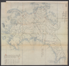
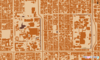
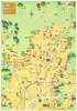
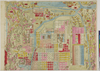
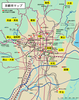
Owned by 立命館大学アート・リサーチセンター 【成立・出版年】 明治251892
Links: Source / Biblio Ref
|
1892 | about 3 years ago | 9 control points |
|
老松
|
over 6 years ago | 4 control points | |

|
老松
|
over 4 years ago | 4 control points | |
|
|
1987 | almost 5 years ago | 3 control points |
|
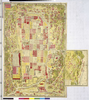
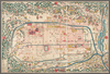
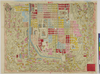
shelfmark: Maps 63150.9
License: Public Domain
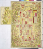
幕末 *多色刷り。蔵書印「小林蔵書」。 Manuscript, 18th century. Acquired 22 July 1868. Ex-Siebold.
Links: Source / Biblio Ref
|
about 3 years ago | 6 control points | |
|
Links: Source / Biblio Ref
|
2018 | over 6 years ago | 3 control points |
|
|
2018 | over 6 years ago | 3 control points |

|
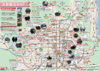
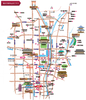
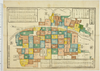
Owned by 立命館大学アート・リサーチセンター 【成立・出版年】 明治121879
Links: Source / Biblio Ref
|
1879 | over 5 years ago | 75 control points |
|
|
over 6 years ago | 7 control points | |
|
|
2018 | over 6 years ago | 3 control points |
|
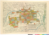
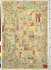
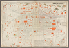
shelfmark: Maps 38.d.406
License: Public Domain
明治42 *洋紙、銅板。多色刷り。 Copperplate. Kyotozu somokuroku, p.115, #141 1907 edition.
Links: Source / Biblio Ref
|
1909 | over 4 years ago | 53 control points |