Browse Maps
| map | Title | Year  |
Last Updated | Status |
|---|---|---|---|---|
|
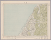
Image from the Map Collections courtesy Stanford University Libraries, licensed under a Creative Commons Attribution-Noncommercial 3.0 Unported License. © Stanford University. 【図幅名】 浅舞 【測量時期】 大正2年測図/昭和9年修正 【発行時期】 昭和11年11月発行 【記号】 新庄9号(共16面) 【測量機関】 大日本帝国陸地測量部 【備考】
Links: Source / Biblio Ref
|
about 2 years ago | 4 control points | |
|
Image from the Map Collections courtesy Stanford University Libraries, licensed under a Creative Commons Attribution-Noncommercial 3.0 Unported License. © Stanford University. 【図幅名】 西古見 【測量時期】 大正8年測圖 【発行時期】 大正10年発行 【記号】 奄美大島要塞近傍十三号 【測量機関】 陸地測量部・参謀本部 【備考】 軍事極祕(戦地ニ在りテハ軍事祕密トス)
Links: Source / Biblio Ref
|
3 months ago | 4 control points | |
|
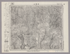
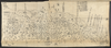
Image from the Map Collections courtesy Stanford University Libraries, licensed under a Creative Commons Attribution-Noncommercial 3.0 Unported License. © Stanford University. 【図幅名】 【測量時期】 【発行時期】 【記号】 【測量機関】 【備考】
Links: Source / Biblio Ref
|
about 4 years ago | 4 control points | |
|
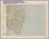
Image from the Map Collections courtesy Stanford University Libraries, licensed under a Creative Commons Attribution-Noncommercial 3.0 Unported License. © Stanford University. 【図幅名】 伊平屋前島 【測量時期】 大正10年測圖 【発行時期】 大正12年発行 【記号】 沖縄郡島八号 【測量機関】 陸地測量部・参謀本部 【備考】 軍事極祕(戦地ニ在りテハ軍事祕密トス)
Links: Source / Biblio Ref
|
3 months ago | 4 control points | |
|
Image from the Map Collections courtesy Stanford University Libraries, licensed under a Creative Commons Attribution-Noncommercial 3.0 Unported License. © Stanford University. 【図幅名】 上札内 【測量時期】 大正9年測圖/昭和5年鐡道補入 【発行時期】 【記号】 広尾十三号 【測量機関】 参謀本部 【備考】 祕 (In 1 layer)
Links: Source / Biblio Ref
|
about 2 years ago | 4 control points | |
|
Image from the Map Collections courtesy Stanford University Libraries, licensed under a Creative Commons Attribution-Noncommercial 3.0 Unported License. © Stanford University. 【図幅名】 熱海 【測量時期】 明治18年測図の縮図/昭和8年第2回修正 【発行時期】 昭和10年12月発行 【記号】 横須賀14号(共11面) 【測量機関】 大日本帝国陸地測量部 【備考】 (In 1 layer)
Links: Source / Biblio Ref
|
about 2 years ago | 4 control points | |
|
Image from the Map Collections courtesy Stanford University Libraries, licensed under a Creative Commons Attribution-Noncommercial 3.0 Unported License. © Stanford University. 【図幅名】 中湧別 【測量時期】 大正13年測圖 【発行時期】 【記号】 紋別七号 【測量機関】 参謀本部 【備考】 祕 假製版 (In 1 layer)
Links: Source / Biblio Ref
|
about 2 years ago | 4 control points | |
|
Image from the Map Collections courtesy Stanford University Libraries, licensed under a Creative Commons Attribution-Noncommercial 3.0 Unported License. © Stanford University. 【図幅名】 剣淵 【測量時期】 大正11年測図 【発行時期】 大正13年5月発行 【記号】 名寄12号(共16面) 【測量機関】 大日本帝国陸地測量部 【備考】 仮製版 (In 1 layer)
Links: Source / Biblio Ref
|
about 2 years ago | 4 control points | |
|
Image from the Map Collections courtesy Stanford University Libraries, licensed under a Creative Commons Attribution-Noncommercial 3.0 Unported License. © Stanford University.
Links: Source / Biblio Ref
|
over 6 years ago | 4 control points | |
|
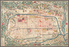
名古屋市則武耕地整理組合地区第1工区における整理前の道路、水路の状況及び地名を知ることが出来る。
|
over 3 years ago | 12 control points | |
|
Image from the Map Collections courtesy Stanford University Libraries, licensed under a Creative Commons Attribution-Noncommercial 3.0 Unported License. © Stanford University. 【図幅名】 舳倉島 【測量時期】 明治43年測図/昭和4年修正 【発行時期】 昭和11年6月発行 【記号】 輪島1号(共3面) 【測量機関】 大日本帝国陸地測量部 【備考】
Links: Source / Biblio Ref
|
about 2 years ago | 4 control points | |
|
Image from the Map Collections courtesy Stanford University Libraries, licensed under a Creative Commons Attribution-Noncommercial 3.0 Unported License. © Stanford University. 【図幅名】 沼宮内 【測量時期】 大正1年測図/昭和4年鉄道補入 【発行時期】 大正6年5月発行 【記号】 盛岡13号(共18面) 【測量機関】 大日本帝国陸地測量部 【備考】
Links: Source / Biblio Ref
|
about 2 years ago | 4 control points | |
|
Image from the Map Collections courtesy Stanford University Libraries, licensed under a Creative Commons Attribution-Noncommercial 3.0 Unported License. © Stanford University.
Links: Source / Biblio Ref
|
over 6 years ago | 4 control points | |
|
Image from the Map Collections courtesy Stanford University Libraries, licensed under a Creative Commons Attribution-Noncommercial 3.0 Unported License. © Stanford University. 【図幅名】 川本 【測量時期】 明治32年測図/昭和7年修正 【発行時期】 昭和10年5月発行 【記号】 浜田11号(共15面) 【測量機関】 大日本帝国陸地測量部 【備考】
Links: Source / Biblio Ref
|
about 1 year ago | 4 control points | |
|
Image from the Map Collections courtesy Stanford University Libraries, licensed under a Creative Commons Attribution-Noncommercial 3.0 Unported License. © Stanford University. 【図幅名】 安芸 【測量時期】 明治40年測図/昭和8年修正 【発行時期】 昭和11年1月発行 【記号】 高知4号(共16面) 【測量機関】 大日本帝国陸地測量部 【備考】
Links: Source / Biblio Ref
|
about 2 years ago | 4 control points | |
|
Image from the Map Collections courtesy Stanford University Libraries, licensed under a Creative Commons Attribution-Noncommercial 3.0 Unported License. © Stanford University. 【図幅名】 小浜 【測量時期】 明治26年測図/大正9年修正/昭和2年鉄道補入 【発行時期】 【記号】 宮津8号 【測量機関】 参謀本部 【備考】 舞鶴要塞近傍2号(共10面) 軍事極秘
Links: Source / Biblio Ref
|
about 2 years ago | 4 control points | |

|
Image from the Map Collections courtesy Stanford University Libraries, licensed under a Creative Commons Attribution-Noncommercial 3.0 Unported License. © Stanford University. 【図幅名】 常葉 【測量時期】 明治41年測図/昭和8年要部修正 【発行時期】 昭和21年11月発行 【記号】 福島8号(共18面) 【測量機関】 内務省地理調査所 【備考】
Links: Source / Biblio Ref
|
about 2 years ago | 4 control points | |
|
shelfmark: Maps 63150.9
License: Public Domain
幕末 *多色刷り。蔵書印「小林蔵書」。 Manuscript, 18th century. Acquired 22 July 1868. Ex-Siebold.
Links: Source / Biblio Ref
|
about 3 years ago | 6 control points | |
|
Image from the Map Collections courtesy Stanford University Libraries, licensed under a Creative Commons Attribution-Noncommercial 3.0 Unported License. © Stanford University. 【図幅名】 吾妻山 【測量時期】 明治41年測図/昭和6年要部修正 【発行時期】 昭和8年1月発行 【記号】 福島14号(共18面) 【測量機関】 大日本帝国陸地測量部 【備考】
Links: Source / Biblio Ref
|
about 2 years ago | 4 control points | |
|
shelfmark: Maps 149.e.223
License: Public Domain
江戸中期刊 *外題「(改正)和泉国大絵図」。無刊記。 Xylograph. Acquired 22 July 1868. Ex-Siebold.
Links: Source / Biblio Ref
|
almost 4 years ago | 32 control points | |
|
|
8 months ago | 10 control points | |
|
Image from the Map Collections courtesy Stanford University Libraries, licensed under a Creative Commons Attribution-Noncommercial 3.0 Unported License. © Stanford University. 【図幅名】 浜田 【測量時期】 明治32年測圖之縮圖/昭和7年修正測圖及修正測圖之縮圖 【発行時期】 【記号】 浜田十五号 【測量機関】 参謀本部 【備考】 祕
Links: Source / Biblio Ref
|
about 1 year ago | 4 control points | |
|
Image from the Map Collections courtesy Stanford University Libraries, licensed under a Creative Commons Attribution-Noncommercial 3.0 Unported License. © Stanford University. 【図幅名】 甲浦 【測量時期】 明治40年測圖/昭和8年修正測圖 【発行時期】 【記号】 剣山十一号 【測量機関】 参謀本部 【備考】 祕
Links: Source / Biblio Ref
|
over 5 years ago | 4 control points | |
|
Image from the Map Collections courtesy Stanford University Libraries, licensed under a Creative Commons Attribution-Noncommercial 3.0 Unported License. © Stanford University. 【図幅名】 釜淵 【測量時期】 大正11年測図 【発行時期】 大正13年5月発行 【記号】 名寄14号(共16面) 【測量機関】 大日本帝国陸地測量部 【備考】 仮製版 (In 1 layer)
Links: Source / Biblio Ref
|
about 2 years ago | 4 control points | |
|
Image from the Map Collections courtesy Stanford University Libraries, licensed under a Creative Commons Attribution-Noncommercial 3.0 Unported License. © Stanford University. 【図幅名】 郡山 【測量時期】 明治41年測図/昭和6年要部修正 【発行時期】 昭和8年9月発行 【記号】 福島12号(共18面) 【測量機関】 大日本帝国陸地測量部 【備考】
Links: Source / Biblio Ref
|
about 2 years ago | 4 control points | |
|
Image from the Map Collections courtesy Stanford University Libraries, licensed under a Creative Commons Attribution-Noncommercial 3.0 Unported License. © Stanford University. 【図幅名】 高崎 【測量時期】 明治40年測図/昭和4年修正/昭和9年要部修正 【発行時期】 昭和21年12月発行 【記号】 宇都宮15号(共16面) 【測量機関】 内務省地理調査所 【備考】 (In 1 layer)
Links: Source / Biblio Ref
|
about 2 years ago | 4 control points | |
|
Image from the Map Collections courtesy Stanford University Libraries, licensed under a Creative Commons Attribution-Noncommercial 3.0 Unported License. © Stanford University. 【図幅名】 若松 【測量時期】 大正2年測図/昭和6年修正/昭和8年鉄道補入 【発行時期】 昭和9年5月発行 【記号】 新潟4号(共16面) 【測量機関】 大日本帝国陸地測量部 【備考】
Links: Source / Biblio Ref
|
about 2 years ago | 4 control points | |
|
Image from the Map Collections courtesy Stanford University Libraries, licensed under a Creative Commons Attribution-Noncommercial 3.0 Unported License. © Stanford University. 【図幅名】 頓原 【測量時期】 明治32年測図/昭和7年修正 【発行時期】 昭和10年6月発行 【記号】 浜田2号(共15面) 【測量機関】 大日本帝国陸地測量部 【備考】
Links: Source / Biblio Ref
|
about 2 years ago | 4 control points | |
|
Image from the Map Collections courtesy Stanford University Libraries, licensed under a Creative Commons Attribution-Noncommercial 3.0 Unported License. © Stanford University. 【図幅名】 綾里 【測量時期】 大正2年測図/昭和8年修正 【発行時期】 昭和11年1月発行 【記号】 一関2号(共14面) 【測量機関】 大日本帝国陸地測量部 【備考】
Links: Source / Biblio Ref
|
about 2 years ago | 4 control points | |
|
Image from the Map Collections courtesy Stanford University Libraries, licensed under a Creative Commons Attribution-Noncommercial 3.0 Unported License. © Stanford University. 【図幅名】 檜枝岐 【測量時期】 大正1年測図/昭和8年要部修正 【発行時期】 昭和11年1月発行 【記号】 日光10号(共16面) 【測量機関】 大日本帝国陸地測量部 【備考】
Links: Source / Biblio Ref
|
about 2 years ago | 4 control points | |
|
Image from the Map Collections courtesy Stanford University Libraries, licensed under a Creative Commons Attribution-Noncommercial 3.0 Unported License. © Stanford University. 【図幅名】 塙 【測量時期】 明治42年測図/昭和8年要部修正 【発行時期】 【記号】 白河11号(共17面) 【測量機関】 参謀本部 【備考】 秘
Links: Source / Biblio Ref
|
over 5 years ago | 4 control points | |
|
Image from the Map Collections courtesy Stanford University Libraries, licensed under a Creative Commons Attribution-Noncommercial 3.0 Unported License. © Stanford University. 【図幅名】 三峰 【測量時期】 明治43年測図/昭和4年要部修正 【発行時期】 昭和7年3月発行 【記号】 甲府1号(共16面) 【測量機関】 大日本帝国陸地測量部 【備考】 (In 1 layer)
Links: Source / Biblio Ref
|
about 2 years ago | 4 control points | |
|
Image from the Map Collections courtesy Stanford University Libraries, licensed under a Creative Commons Attribution-Noncommercial 3.0 Unported License. © Stanford University.
Links: Source / Biblio Ref
|
over 6 years ago | 4 control points | |
|
Image from the Map Collections courtesy Stanford University Libraries, licensed under a Creative Commons Attribution-Noncommercial 3.0 Unported License. © Stanford University. 【図幅名】 若桜 【測量時期】 明治30年測図の縮図/明治31年測図/昭和7年修正 【発行時期】 昭和9年8月発行 【記号】 鳥取12号(共9面) 【測量機関】 大日本帝国陸地測量部 【備考】
Links: Source / Biblio Ref
|
about 2 years ago | 4 control points | |
|
Image from the Map Collections courtesy Stanford University Libraries, licensed under a Creative Commons Attribution-Noncommercial 3.0 Unported License. © Stanford University. 【図幅名】 サロマ湖 【測量時期】 大正13年測圖 【発行時期】 【記号】 紋別四号 【測量機関】 参謀本部 【備考】 祕 假製版 (In 1 layer)
Links: Source / Biblio Ref
|
about 2 years ago | 4 control points | |
|
Image from the Map Collections courtesy Stanford University Libraries, licensed under a Creative Commons Attribution-Noncommercial 3.0 Unported License. © Stanford University. 【図幅名】 燧岳 【測量時期】 大正1年測図/昭和6年要部修正 【発行時期】 【記号】 日光11号(共16面) 【測量機関】 参謀本部 【備考】 秘
Links: Source / Biblio Ref
|
about 2 years ago | 4 control points | |
|
Image from the Map Collections courtesy Stanford University Libraries, licensed under a Creative Commons Attribution-Noncommercial 3.0 Unported License. © Stanford University. 【図幅名】 浜松 【測量時期】 明治23年測図/大正6年修正/昭和2年部分修正/昭和22年資料修正 【発行時期】 昭和22年2月発行 【記号】 豊橋8号(共16面) 【測量機関】 地理調査所 【備考】
Links: Source / Biblio Ref
|
over 5 years ago | 4 control points | |
|
Image from the Map Collections courtesy Stanford University Libraries, licensed under a Creative Commons Attribution-Noncommercial 3.0 Unported License. © Stanford University. 【図幅名】 大洲 【測量時期】 明治37年測図/昭和8年修正 【発行時期】 昭和11年7月発行 【記号】 松山7号(共15面) 【測量機関】 大日本帝国陸地測量部 【備考】 (In 1 layer)
Links: Source / Biblio Ref
|
5 months ago | 4 control points | |
|
Image from the Map Collections courtesy Stanford University Libraries, licensed under a Creative Commons Attribution-Noncommercial 3.0 Unported License. © Stanford University. 【図幅名】 徳山 【測量時期】 明治32年測図/昭和2年修正/昭和7年鉄道補入/昭和24年資料修正 【発行時期】 昭和24年3月発行 【記号】 山口4号(共15面) 【測量機関】 地理調査所 【備考】
Links: Source / Biblio Ref
|
about 2 years ago | 4 control points | |
|
Image from the Map Collections courtesy Stanford University Libraries, licensed under a Creative Commons Attribution-Noncommercial 3.0 Unported License. © Stanford University. 【図幅名】 鳥取南部 【測量時期】 明治30年測図/明治31年測図の縮図/昭和7年修正 【発行時期】 昭和9年8月発行 【記号】 鳥取16号(共9面) 【測量機関】 大日本帝国陸地測量部 【備考】
Links: Source / Biblio Ref
|
3 months ago | 4 control points | |
|
Image from the Map Collections courtesy Stanford University Libraries, licensed under a Creative Commons Attribution-Noncommercial 3.0 Unported License. © Stanford University. 【図幅名】 六郷 【測量時期】 大正5年測図 【発行時期】 昭和16年10月発行 【記号】 秋田8号 【測量機関】 大日本帝国陸地測量部 【備考】
Links: Source / Biblio Ref
|
about 2 years ago | 4 control points | |
|
Image from the Map Collections courtesy Stanford University Libraries, licensed under a Creative Commons Attribution-Noncommercial 3.0 Unported License. © Stanford University. 【図幅名】 岩国 【測量時期】 明治27年測図の縮図/明治34年測図/昭和2年修正、測図の縮図/昭和7年鉄道補入、測図の縮図 【発行時期】 昭和22年2月発行 【記号】 広島16号(共16面) 【測量機関】 内務省地理調査所 【備考】
Links: Source / Biblio Ref
|
3 months ago | 4 control points | |
|
Image from the Map Collections courtesy Stanford University Libraries, licensed under a Creative Commons Attribution-Noncommercial 3.0 Unported License. © Stanford University. 【図幅名】 十日町 【測量時期】 明治44年測図/昭和6年修正 【発行時期】 昭和10年5月発行 【記号】 高田2号(共15面) 【測量機関】 大日本帝国陸地測量部 【備考】
Links: Source / Biblio Ref
|
about 2 years ago | 4 control points | |
|
Image from the Map Collections courtesy Stanford University Libraries, licensed under a Creative Commons Attribution-Noncommercial 3.0 Unported License. © Stanford University. 【図幅名】 石切山 【測量時期】 大正6年測圖/昭和10年修正測圖及修正測圖之縮圖 【発行時期】 【記号】 札幌十一号 【測量機関】 参謀本部 【備考】 祕 (In 1 layer)
Links: Source / Biblio Ref
|
about 2 years ago | 4 control points | |
|
Image from the Map Collections courtesy Stanford University Libraries, licensed under a Creative Commons Attribution-Noncommercial 3.0 Unported License. © Stanford University. 【図幅名】 土佐長浜 【測量時期】 明治39年測図の縮図/昭和8年修正、測図の縮図 【発行時期】 昭和11年2月発行 【記号】 高知8号(共16面) 【測量機関】 大日本帝国陸地測量部 【備考】
Links: Source / Biblio Ref
|
about 2 years ago | 4 control points | |
|
Image from the Map Collections courtesy Stanford University Libraries, licensed under a Creative Commons Attribution-Noncommercial 3.0 Unported License. © Stanford University. 【図幅名】 佐多岬 【測量時期】 明治34年測圖/昭和7年要部修正測圖/昭和10年部分修正測圖 【発行時期】 【記号】 開聞岳六号 【測量機関】 参謀本部 【備考】 祕
Links: Source / Biblio Ref
|
over 2 years ago | 4 control points | |
|
Image from the Map Collections courtesy Stanford University Libraries, licensed under a Creative Commons Attribution-Noncommercial 3.0 Unported License. © Stanford University. 【図幅名】 八海山 【測量時期】 大正1年測図/昭和6年要部修正/昭和28年応急修正 【発行時期】 昭和34年8月発行 【記号】 日光14号(共16面) 【測量機関】 国土地理院 【備考】 応急修正版
Links: Source / Biblio Ref
|
about 2 years ago | 4 control points | |
|
Image from the Map Collections courtesy Stanford University Libraries, licensed under a Creative Commons Attribution-Noncommercial 3.0 Unported License. © Stanford University. 【図幅名】 平戸 【測量時期】 大正12年測図の縮図/昭和10年修正、測図の縮図 【発行時期】 昭和21年11月発行 【記号】 唐津8号(共12面) 【測量機関】 地理調査所 【備考】
Links: Source / Biblio Ref
|
about 2 years ago | 4 control points | |
|
Image from the Map Collections courtesy Stanford University Libraries, licensed under a Creative Commons Attribution-Noncommercial 3.0 Unported License. © Stanford University. 【図幅名】 糸沢 【測量時期】 大正1年測図/昭和8年要部修正 【発行時期】 【記号】 日光6号(共16面) 【測量機関】 参謀本部 【備考】 秘
Links: Source / Biblio Ref
|
about 2 years ago | 4 control points | |
|
Image from the Map Collections courtesy Stanford University Libraries, licensed under a Creative Commons Attribution-Noncommercial 3.0 Unported License. © Stanford University. 【図幅名】 渡名喜島 【測量時期】 大正10年測図 【発行時期】 昭和11年発行 【記号】 沖縄群島20号 【測量機関】 陸地測量部・参謀本部 【備考】 那覇14号
Links: Source / Biblio Ref
|
3 months ago | 4 control points |