Browse Maps
| map | Title  |
Year | Last Updated | Status |
|---|---|---|---|---|
|
Image from the Map Collections courtesy Stanford University Libraries, licensed under a Creative Commons Attribution-Noncommercial 3.0 Unported License. © Stanford University. 【図幅名】 楯岡 【測量時期】 明治34年測図/昭和6年修正 【発行時期】 昭和9年6月発行 【記号】 仙台10号(共16面) 【測量機関】 大日本帝国陸地測量部 【備考】
Links: Source / Biblio Ref
|
about 2 years ago | 4 control points | |
|
Image from the Map Collections courtesy Stanford University Libraries, licensed under a Creative Commons Attribution-Noncommercial 3.0 Unported License. © Stanford University. 【図幅名】 楽古岳 【測量時期】 大正9年測圖 【発行時期】 【記号】 広尾十五号 【測量機関】 参謀本部 【備考】 祕 (In 1 layer)
Links: Source / Biblio Ref
|
about 2 years ago | 4 control points | |
|
Image from the Map Collections courtesy Stanford University Libraries, licensed under a Creative Commons Attribution-Noncommercial 3.0 Unported License. © Stanford University. 【図幅名】 榛名山 【測量時期】 明治44年測図/昭和4年修正/昭和9年要部修正 【発行時期】 昭和15年11月発行 【記号】 長野2号(共16面) 【測量機関】 大日本帝国陸地測量部 【備考】 (In 1 layer)
Links: Source / Biblio Ref
|
about 2 years ago | 4 control points | |
|
Image from the Map Collections courtesy Stanford University Libraries, licensed under a Creative Commons Attribution-Noncommercial 3.0 Unported License. © Stanford University. 【図幅名】 槍ヶ嶽 【測量時期】 大正元年測圖/昭和5年修正測圖(地上寫真測量併用) 【発行時期】 昭和7年発行 【記号】 高山六号 【測量機関】 大日本帝國陸地測量部 【備考】
Links: Source / Biblio Ref
|
about 2 years ago | 4 control points | |
|
Image from the Map Collections courtesy Stanford University Libraries, licensed under a Creative Commons Attribution-Noncommercial 3.0 Unported License. © Stanford University. 【図幅名】 春苅古丹 【測量時期】 昭和13年測図/昭和19年部分修正測量 【発行時期】 【記号】 標津13号(共13面) 【測量機関】 参謀本部 【備考】 秘 (In 1 layer)
Links: Source / Biblio Ref
|
about 2 years ago | 4 control points | |
|
Image from the Map Collections courtesy Stanford University Libraries, licensed under a Creative Commons Attribution-Noncommercial 3.0 Unported License. © Stanford University.
Links: Source / Biblio Ref
|
over 6 years ago | 4 control points | |
|
Image from the Map Collections courtesy Stanford University Libraries, licensed under a Creative Commons Attribution-Noncommercial 3.0 Unported License. © Stanford University. 【図幅名】 標茶 【測量時期】 大正10年測図/昭和7年鉄道補入 【発行時期】 昭和9年8月発行 【記号】 釧路5号(共12面) 【測量機関】 大日本帝国陸地測量部 【備考】 (In 1 layer)
Links: Source / Biblio Ref
|
about 2 years ago | 4 control points | |
|
Image from the Map Collections courtesy Stanford University Libraries, licensed under a Creative Commons Attribution-Noncommercial 3.0 Unported License. © Stanford University. 【図幅名】 横山 【測量時期】 明治42年測圖/昭和8年要部修正測圖 【発行時期】 【記号】 岐阜十一号 【測量機関】 参謀本部 【備考】 祕
Links: Source / Biblio Ref
|
about 2 years ago | 4 control points | |
|
Image from the Map Collections courtesy Stanford University Libraries, licensed under a Creative Commons Attribution-Noncommercial 3.0 Unported License. © Stanford University. 【図幅名】 横手 【測量時期】 大正2年測図/昭和9年修正 【発行時期】 昭和11年11月発行 【記号】 新庄5号(共16面) 【測量機関】 大日本帝国陸地測量部 【備考】
Links: Source / Biblio Ref
|
about 2 years ago | 4 control points | |
|
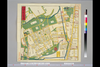
Image from the Map Collections courtesy Stanford University Libraries, licensed under a Creative Commons Attribution-Noncommercial 3.0 Unported License. © Stanford University. 【図幅名】 横浜 【測量時期】 明治39年測図/昭和7年測図の縮図、第2回修正、測図の縮図 【発行時期】 昭和21年8月発行 【記号】 東京8号 【測量機関】 内務省地理調査所 【備考】 (In 1 layer)
Links: Source / Biblio Ref
|
3 months ago | 4 control points | |
|
shelfmark: Maps 31.a.31
License: Public Domain
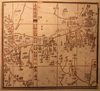
明治3 *多色刷り。英語の地名記載あり。刊記書肆「東京、大黒屋金之助/横浜、佐野屋富五郎・小林屋銀次」。存原外袋(「Map of Yokohama/(新版)横浜全図/吟香閣蔵版」)。 Xylograph; some place names printed in roman letters.
Links: Source / Biblio Ref
|
1870 | over 2 years ago | 20 control points |
|
shelfmark: Maps 63145.11
License: Public Domain
明治3 *多色刷り。外題「横浜明細全図」。 Manuscript copied in the early 19th century. Purchased from Martinus Nijhof, The Hague, 8 November 1893.
Links: Source / Biblio Ref
|
1870 | about 3 years ago | 7 control points |
|
Image from the Map Collections courtesy Stanford University Libraries, licensed under a Creative Commons Attribution-Noncommercial 3.0 Unported License. © Stanford University. 【図幅名】 横田 【測量時期】 明治32年測圖/昭和7年要部修正測圖 【発行時期】 【記号】 高梁十三号 【測量機関】 参謀本部 【備考】 祕
Links: Source / Biblio Ref
|
about 2 years ago | 4 control points | |
|
【最初期発行】 この地図の作成に当たっては、国土地理院長の承認を得て、同院発行の20万分の1地勢図及び5万分の1地形図を使用した。(承認番号 平30情使、 第1148号) (In 1 layer)
Links: Source / Biblio Ref
|
1910 | about 2 years ago | 4 control points |
|
この地図の作成に当たっては、国土地理院長の承認を得て、同院発行の20万分の1地勢図及び5万分の1地形図を使用した。(承認番号 平30情使、 第1148号) (In 1 layer)
Links: Source / Biblio Ref
|
1947 | over 5 years ago | 4 control points |
|
Image from the Map Collections courtesy Stanford University Libraries, licensed under a Creative Commons Attribution-Noncommercial 3.0 Unported License. © Stanford University.
Links: Source / Biblio Ref
|
over 6 years ago | 4 control points | |
|
Image from the Map Collections courtesy Stanford University Libraries. This item is in the public domain. There are no restrictions on use.
【図幅名】 樺里【測量時期】 大正3年測圖 【発行時期】大正13年 【記号】 幌筵島八号 【測量機関】 参謀本部 【その他】千島列島 陸地測量部 (In 1 layer)
Links: Source / Biblio Ref
|
1924 | over 1 year ago | 4 control points |
|
Image from the Map Collections courtesy Stanford University Libraries, licensed under a Creative Commons Attribution-Noncommercial 3.0 Unported License. © Stanford University. 【図幅名】 樽前山 【測量時期】 大正6年測圖/昭和10年修正測圖 【発行時期】 【記号】 札幌十二号 【測量機関】 参謀本部 【備考】 祕 (In 1 layer)
Links: Source / Biblio Ref
|
about 2 years ago | 4 control points | |
|
Image from the Map Collections courtesy Stanford University Libraries, licensed under a Creative Commons Attribution-Noncommercial 3.0 Unported License. © Stanford University. 【図幅名】 檜枝岐 【測量時期】 大正1年測図/昭和8年要部修正 【発行時期】 昭和11年1月発行 【記号】 日光10号(共16面) 【測量機関】 大日本帝国陸地測量部 【備考】
Links: Source / Biblio Ref
|
about 2 years ago | 4 control points | |
|
Image from the Map Collections courtesy Stanford University Libraries. This item is in the public domain. There are no restrictions on use.
【図幅名】 櫛ノ崎【測量時期】 大正4年測圖 【発行時期】昭和11年 【記号】 得撫嶋七号 【測量機関】 参謀本部 【その他】千島列島 陸地測量部 (In 1 layer)
Links: Source / Biblio Ref
|
1936 | over 1 year ago | 4 control points |
|
Image from the Map Collections courtesy Stanford University Libraries, licensed under a Creative Commons Attribution-Noncommercial 3.0 Unported License. © Stanford University. 【図幅名】 潮路 【測量時期】 大正6年測圖/昭和3年鐡道補入 【発行時期】 【記号】 岩内十二号 【測量機関】 参謀本部 【備考】 祕 (In 1 layer)
Links: Source / Biblio Ref
|
about 2 years ago | 4 control points | |
|
Image from the Map Collections courtesy Stanford University Libraries, licensed under a Creative Commons Attribution-Noncommercial 3.0 Unported License. © Stanford University. 【図幅名】 武佐岳 【測量時期】 大正13年測圖/昭和19年部分修正測圖 【発行時期】 【記号】 斜里二号 【測量機関】 参謀本部 【備考】 祕 (In 1 layer)
Links: Source / Biblio Ref
|
about 2 years ago | 4 control points | |
|
Image from the Map Collections courtesy Stanford University Libraries, licensed under a Creative Commons Attribution-Noncommercial 3.0 Unported License. © Stanford University. 【図幅名】 武雄 【測量時期】 明治33年及大正3年測圖之縮圖/大正6年修正測圖/昭和6年鐡道補入/昭和7年部分修正測圖 【発行時期】 昭和9年発行 【記号】 熊本十三号 【測量機関】 大日本帝國陸地測量部 【備考】
Links: Source / Biblio Ref
|
about 4 years ago | 4 control points | |
|
Image from the Map Collections courtesy Stanford University Libraries. This item is in the public domain. There are no restrictions on use.
【図幅名】 武魯頓嶋【測量時期】 大正5年測圖 【発行時期】昭和11年 【記号】 千島列島四十七号、知理保以嶋一号西北部 【測量機関】 参謀本部 【その他】千島列島 陸地測量部 (In 1 layer)
Links: Source / Biblio Ref
|
1936 | over 1 year ago | 5 control points |
|
Image from the Map Collections courtesy Stanford University Libraries. This item is in the public domain. There are no restrictions on use.
【図幅名】 武魯頓灣 【測量時期】 大正5年測圖 【発行時期】昭和11年 【記号】 新知島七号 【測量機関】 参謀本部 【その他】千島列島 陸地測量部 (In 1 layer)
Links: Source / Biblio Ref
|
1936 | 11 months ago | 14 control points |
|
この地図の作成に当たっては、国土地理院長の承認を得て、同院発行の20万分の1地勢図及び5万分の1地形図を使用した。(承認番号 平30情使、 第1148号)
Links: Source / Biblio Ref
|
1936 | over 5 years ago | 4 control points |
|
【最初期発行】 この地図の作成に当たっては、国土地理院長の承認を得て、同院発行の20万分の1地勢図及び5万分の1地形図を使用した。(承認番号 平30情使、 第1148号)
Links: Source / Biblio Ref
|
1934 | over 5 years ago | 4 control points |
|
Image from the Map Collections courtesy Stanford University Libraries, licensed under a Creative Commons Attribution-Noncommercial 3.0 Unported License. © Stanford University. 【図幅名】 母島北部 【測量時期】 明治44年測圖/昭和10年修正測圖 【発行時期】 【記号】 父島十六号 【測量機関】 参謀本部 【備考】 軍事極祕(戦地ニ在りテハ軍事祕密トス)
Links: Source / Biblio Ref
|
about 2 years ago | 4 control points | |
|
Image from the Map Collections courtesy Stanford University Libraries, licensed under a Creative Commons Attribution-Noncommercial 3.0 Unported License. © Stanford University. 【図幅名】 【測量時期】 【発行時期】 【記号】 【測量機関】 【備考】
Links: Source / Biblio Ref
|
about 2 years ago | 4 control points | |
|
この地図の作成に当たっては、国土地理院長の承認を得て、同院発行の20万分の1地勢図及び5万分の1地形図を使用した。(承認番号 平30情使、 第1148号)
Links: Source / Biblio Ref
|
1947 | over 5 years ago | 4 control points |
|
Image from the Map Collections courtesy Stanford University Libraries, licensed under a Creative Commons Attribution-Noncommercial 3.0 Unported License. © Stanford University. 【図幅名】 比布 【測量時期】 大正8年測圖 【発行時期】 【記号】 旭川九号 【測量機関】 参謀本部 【備考】 祕 (In 1 layer)
Links: Source / Biblio Ref
|
about 2 years ago | 4 control points | |
|
Image from the Map Collections courtesy Stanford University Libraries, licensed under a Creative Commons Attribution-Noncommercial 3.0 Unported License. © Stanford University. 【図幅名】 気仙沼 【測量時期】 大正2年測圖/昭和8年部分修正測圖 【発行時期】 昭和11年発行 【記号】 一関七号 【測量機関】 大日本帝國陸地測量部 【備考】
Links: Source / Biblio Ref
|
about 2 years ago | 4 control points | |
|
Image from the Map Collections courtesy Stanford University Libraries, licensed under a Creative Commons Attribution-Noncommercial 3.0 Unported License. © Stanford University. 【図幅名】 水俣 【測量時期】 明治34年測圖/昭和7年要部修正測圖/昭和10年部分修正測圖 【発行時期】 【記号】 八代十一号 【測量機関】 参謀本部 【備考】 祕
Links: Source / Biblio Ref
|
about 4 years ago | 4 control points | |
|
Image from the Map Collections courtesy Stanford University Libraries, licensed under a Creative Commons Attribution-Noncommercial 3.0 Unported License. © Stanford University. 【図幅名】 水口 【測量時期】 明治25年測図の縮図/昭和12年第2回修正、測図の縮図 【発行時期】 昭和13年11月発行 【記号】 名古屋15号(共16面) 【測量機関】 大日本帝国陸地測量部 【備考】
Links: Source / Biblio Ref
|
about 2 years ago | 4 control points | |
|
この地図の作成に当たっては、国土地理院長の承認を得て、同院発行の20万分の1地勢図及び5万分の1地形図を使用した。(承認番号 平30情使、 第1148号)
Links: Source / Biblio Ref
|
1952 | over 5 years ago | 4 control points |
|
【最初期発行】 この地図の作成に当たっては、国土地理院長の承認を得て、同院発行の20万分の1地勢図及び5万分の1地形図を使用した。(承認番号 平30情使、 第1148号) (In 1 layer)
Links: Source / Biblio Ref
|
1915 | about 4 years ago | 4 control points |
|
Image from the Map Collections courtesy Stanford University Libraries, licensed under a Creative Commons Attribution-Noncommercial 3.0 Unported License. © Stanford University. 【図幅名】 水戸 【測量時期】 明治36年測図/昭和15年第2回修正、測図の縮図/昭和27年応急修正 【発行時期】 昭和34年6月発行 【記号】 水戸10号(共12面) 【測量機関】 国土地理院 【備考】 応急修正版 (In 1 layer)
Links: Source / Biblio Ref
|
3 months ago | 4 control points | |
|
茨城県立図書館デジタルライブラリー
https://www.lib.pref.ibaraki.jp/guide/shiryou/digital_lib/valuable_m/001051354916/Bibliography.html
より引用
Links: Source / Biblio Ref
|
almost 5 years ago | 34 control points | |
|
Image from the Map Collections courtesy Stanford University Libraries, licensed under a Creative Commons Attribution-Noncommercial 3.0 Unported License. © Stanford University. 【図幅名】 水沢 【測量時期】 大正2年測図/昭和8年修正 【発行時期】 昭和11年2月発行 【記号】 一関14号 【測量機関】 大日本帝国陸地測量部 【備考】
Links: Source / Biblio Ref
|
about 2 years ago | 4 control points | |
|
Image from the Map Collections courtesy Stanford University Libraries, licensed under a Creative Commons Attribution-Noncommercial 3.0 Unported License. © Stanford University. 【図幅名】 水海道 【測量時期】 明治40年測図/昭和4年修正/昭和35年部分修正 【発行時期】 【記号】 宇都宮4号(共16面) 【測量機関】 国土地理院 【備考】 (In 1 layer)
Links: Source / Biblio Ref
|
about 2 years ago | 4 control points | |
|
Links: Source / Biblio Ref
|
over 3 years ago | 4 control points | |
|
Image from the Map Collections courtesy Stanford University Libraries, licensed under a Creative Commons Attribution-Noncommercial 3.0 Unported License. © Stanford University. 【図幅名】 邑知潟 【測量時期】 明治42年測図/昭和5年修正 【発行時期】 昭和11年12月発行 【記号】 七尾3号(共7面) 【測量機関】 大日本帝国陸地測量部 【備考】 (In 1 layer)
Links: Source / Biblio Ref
|
about 2 years ago | 4 control points | |
|
Image from the Map Collections courtesy Stanford University Libraries, licensed under a Creative Commons Attribution-Noncommercial 3.0 Unported License. © Stanford University. 【図幅名】 永平寺 【測量時期】 【発行時期】 昭和8年7月発行 【記号】 金沢12号(共13面) 【測量機関】 大日本帝国陸地測量部 【備考】
Links: Source / Biblio Ref
|
about 2 years ago | 4 control points | |
|
この地図の作成に当たっては、国土地理院長の承認を得て、同院発行の20万分の1地勢図及び5万分の1地形図を使用した。(承認番号 平30情使、 第1148号)
Links: Source / Biblio Ref
|
1947 | over 2 years ago | 4 control points |
|
Image from the Map Collections courtesy Stanford University Libraries, licensed under a Creative Commons Attribution-Noncommercial 3.0 Unported License. © Stanford University. 【図幅名】 江別 【測量時期】 大正5年測図の縮図/昭和10年修正改版、測図の縮図 【発行時期】 昭和12年4月発行 【記号】 札幌6号(共16面) 【測量機関】 大日本帝国陸地測量部 【備考】 (In 1 layer)
Links: Source / Biblio Ref
|
about 2 years ago | 4 control points | |
|
Image from the Map Collections courtesy Stanford University Libraries, licensed under a Creative Commons Attribution-Noncommercial 3.0 Unported License. © Stanford University. 【図幅名】 江差 【測量時期】 大正6年測図 【発行時期】 大正9年2月発行 【記号】 函館13号(共14面) 【測量機関】 内務省地理調査所 【備考】 (In 1 layer)
Links: Source / Biblio Ref
|
about 2 years ago | 4 control points | |
|
国立国会図書館デジタルコレクション インターネット公開(保護期間満了) (In 2 layers)
Links: Source / Biblio Ref
|
1851 | over 3 years ago | 25 control points |
|
国立国会図書館デジタルコレクション インターネット公開(保護期間満了) (In 2 layers)
Links: Source / Biblio Ref
|
1853 | over 3 years ago | 33 control points |
|
国立国会図書館デジタルコレクション インターネット公開(保護期間満了) (In 2 layers)
Links: Source / Biblio Ref
|
1862 | over 3 years ago | 15 control points |
|
国立国会図書館デジタルコレクション インターネット公開(保護期間満了) (In 2 layers)
Links: Source / Biblio Ref
|
1850 | over 3 years ago | 26 control points |