Browse Maps
| map | Title  |
Year | Last Updated | Status |
|---|---|---|---|---|
|
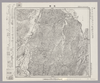
Image from the Map Collections courtesy Stanford University Libraries, licensed under a Creative Commons Attribution-Noncommercial 3.0 Unported License. © Stanford University. 【図幅名】 遠軽 【測量時期】 大正13年測圖/昭和3年鐡道補入 【発行時期】 【記号】 紋別八号 【測量機関】 参謀本部 【備考】 祕 假製版
Links: Source / Biblio Ref
|
about 2 years ago | 4 control points | |
|
shelfmark: Maps 24.b.212
License: Public Domain
江戸後期写 *浜松助郷村名等を明記す。藩政用の図力。 Manuscript, early 19th century.
Links: Source / Biblio Ref
|
about 3 years ago | 14 control points | |
|
shelfmark: Maps 63100.5
License: Public Domain
明治10 *多色刷り。 Xylograph.
Links: Source / Biblio Ref
|
1877 | about 3 years ago | 14 control points |
|
Image from the Map Collections courtesy Stanford University Libraries, licensed under a Creative Commons Attribution-Noncommercial 3.0 Unported License. © Stanford University. 【図幅名】 遠別 【測量時期】 大正12年測図 【発行時期】 大正13年8月発行 【記号】 天塩4号(共9面) 【測量機関】 大日本帝国陸地測量部 【備考】 仮製版 (In 1 layer)
Links: Source / Biblio Ref
|
about 2 years ago | 4 control points | |
|
Image from the Map Collections courtesy Stanford University Libraries, licensed under a Creative Commons Attribution-Noncommercial 3.0 Unported License. © Stanford University. 【図幅名】 寧楽 【測量時期】 大正11年測圖 【発行時期】 【記号】 羽幌四号 【測量機関】 参謀本部 【備考】 祕 假製版 (In 1 layer)
Links: Source / Biblio Ref
|
about 2 years ago | 4 control points | |
|
Image from the Map Collections courtesy Stanford University Libraries, licensed under a Creative Commons Attribution-Noncommercial 3.0 Unported License. © Stanford University. 【図幅名】 遊楽部岳 【測量時期】 大正6年測図 【発行時期】 大正8年12月発行 【記号】 室蘭15号(共14面) 【測量機関】 大日本帝国陸地測量部 【備考】 (In 1 layer)
Links: Source / Biblio Ref
|
over 4 years ago | 4 control points | |
|
Image from the Map Collections courtesy Stanford University Libraries. This item is in the public domain. There are no restrictions on use.
【図幅名】 速毛川【測量時期】 大正2年測圖 【発行時期】大正13年 【記号】 幌筵島二号 【測量機関】 参謀本部 【その他】千島列島 陸地測量部 (In 1 layer)
Links: Source / Biblio Ref
|
1924 | over 1 year ago | 4 control points |
|
Image from the Map Collections courtesy Stanford University Libraries, licensed under a Creative Commons Attribution-Noncommercial 3.0 Unported License. © Stanford University. 【図幅名】 追貝 【測量時期】 大正1年測図/昭和33年要部修正 【発行時期】 昭和35年4月発行 【記号】 日光16号 【測量機関】 国土地理院 【備考】
Links: Source / Biblio Ref
|
about 2 years ago | 4 control points | |
|
Image from the Map Collections courtesy Stanford University Libraries, licensed under a Creative Commons Attribution-Noncommercial 3.0 Unported License. © Stanford University. 【図幅名】 追分 【測量時期】 大正8年測図/昭和10年修正改版 【発行時期】 昭和11年7月発行 【記号】 札幌3号(共16面) 【測量機関】 大日本帝国陸地測量部 【備考】 (In 1 layer)
Links: Source / Biblio Ref
|
about 2 years ago | 4 control points | |
|
|
2023 | 11 months ago | 3 control points |
|
shelfmark: Maps 149.e.251
License: Public Domain
寛保2 *二色刷。外題「近江国大絵図」。 Xylograph. Acquired 22 July 1868. Ex-Siebold.
Links: Source / Biblio Ref
|
1824 | over 4 years ago | Unrectified |
|
shelfmark: Maps 62987.6
License: Public Domain
寛保2 *二色刷り。無刊記。外題「近江国大絵図」。 Xylograph. Acquired 21 December 1878. Beans 22.
Links: Source / Biblio Ref
|
1742 | over 4 years ago | Unrectified |
|
Image from the Map Collections courtesy Stanford University Libraries, licensed under a Creative Commons Attribution-Noncommercial 3.0 Unported License. © Stanford University. 【図幅名】 近江八幡 【測量時期】 明治25年測図/大正9年修正/昭和3年部分修正 【発行時期】 昭和4年8月発行 【記号】 名古屋14号(共16面) 【測量機関】 大日本帝国陸地測量部 【備考】
Links: Source / Biblio Ref
|
about 2 years ago | 4 control points | |
|
Image from the Map Collections courtesy Stanford University Libraries, licensed under a Creative Commons Attribution-Noncommercial 3.0 Unported License. © Stanford University. 【図幅名】 近川 【測量時期】 大正3年測図/昭和19年部分修正 【発行時期】 【記号】 辺地9号(共7面) 【測量機関】 内務省地理調査所 【備考】
Links: Source / Biblio Ref
|
about 2 years ago | 4 control points | |
|
Image from the Map Collections courtesy Stanford University Libraries, licensed under a Creative Commons Attribution-Noncommercial 3.0 Unported License. © Stanford University. 【図幅名】 渡塚 【測量時期】 明治35年測圖/昭和7年要部修正測圖/昭和10年部分修正測圖 【発行時期】 【記号】 開聞岳二号 【測量機関】 参謀本部 【備考】 祕
Links: Source / Biblio Ref
|
about 4 years ago | 4 control points | |
|
Image from the Map Collections courtesy Stanford University Libraries, licensed under a Creative Commons Attribution-Noncommercial 3.0 Unported License. © Stanford University. 【図幅名】 邊土名 【測量時期】 大正10年測圖 【発行時期】 大正12年発行 【記号】 沖縄郡島五号 【測量機関】 陸地測量部・参謀本部 【備考】 軍事極祕(戦地ニ在りテハ軍事祕密トス)
Links: Source / Biblio Ref
|
about 2 months ago | 4 control points | |
|
Image from the Map Collections courtesy Stanford University Libraries, licensed under a Creative Commons Attribution-Noncommercial 3.0 Unported License. © Stanford University. 【図幅名】 農家 【測量時期】 大正9年測圖/昭和20年部分修正測圖(空中寫眞測圖) 【発行時期】 【記号】 浦河六号 【測量機関】 参謀本部 【備考】 祕
Links: Source / Biblio Ref
|
about 2 years ago | 4 control points | |
|
shelfmark: Or.75.f.9
License: Public Domain
元禄1 *ケンペル旧蔵。 Xylograph. Ex-Kaempfer. Gardner, #570.
Links: Source / Biblio Ref
|
1688 | over 1 year ago | 3 control points |
|
Image from the Map Collections courtesy Stanford University Libraries. This item is in the public domain. There are no restrictions on use.
【図幅名】 轟川【測量時期】 大正3年測圖 【発行時期】大正13年 【記号】 幌筵島七号 【測量機関】 参謀本部 【その他】千島列島 陸地測量部 (In 1 layer)
Links: Source / Biblio Ref
|
1924 | over 1 year ago | 4 control points |
|
shelfmark: Maps 920.150
License: Public Domain
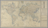
安政5 *手彩色。外題「輿地航海図」。無刊記。内題横に「原刻一千八百四十五年」とあり。例言に庸普爾地は「イヨンビュルヂ」と振ってある。 Xylograph. Acquired 10 June 1869. Beans 42 he is mistaken in describing this map as ‘copper-engraved’. Iyonbyuruji is the Japanese representation of the name of JohnPurdy, said in the tExt to have been the original maker of the map, published in 1845; this is probably a reference to his A chart of the world, on Mercator's Projection; with the tracks of the more distinguished modern navigators, which was first published in 1810.
Links: Source / Biblio Ref
|
1858 | over 4 years ago | Unrectified |
|
Image from the Map Collections courtesy Stanford University Libraries, licensed under a Creative Commons Attribution-Noncommercial 3.0 Unported License. © Stanford University.
Links: Source / Biblio Ref
|
over 6 years ago | 4 control points | |
|
Image from the Map Collections courtesy Stanford University Libraries, licensed under a Creative Commons Attribution-Noncommercial 3.0 Unported License. © Stanford University.
Links: Source / Biblio Ref
|
over 6 years ago | 4 control points | |
|
Image from the Map Collections courtesy Stanford University Libraries, licensed under a Creative Commons Attribution-Noncommercial 3.0 Unported License. © Stanford University. 【図幅名】 輪島 【測量時期】 明治43年測図/昭和4年修正 【発行時期】 昭和11年9月発行 【記号】 輪島4号(共3面) 【測量機関】 大日本帝国陸地測量部 【備考】
Links: Source / Biblio Ref
|
over 5 years ago | 4 control points | |
|
【最初期発行】 この地図の作成に当たっては、国土地理院長の承認を得て、同院発行の20万分の1地勢図及び5万分の1地形図を使用した。(承認番号 平30情使、 第1148号) (In 1 layer)
Links: Source / Biblio Ref
|
1918 | over 2 years ago | 4 control points |
|
Image from the Map Collections courtesy Stanford University Libraries, licensed under a Creative Commons Attribution-Noncommercial 3.0 Unported License. © Stanford University. 【図幅名】 軽井沢 【測量時期】 大正1年測図/昭和12年修正 【発行時期】 【記号】 長野6号 【測量機関】 参謀本部 【備考】 秘 (In 1 layer)
Links: Source / Biblio Ref
|
about 2 years ago | 4 control points | |
|
この地図の作成に当たっては、国土地理院長の承認を得て、同院発行の20万分の1地勢図及び5万分の1地形図を使用した。(承認番号 平30情使、 第1148号)
Links: Source / Biblio Ref
|
1947 | over 5 years ago | 4 control points |
|
Image from the Map Collections courtesy Stanford University Libraries, licensed under a Creative Commons Attribution-Noncommercial 3.0 Unported License. © Stanford University. 【図幅名】 足尾 【測量時期】 明治40年測図/昭和4年要部修正 【発行時期】 【記号】 宇都宮9号 【測量機関】 参謀本部 【備考】 秘
Links: Source / Biblio Ref
|
about 2 years ago | 4 control points | |
|
Image from the Map Collections courtesy Stanford University Libraries, licensed under a Creative Commons Attribution-Noncommercial 3.0 Unported License. © Stanford University. 【図幅名】 足寄太 【測量時期】 大正9年測圖 【発行時期】 【記号】 帯広五号 【測量機関】 参謀本部 【備考】 祕 (In 1 layer)
Links: Source / Biblio Ref
|
about 2 years ago | 4 control points | |
|
Image from the Map Collections courtesy Stanford University Libraries, licensed under a Creative Commons Attribution-Noncommercial 3.0 Unported License. © Stanford University. 【図幅名】 足助 【測量時期】 明治24年測図/昭和3年要部修正 【発行時期】 昭和6年2月発行 【記号】 豊橋10号(共16面) 【測量機関】 大日本帝国陸地測量部 【備考】
Links: Source / Biblio Ref
|
about 2 years ago | 4 control points | |
|
Image from the Map Collections courtesy Stanford University Libraries. This item is in the public domain. There are no restrictions on use.
【図幅名】 越渇麿嶋【測量時期】 大正5年測圖 【発行時期】昭和11年 【記号】 知林古丹島三号 【測量機関】 参謀本部 【その他】千島列島 陸地測量部 (In 1 layer)
Links: Source / Biblio Ref
|
1936 | over 1 year ago | 4 control points |
|
shelfmark: Maps C.27.e.14
License: Public Domain
江戸後期刊 *多色刷り。無刊記。図右上に「先版摩滅二附猶改正シ本道閑道ヲ記シ今般令再版者也」とあり。裏表紙に識語「嘉永五年子九月/□井」あり。 Xylograph. Acquired 21 Dec 1878.
Links: Source / Biblio Ref
|
over 4 years ago | Unrectified | |
|
Image from the Map Collections courtesy Stanford University Libraries, licensed under a Creative Commons Attribution-Noncommercial 3.0 Unported License. © Stanford University. 【図幅名】 越後湯沢 【測量時期】 明治44年測図/昭和6年修正 【発行時期】 【記号】 高田3号 【測量機関】 大日本帝国陸地測量部 【備考】 秘
Links: Source / Biblio Ref
|
about 2 years ago | 4 control points | |
|
shelfmark: Maps 149.e.277
License: Public Domain
江戸後期写 Manuscript, early 19th century. Acquired 22 July 1868. Ex-Siebold.
Links: Source / Biblio Ref
|
over 4 years ago | Unrectified | |
|
shelfmark: Maps 149.e.278
License: Public Domain
江戸後期写 Manuscript, early 19th century. Acquired 22 July 1868. Ex-Siebold.
Links: Source / Biblio Ref
|
over 4 years ago | Unrectified | |
|
Image from the Map Collections courtesy Stanford University Libraries, licensed under a Creative Commons Attribution-Noncommercial 3.0 Unported License. © Stanford University. 【図幅名】 経ヶ岳 【測量時期】 明治43年測図/昭和5年要部修正 【発行時期】 昭和7年11月発行 【記号】 金沢8号(共13面) 【測量機関】 大日本帝国陸地測量部 【備考】
Links: Source / Biblio Ref
|
about 2 years ago | 4 control points | |
|
この地図の作成に当たっては、国土地理院長の承認を得て、同院発行の20万分の1地勢図及び5万分の1地形図を使用した。(承認番号 平30情使、 第1148号)
Links: Source / Biblio Ref
|
1947 | over 5 years ago | 4 control points |
|
この地図の作成に当たっては、国土地理院長の承認を得て、同院発行の20万分の1地勢図及び5万分の1地形図を使用した。(承認番号 平30情使、 第1148号)
Links: Source / Biblio Ref
|
1947 | over 5 years ago | 4 control points |
|
Image from the Map Collections courtesy Stanford University Libraries, licensed under a Creative Commons Attribution-Noncommercial 3.0 Unported License. © Stanford University. 【図幅名】 赤石岳 【測量時期】 明治43年測図/昭和5年修正 【発行時期】 【記号】 甲府16号(共16面) 【測量機関】 参謀本部 【備考】 秘
Links: Source / Biblio Ref
|
about 2 years ago | 4 control points | |
|
Image from the Map Collections courtesy Stanford University Libraries, licensed under a Creative Commons Attribution-Noncommercial 3.0 Unported License. © Stanford University. 【図幅名】 赤湯 【測量時期】 明治43年測図/昭和6年修正 【発行時期】 昭和9年5月発行 【記号】 仙台16号(共16面) 【測量機関】 大日本帝国陸地測量部 【備考】
Links: Source / Biblio Ref
|
about 2 years ago | 4 control points | |
|
Image from the Map Collections courtesy Stanford University Libraries, licensed under a Creative Commons Attribution-Noncommercial 3.0 Unported License. © Stanford University. 【図幅名】 岩首 【測量時期】 大正2年測図/昭和9年修正 【発行時期】 昭和10年10月発行 【記号】 長岡5号(共11面) 【測量機関】 大日本帝国陸地測量部 【備考】
Links: Source / Biblio Ref
|
about 2 years ago | 4 control points | |
|
この地図の作成に当たっては、国土地理院長の承認を得て、同院発行の20万分の1地勢図及び5万分の1地形図を使用した。(承認番号 平30情使、 第1148号)
Links: Source / Biblio Ref
|
1953 | over 5 years ago | 4 control points |
|
Image from the Map Collections courtesy Stanford University Libraries, licensed under a Creative Commons Attribution-Noncommercial 3.0 Unported License. © Stanford University. 【図幅名】 歌志内 【測量時期】 大正6年測図 【発行時期】 昭和22年2月発行 【記号】 旭川15号(共16面) 【測量機関】 内務省地理調査所 【備考】
Links: Source / Biblio Ref
|
over 5 years ago | 4 control points | |
|
Image from the Map Collections courtesy Stanford University Libraries, licensed under a Creative Commons Attribution-Noncommercial 3.0 Unported License. © Stanford University.
Links: Source / Biblio Ref
|
over 6 years ago | 4 control points | |
|
Image from the Map Collections courtesy Stanford University Libraries, licensed under a Creative Commons Attribution-Noncommercial 3.0 Unported License. © Stanford University. 【図幅名】 赤尾嶼 【測量時期】 昭和5年測圖(海上寫眞測量) 【発行時期】 昭和11年発行 【記号】 先島群島一号 【測量機関】 陸地測量部・参謀本部 【備考】 軍事極祕(戦地ニ在りテハ軍事祕密トス) 假製版
Links: Source / Biblio Ref
|
over 4 years ago | 4 control points | |
|
Image from the Map Collections courtesy Stanford University Libraries, licensed under a Creative Commons Attribution-Noncommercial 3.0 Unported License. © Stanford University. 【図幅名】 赤名 【測量時期】 明治32年測圖/昭和7年修正測圖 【発行時期】 【記号】 浜田七号 【測量機関】 参謀本部 【備考】 祕
Links: Source / Biblio Ref
|
about 2 years ago | 4 control points | |
|
Image from the Map Collections courtesy Stanford University Libraries, licensed under a Creative Commons Attribution-Noncommercial 3.0 Unported License. © Stanford University. 【図幅名】 赤名 【測量時期】 明治32年測圖/昭和7年修正測圖 【発行時期】 【記号】 浜田七号 【測量機関】 参謀本部 【備考】 祕
Links: Source / Biblio Ref
|
11 months ago | 4 control points | |
|
この地図の作成に当たっては、国土地理院長の承認を得て、同院発行の20万分の1地勢図及び5万分の1地形図を使用した。(承認番号 平30情使、 第1148号)
Links: Source / Biblio Ref
|
1946 | over 5 years ago | 4 control points |

|
|
2023 | about 1 year ago | Unrectified |
|
|
|
2023 | about 1 year ago | Unrectified |
|
Image from the Map Collections courtesy Stanford University Libraries, licensed under a Creative Commons Attribution-Noncommercial 3.0 Unported License. © Stanford University. 【図幅名】 象潟 【測量時期】 大正2年測図/昭和9年修正 【発行時期】 昭和21年11月発行 【記号】 酒田1号(共6面) 【測量機関】 内務省地理調査所 【備考】
Links: Source / Biblio Ref
|
about 2 years ago | 4 control points |