Browse Maps
| map | Title | Year | Last Updated | Status  |
|---|---|---|---|---|
|
Links: Source / Biblio Ref
|
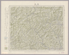
2020 | over 1 year ago | 5 control points |
|
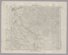
この地図の作成に当たっては、国土地理院長の承認を得て、同院発行の20万分の1地勢図及び5万分の1地形図を使用した。(承認番号 平30情使、 第1148号)
Links: Source / Biblio Ref
|
1947 | over 5 years ago | 4 control points |
|
Image from the Map Collections courtesy Stanford University Libraries, licensed under a Creative Commons Attribution-Noncommercial 3.0 Unported License. © Stanford University. 【図幅名】 サロマ湖 【測量時期】 大正13年測圖 【発行時期】 【記号】 紋別四号 【測量機関】 参謀本部 【備考】 祕 假製版 (In 1 layer)
Links: Source / Biblio Ref
|
over 2 years ago | 4 control points | |
|
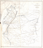
この地図の作成に当たっては、国土地理院長の承認を得て、同院発行の20万分の1地勢図及び5万分の1地形図を使用した。(承認番号 平30情使、 第1148号)
Links: Source / Biblio Ref
|
1946 | about 1 month ago | 4 control points |
|
Image from the Map Collections courtesy Stanford University Libraries, licensed under a Creative Commons Attribution-Noncommercial 3.0 Unported License. © Stanford University.
Links: Source / Biblio Ref
|
over 6 years ago | 4 control points | |
|
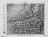
この地図の作成に当たっては、国土地理院長の承認を得て、同院発行の20万分の1地勢図及び5万分の1地形図を使用した。(承認番号 平30情使、 第1148号)
Links: Source / Biblio Ref
|
1947 | over 5 years ago | 4 control points |

|
Links: Source / Biblio Ref
|
1879 | over 6 years ago | 4 control points |
|
Links: Source / Biblio Ref
|
2020 | over 1 year ago | 4 control points |
|
Image from the Map Collections courtesy Stanford University Libraries, licensed under a Creative Commons Attribution-Noncommercial 3.0 Unported License. © Stanford University. 【図幅名】 白川村 【測量時期】 明治43年測図/昭和5年要部修正 【発行時期】 昭和21年10月発行 【記号】 金沢3号(共13面) 【測量機関】 地理調査所 【備考】
Links: Source / Biblio Ref
|
3 months ago | 4 control points | |
|
この地図の作成に当たっては、国土地理院長の承認を得て、同院発行の20万分の1地勢図及び5万分の1地形図を使用した。(承認番号 平30情使、 第1148号)
Links: Source / Biblio Ref
|
1947 | over 5 years ago | 4 control points |
|
Image from the Map Collections courtesy Stanford University Libraries, licensed under a Creative Commons Attribution-Noncommercial 3.0 Unported License. © Stanford University.
Links: Source / Biblio Ref
|
over 6 years ago | 4 control points | |
|
Image from the Map Collections courtesy Stanford University Libraries. This item is in the public domain. There are no restrictions on use.
【図幅名】 鐘灣【測量時期】 大正4年測圖 【発行時期】昭和11年 【記号】 千島列島五十二号 【測量機関】 参謀本部 【その他】千島列島 陸地測量部 (In 1 layer)
Links: Source / Biblio Ref
|
2023 | over 1 year ago | 4 control points |
|
Image from the Map Collections courtesy Stanford University Libraries, licensed under a Creative Commons Attribution-Noncommercial 3.0 Unported License. © Stanford University. 【図幅名】 信濃池田 【測量時期】 明治43年測図/昭和5年測図/昭和6年修正 【発行時期】 昭和8年8月発行 【記号】 高山2号(共16面) 【測量機関】 大日本帝国陸地測量部 【備考】
Links: Source / Biblio Ref
|
2 months ago | 4 control points | |
|
【Courtesy of the C. V. Starr East Asian Library University of California, Berkeley】 Col. wood block print. In Japanese. East Asian Library call number: Ca 24.5 Rare-Map.
Links: Source / Biblio Ref
|
1834 | over 3 years ago | 4 control points |
|
Image from the Map Collections courtesy Stanford University Libraries, licensed under a Creative Commons Attribution-Noncommercial 3.0 Unported License. © Stanford University. 【図幅名】 鹿沼 【測量時期】 明治40年測図/昭和4年要部修正 【発行時期】 昭和6年8月発行 【記号】 宇都宮5号(共16面) 【測量機関】 大日本帝国陸地測量部 【備考】 (In 1 layer)
Links: Source / Biblio Ref
|
2 months ago | 4 control points | |
|
この地図の作成に当たっては、国土地理院長の承認を得て、同院発行の20万分の1地勢図及び5万分の1地形図を使用した。(承認番号 平30情使、 第1148号)
Links: Source / Biblio Ref
|
1947 | almost 3 years ago | 4 control points |
|
【Courtesy of the C. V. Starr East Asian Library University of California, Berkeley】 Lithograph print. In Japanese. Oriented wit north to the left. Relief shown pictorially. Inlcudes legend.
Links: Source / Biblio Ref
|
1895 | over 3 years ago | 4 control points |
|
この地図の作成に当たっては、国土地理院長の承認を得て、同院発行の20万分の1地勢図及び5万分の1地形図を使用した。(承認番号 平30情使、 第1148号)
Links: Source / Biblio Ref
|
1947 | over 5 years ago | 4 control points |
|
|
2018 | over 6 years ago | 3 control points |
|
Links: Source / Biblio Ref
|
2020 | almost 2 years ago | 5 control points |
|
Image from the Map Collections courtesy Stanford University Libraries, licensed under a Creative Commons Attribution-Noncommercial 3.0 Unported License. © Stanford University. 【図幅名】 滝ノ上 【測量時期】 大正12年測図 【発行時期】 大正13年10月発行 【記号】 紋別15号(共11面) 【測量機関】 大日本帝国陸地測量部 【備考】 仮製版 (In 1 layer)
Links: Source / Biblio Ref
|
over 2 years ago | 4 control points | |
|
Image from the Map Collections courtesy Stanford University Libraries, licensed under a Creative Commons Attribution-Noncommercial 3.0 Unported License. © Stanford University. 【図幅名】 青森東部 【測量時期】 大正1年測図/昭和14年修正、測図の縮図 【発行時期】 【記号】 青森4号 【測量機関】 内務省地理調査所 【備考】
Links: Source / Biblio Ref
|
2 months ago | 4 control points | |
|
|
2018 | over 6 years ago | 3 control points |
|
(In 1 layer)
Links: Source / Biblio Ref
|
2020 | over 3 years ago | 14 control points |
|
【最初期発行】 この地図の作成に当たっては、国土地理院長の承認を得て、同院発行の20万分の1地勢図及び5万分の1地形図を使用した。(承認番号 平30情使、 第1148号) (In 1 layer)
Links: Source / Biblio Ref
|
1920 | over 4 years ago | 4 control points |
|
Links: Source / Biblio Ref
|
2020 | over 3 years ago | 5 control points |
|
Image from the Map Collections courtesy Stanford University Libraries, licensed under a Creative Commons Attribution-Noncommercial 3.0 Unported License. © Stanford University. 【図幅名】 人吉 【測量時期】 明治35年測圖/昭和7年要部修正測圖/昭和10年部分修正測圖 【発行時期】 【記号】 八代三号 【測量機関】 参謀本部 【備考】 祕
Links: Source / Biblio Ref
|
about 1 month ago | 4 control points | |
|
Links: Source / Biblio Ref
|
2020 | about 3 years ago | 4 control points |
|
Image from the Map Collections courtesy Stanford University Libraries, licensed under a Creative Commons Attribution-Noncommercial 3.0 Unported License. © Stanford University. 【図幅名】 福渡 【測量時期】 明治30年測圖/昭和7年要部修正測圖 【発行時期】 【記号】 高梁三号 【測量機関】 参謀本部 【備考】 祕
Links: Source / Biblio Ref
|
6 months ago | 4 control points | |
|
この地図の作成に当たっては、国土地理院長の承認を得て、同院発行の20万分の1地勢図及び5万分の1地形図を使用した。(承認番号 平30情使、 第1148号)
Links: Source / Biblio Ref
|
1946 | over 5 years ago | 4 control points |
|
Image from the Map Collections courtesy Stanford University Libraries, licensed under a Creative Commons Attribution-Noncommercial 3.0 Unported License. © Stanford University. 【図幅名】 北方 【測量時期】 大正1年測図/昭和9年修正 【発行時期】 昭和10年8月発行 【記号】 西郷15号(共4面) 【測量機関】 大日本帝国陸地測量部 【備考】
Links: Source / Biblio Ref
|
2 months ago | 4 control points | |
|
|
2023 | over 1 year ago | 5 control points |
|
Image from the Map Collections courtesy Stanford University Libraries, licensed under a Creative Commons Attribution-Noncommercial 3.0 Unported License. © Stanford University. 【図幅名】 三国 【測量時期】 【発行時期】 昭和8年8月発行 【記号】 金沢15号(共13面) 【測量機関】 大日本帝国陸地測量部 【備考】 (In 1 layer)
Links: Source / Biblio Ref
|
3 months ago | 4 control points | |
|
この地図の作成に当たっては、国土地理院長の承認を得て、同院発行の20万分の1地勢図及び5万分の1地形図を使用した。(承認番号 平30情使、 第1148号)
Links: Source / Biblio Ref
|
1931 | 2 months ago | 4 control points |
|
Links: Source / Biblio Ref
|
2020 | almost 2 years ago | 3 control points |
|
この地図の作成に当たっては、国土地理院長の承認を得て、同院発行の20万分の1地勢図及び5万分の1地形図を使用した。(承認番号 平30情使、 第1148号)
Links: Source / Biblio Ref
|
1946 | over 5 years ago | 4 control points |
|
Image from the Map Collections courtesy Stanford University Libraries, licensed under a Creative Commons Attribution-Noncommercial 3.0 Unported License. © Stanford University. 【図幅名】 【測量時期】 【発行時期】 【記号】 【測量機関】 【備考】
Links: Source / Biblio Ref
|
over 2 years ago | 4 control points | |
|
Links: Source / Biblio Ref
|
2020 | about 3 years ago | 5 control points |
|
【Courtesy of the C. V. Starr East Asian Library University of California, Berkeley】 Mounted cover title. Title on map: Meisho eiri Tokyo shinzu. Copperplate print. In Japanese. Oriented with north to the right. Includes address chart and distance chart. Shows points of interest pictorially. Shows views of attractions.
Links: Source / Biblio Ref
|
1883 | over 3 years ago | 4 control points |
|
Links: Source / Biblio Ref
|
2020 | about 3 years ago | 5 control points |
|
Links: Source / Biblio Ref
|
2020 | about 3 years ago | 5 control points |
|
【Courtesy of the C. V. Starr East Asian Library University of California, Berkeley】 In Japanese. Oriented with north to the upper left. Relief shown by hachures. Includes 4 insets and legend. Includes distance chart and text on districts on verso.
Links: Source / Biblio Ref
|
1898 | over 3 years ago | 4 control points |
|
Image from the Map Collections courtesy Stanford University Libraries, licensed under a Creative Commons Attribution-Noncommercial 3.0 Unported License. © Stanford University. 【図幅名】 菱 【測量時期】 大正1年測図/昭和9年修正/昭和28年応急修正 【発行時期】 昭和34年8月発行 【記号】 西郷16号(共4面) 【測量機関】 国土地理院 【備考】 応急修正版
Links: Source / Biblio Ref
|
2 months ago | 4 control points | |
|
この地図の作成に当たっては、国土地理院長の承認を得て、同院発行の20万分の1地勢図及び5万分の1地形図を使用した。(承認番号 平30情使、 第1148号)
Links: Source / Biblio Ref
|
1946 | over 5 years ago | 4 control points |
|
|
2022 | over 2 years ago | 3 control points |
|
(In 1 layer)
Links: Source / Biblio Ref
|
2020 | over 3 years ago | 6 control points |
|
Image from the Map Collections courtesy Stanford University Libraries, licensed under a Creative Commons Attribution-Noncommercial 3.0 Unported License. © Stanford University. 【図幅名】 宮之城 【測量時期】 明治34年測圖/昭和7年要部修正測圖/昭和10年部分修正測圖 【発行時期】 【記号】 鹿児島九号 【測量機関】 参謀本部 【備考】 祕
Links: Source / Biblio Ref
|
about 1 month ago | 4 control points | |
|
shelfmark: Maps 38.c.218
License: Public Domain
天保14 *無刊記。外題「(富士見十三州)輿地之全図」。江戸湾に「御台場」あり。凡例末を入れ木して「故名焉」と改む。左下欄外に「木邨嘉平刻」とあり。 Xylograph.
Links: Source / Biblio Ref
|
1843 | about 4 years ago | 32 control points |
|
Links: Source / Biblio Ref
|
2020 | over 1 year ago | 8 control points |
|
この地図の作成に当たっては、国土地理院長の承認を得て、同院発行の20万分の1地勢図及び5万分の1地形図を使用した。(承認番号 平30情使、 第1148号)
Links: Source / Biblio Ref
|
1947 | about 1 month ago | 4 control points |