Browse Maps
| map | Title | Year | Last Updated | Status  |
|---|---|---|---|---|
|
|
2019 | over 5 years ago | 4 control points |
|
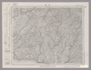
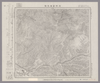
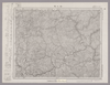
Image from the Map Collections courtesy Stanford University Libraries, licensed under a Creative Commons Attribution-Noncommercial 3.0 Unported License. © Stanford University. 【図幅名】 小野新町 【測量時期】 明治41年測図/昭和8年要部修正 【発行時期】 【記号】 白河5号(共17面) 【測量機関】 参謀本部 【備考】 秘
Links: Source / Biblio Ref
|
about 2 years ago | 4 control points | |
|
|
2019 | over 5 years ago | 3 control points |
|
この地図の作成に当たっては、国土地理院長の承認を得て、同院発行の20万分の1地勢図及び5万分の1地形図を使用した。(承認番号 平30情使、 第1148号)
Links: Source / Biblio Ref
|
1946 | about 1 year ago | 4 control points |
|
|
2019 | over 5 years ago | 4 control points |
|
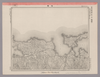
Image from the Map Collections courtesy Stanford University Libraries, licensed under a Creative Commons Attribution-Noncommercial 3.0 Unported License. © Stanford University. 【図幅名】 頭地 【測量時期】 明治35年測圖/昭和7年要部修正測圖 【発行時期】 【記号】 八代二号 【測量機関】 参謀本部 【備考】 祕
Links: Source / Biblio Ref
|
about 4 years ago | 4 control points | |
|
Image from the Map Collections courtesy Stanford University Libraries, licensed under a Creative Commons Attribution-Noncommercial 3.0 Unported License. © Stanford University. 【図幅名】 沼川 【測量時期】 大正12年測図 【発行時期】 昭和21年5月発行 【記号】 天塩1号(共11面) 【測量機関】 内務省地理調査所 【備考】 (In 1 layer)
Links: Source / Biblio Ref
|
about 2 years ago | 4 control points | |
|
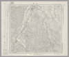
Image from the Map Collections courtesy Stanford University Libraries, licensed under a Creative Commons Attribution-Noncommercial 3.0 Unported License. © Stanford University. 【図幅名】 川前 【測量時期】 明治41年測図/昭和8年要部修正 【発行時期】 昭和10年12月発行 【記号】 白河1号(共17面) 【測量機関】 大日本帝国陸地測量部 【備考】
Links: Source / Biblio Ref
|
about 2 years ago | 4 control points | |
|
Image from the Map Collections courtesy Stanford University Libraries, licensed under a Creative Commons Attribution-Noncommercial 3.0 Unported License. © Stanford University. 【図幅名】 愛別 【測量時期】 大正8年測図/昭和3年鉄道補入 【発行時期】 昭和6年10月発行 【記号】 旭川5号(共16面) 【測量機関】 大日本帝国陸地測量部 【備考】 (In 1 layer)
Links: Source / Biblio Ref
|
about 2 years ago | 4 control points | |
|
Image from the Map Collections courtesy Stanford University Libraries, licensed under a Creative Commons Attribution-Noncommercial 3.0 Unported License. © Stanford University. 【図幅名】 北川 【測量時期】 明治40年測圖/昭和8年修正測圖 【発行時期】 【記号】 剣山十四号 【測量機関】 参謀本部 【備考】 祕
Links: Source / Biblio Ref
|
about 2 years ago | 4 control points | |
|
|
2022 | almost 2 years ago | 4 control points |
|
Image from the Map Collections courtesy Stanford University Libraries, licensed under a Creative Commons Attribution-Noncommercial 3.0 Unported License. © Stanford University. 【図幅名】 【測量時期】 【発行時期】 【記号】 【測量機関】 【備考】 (In 1 layer)
Links: Source / Biblio Ref
|
about 2 years ago | 4 control points | |
|
Image from the Map Collections courtesy Stanford University Libraries, licensed under a Creative Commons Attribution-Noncommercial 3.0 Unported License. © Stanford University. 【図幅名】 手結 【測量時期】 明治40年測図の縮図/昭和8年修正、測図の縮図 【発行時期】 昭和11年5月発行 【記号】 高知3号(共16面) 【測量機関】 大日本帝国陸地測量部 【備考】
Links: Source / Biblio Ref
|
about 2 years ago | 4 control points | |
|
Image from the Map Collections courtesy Stanford University Libraries, licensed under a Creative Commons Attribution-Noncommercial 3.0 Unported License. © Stanford University. 【図幅名】 仙崎 【測量時期】 明治30年測図/昭和2年要部修正/昭和7年鉄道補入 【発行時期】 昭和17年12月発行 【記号】 山口14号 【測量機関】 大日本帝国陸地測量部 【備考】
Links: Source / Biblio Ref
|
about 2 years ago | 4 control points | |
|
Image from the Map Collections courtesy Stanford University Libraries, licensed under a Creative Commons Attribution-Noncommercial 3.0 Unported License. © Stanford University. 【図幅名】 美幌 【測量時期】 大正13年測圖/昭和3年鐡道補入 【発行時期】 【記号】 斜里十四号 【測量機関】 参謀本部 【備考】 祕 假製版 (In 1 layer)
Links: Source / Biblio Ref
|
about 2 years ago | 4 control points | |
|
|
1864 | over 6 years ago | 3 control points |
|
この地図の作成に当たっては、国土地理院長の承認を得て、同院発行の20万分の1地勢図及び5万分の1地形図を使用した。(承認番号 平30情使、 第1148号)
Links: Source / Biblio Ref
|
1947 | 5 months ago | 4 control points |
|
Image from the Map Collections courtesy Stanford University Libraries, licensed under a Creative Commons Attribution-Noncommercial 3.0 Unported License. © Stanford University. 【図幅名】 神戸 【測量時期】 明治43年測図/大正12年修正、測図の縮図/昭和10年第2回修正 【発行時期】 【記号】 京都及大阪16号(共16面) 【測量機関】 参謀本部 【備考】 秘
Links: Source / Biblio Ref
|
about 2 years ago | 4 control points | |
|
Image from the Map Collections courtesy Stanford University Libraries. This item is in the public domain. There are no restrictions on use.
【図幅名】 知林古丹嶋【測量時期】 大正5年測圖 【発行時期】昭和11年 【記号】 知林古丹嶋十一号 【測量機関】 参謀本部 【その他】千島列島 陸地測量部
Links: Source / Biblio Ref
|
1936 | over 1 year ago | 4 control points |
|
Image from the Map Collections courtesy Stanford University Libraries, licensed under a Creative Commons Attribution-Noncommercial 3.0 Unported License. © Stanford University.
Links: Source / Biblio Ref
|
over 6 years ago | 4 control points | |
|
Image from the Map Collections courtesy Stanford University Libraries, licensed under a Creative Commons Attribution-Noncommercial 3.0 Unported License. © Stanford University. 【図幅名】 茅登温泉 【測量時期】 大正9年測図 【発行時期】 大正11年5月発行 【記号】 淕別12号(共16面) 【測量機関】 大日本帝国陸地測量部 【備考】 (In 1 layer)
Links: Source / Biblio Ref
|
about 2 years ago | 4 control points | |
|
Image from the Map Collections courtesy Stanford University Libraries, licensed under a Creative Commons Attribution-Noncommercial 3.0 Unported License. © Stanford University. 【図幅名】 月形 【測量時期】 大正5年測図/昭和10年鉄道補入 【発行時期】 昭和11年2月発行 【記号】 留萌8号(共11面) 【測量機関】 大日本帝国陸地測量部 【備考】 (In 1 layer)
Links: Source / Biblio Ref
|
about 2 years ago | 4 control points | |
|
Image from the Map Collections courtesy Stanford University Libraries, licensed under a Creative Commons Attribution-Noncommercial 3.0 Unported License. © Stanford University. 【図幅名】 武佐岳 【測量時期】 大正13年測圖/昭和19年部分修正測圖 【発行時期】 【記号】 斜里二号 【測量機関】 参謀本部 【備考】 祕 (In 1 layer)
Links: Source / Biblio Ref
|
about 2 years ago | 4 control points | |
|
Image from the Map Collections courtesy Stanford University Libraries, licensed under a Creative Commons Attribution-Noncommercial 3.0 Unported License. © Stanford University. 【図幅名】 下富良野 【測量時期】 大正8年測図 【発行時期】 大正10年4月発行 【記号】 旭川12号(共16面) 【測量機関】 大日本帝国陸地測量部 【備考】 (In 1 layer)
Links: Source / Biblio Ref
|
about 2 years ago | 4 control points | |
|
Links: Source / Biblio Ref
|
2020 | about 1 year ago | 6 control points |
|
|
2017 | about 4 years ago | 6 control points |
|
|
2022 | almost 2 years ago | 5 control points |
|
Image from the Map Collections courtesy Stanford University Libraries, licensed under a Creative Commons Attribution-Noncommercial 3.0 Unported License. © Stanford University. 【図幅名】 宇和島 【測量時期】 明治37年測図/昭和8年修正 【発行時期】 昭和11年8月発行 【記号】 宇和島5号(共13面) 【測量機関】 大日本帝国陸地測量部 【備考】 (In 1 layer)
Links: Source / Biblio Ref
|
about 2 years ago | 4 control points | |
|
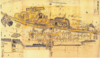
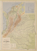
【Courtesy of the C. V. Starr East Asian Library University of California, Berkeley】 Japanese date Meiji 11 1878. In color. Folded. Mounted cover title. Wood block print. In Japanese. Relief shown pictorially. Shows distance of roads and sea routes. Includes list of kokudaka and legend.
Links: Source / Biblio Ref
|
1878 | over 3 years ago | 5 control points |
|
Links: Source / Biblio Ref
|
2021 | over 1 year ago | 3 control points |
|
Image from the Map Collections courtesy Stanford University Libraries, licensed under a Creative Commons Attribution-Noncommercial 3.0 Unported License. © Stanford University. 【図幅名】 芽登 【測量時期】 大正9年測図/昭和6年鉄道補入 【発行時期】 昭和8年1月発行 【記号】 帯広9号(共16面) 【測量機関】 大日本帝国陸地測量部 【備考】 (In 1 layer)
Links: Source / Biblio Ref
|
about 2 years ago | 4 control points | |
|
【Courtesy of the C. V. Starr East Asian Library University of California, Berkeley】 Col. map.
Links: Source / Biblio Ref
|
1895 | almost 4 years ago | 47 control points |
|
Image from the Map Collections courtesy Stanford University Libraries, licensed under a Creative Commons Attribution-Noncommercial 3.0 Unported License. © Stanford University. 【図幅名】 石狩留辺志部 【測量時期】 大正11年測図/昭和8年鉄道補入 【発行時期】 昭和10年3月発行 【記号】 旭川1号(共16面) 【測量機関】 大日本帝国陸地測量部 【備考】 (In 1 layer)
Links: Source / Biblio Ref
|
about 2 years ago | 4 control points | |
|
Links: Source / Biblio Ref
|
2020 | about 1 year ago | 4 control points |
|
Image from the Map Collections courtesy Stanford University Libraries, licensed under a Creative Commons Attribution-Noncommercial 3.0 Unported License. © Stanford University. 【図幅名】 比布 【測量時期】 大正8年測圖 【発行時期】 【記号】 旭川九号 【測量機関】 参謀本部 【備考】 祕 (In 1 layer)
Links: Source / Biblio Ref
|
about 2 years ago | 4 control points | |
|
|
over 1 year ago | 31 control points | |
|
Image from the Map Collections courtesy Stanford University Libraries, licensed under a Creative Commons Attribution-Noncommercial 3.0 Unported License. © Stanford University. 【図幅名】 舌幸 【測量時期】 大正10年測図/昭和3年鉄道補入 【発行時期】 昭和5年3月発行 【記号】 釧路14号(共12面) 【測量機関】 大日本帝国陸地測量部 【備考】 (In 1 layer)
Links: Source / Biblio Ref
|
about 2 years ago | 4 control points | |
|
Image from the Map Collections courtesy Stanford University Libraries, licensed under a Creative Commons Attribution-Noncommercial 3.0 Unported License. © Stanford University. 【図幅名】 油川 【測量時期】 大正3年測図の縮図/昭和14年修正、測図の縮図 【発行時期】 昭和17年5月発行 【記号】 青森7号 【測量機関】 大日本帝国陸地測量部 【備考】
Links: Source / Biblio Ref
|
about 2 years ago | 4 control points | |
|
Image from the Map Collections courtesy Stanford University Libraries, licensed under a Creative Commons Attribution-Noncommercial 3.0 Unported License. © Stanford University. 【図幅名】 昆布森 【測量時期】 大正11年測図/昭和19年部分修正 【発行時期】 昭和21年11月発行 【記号】 釧路7号(共12面) 【測量機関】 内務省地理調査所 【備考】 仮製版 (In 1 layer)
Links: Source / Biblio Ref
|
about 2 years ago | 4 control points | |
|
Image from the Map Collections courtesy Stanford University Libraries, licensed under a Creative Commons Attribution-Noncommercial 3.0 Unported License. © Stanford University.
Links: Source / Biblio Ref
|
over 6 years ago | 4 control points | |
|
|
2019 | over 4 years ago | 4 control points |
|
|
over 6 years ago | 7 control points | |
|
国立国会図書館デジタルコレクション インターネット公開(保護期間満了) (In 2 layers)
Links: Source / Biblio Ref
|
1852 | almost 4 years ago | 29 control points |
|
(In 1 layer)
Links: Source / Biblio Ref
|
2020 | over 2 years ago | 8 control points |
|
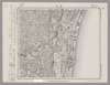
Image from the Map Collections courtesy Stanford University Libraries, licensed under a Creative Commons Attribution-Noncommercial 3.0 Unported License. © Stanford University. 【図幅名】 卯之町 【測量時期】 明治37年測図/昭和8年修正/昭和22年資料修正 【発行時期】 昭和22年11月発行 【記号】 松山8号(共15面) 【測量機関】 地理調査所 【備考】 (In 1 layer)
Links: Source / Biblio Ref
|
5 months ago | 4 control points | |
|
Links: Source / Biblio Ref
|
2021 | over 1 year ago | 12 control points |
|
Image from the Map Collections courtesy Stanford University Libraries, licensed under a Creative Commons Attribution-Noncommercial 3.0 Unported License. © Stanford University. 【図幅名】 【測量時期】 【発行時期】 【記号】 【測量機関】 【備考】 (In 1 layer)
Links: Source / Biblio Ref
|
about 2 years ago | 10 control points | |
|
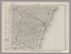
Image from the Map Collections courtesy Stanford University Libraries, licensed under a Creative Commons Attribution-Noncommercial 3.0 Unported License. © Stanford University. 【図幅名】 岩沼 【測量時期】 明治40年測図/昭和3年修正/昭和4年鉄道補入 【発行時期】 昭和6年11月発行 【記号】 仙台4号(共16面) 【測量機関】 大日本帝国陸地測量部 【備考】
Links: Source / Biblio Ref
|
about 2 years ago | 4 control points | |
|
|
2022 | almost 2 years ago | 4 control points |
|
Image from the Map Collections courtesy Stanford University Libraries, licensed under a Creative Commons Attribution-Noncommercial 3.0 Unported License. © Stanford University. 【図幅名】 小木 【測量時期】 大正2年測図/昭和9年修正 【発行時期】 【記号】 長岡10号(共11面) 【測量機関】 参謀本部 【備考】 秘
Links: Source / Biblio Ref
|
about 2 years ago | 4 control points |