地図を見る
| 地図 | タイトル | 年 | 前回の更新 | ステータス  |
|---|---|---|---|---|
|
|
2022 | 1年以上 前 | 8個の基準点 |
|
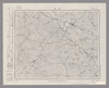
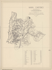
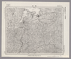
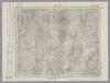
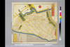
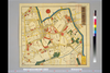
Image from the Map Collections courtesy Stanford University Libraries, licensed under a Creative Commons Attribution-Noncommercial 3.0 Unported License. © Stanford University. 【図幅名】 尾道 【測量時期】 明治31年測図/大正14年修正/昭和7年鉄道補入 【発行時期】 昭和8年6月発行 【記号】 岡山及丸亀14号(共16面) 【測量機関】 大日本帝国陸地測量部 【備考】
リンク: 出所・参照情報
|
約2年 前 | 4個の基準点 | |
|
|
2022 | 1年以上 前 | 5個の基準点 |
|
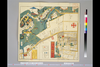
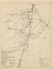
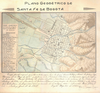
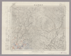
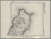
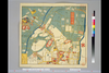
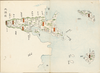
【Courtesy of the C. V. Starr East Asian Library University of California, Berkeley】 Lithograph In Japanese and English. Shows points of interest pictorially. 1 inset: Kōbe-kō no zu. Includes sketch map of Exhibition grounds and buildings on verso. Includes index of key government buildings, businesses, bridges, schools, and factories. Title on map: Daigokai Naikoku Kangyō Hakurankai kanran hikkei Ōsaka zenzu fu Kōbe = Bird's eye view of Osaka City and Harbor with map of Kobe. Folded to 27 x 14.
リンク: 出所・参照情報
|
1902 | 3年以上 前 | 4個の基準点 |
|
リンク: 出所・参照情報
|
2020 | 1年以上 前 | 11個の基準点 |
|
|
2022 | 1年以上 前 | 10個の基準点 |
|
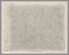
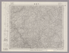
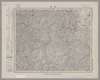
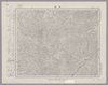
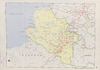
Image from the Map Collections courtesy Stanford University Libraries, licensed under a Creative Commons Attribution-Noncommercial 3.0 Unported License. © Stanford University. 【図幅名】 岡山北部 【測量時期】 明治30年測図/大正12年第2回修正 【発行時期】 昭和4年4月発行 【記号】 高梁4号(共16面) 【測量機関】 大日本帝国陸地測量部 【備考】
リンク: 出所・参照情報
|
24日 前 | 4個の基準点 | |
|
国立国会図書館デジタルコレクション インターネット公開(保護期間満了) ( 2枚のレイヤー)
リンク: 出所・参照情報
|
1854 | 3年以上 前 | 25個の基準点 |
|
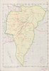
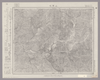
Image from the Map Collections courtesy Stanford University Libraries, licensed under a Creative Commons Attribution-Noncommercial 3.0 Unported License. © Stanford University. 【図幅名】 上下 【測量時期】 明治31年測圖/昭和7年要部修正測圖 【発行時期】 【記号】 高梁十六号 【測量機関】 参謀本部 【備考】 祕
リンク: 出所・参照情報
|
約2年 前 | 4個の基準点 | |
|
Image from the Map Collections courtesy Stanford University Libraries, licensed under a Creative Commons Attribution-Noncommercial 3.0 Unported License. © Stanford University. 【図幅名】 高梁 【測量時期】 明治29年測圖之縮圖/明治31年測圖/昭和7年要部修正測圖及修正測圖 【発行時期】 【記号】 高梁八号 【測量機関】 参謀本部 【備考】 祕
リンク: 出所・参照情報
|
約2年 前 | 4個の基準点 | |
|
Image from the Map Collections courtesy Stanford University Libraries. This item is in the public domain. There are no restrictions on use.
【図幅名】 三股山【測量時期】 大正4年測圖 【発行時期】昭和11年 【記号】 温禰古丹嶋四号 【測量機関】 参謀本部 【その他】千島列島 陸地測量部
リンク: 出所・参照情報
|
1936 | 約1年 前 | 4個の基準点 |
|
Image from the Map Collections courtesy Stanford University Libraries, licensed under a Creative Commons Attribution-Noncommercial 3.0 Unported License. © Stanford University. 【図幅名】 三次 【測量時期】 明治31年測図/昭和7年修正 【発行時期】 昭和10年6月発行 【記号】 浜田4号(共15面) 【測量機関】 大日本帝国陸地測量部 【備考】
リンク: 出所・参照情報
|
約2年 前 | 4個の基準点 | |
|
国立国会図書館デジタルコレクション インターネット公開(保護期間満了) ( 2枚のレイヤー)
リンク: 出所・参照情報
|
1850 | 3年以上 前 | 26個の基準点 |
|
国立国会図書館デジタルコレクション インターネット公開(保護期間満了) ( 2枚のレイヤー)
リンク: 出所・参照情報
|
1854 | 3年以上 前 | 14個の基準点 |
|
Image from the Map Collections courtesy Stanford University Libraries, licensed under a Creative Commons Attribution-Noncommercial 3.0 Unported License. © Stanford University. 【図幅名】 津西部 【測量時期】 明治25年測図の縮図/昭和12年第2回修正、測図の縮図 【発行時期】 昭和12年10月発行 【記号】 名古屋12号(共16面) 【測量機関】 大日本帝国陸地測量部 【備考】
リンク: 出所・参照情報
|
約2年 前 | 4個の基準点 | |
|
Image from the Map Collections courtesy Stanford University Libraries, licensed under a Creative Commons Attribution-Noncommercial 3.0 Unported License. © Stanford University. 【図幅名】 豊橋 【測量時期】 明治23年測図/大正6年修正/昭和2年鉄道補入 【発行時期】 昭和3年3月発行 【記号】 豊橋12号(共16面) 【測量機関】 大日本帝国陸地測量部 【備考】
リンク: 出所・参照情報
|
約2年 前 | 4個の基準点 | |
|
Image from the Map Collections courtesy Stanford University Libraries, licensed under a Creative Commons Attribution-Noncommercial 3.0 Unported License. © Stanford University. 【図幅名】 水口 【測量時期】 明治25年測図の縮図/昭和12年第2回修正、測図の縮図 【発行時期】 昭和13年11月発行 【記号】 名古屋15号(共16面) 【測量機関】 大日本帝国陸地測量部 【備考】
リンク: 出所・参照情報
|
約2年 前 | 4個の基準点 | |
|
Image from the Map Collections courtesy Stanford University Libraries, licensed under a Creative Commons Attribution-Noncommercial 3.0 Unported License. © Stanford University. 【図幅名】 三田 【測量時期】 明治43年測図/大正12年修正/昭和4年鉄道補入 【発行時期】 【記号】 京都及大阪15号(共16面) 【測量機関】 参謀本部 【備考】 秘
リンク: 出所・参照情報
|
約2年 前 | 4個の基準点 | |
|
Image from the Map Collections courtesy Stanford University Libraries, licensed under a Creative Commons Attribution-Noncommercial 3.0 Unported License. © Stanford University. 【図幅名】 上野 【測量時期】 明治25年測図の縮図/昭和12年第2回修正 【発行時期】 【記号】 名古屋16号 【測量機関】 参謀本部 【備考】 秘
リンク: 出所・参照情報
|
約2年 前 | 4個の基準点 | |
|
Image from the Map Collections courtesy Stanford University Libraries, licensed under a Creative Commons Attribution-Noncommercial 3.0 Unported License. © Stanford University. 【図幅名】 住吉 【測量時期】 明治21年測量、測図の縮図/昭和15年第2回修正、測図の縮図 【発行時期】 【記号】 静岡12号(共15面) 【測量機関】 参謀本部 【備考】 秘
リンク: 出所・参照情報
|
約2年 前 | 4個の基準点 | |
|
Image from the Map Collections courtesy Stanford University Libraries. This item is in the public domain. There are no restrictions on use.
【図幅名】 黒石山【測量時期】 大正4年測圖 【発行時期】昭和11年 【記号】 温禰古丹嶋八号 【測量機関】 参謀本部 【その他】千島列島 陸地測量部
リンク: 出所・参照情報
|
1936 | 約1年 前 | 4個の基準点 |
|
Image from the Map Collections courtesy Stanford University Libraries, licensed under a Creative Commons Attribution-Noncommercial 3.0 Unported License. © Stanford University. 【図幅名】 園部 【測量時期】 明治26年測圖/大正9年修正測圖 【発行時期】 【記号】 京都及大阪十号 【測量機関】 参謀本部 【備考】 祕
リンク: 出所・参照情報
|
約2年 前 | 4個の基準点 | |
|
Image from the Map Collections courtesy Stanford University Libraries, licensed under a Creative Commons Attribution-Noncommercial 3.0 Unported License. © Stanford University. 【図幅名】 三河大野 【測量時期】 明治22年測図の縮図/昭和15年第2回修正、測図の縮図 【発行時期】 昭和22年2月発行 【記号】 豊橋7号 【測量機関】 内務省地理調査所 【備考】 仮製版
リンク: 出所・参照情報
|
約2年 前 | 4個の基準点 | |
|
Image from the Map Collections courtesy Stanford University Libraries, licensed under a Creative Commons Attribution-Noncommercial 3.0 Unported License. © Stanford University. 【図幅名】 北小松 【測量時期】 明治26年測図/大正9年修正/昭和7年鉄道補入 【発行時期】 【記号】 京都及大阪1号(共16面) 【測量機関】 参謀本部 【備考】 秘
リンク: 出所・参照情報
|
約2年 前 | 4個の基準点 | |
|
( 1枚のレイヤー)
リンク: 出所・参照情報
|
2020 | 3年以上 前 | 4個の基準点 |
|
Image from the Map Collections courtesy Stanford University Libraries, licensed under a Creative Commons Attribution-Noncommercial 3.0 Unported License. © Stanford University. 【図幅名】 下呰部 【測量時期】 明治31年測圖/昭和7年要部修正測圖 【発行時期】 【記号】 高梁七号 【測量機関】 参謀本部 【備考】 祕
リンク: 出所・参照情報
|
約2年 前 | 4個の基準点 | |
|
|
2023 | 11ヶ月 前 | 11個の基準点 |
|
|
2022 | 1年以上 前 | 5個の基準点 |
|
Image from the Map Collections courtesy Stanford University Libraries, licensed under a Creative Commons Attribution-Noncommercial 3.0 Unported License. © Stanford University. 【図幅名】 冠山 【測量時期】 明治42年測図/昭和8年要部修正 【発行時期】 昭和11年3月発行 【記号】 岐阜10号(共16面) 【測量機関】 大日本帝国陸地測量部 【備考】 ( 1枚のレイヤー)
リンク: 出所・参照情報
|
約2年 前 | 4個の基準点 | |
|
|
2020 | 3年以上 前 | 4個の基準点 |
|
Image from the Map Collections courtesy Stanford University Libraries, licensed under a Creative Commons Attribution-Noncommercial 3.0 Unported License. © Stanford University. 【図幅名】 寄居 【測量時期】 明治40年測図/昭和4年修正/昭和9年要部修正/昭和14年部分修正 【発行時期】 昭和15年8月発行 【記号】 宇都宮16号 【測量機関】 大日本帝国陸地測量部 【備考】 ( 1枚のレイヤー)
リンク: 出所・参照情報
|
14日 前 | 4個の基準点 | |
|
Image from the Map Collections courtesy Stanford University Libraries, licensed under a Creative Commons Attribution-Noncommercial 3.0 Unported License. © Stanford University. 【図幅名】 上高地 【測量時期】 大正元年測圖/昭和5年修正測圖(地上寫真測量併用) 【発行時期】 昭和6年発行 【記号】 高山七号 【測量機関】 大日本帝國陸地測量部 【備考】
リンク: 出所・参照情報
|
約2年 前 | 4個の基準点 | |
|
Image from the Map Collections courtesy Stanford University Libraries, licensed under a Creative Commons Attribution-Noncommercial 3.0 Unported License. © Stanford University. 【図幅名】 舞鶴 【測量時期】 明治26年測図/大正10年修正/昭和2年鉄道補入 【発行時期】 【記号】 舞鶴要塞近傍5号(共10面) 【測量機関】 参謀本部 【備考】 宮津12号(共12面) 軍事極秘
リンク: 出所・参照情報
|
約2年 前 | 4個の基準点 | |

|
test
|
2020 | 3年以上 前 | 4個の基準点 |
|
Image from the Map Collections courtesy Stanford University Libraries, licensed under a Creative Commons Attribution-Noncommercial 3.0 Unported License. © Stanford University. 【図幅名】 和田 【測量時期】 明治43年測図/昭和6年要部修正 【発行時期】 昭和8年9月発行 【記号】 長野15号(共16面) 【測量機関】 大日本帝国陸地測量部 【備考】
リンク: 出所・参照情報
|
約2年 前 | 4個の基準点 | |
|
Image from the Map Collections courtesy Stanford University Libraries, licensed under a Creative Commons Attribution-Noncommercial 3.0 Unported License. © Stanford University. 【図幅名】 御岳昇仙峡 【測量時期】 明治43年測図/昭和4年要部修正 【発行時期】 【記号】 甲府6号 【測量機関】 参謀本部 【備考】 秘
リンク: 出所・参照情報
|
約2年 前 | 4個の基準点 | |
|
|
2023 | 11ヶ月 前 | 9個の基準点 |
|
Image from the Map Collections courtesy Stanford University Libraries, licensed under a Creative Commons Attribution-Noncommercial 3.0 Unported License. © Stanford University. 【図幅名】 藤原 【測量時期】 大正1年測図/昭和6年要部修正 【発行時期】 昭和8年8月発行 【記号】 日光15号(共16面) 【測量機関】 大日本帝国陸地測量部 【備考】
リンク: 出所・参照情報
|
約2年 前 | 4個の基準点 | |
|
Image from the Map Collections courtesy Stanford University Libraries. This item is in the public domain. There are no restrictions on use.
【図幅名】 根茂山【測量時期】 大正4年測圖 【発行時期】昭和11年 【記号】 捨子古丹島六号 【測量機関】 参謀本部 【その他】千島列島 陸地測量部
リンク: 出所・参照情報
|
1936 | 約1年 前 | 4個の基準点 |
|
国立国会図書館デジタルコレクション インターネット公開(保護期間満了) ( 2枚のレイヤー)
リンク: 出所・参照情報
|
1854 | 3年以上 前 | 21個の基準点 |
|
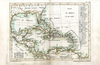
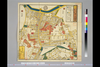
【Courtesy of the C. V. Starr East Asian Library University of California, Berkeley】 Title on map: Meiji shinpan dōkoku Dai Nihon shokoku saiken ezu. Copperplate print. In Japanese. Orientation varies. Relief shown pictorially. Includes 4 ancillary maps, list of shrines and legend. Shows distances of roads and sea routes. Features hand tinted in red, pink, green, pale green, and purple. Folded in covers to 19 x 8 cm.
リンク: 出所・参照情報
|
1885 | 3年以上 前 | 4個の基準点 |
|
国立国会図書館デジタルコレクション インターネット公開(保護期間満了) ( 2枚のレイヤー)
リンク: 出所・参照情報
|
1850 | 3年以上 前 | 33個の基準点 |
|
【Courtesy of the C. V. Starr East Asian Library University of California, Berkeley】 1 atlas 2 v. : 76 col. maps ; 26 cm. Wood block print. In Japanese. Preface by Saito Ken and afterword by Yamazaki Giko. Date of publication on preface and afterword. Orientation varies. Covers Matsumae to Tsushima. Engraved by Shogetsudo. Includes Dai Nihon yochi zenzu and Gokai Bunkoku chikyu zenzu. East Asian Library call number: Ca 24.5 Rare-Map.
リンク: 出所・参照情報
|
1834 | 3年以上 前 | 4個の基準点 |
|
|
2022 | 1年以上 前 | 6個の基準点 |
|
|
2019 | 4年以上 前 | 3個の基準点 |
|
国立国会図書館デジタルコレクション インターネット公開(保護期間満了) ( 2枚のレイヤー)
リンク: 出所・参照情報
|
1851 | 11ヶ月 前 | 39個の基準点 |

|
test
|
2020 | 3年以上 前 | 4個の基準点 |
|
Image from the Map Collections courtesy Stanford University Libraries, licensed under a Creative Commons Attribution-Noncommercial 3.0 Unported License. © Stanford University. 【図幅名】 白河 【測量時期】 明治42年測図/昭和4年修正/昭和7年測図の縮図/昭和8年部分修正 【発行時期】 昭和22年4月発行 【記号】 白河14号(共17面) 【測量機関】 内務省地理調査所 【備考】
リンク: 出所・参照情報
|
約2年 前 | 4個の基準点 | |
|
リンク: 出所・参照情報
|
2020 | 約1年 前 | 3個の基準点 |
|
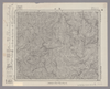
【Courtesy of the C. V. Starr East Asian Library University of California, Berkeley】 1 map : col. ; 43 x 60 cm., folded to 26 x 17 cm. Mounted cover title. In Japanese. Shows distance of sea routes. Includes legend. Relief shown by hachures. East Asian Library call number: Bb 4.
リンク: 出所・参照情報
|
1904 | 3年以上 前 | 4個の基準点 |