地図を見る
| 地図 | タイトル  |
年 | 前回の更新 | ステータス |
|---|---|---|---|---|
|
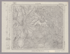
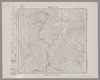
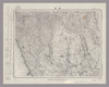
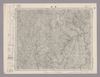
Image from the Map Collections courtesy Stanford University Libraries, licensed under a Creative Commons Attribution-Noncommercial 3.0 Unported License. © Stanford University. 【図幅名】 高見山 【測量時期】 明治25年測圖/昭和3年要部修正測圖/昭和6年部分修正測圖 【発行時期】 【記号】 宇治山田十四号 【測量機関】 参謀本部 【備考】 祕
リンク: 出所・参照情報
|
約2年 前 | 4個の基準点 | |
|
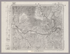
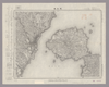
Image from the Map Collections courtesy Stanford University Libraries, licensed under a Creative Commons Attribution-Noncommercial 3.0 Unported License. © Stanford University. 【図幅名】 高遠 【測量時期】 明治43年測図/昭和6年要部修正 【発行時期】 【記号】 甲府13号(共16面) 【測量機関】 参謀本部 【備考】 秘
リンク: 出所・参照情報
|
約2年 前 | 4個の基準点 | |
|
この地図の作成に当たっては、国土地理院長の承認を得て、同院発行の20万分の1地勢図及び5万分の1地形図を使用した。(承認番号 平30情使、 第1148号)
リンク: 出所・参照情報
|
1947 | 5年以上 前 | 4個の基準点 |
|
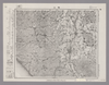
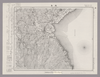
Image from the Map Collections courtesy Stanford University Libraries, licensed under a Creative Commons Attribution-Noncommercial 3.0 Unported License. © Stanford University. 【図幅名】 高鍋 【測量時期】 明治35年測図/昭和7年要部修正/昭和10年部分修正 【発行時期】 【記号】 延岡8号(共13面) 【測量機関】 参謀本部 【備考】 秘
リンク: 出所・参照情報
|
4年弱 前 | 4個の基準点 | |
|
Image from the Map Collections courtesy Stanford University Libraries, licensed under a Creative Commons Attribution-Noncommercial 3.0 Unported License. © Stanford University.
リンク: 出所・参照情報
|
約6年 前 | 4個の基準点 | |
|
リンク: 出所・参照情報
|
1936 | 約3年 前 | 5個の基準点 |
|
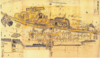
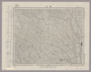
Image from the Map Collections courtesy Stanford University Libraries, licensed under a Creative Commons Attribution-Noncommercial 3.0 Unported License. © Stanford University. 【図幅名】 浅芽野台地 【測量時期】 大正12年測図 【発行時期】 大正13年6月発行 【記号】 枝幸9号(共12面) 【測量機関】 大日本帝国陸地測量部 【備考】 仮製版
リンク: 出所・参照情報
|
5年以上 前 | 4個の基準点 | |
|
Image from the Map Collections courtesy Stanford University Libraries, licensed under a Creative Commons Attribution-Noncommercial 3.0 Unported License. © Stanford University. 【図幅名】 魚島 【測量時期】 明治31年測図 【発行時期】 明治36年12月発行 【記号】 岡山及丸亀11号(共16面) 【測量機関】 大日本帝国陸地測量部 【備考】
リンク: 出所・参照情報
|
約2年 前 | 4個の基準点 | |
|
Image from the Map Collections courtesy Stanford University Libraries, licensed under a Creative Commons Attribution-Noncommercial 3.0 Unported License. © Stanford University. 【図幅名】 魚津 【測量時期】 明治44年測図/昭和5年修正 【発行時期】 昭和8年11月発行 【記号】 富山12号(共11面) 【測量機関】 大日本帝国陸地測量部 【備考】 ( 1枚のレイヤー)
リンク: 出所・参照情報
|
約2年 前 | 4個の基準点 | |
|
Image from the Map Collections courtesy Stanford University Libraries, licensed under a Creative Commons Attribution-Noncommercial 3.0 Unported License. © Stanford University. 【図幅名】 魚神山 【測量時期】 昭和8年測図の縮図/昭和20年部分修正 【発行時期】 昭和23年2月発行 【記号】 宇和島10号(共13面) 【測量機関】 地理調査所 【備考】 ( 1枚のレイヤー)
リンク: 出所・参照情報
|
約2年 前 | 4個の基準点 | |
|
Image from the Map Collections courtesy Stanford University Libraries, licensed under a Creative Commons Attribution-Noncommercial 3.0 Unported License. © Stanford University. 【図幅名】 魚貫崎 【測量時期】 明治34年測圖/昭和7年要部修正測圖 【発行時期】 【記号】 野母崎三号 【測量機関】 参謀本部 【備考】 祕
リンク: 出所・参照情報
|
4年弱 前 | 4個の基準点 | |
|
Image from the Map Collections courtesy Stanford University Libraries, licensed under a Creative Commons Attribution-Noncommercial 3.0 Unported License. © Stanford University. 【図幅名】 魚釣島 【測量時期】 昭和5年測圖(海上寫眞測量) 【発行時期】 昭和11年発行 【記号】 先島群島三号 【測量機関】 陸地測量部・参謀本部 【備考】 軍事極祕(戦地ニ在りテハ軍事祕密トス) 假製版
リンク: 出所・参照情報
|
4年以上 前 | 4個の基準点 | |
|
Image from the Map Collections courtesy Stanford University Libraries, licensed under a Creative Commons Attribution-Noncommercial 3.0 Unported License. © Stanford University.
リンク: 出所・参照情報
|
約6年 前 | 4個の基準点 | |
|
Image from the Map Collections courtesy Stanford University Libraries, licensed under a Creative Commons Attribution-Noncommercial 3.0 Unported License. © Stanford University. 【図幅名】 ?崎 【測量時期】 大正5年測図 【発行時期】 大正7年6月発行 【記号】 盛岡3号東部(共18面) 【測量機関】 大日本帝国陸地測量部 【備考】
リンク: 出所・参照情報
|
約2年 前 | 4個の基準点 | |
|
Image from the Map Collections courtesy Stanford University Libraries, licensed under a Creative Commons Attribution-Noncommercial 3.0 Unported License. © Stanford University. 【図幅名】 鯖江 【測量時期】 明治42年測図/昭和5年修正/昭和8年要部修正 【発行時期】 昭和8年7月発行 【記号】 岐阜13号(共16面) 【測量機関】 大日本帝国陸地測量部 【備考】 ( 1枚のレイヤー)
リンク: 出所・参照情報
|
約2年 前 | 4個の基準点 | |
|
|
1年以上 前 | 31個の基準点 | |
|
Image from the Map Collections courtesy Stanford University Libraries, licensed under a Creative Commons Attribution-Noncommercial 3.0 Unported License. © Stanford University. 【図幅名】 鰍沢 【測量時期】 明治43年測図/昭和4年修正 【発行時期】 昭和22年2月発行 【記号】 甲府11号(共16面) 【測量機関】 内務省地理調査所 【備考】
リンク: 出所・参照情報
|
約2年 前 | 4個の基準点 | |
|
Image from the Map Collections courtesy Stanford University Libraries, licensed under a Creative Commons Attribution-Noncommercial 3.0 Unported License. © Stanford University. 【図幅名】 鯵ヶ沢 【測量時期】 大正3年測図の縮図/昭和14年修正、測図の縮図 【発行時期】 【記号】 青森16号(共14面) 【測量機関】 参謀本部 【備考】 秘
リンク: 出所・参照情報
|
約2年 前 | 4個の基準点 | |
|
【最初期発行】 この地図の作成に当たっては、国土地理院長の承認を得て、同院発行の20万分の1地勢図及び5万分の1地形図を使用した。(承認番号 平30情使、 第1148号) ( 1枚のレイヤー)
リンク: 出所・参照情報
|
1904 | 4年弱 前 | 4個の基準点 |
|
この地図の作成に当たっては、国土地理院長の承認を得て、同院発行の20万分の1地勢図及び5万分の1地形図を使用した。(承認番号 平30情使、 第1148号)
リンク: 出所・参照情報
|
1947 | 5年以上 前 | 4個の基準点 |
|
Image from the Map Collections courtesy Stanford University Libraries, licensed under a Creative Commons Attribution-Noncommercial 3.0 Unported License. © Stanford University. 【図幅名】 鳥取北部 【測量時期】 明治30年測図の縮図/昭和7年修正 【発行時期】 昭和9年1月発行 【記号】 鳥取15号(共9面) 【測量機関】 大日本帝国陸地測量部 【備考】
リンク: 出所・参照情報
|
5年以上 前 | 4個の基準点 | |
|
Image from the Map Collections courtesy Stanford University Libraries, licensed under a Creative Commons Attribution-Noncommercial 3.0 Unported License. © Stanford University. 【図幅名】 鳥取南部 【測量時期】 明治30年測図/明治31年測図の縮図/昭和7年修正 【発行時期】 昭和9年8月発行 【記号】 鳥取16号(共9面) 【測量機関】 大日本帝国陸地測量部 【備考】
リンク: 出所・参照情報
|
約1ヶ月 前 | 4個の基準点 | |
|
Image from the Map Collections courtesy Stanford University Libraries. This item is in the public domain. There are no restrictions on use.
【図幅名】 鳥ノ尾崎【測量時期】 大正4年測圖 【発行時期】昭和11年 【記号】 千島列島四十八号 【測量機関】 参謀本部 【その他】千島列島 陸地測量部 ( 1枚のレイヤー)
リンク: 出所・参照情報
|
1936 | 1年以上 前 | 4個の基準点 |
|
【最初期発行】 この地図の作成に当たっては、国土地理院長の承認を得て、同院発行の20万分の1地勢図及び5万分の1地形図を使用した。(承認番号 平30情使、 第1148号)
リンク: 出所・参照情報
|
1935 | 約5年 前 | 4個の基準点 |
|
Image from the Map Collections courtesy Stanford University Libraries, licensed under a Creative Commons Attribution-Noncommercial 3.0 Unported License. © Stanford University. 【図幅名】 鳥海山 【測量時期】 大正2年測図/昭和9年修正 【発行時期】 昭和11年10月発行 【記号】 新庄14号(共16面) 【測量機関】 大日本帝国陸地測量部 【備考】
リンク: 出所・参照情報
|
約2年 前 | 4個の基準点 | |
|
Image from the Map Collections courtesy Stanford University Libraries, licensed under a Creative Commons Attribution-Noncommercial 3.0 Unported License. © Stanford University. 【図幅名】 鳥羽 【測量時期】 明治23年測図/大正9年修正/昭和19年部分修正 【発行時期】 【記号】 宇治山田2号(共14面) 【測量機関】 参謀本部 【備考】 秘
リンク: 出所・参照情報
|
約2年 前 | 4個の基準点 | |
|
Image from the Map Collections courtesy Stanford University Libraries, licensed under a Creative Commons Attribution-Noncommercial 3.0 Unported License. © Stanford University. 【図幅名】 鳴子 【測量時期】 大正2年測図/昭和9年修正 【発行時期】 昭和11年9月発行 【記号】 新庄8号(共16面) 【測量機関】 大日本帝国陸地測量部 【備考】
リンク: 出所・参照情報
|
約2年 前 | 4個の基準点 | |
|
この地図の作成に当たっては、国土地理院長の承認を得て、同院発行の20万分の1地勢図及び5万分の1地形図を使用した。(承認番号 平30情使、 第1148号)
リンク: 出所・参照情報
|
1932 | 5年以上 前 | 4個の基準点 |
|
Image from the Map Collections courtesy Stanford University Libraries, licensed under a Creative Commons Attribution-Noncommercial 3.0 Unported License. © Stanford University. 【図幅名】 鴨川 【測量時期】 明治36年測図/昭和6年修正 【発行時期】 昭和8年2月発行 【記号】 大多喜14号(共4面) 【測量機関】 大日本帝国陸地測量部 【備考】 ( 1枚のレイヤー)
リンク: 出所・参照情報
|
約2年 前 | 4個の基準点 | |
|
この地図の作成に当たっては、国土地理院長の承認を得て、同院発行の20万分の1地勢図及び5万分の1地形図を使用した。(承認番号 平30情使、 第1148号) ( 1枚のレイヤー)
リンク: 出所・参照情報
|
1947 | 4年弱 前 | 4個の基準点 |
|
Image from the Map Collections courtesy Stanford University Libraries, licensed under a Creative Commons Attribution-Noncommercial 3.0 Unported License. © Stanford University.
リンク: 出所・参照情報
|
約6年 前 | 4個の基準点 | |
|
Image from the Map Collections courtesy Stanford University Libraries, licensed under a Creative Commons Attribution-Noncommercial 3.0 Unported License. © Stanford University. 【図幅名】 鵡川 【測量時期】 大正8年測圖/昭和10年修正測圖 【発行時期】 【記号】 苫小牧一号 【測量機関】 参謀本部 【備考】 祕 ( 1枚のレイヤー)
リンク: 出所・参照情報
|
約2年 前 | 4個の基準点 | |
|
Image from the Map Collections courtesy Stanford University Libraries, licensed under a Creative Commons Attribution-Noncommercial 3.0 Unported License. © Stanford University. 【図幅名】 鶯宿 【測量時期】 大正5年測図/昭和14年修正 【発行時期】 昭和16年5月発行 【記号】 秋田3号(共16面) 【測量機関】 大日本帝国陸地測量部 【備考】
リンク: 出所・参照情報
|
約2年 前 | 4個の基準点 | |
|
この地図の作成に当たっては、国土地理院長の承認を得て、同院発行の20万分の1地勢図及び5万分の1地形図を使用した。(承認番号 平30情使、 第1148号)
リンク: 出所・参照情報
|
1946 | 5年以上 前 | 4個の基準点 |
|
Image from the Map Collections courtesy Stanford University Libraries, licensed under a Creative Commons Attribution-Noncommercial 3.0 Unported License. © Stanford University. 【図幅名】 鶴岡 【測量時期】 大正2年測図/昭和9年修正 【発行時期】 【記号】 酒田4号(共6面) 【測量機関】 参謀本部 【備考】 秘
リンク: 出所・参照情報
|
約2年 前 | 4個の基準点 | |
|
Image from the Map Collections courtesy Stanford University Libraries, licensed under a Creative Commons Attribution-Noncommercial 3.0 Unported License. © Stanford University. 【図幅名】 鶴川 【測量時期】 明治36年測圖/昭和2年要部修正測圖 【発行時期】 【記号】 中津七号 【測量機関】 参謀本部 【備考】 祕
リンク: 出所・参照情報
|
4年弱 前 | 4個の基準点 | |
|
この地図の作成に当たっては、国土地理院長の承認を得て、同院発行の20万分の1地勢図及び5万分の1地形図を使用した。(承認番号 平30情使、 第1148号)
リンク: 出所・参照情報
|
1946 | 5年以上 前 | 4個の基準点 |
|
Image from the Map Collections courtesy Stanford University Libraries, licensed under a Creative Commons Attribution-Noncommercial 3.0 Unported License. © Stanford University. 【図幅名】 鶴来 【測量時期】 明治42年測図/昭和5年修正 【発行時期】 昭和8年10月発行 【記号】 金沢6号(共13面) 【測量機関】 大日本帝国陸地測量部 【備考】 (改) ( 2枚のレイヤー)
リンク: 出所・参照情報
|
4ヶ月 前 | 4個の基準点 | |
|
Image from the Map Collections courtesy Stanford University Libraries, licensed under a Creative Commons Attribution-Noncommercial 3.0 Unported License. © Stanford University. 【図幅名】 鷲崎 【測量時期】 大正2年測図/昭和9年修正 【発行時期】 【記号】 相川11号 【測量機関】 参謀本部 【備考】 秘
リンク: 出所・参照情報
|
2年以上 前 | 4個の基準点 | |
|
Image from the Map Collections courtesy Stanford University Libraries, licensed under a Creative Commons Attribution-Noncommercial 3.0 Unported License. © Stanford University. 【図幅名】 鷹巣 【測量時期】 大正3年測図 【発行時期】 大正6年4月発行 【記号】 弘前11号(共16面) 【測量機関】 大日本帝国陸地測量部 【備考】
リンク: 出所・参照情報
|
約2年 前 | 4個の基準点 | |
|
Image from the Map Collections courtesy Stanford University Libraries, licensed under a Creative Commons Attribution-Noncommercial 3.0 Unported License. © Stanford University. 【図幅名】 上江丹別 【測量時期】 大正8年測図/昭和6年鉄道補入 【発行時期】 昭和8年1月発行 【記号】 旭川13号(共16面) 【測量機関】 大日本帝国陸地測量部 【備考】 ( 1枚のレイヤー)
リンク: 出所・参照情報
|
約2年 前 | 4個の基準点 | |
|
この地図の作成に当たっては、国土地理院長の承認を得て、同院発行の20万分の1地勢図及び5万分の1地形図を使用した。(承認番号 平30情使、 第1148号)
リンク: 出所・参照情報
|
1947 | 5年以上 前 | 4個の基準点 |
|
【最初期発行】 この地図の作成に当たっては、国土地理院長の承認を得て、同院発行の20万分の1地勢図及び5万分の1地形図を使用した。(承認番号 平30情使、 第1148号)
リンク: 出所・参照情報
|
1914 | 約5年 前 | 4個の基準点 |
|
Image from the Map Collections courtesy Stanford University Libraries, licensed under a Creative Commons Attribution-Noncommercial 3.0 Unported License. © Stanford University. 【図幅名】 鹿児島 【測量時期】 大正4年測図の縮図/昭和7年修正、測図の縮図/昭和10年部分修正/昭和28年応急修正 【発行時期】 昭和29年11月発行 【記号】 鹿児島7号(共16面) 【測量機関】 国土地理院 【備考】 応急修正版
リンク: 出所・参照情報
|
約4年 前 | 4個の基準点 | |
|
Image from the Map Collections courtesy Stanford University Libraries, licensed under a Creative Commons Attribution-Noncommercial 3.0 Unported License. © Stanford University. 【図幅名】 鹿屋 【測量時期】 明治35年測図/昭和7年修正/昭和10年部分修正/昭和24年資料修正 【発行時期】 昭和24年6月発行 【記号】 鹿児島4号(共16面) 【測量機関】 地理調査所 【備考】
リンク: 出所・参照情報
|
約4年 前 | 4個の基準点 | |
|
Image from the Map Collections courtesy Stanford University Libraries, licensed under a Creative Commons Attribution-Noncommercial 3.0 Unported License. © Stanford University. 【図幅名】 鹿島 【測量時期】 明治33年及大正3年測圖之縮圖/大正6年修正測圖/昭和6年鐡道補入/昭和7年部分修正測圖 【発行時期】 【記号】 熊本十四号 【測量機関】 参謀本部 【備考】 祕
リンク: 出所・参照情報
|
4年弱 前 | 4個の基準点 | |
|
Image from the Map Collections courtesy Stanford University Libraries, licensed under a Creative Commons Attribution-Noncommercial 3.0 Unported License. © Stanford University. 【図幅名】 鹿沼 【測量時期】 明治40年測図/昭和4年要部修正 【発行時期】 昭和6年8月発行 【記号】 宇都宮5号(共16面) 【測量機関】 大日本帝国陸地測量部 【備考】 ( 1枚のレイヤー)
リンク: 出所・参照情報
|
約2年 前 | 4個の基準点 | |
|
Image from the Map Collections courtesy Stanford University Libraries, licensed under a Creative Commons Attribution-Noncommercial 3.0 Unported License. © Stanford University. 【図幅名】 鹿部 【測量時期】 大正4年測圖 【発行時期】 【記号】 室蘭四号 【測量機関】 参謀本部 【備考】 祕 ( 1枚のレイヤー)
リンク: 出所・参照情報
|
約2年 前 | 4個の基準点 | |
|
Image from the Map Collections courtesy Stanford University Libraries, licensed under a Creative Commons Attribution-Noncommercial 3.0 Unported License. © Stanford University. 【図幅名】 鹿野 【測量時期】 明治32年測図/昭和2年要部修正 【発行時期】 昭和6年2月発行 【記号】 山口3号(共15面) 【測量機関】 大日本帝国陸地測量部 【備考】
リンク: 出所・参照情報
|
約2年 前 | 4個の基準点 | |
|
Image from the Map Collections courtesy Stanford University Libraries, licensed under a Creative Commons Attribution-Noncommercial 3.0 Unported License. © Stanford University. 【図幅名】 黄尾嶼 【測量時期】 昭和5年測圖(海上寫眞測量) 【発行時期】 昭和11年発行 【記号】 先島群島二号 【測量機関】 陸地測量部・参謀本部 【備考】 軍事極祕(戦地ニ在りテハ軍事祕密トス) 假製版
リンク: 出所・参照情報
|
4年以上 前 | 4個の基準点 |