Browse Maps
| map | Title | Year | Last Updated | Status  |
|---|---|---|---|---|

|
|
2023 | about 1 year ago | 8 control points |
|
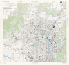
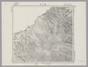
Japan City Plans 1:12,500
U.S. Army Map Service, 1945-1946
https://maps.lib.utexas.edu/maps/ams/japan_city_plans/
Links: Source / Biblio Ref
|
1945 | 4 months ago | 4 control points |
|
|
2020 | over 3 years ago | 3 control points |
|
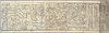
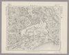
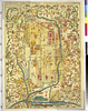
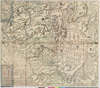
【Courtesy of the C. V. Starr East Asian Library University of California, Berkeley】 Japanese date Bunsei 5 1822. In color. Folded. Printed 2 sides. Cover title. Wood block print. In Japanese. Orientation varies. Covers Nagasaki to Morioka. Includes lists of messenger fees on verso. Includes legend.
Links: Source / Biblio Ref
|
1822 | over 3 years ago | 4 control points |
|
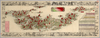
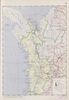
【Courtesy of the C. V. Starr East Asian Library University of California, Berkeley】 Japanese date Meiji 17 1884. In color. Folded. Mounted cover title. Title on map: Dai Nihon fuken meisho hitori annai : fu tokai benran meisho eiri. Copperplate print. In Japanese. Orientation varies. Bird's-eye view. Shows views of tourist attractions. Includes list of city names and distance chart.
Links: Source / Biblio Ref
|
1884 | over 3 years ago | 5 control points |
|
ImagefromtheMapCollectionscourtesyStanfordUniversityLibraries.Ifyouhavequestions,pleasecontacttheBrannerEarthScienceLibrary&MapCollectionsatbrannerlibrary@stanford.edu.
|
almost 4 years ago | 8 control points | |
|
国立国会図書館デジタルコレクション インターネット公開(保護期間満了) (In 2 layers)
Links: Source / Biblio Ref
|
1853 | almost 4 years ago | 26 control points |
|
国立国会図書館デジタルコレクション インターネット公開(保護期間満了) (In 2 layers)
Links: Source / Biblio Ref
|
1852 | almost 4 years ago | 22 control points |
|
|
2022 | almost 2 years ago | 7 control points |
|
|
2022 | almost 2 years ago | 5 control points |
|
Image from the Map Collections courtesy Stanford University Libraries, licensed under a Creative Commons Attribution-Noncommercial 3.0 Unported License. © Stanford University. 【図幅名】 八王子 【測量時期】 明治39年測図/大正10年修正/昭和2年第2回部分修正/昭和4年鉄道補入 【発行時期】 昭和21年9月発行 【記号】 東京11号(共16面) 【測量機関】 内務省地理調査所 【備考】 (In 1 layer)
Links: Source / Biblio Ref
|
about 2 years ago | 4 control points | |
|
|
2022 | almost 2 years ago | 4 control points |
|
Image from the Map Collections courtesy Stanford University Libraries, licensed under a Creative Commons Attribution-Noncommercial 3.0 Unported License. © Stanford University. 【図幅名】 柏崎 【測量時期】 明治44年測図/昭和6年修正 【発行時期】 昭和9年4月発行 【記号】 長岡8号(共11面) 【測量機関】 大日本帝国陸地測量部 【備考】
Links: Source / Biblio Ref
|
about 2 years ago | 4 control points | |
|
Image from the Map Collections courtesy Stanford University Libraries, licensed under a Creative Commons Attribution-Noncommercial 3.0 Unported License. © Stanford University. 【図幅名】 八日市場 【測量時期】 明治36年測図/昭和9年第2回修正/昭和19年部分修正 【発行時期】 昭和22年5月発行 【記号】 佐倉6号(共12面) 【測量機関】 内務省地理調査所 【備考】 (In 1 layer)
Links: Source / Biblio Ref
|
about 2 years ago | 4 control points | |
|
Image from the Map Collections courtesy Stanford University Libraries, licensed under a Creative Commons Attribution-Noncommercial 3.0 Unported License. © Stanford University. 【図幅名】 銚子 【測量時期】 明治36年測図/昭和9年第2回修正/昭和19年部分修正/昭和28年応急修正 【発行時期】 昭和30年6月発行 【記号】 千葉2号(共12面) 【測量機関】 国土地理院 【備考】 応急修正版 (In 1 layer)
Links: Source / Biblio Ref
|
about 2 years ago | 4 control points | |
|
Image from the Map Collections courtesy Stanford University Libraries, licensed under a Creative Commons Attribution-Noncommercial 3.0 Unported License. © Stanford University. 【図幅名】 五日市 【測量時期】 明治40年測図/昭和34年部分修正 【発行時期】 昭和36年8月発行 【記号】 東京14号(共16面) 【測量機関】 国土地理院 【備考】 (In 1 layer)
Links: Source / Biblio Ref
|
about 2 years ago | 4 control points | |
|
Image from the Map Collections courtesy Stanford University Libraries, licensed under a Creative Commons Attribution-Noncommercial 3.0 Unported License. © Stanford University. 【図幅名】 粟島 【測量時期】 大正2年測図/昭和9年修正 【発行時期】 昭和11年8月発行 【記号】 村上14号(共12面) 【測量機関】 大日本帝国陸地測量部 【備考】
Links: Source / Biblio Ref
|
about 2 years ago | 4 control points | |
|
|
2022 | almost 2 years ago | 3 control points |
|
|
2022 | almost 2 years ago | 5 control points |
|
Image from the Map Collections courtesy Stanford University Libraries, licensed under a Creative Commons Attribution-Noncommercial 3.0 Unported License. © Stanford University. 【図幅名】 大宮 【測量時期】 明治39年測図/大正13年修正/昭和4年鉄道補入 【発行時期】 昭和21年8月発行 【記号】 東京5号(共16面) 【測量機関】 地理調査所 【備考】 (In 1 layer)
Links: Source / Biblio Ref
|
about 2 years ago | 4 control points | |
|
|
2022 | almost 2 years ago | 5 control points |
|
Image from the Map Collections courtesy Stanford University Libraries, licensed under a Creative Commons Attribution-Noncommercial 3.0 Unported License. © Stanford University. 【図幅名】 玉造 【測量時期】 明治36年測図/昭和4年修正 【発行時期】 【記号】 水戸12号 【測量機関】 参謀本部 【備考】 秘 (In 1 layer)
Links: Source / Biblio Ref
|
about 2 years ago | 4 control points | |
|
Image from the Map Collections courtesy Stanford University Libraries, licensed under a Creative Commons Attribution-Noncommercial 3.0 Unported License. © Stanford University. 【図幅名】 熊谷 【測量時期】 明治40年測図/昭和4年修正/昭和9年要部修正/昭和14年部分修正 【発行時期】 昭和15年9月発行 【記号】 宇都宮12号(共16面) 【測量機関】 大日本帝国陸地測量部 【備考】 (In 1 layer)
Links: Source / Biblio Ref
|
about 2 years ago | 4 control points | |
|
Image from the Map Collections courtesy Stanford University Libraries, licensed under a Creative Commons Attribution-Noncommercial 3.0 Unported License. © Stanford University. 【図幅名】 沼津 【測量時期】 明治19年測図の縮図/大正5年修正、測図の縮図/大正14年鉄道補入/昭和7年第2回部分修正、測図の縮図 【発行時期】 昭和8年5月発行 【記号】 静岡2号 【測量機関】 大日本帝国陸地測量部 【備考】 (In 1 layer)
Links: Source / Biblio Ref
|
about 2 years ago | 4 control points | |
|
Image from the Map Collections courtesy Stanford University Libraries, licensed under a Creative Commons Attribution-Noncommercial 3.0 Unported License. © Stanford University. 【図幅名】 川越 【測量時期】 明治40年測図/大正12年修正、測図の縮図/昭和14年第2回部分修正及部分修正、測図の縮図 【発行時期】 昭和16年4月発行 【記号】 東京9号(共16面) 【測量機関】 大日本帝国陸地測量部 【備考】 (In 1 layer)
Links: Source / Biblio Ref
|
about 2 years ago | 4 control points | |
|
|
2022 | almost 2 years ago | 6 control points |
|
Image from the Map Collections courtesy Stanford University Libraries, licensed under a Creative Commons Attribution-Noncommercial 3.0 Unported License. © Stanford University. 【図幅名】 鉾田 【測量時期】 明治36年測図/昭和4年修正 【発行時期】 昭和21年10月発行 【記号】 水戸8号(共12面) 【測量機関】 内務省地理調査所 【備考】 (In 1 layer)
Links: Source / Biblio Ref
|
about 2 years ago | 4 control points | |
|
|
2022 | almost 2 years ago | 9 control points |
|
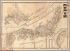
【Courtesy of the C. V. Starr East Asian Library University of California, Berkeley】 Japanese date Meiji 11 1878. In color. Folded. Mounted cover title. Copperplate print. In Japanese. Oriented with north to the upper left. Relief shown by hachures. 5 insets: Chishima Guntō.--Ryūkyū Shotō.--Sakishima Guntō.--Ogasawarajima.--Nihon. Engraved by Yuasa Yoshio. Includes tables of mountains and rivers, preface and legend. Title on map: Dai Nihon yochi zenzu.
Links: Source / Biblio Ref
|
1878 | over 3 years ago | 5 control points |
|
Links: Source / Biblio Ref
|
2019 | almost 5 years ago | 6 control points |
|
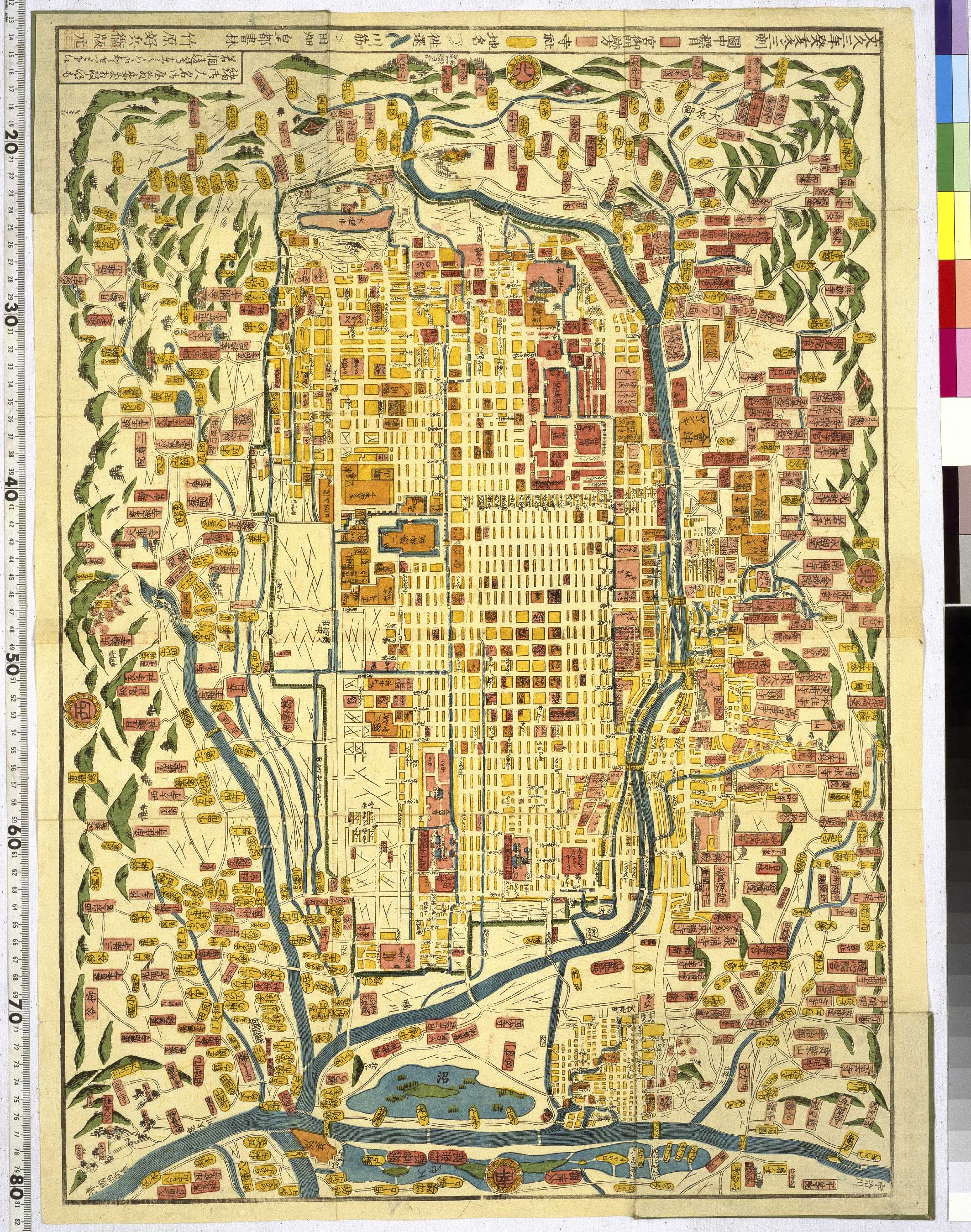
【Courtesy of the C. V. Starr East Asian Library University of California, Berkeley】 Japanese date Meiji 43 1910. In color. Folded. Title on envelope: Saikin jissoku Kyōto shinchizu = The new map of Kyoto. In Japanese. Oriented with north to the left. Relief shown by hachures. 4 insets: Kyōto fukin meisho chizu; Kyōto-fu kannai chizu, Nara-shi zenzu; Fushimi-chō zenzu. Includes text, views of tourist attractions and list of addresses local products and postages on verso. Includes distance chart and legend.
Links: Source / Biblio Ref
|
1910 | over 3 years ago | 4 control points |
|
天保15年絵図屋庄八版
早稲田大学図書館千崖文庫蔵
|
2021 | about 3 years ago | 7 control points |
|
【Courtesy of the C. V. Starr East Asian Library University of California, Berkeley】 Japanese date Meiji 34 1901 In color. Folded. Lithograph. In Japanese. Oriented with north to the upper right. Relief shown by hachures. Includes 6 insets: Hokkaidō ; Chishima Shotō ; Taiwan oyobi Bōko Rettō et al Shows sea routes with distances. Includes distance chart and list of place names on verso.
Links: Source / Biblio Ref
|
1901 | over 3 years ago | 5 control points |
|
Owned by 舞鶴市糸井文庫 【成立・出版年】 文化041807
Links: Source / Biblio Ref
|
1807 | almost 4 years ago | 33 control points |
|
国立国会図書館デジタルコレクション インターネット公開(保護期間満了) (In 2 layers)
Links: Source / Biblio Ref
|
1853 | almost 4 years ago | 36 control points |
|
|
2022 | almost 2 years ago | 5 control points |
|
Image from the Map Collections courtesy Stanford University Libraries, licensed under a Creative Commons Attribution-Noncommercial 3.0 Unported License. © Stanford University. 【図幅名】 栃木 【測量時期】 明治40年測図/昭和4年第2回修正/昭和9年要部修正 【発行時期】 昭和15年12月発行 【記号】 宇都宮6号(共16面) 【測量機関】 参謀本部 【備考】 秘 (In 1 layer)
Links: Source / Biblio Ref
|
about 2 years ago | 4 control points | |
|
Image from the Map Collections courtesy Stanford University Libraries, licensed under a Creative Commons Attribution-Noncommercial 3.0 Unported License. © Stanford University. 【図幅名】 石岡 【測量時期】 明治36年測図/大正6年修正/昭和5年鉄道補入 【発行時期】 昭和6年10月発行 【記号】 水戸11号(共12面) 【測量機関】 大日本帝国陸地測量部 【備考】 (In 1 layer)
Links: Source / Biblio Ref
|
about 2 years ago | 4 control points | |
|
Image from the Map Collections courtesy Stanford University Libraries, licensed under a Creative Commons Attribution-Noncommercial 3.0 Unported License. © Stanford University. 【図幅名】 深谷 【測量時期】 明治40年測図/昭和4年修正/昭和9年要部修正/昭和14年部分修正 【発行時期】 【記号】 宇都宮11号(共16面) 【測量機関】 参謀本部 【備考】 秘 (In 1 layer)
Links: Source / Biblio Ref
|
about 2 years ago | 4 control points | |
|
Image from the Map Collections courtesy Stanford University Libraries, licensed under a Creative Commons Attribution-Noncommercial 3.0 Unported License. © Stanford University. 【図幅名】 真岡 【測量時期】 明治38年測図/大正4年修正/大正15年鉄道補入 【発行時期】 【記号】 水戸14号(共12面) 【測量機関】 参謀本部 【備考】 秘 (In 1 layer)
Links: Source / Biblio Ref
|
about 2 years ago | 4 control points | |
|
Image from the Map Collections courtesy Stanford University Libraries, licensed under a Creative Commons Attribution-Noncommercial 3.0 Unported License. © Stanford University. 【図幅名】 榛名山 【測量時期】 明治44年測図/昭和4年修正/昭和9年要部修正 【発行時期】 昭和15年11月発行 【記号】 長野2号(共16面) 【測量機関】 大日本帝国陸地測量部 【備考】 (In 1 layer)
Links: Source / Biblio Ref
|
about 2 years ago | 4 control points | |
|
Links: Source / Biblio Ref
|
2020 | over 1 year ago | 3 control points |
|
Image from the Map Collections courtesy Stanford University Libraries, licensed under a Creative Commons Attribution-Noncommercial 3.0 Unported License. © Stanford University. 【図幅名】 真壁 【測量時期】 明治38年測図/大正6年修正/昭和4年部分修正 【発行時期】 昭和7年5月発行 【記号】 水戸15号(共12面) 【測量機関】 大日本帝国陸地測量部 【備考】 (In 1 layer)
Links: Source / Biblio Ref
|
about 2 years ago | 4 control points | |
|
|
2022 | almost 2 years ago | 5 control points |
|
Image from the Map Collections courtesy Stanford University Libraries, licensed under a Creative Commons Attribution-Noncommercial 3.0 Unported License. © Stanford University. 【図幅名】 高萩 【測量時期】 明治42年測図/昭和8年要部修正 【発行時期】 昭和11年1月発行 【記号】 白河8号(共17面) 【測量機関】 大日本帝国陸地測量部 【備考】 (In 1 layer)
Links: Source / Biblio Ref
|
about 2 years ago | 4 control points | |
|
|
2022 | almost 2 years ago | 5 control points |
|
Image from the Map Collections courtesy Stanford University Libraries, licensed under a Creative Commons Attribution-Noncommercial 3.0 Unported License. © Stanford University. 【図幅名】 矢板 【測量時期】 明治42年測図/昭和4年第2回修正 【発行時期】 昭和21年10月発行 【記号】 日光4号(共16面) 【測量機関】 内務省地理調査所 【備考】 (In 1 layer)
Links: Source / Biblio Ref
|
about 2 years ago | 4 control points | |
|
Image from the Map Collections courtesy Stanford University Libraries, licensed under a Creative Commons Attribution-Noncommercial 3.0 Unported License. © Stanford University. 【図幅名】 日光 【測量時期】 大正1年測図/昭和4年修正/昭和8年鉄道補入、測図の縮図 【発行時期】 昭和22年1月発行 【記号】 日光8号(共16面) 【測量機関】 内務省地理調査所 【備考】 (In 1 layer)
Links: Source / Biblio Ref
|
about 2 years ago | 4 control points | |
|
Image from the Map Collections courtesy Stanford University Libraries, licensed under a Creative Commons Attribution-Noncommercial 3.0 Unported License. © Stanford University. 【図幅名】 宇都宮 【測量時期】 明治40年測図/昭和4年第2回修正/昭和8年鉄道補入、測図の縮図 【発行時期】 昭和22年6月発行 【記号】 宇都宮1号(共16面) 【測量機関】 参謀本部 【備考】 (In 1 layer)
Links: Source / Biblio Ref
|
about 2 years ago | 4 control points | |
|
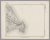
Image from the Map Collections courtesy Stanford University Libraries, licensed under a Creative Commons Attribution-Noncommercial 3.0 Unported License. © Stanford University. 【図幅名】 与那国島 【測量時期】 大正10年測圖 【発行時期】 昭和11年発行 【記号】 先島群島十九号 【測量機関】 陸地測量部・参謀本部 【備考】 軍事極祕(戦地ニ在りテハ軍事祕密トス)
Links: Source / Biblio Ref
|
over 4 years ago | 4 control points |