Browse Maps
| map | Title | Year | Last Updated | Status  |
|---|---|---|---|---|
|
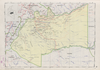
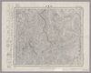
Image from the Map Collections courtesy Stanford University Libraries, licensed under a Creative Commons Attribution-Noncommercial 3.0 Unported License. © Stanford University. 【図幅名】 白河 【測量時期】 明治42年測図/昭和4年修正/昭和7年測図の縮図/昭和8年部分修正 【発行時期】 昭和22年4月発行 【記号】 白河14号(共17面) 【測量機関】 内務省地理調査所 【備考】
Links: Source / Biblio Ref
|
about 2 years ago | 4 control points | |
|
Links: Source / Biblio Ref
|
2020 | about 1 year ago | 3 control points |
|
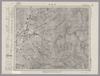
【Courtesy of the C. V. Starr East Asian Library University of California, Berkeley】 1 map : col. ; 43 x 60 cm., folded to 26 x 17 cm. Mounted cover title. In Japanese. Shows distance of sea routes. Includes legend. Relief shown by hachures. East Asian Library call number: Bb 4.
Links: Source / Biblio Ref
|
1904 | over 3 years ago | 4 control points |
|
Links: Source / Biblio Ref
|
2020 | about 1 year ago | 3 control points |
|
|
2022 | almost 2 years ago | 6 control points |
|
|
2019 | over 4 years ago | 7 control points |
|
Links: Source / Biblio Ref
|
2020 | about 1 year ago | 4 control points |
|
国立国会図書館デジタルコレクション インターネット公開(保護期間満了) (In 2 layers)
Links: Source / Biblio Ref
|
1850 | almost 4 years ago | 37 control points |
|
Links: Source / Biblio Ref
|
2020 | about 1 year ago | 5 control points |
|
国立国会図書館デジタルコレクション インターネット公開(保護期間満了) (In 2 layers)
Links: Source / Biblio Ref
|
1856 | almost 4 years ago | 13 control points |
|
Links: Source / Biblio Ref
|
2020 | about 1 year ago | 4 control points |
|
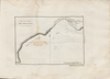
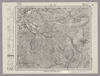
Image from the Map Collections courtesy Stanford University Libraries, licensed under a Creative Commons Attribution-Noncommercial 3.0 Unported License. © Stanford University. 【図幅名】 弥彦 【測量時期】 明治44年測図/昭和6年修正/昭和28年応急修正 【発行時期】 昭和33年6月発行 【記号】 長岡2号(共11面) 【測量機関】 国土地理院 【備考】 応急修正版
Links: Source / Biblio Ref
|
about 2 years ago | 4 control points | |
|
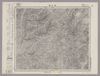
Image from the Map Collections courtesy Stanford University Libraries, licensed under a Creative Commons Attribution-Noncommercial 3.0 Unported License. © Stanford University. 【図幅名】 珠洲岬 【測量時期】 明治43年測圖/昭和9年修正測圖 【発行時期】 【記号】 珠洲岬十一号 【測量機関】 参謀本部 【備考】 祕
Links: Source / Biblio Ref
|
about 2 years ago | 4 control points | |
|
Image from the Map Collections courtesy Stanford University Libraries, licensed under a Creative Commons Attribution-Noncommercial 3.0 Unported License. © Stanford University. 【図幅名】 出雲崎 【測量時期】 明治44年測図/昭和6年修正 【発行時期】 昭和8年9月発行 【記号】 長岡7号(共11面) 【測量機関】 大日本帝国陸地測量部 【備考】
Links: Source / Biblio Ref
|
about 2 years ago | 4 control points | |
|
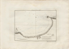
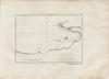
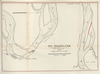
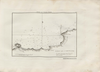
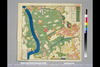
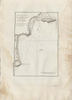
RIO MAGDALENA. PARA ACOMPAÑAR AL INFORME DE SIR. A.GIBB G.B.C G.B. 14 DE JULIO DE 1930. PUERTO DE DE PTO. LIEVANO. PLANO Nº5.
|
1930 | 8 months ago | 27 control points |
|
Image from the Map Collections courtesy Stanford University Libraries, licensed under a Creative Commons Attribution-Noncommercial 3.0 Unported License. © Stanford University. 【図幅名】 只見 【測量時期】 大正3年測図/昭和6年要部修正 【発行時期】 昭和8年11月発行 【記号】 新潟12号(共16面) 【測量機関】 大日本帝国陸地測量部 【備考】
Links: Source / Biblio Ref
|
about 2 years ago | 4 control points | |
|
「新撰鯖江誌」より
出展:越前鯖江5万石 ふるさと史跡紹介(2002年 鯖江地区まちづくり推進協議会 発行)
Links: Source / Biblio Ref
|
1914 | about 4 years ago | 12 control points |
|
Links: Source / Biblio Ref
|
2020 | about 1 year ago | 3 control points |
|
|
2022 | almost 2 years ago | 4 control points |
|
|
2020 | almost 4 years ago | 3 control points |
|
|
2020 | over 1 year ago | 7 control points |
|
Image from the Map Collections courtesy Stanford University Libraries, licensed under a Creative Commons Attribution-Noncommercial 3.0 Unported License. © Stanford University. 【図幅名】 猪苗代湖 【測量時期】 明治41年測図/昭和6年要部修正 【発行時期】 【記号】 福島16号(共18面) 【測量機関】 参謀本部 【備考】 秘
Links: Source / Biblio Ref
|
about 2 years ago | 4 control points | |
|
Links: Source / Biblio Ref
|
2020 | about 1 year ago | 3 control points |
|
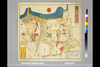
【Courtesy of the C. V. Starr East Asian Library University of California, Berkeley】 Japanese date Meiji 27 1894. In color. Folded. Printed 2 sides. Orientation varies. Relief shown pictorially and by hachures. In Japanese. On recto: Includes distance chart, address chart, and legend. On verso: Includes 7 insets, distance chart, address chart, and legend.
Links: Source / Biblio Ref
|
1894 | over 3 years ago | 4 control points |
|
Links: Source / Biblio Ref
|
2020 | over 1 year ago | 8 control points |
|
国立国会図書館デジタルコレクション インターネット公開(保護期間満了) (In 2 layers)
Links: Source / Biblio Ref
|
1851 | almost 4 years ago | 28 control points |
|
Links: Source / Biblio Ref
|
2020 | almost 2 years ago | 22 control points |
|
国立国会図書館デジタルコレクション インターネット公開(保護期間満了) (In 2 layers)
Links: Source / Biblio Ref
|
1856 | almost 4 years ago | 21 control points |
|
Links: Source / Biblio Ref
|
2020 | over 1 year ago | 44 control points |
|
Image from the Map Collections courtesy Stanford University Libraries, licensed under a Creative Commons Attribution-Noncommercial 3.0 Unported License. © Stanford University. 【図幅名】 山形 【測量時期】 明治36年測図/昭和6年修正 【発行時期】 昭和22年3月発行 【記号】 仙台11号(共16面) 【測量機関】 内務省地理調査所 【備考】
Links: Source / Biblio Ref
|
about 2 years ago | 4 control points | |
|
Links: Source / Biblio Ref
|
2020 | over 1 year ago | 50 control points |
|
Image from the Map Collections courtesy Stanford University Libraries, licensed under a Creative Commons Attribution-Noncommercial 3.0 Unported License. © Stanford University. 【図幅名】 網地嶋 【測量時期】 大正2年測図/昭和8年要部修正 【発行時期】 昭和10年11月発行 【記号】 石巻11号(共9面) 【測量機関】 大日本帝国陸地測量部 【備考】
Links: Source / Biblio Ref
|
over 1 year ago | 4 control points | |
|
Image from the Map Collections courtesy Stanford University Libraries, licensed under a Creative Commons Attribution-Noncommercial 3.0 Unported License. © Stanford University. 【図幅名】 大鳥池 【測量時期】 大正2年測図/昭和6年部分修正 【発行時期】 昭和8年9月発行 【記号】 村上2号(共12面) 【測量機関】 大日本帝国陸地測量部 【備考】
Links: Source / Biblio Ref
|
about 2 years ago | 4 control points | |
|
Image from the Map Collections courtesy Stanford University Libraries, licensed under a Creative Commons Attribution-Noncommercial 3.0 Unported License. © Stanford University. 【図幅名】 塩野町 【測量時期】 大正2年測図/昭和6年要部修正 【発行時期】 昭和8年3月発行 【記号】 村上7号(共12面) 【測量機関】 大日本帝国陸地測量部 【備考】
Links: Source / Biblio Ref
|
about 2 years ago | 4 control points | |
|
Image from the Map Collections courtesy Stanford University Libraries, licensed under a Creative Commons Attribution-Noncommercial 3.0 Unported License. © Stanford University. 【図幅名】 上ノ山 【測量時期】 明治44年測図/昭和6年要部修正 【発行時期】 昭和8年2月発行 【記号】 仙台12号(共16面) 【測量機関】 大日本帝国陸地測量部 【備考】
Links: Source / Biblio Ref
|
about 2 years ago | 4 control points | |
|
Image from the Map Collections courtesy Stanford University Libraries, licensed under a Creative Commons Attribution-Noncommercial 3.0 Unported License. © Stanford University. 【図幅名】 朝日岳 【測量時期】 大正2年測図/昭和6年部分修正 【発行時期】 昭和8年9月発行 【記号】 村上3号(共12面) 【測量機関】 大日本帝国陸地測量部 【備考】
Links: Source / Biblio Ref
|
about 2 years ago | 4 control points | |
|
Links: Source / Biblio Ref
|
2020 | over 1 year ago | 5 control points |
|
Links: Source / Biblio Ref
|
2020 | about 1 year ago | 3 control points |
|
Links: Source / Biblio Ref
|
2020 | almost 2 years ago | 3 control points |
|
|
2023 | about 1 year ago | 8 control points |
|
Image from the Map Collections courtesy Stanford University Libraries, licensed under a Creative Commons Attribution-Noncommercial 3.0 Unported License. © Stanford University. 【図幅名】 清川 【測量時期】 大正2年測図/昭和9年修正 【発行時期】 昭和11年10月発行 【記号】 新庄16号(共16面) 【測量機関】 大日本帝国陸地測量部 【備考】
Links: Source / Biblio Ref
|
about 2 years ago | 4 control points | |
|
|
2022 | almost 2 years ago | 7 control points |
|
Image from the Map Collections courtesy Stanford University Libraries, licensed under a Creative Commons Attribution-Noncommercial 3.0 Unported License. © Stanford University. 【図幅名】 左沢 【測量時期】 明治43年測図/昭和6年要部修正 【発行時期】 昭和8年7月発行 【記号】 仙台14号(共16面) 【測量機関】 大日本帝国陸地測量部 【備考】
Links: Source / Biblio Ref
|
about 2 years ago | 4 control points | |
|
|
2022 | 12 months ago | 10 control points |
|
Image from the Map Collections courtesy Stanford University Libraries, licensed under a Creative Commons Attribution-Noncommercial 3.0 Unported License. © Stanford University. 【図幅名】 月山 【測量時期】 明治43年測図/昭和6年要部修正 【発行時期】 昭和8年3月発行 【記号】 仙台13号(共16面) 【測量機関】 大日本帝国陸地測量部 【備考】
Links: Source / Biblio Ref
|
about 2 years ago | 4 control points | |
|
Links: Source / Biblio Ref
|
2020 | almost 2 years ago | 5 control points |
|
Links: Source / Biblio Ref
|
2020 | over 1 year ago | 4 control points |
|
Links: Source / Biblio Ref
|
2020 | almost 2 years ago | 8 control points |
|
Links: Source / Biblio Ref
|
2020 | almost 2 years ago | 4 control points |
|
Links: Source / Biblio Ref
|
2020 | almost 2 years ago | 7 control points |