Browse Maps
| map | Title | Year  |
Last Updated | Status |
|---|---|---|---|---|
|
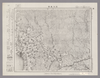
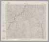
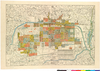
Image from the Map Collections courtesy Stanford University Libraries, licensed under a Creative Commons Attribution-Noncommercial 3.0 Unported License. © Stanford University. 【図幅名】 瀬戸 【測量時期】 明治24年測図/大正9年修正/昭和5年鉄道補入 【発行時期】 昭和7年3月発行 【記号】 豊橋13号(共16面) 【測量機関】 大日本帝国陸地測量部 【備考】
Links: Source / Biblio Ref
|
about 2 years ago | 4 control points | |
|
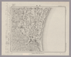
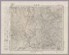
Image from the Map Collections courtesy Stanford University Libraries, licensed under a Creative Commons Attribution-Noncommercial 3.0 Unported License. © Stanford University. 【図幅名】 大口 【測量時期】 明治34年測圖/昭和7年要部修正測圖/昭和10年部分修正測圖 【発行時期】 【記号】 八代八号 【測量機関】 参謀本部 【備考】 祕
Links: Source / Biblio Ref
|
about 4 years ago | 4 control points | |
|
|
8 months ago | 4 control points | |
|
|
8 months ago | 4 control points | |
|
Image from the Map Collections courtesy Stanford University Libraries, licensed under a Creative Commons Attribution-Noncommercial 3.0 Unported License. © Stanford University. 【図幅名】 近江長浜 【測量時期】 明治39年測図/大正9年修正 【発行時期】 大正12年11月発行 【記号】 岐阜12号(共16面) 【測量機関】 大日本帝国陸地測量部 【備考】 (In 1 layer)
Links: Source / Biblio Ref
|
3 months ago | 4 control points | |
|
Image from the Map Collections courtesy Stanford University Libraries, licensed under a Creative Commons Attribution-Noncommercial 3.0 Unported License. © Stanford University. 【図幅名】 須木 【測量時期】 明治35年測圖/昭和7年要部修正測圖/昭和10年部分修正測圖 【発行時期】 【記号】 延岡十六号 【測量機関】 参謀本部 【備考】 祕
Links: Source / Biblio Ref
|
about 4 years ago | 4 control points | |
|
Image from the Map Collections courtesy Stanford University Libraries, licensed under a Creative Commons Attribution-Noncommercial 3.0 Unported License. © Stanford University. 【図幅名】 茂原 【測量時期】 明治36年測図/昭和6年修正 【発行時期】 昭和8年9月発行 【記号】 佐倉12号(共12面) 【測量機関】 大日本帝国陸地測量部 【備考】 (In 1 layer)
Links: Source / Biblio Ref
|
about 2 years ago | 4 control points | |
|
Image from the Map Collections courtesy Stanford University Libraries, licensed under a Creative Commons Attribution-Noncommercial 3.0 Unported License. © Stanford University. 【図幅名】 東金 【測量時期】 明治36年測量、測図の縮図/昭和9年第2回修正/昭和19年部分修正 【発行時期】 昭和21年11月発行 【記号】 佐倉11号(共12面) 【測量機関】 内務省地理調査所 【備考】 (In 1 layer)
Links: Source / Biblio Ref
|
about 2 years ago | 4 control points | |
|
Image from the Map Collections courtesy Stanford University Libraries, licensed under a Creative Commons Attribution-Noncommercial 3.0 Unported License. © Stanford University. 【図幅名】 開聞岳 【測量時期】 明治34年測圖/昭和7年要部修正測圖/昭和10年部分修正測圖 【発行時期】 【記号】 開聞岳五号 【測量機関】 参謀本部 【備考】 祕
Links: Source / Biblio Ref
|
about 4 years ago | 4 control points | |
|
Image from the Map Collections courtesy Stanford University Libraries, licensed under a Creative Commons Attribution-Noncommercial 3.0 Unported License. © Stanford University. 【図幅名】 明知 【測量時期】 明治24年測図/昭和3年要部修正 【発行時期】 昭和6年2月発行 【記号】 豊橋9号(共16面) 【測量機関】 大日本帝国陸地測量部 【備考】
Links: Source / Biblio Ref
|
about 2 years ago | 4 control points | |
|
Image from the Map Collections courtesy Stanford University Libraries, licensed under a Creative Commons Attribution-Noncommercial 3.0 Unported License. © Stanford University. 【図幅名】 八甲田山 【測量時期】 大正3年測図/昭和8年修正 【発行時期】 【記号】 弘前1号(共16面) 【測量機関】 内務省 【備考】
Links: Source / Biblio Ref
|
about 2 years ago | 4 control points | |
|
Image from the Map Collections courtesy Stanford University Libraries, licensed under a Creative Commons Attribution-Noncommercial 3.0 Unported License. © Stanford University.
Links: Source / Biblio Ref
|
over 6 years ago | 4 control points | |
|
Image from the Map Collections courtesy Stanford University Libraries, licensed under a Creative Commons Attribution-Noncommercial 3.0 Unported License. © Stanford University.
Links: Source / Biblio Ref
|
over 6 years ago | 4 control points | |
|
Image from the Map Collections courtesy Stanford University Libraries, licensed under a Creative Commons Attribution-Noncommercial 3.0 Unported License. © Stanford University. 【図幅名】 黒石 【測量時期】 大正1年測図/昭和4年鉄道補入 【発行時期】 昭和6年5月発行 【記号】 弘前5号(共16面) 【測量機関】 大日本帝国陸地測量部 【備考】
Links: Source / Biblio Ref
|
about 2 years ago | 4 control points | |
|
Image from the Map Collections courtesy Stanford University Libraries, licensed under a Creative Commons Attribution-Noncommercial 3.0 Unported License. © Stanford University. 【図幅名】 相沼内 【測量時期】 大正6年測図 【発行時期】 【記号】 室蘭16号(共14面) 【測量機関】 参謀本部 【備考】 秘
Links: Source / Biblio Ref
|
about 2 years ago | 4 control points | |
|
Image from the Map Collections courtesy Stanford University Libraries, licensed under a Creative Commons Attribution-Noncommercial 3.0 Unported License. © Stanford University.
Links: Source / Biblio Ref
|
over 6 years ago | 4 control points | |
|
Image from the Map Collections courtesy Stanford University Libraries, licensed under a Creative Commons Attribution-Noncommercial 3.0 Unported License. © Stanford University. 【図幅名】 大野 【測量時期】 明治42年測図/昭和5年修正/昭和8年要部修正 【発行時期】 昭和8年7月発行 【記号】 岐阜9号(共16面) 【測量機関】 大日本帝国陸地測量部 【備考】
Links: Source / Biblio Ref
|
about 2 years ago | 4 control points | |
|
|
over 6 years ago | 8 control points | |
|
Image from the Map Collections courtesy Stanford University Libraries, licensed under a Creative Commons Attribution-Noncommercial 3.0 Unported License. © Stanford University. 【図幅名】 鰍沢 【測量時期】 明治43年測図/昭和4年修正 【発行時期】 昭和22年2月発行 【記号】 甲府11号(共16面) 【測量機関】 内務省地理調査所 【備考】
Links: Source / Biblio Ref
|
about 2 years ago | 4 control points | |
|
Image from the Map Collections courtesy Stanford University Libraries, licensed under a Creative Commons Attribution-Noncommercial 3.0 Unported License. © Stanford University. 【図幅名】 知来別 【測量時期】 大正12年測図 【発行時期】 大正14年2月発行 【記号】 聲問近傍1号(共7面) 【測量機関】 陸地測量部・参謀本部 【備考】 宗谷4号東部(共7面) 仮製版 軍事極秘
Links: Source / Biblio Ref
|
about 2 years ago | 4 control points | |
|
Image from the Map Collections courtesy Stanford University Libraries, licensed under a Creative Commons Attribution-Noncommercial 3.0 Unported License. © Stanford University. 【図幅名】 森吉山 【測量時期】 大正5年測図/昭和14年修正 【発行時期】 昭和22年1月発行 【記号】 秋田5号(共16面) 【測量機関】 内務省地理調査所 【備考】
Links: Source / Biblio Ref
|
about 2 years ago | 4 control points | |
|
Image from the Map Collections courtesy Stanford University Libraries, licensed under a Creative Commons Attribution-Noncommercial 3.0 Unported License. © Stanford University. 【図幅名】 陸中野田 【測量時期】 大正3年測図 【発行時期】 大正6年4月発行 【記号】 八戸4号(共15面) 【測量機関】 大日本帝国陸地測量部 【備考】
Links: Source / Biblio Ref
|
about 2 years ago | 4 control points | |
|
Image from the Map Collections courtesy Stanford University Libraries, licensed under a Creative Commons Attribution-Noncommercial 3.0 Unported License. © Stanford University. 【図幅名】 潮来 【測量時期】 明治36年測圖/昭和6年第二回修正測圖 【発行時期】 昭和11年発行 【記号】 佐倉五号 【測量機関】 大日本帝國陸地測量部 【備考】 (In 1 layer)
Links: Source / Biblio Ref
|
about 2 years ago | 4 control points | |
|
Image from the Map Collections courtesy Stanford University Libraries, licensed under a Creative Commons Attribution-Noncommercial 3.0 Unported License. © Stanford University. 【図幅名】 米内沢 【測量時期】 大正5年測図 【発行時期】 大正7年8月発行 【記号】 弘前12号(共16面) 【測量機関】 大日本帝国陸地測量部 【備考】
Links: Source / Biblio Ref
|
about 2 years ago | 4 control points | |
|
Image from the Map Collections courtesy Stanford University Libraries, licensed under a Creative Commons Attribution-Noncommercial 3.0 Unported License. © Stanford University. 【図幅名】 寒霞渓 【測量時期】 明治30年測図/大正12年測図/大正13年修正 【発行時期】 昭和6年11月発行 【記号】 徳島9号(共14面) 【測量機関】 大日本帝国陸地測量部 【備考】
Links: Source / Biblio Ref
|
about 2 years ago | 4 control points | |
|
Image from the Map Collections courtesy Stanford University Libraries, licensed under a Creative Commons Attribution-Noncommercial 3.0 Unported License. © Stanford University.
Links: Source / Biblio Ref
|
over 6 years ago | 4 control points | |
|
Image from the Map Collections courtesy Stanford University Libraries, licensed under a Creative Commons Attribution-Noncommercial 3.0 Unported License. © Stanford University. 【図幅名】 野間岳 【測量時期】 明治35年測圖/昭和7年要部修正測圖/昭和10年部分修正測圖 【発行時期】 【記号】 鹿児島十六号 【測量機関】 参謀本部 【備考】 祕
Links: Source / Biblio Ref
|
about 4 years ago | 4 control points | |
|
Image from the Map Collections courtesy Stanford University Libraries, licensed under a Creative Commons Attribution-Noncommercial 3.0 Unported License. © Stanford University. 【図幅名】 松阪 【測量時期】 明治25年測図の縮図/昭和12年第2回修正、測図の縮図 【発行時期】 昭和12年10月発行 【記号】 宇治山田5号(共14面) 【測量機関】 大日本帝国陸地測量部 【備考】
Links: Source / Biblio Ref
|
about 2 years ago | 4 control points | |
|
Image from the Map Collections courtesy Stanford University Libraries, licensed under a Creative Commons Attribution-Noncommercial 3.0 Unported License. © Stanford University. 【図幅名】 荒屋 【測量時期】 大正5年測図/昭和4年鉄道補入 【発行時期】 【記号】 八戸16号(共15面) 【測量機関】 参謀本部 【備考】 秘
Links: Source / Biblio Ref
|
about 2 years ago | 4 control points | |
|
Image from the Map Collections courtesy Stanford University Libraries, licensed under a Creative Commons Attribution-Noncommercial 3.0 Unported License. © Stanford University. 【図幅名】 軽井沢 【測量時期】 大正1年測図/昭和12年修正 【発行時期】 【記号】 長野6号 【測量機関】 参謀本部 【備考】 秘 (In 1 layer)
Links: Source / Biblio Ref
|
about 2 years ago | 4 control points | |
|
Image from the Map Collections courtesy Stanford University Libraries, licensed under a Creative Commons Attribution-Noncommercial 3.0 Unported License. © Stanford University. 【図幅名】 下梨 【測量時期】 明治42年測図/昭和5年修正 【発行時期】 【記号】 金沢2号(共13面) 【測量機関】 参謀本部 【備考】 秘
Links: Source / Biblio Ref
|
about 2 years ago | 4 control points | |
|
Image from the Map Collections courtesy Stanford University Libraries, licensed under a Creative Commons Attribution-Noncommercial 3.0 Unported License. © Stanford University.
Links: Source / Biblio Ref
|
over 6 years ago | 4 control points | |
|
Image from the Map Collections courtesy Stanford University Libraries, licensed under a Creative Commons Attribution-Noncommercial 3.0 Unported License. © Stanford University.
Links: Source / Biblio Ref
|
over 6 years ago | 4 control points | |
|
Image from the Map Collections courtesy Stanford University Libraries, licensed under a Creative Commons Attribution-Noncommercial 3.0 Unported License. © Stanford University. 【図幅名】 草津 【測量時期】 大正1年測図/昭和12年修正 【発行時期】 【記号】 長野5号(共16面) 【測量機関】 参謀本部 【備考】 秘
Links: Source / Biblio Ref
|
about 2 years ago | 4 control points | |
|
Image from the Map Collections courtesy Stanford University Libraries, licensed under a Creative Commons Attribution-Noncommercial 3.0 Unported License. © Stanford University. 【図幅名】 鳥羽 【測量時期】 明治23年測図/大正9年修正/昭和19年部分修正 【発行時期】 【記号】 宇治山田2号(共14面) 【測量機関】 参謀本部 【備考】 秘
Links: Source / Biblio Ref
|
about 2 years ago | 4 control points | |
|
Image from the Map Collections courtesy Stanford University Libraries, licensed under a Creative Commons Attribution-Noncommercial 3.0 Unported License. © Stanford University. 【図幅名】 小川原沼 【測量時期】 大正3年測図 【発行時期】 【記号】 辺地12号(共7面) 【測量機関】 参謀本部 【備考】 秘
Links: Source / Biblio Ref
|
about 2 years ago | 4 control points | |
|
Image from the Map Collections courtesy Stanford University Libraries, licensed under a Creative Commons Attribution-Noncommercial 3.0 Unported License. © Stanford University. 【図幅名】 上濁川 【測量時期】 大正6年測圖 【発行時期】 【記号】 室蘭十二号 【測量機関】 参謀本部 【備考】 祕
Links: Source / Biblio Ref
|
about 2 years ago | 4 control points | |
|
Image from the Map Collections courtesy Stanford University Libraries, licensed under a Creative Commons Attribution-Noncommercial 3.0 Unported License. © Stanford University. 【図幅名】 稲庭 【測量時期】 大正2年測図/昭和9年修正 【発行時期】 昭和11年6月発行 【記号】 新庄6号(共16面) 【測量機関】 大日本帝国陸地測量部 【備考】
Links: Source / Biblio Ref
|
about 2 years ago | 4 control points | |
|
Image from the Map Collections courtesy Stanford University Libraries, licensed under a Creative Commons Attribution-Noncommercial 3.0 Unported License. © Stanford University. 【図幅名】 答志 【測量時期】 明治23年測図/大正9年修正 【発行時期】 大正11年11月発行 【記号】 宇治山田1号(共14面) 【測量機関】 大日本帝国陸地測量部 【備考】
Links: Source / Biblio Ref
|
about 2 years ago | 4 control points | |
|
Image from the Map Collections courtesy Stanford University Libraries, licensed under a Creative Commons Attribution-Noncommercial 3.0 Unported License. © Stanford University. 【図幅名】 川辺 【測量時期】 明治35年測図/昭和7年要部修正/昭和10年部分修正 【発行時期】 【記号】 鹿児島12号(共16面) 【測量機関】 参謀本部 【備考】 秘
Links: Source / Biblio Ref
|
about 4 years ago | 4 control points | |
|
Image from the Map Collections courtesy Stanford University Libraries, licensed under a Creative Commons Attribution-Noncommercial 3.0 Unported License. © Stanford University. 【図幅名】 吉原 【測量時期】 明治20年測図/大正4年第2回修正/昭和5年部分修正 【発行時期】 昭和9年4月発行 【記号】 静岡6号(共15面) 【測量機関】 大日本帝国陸地測量部 【備考】
Links: Source / Biblio Ref
|
about 2 years ago | 4 control points | |
|
Image from the Map Collections courtesy Stanford University Libraries, licensed under a Creative Commons Attribution-Noncommercial 3.0 Unported License. © Stanford University.
Links: Source / Biblio Ref
|
over 6 years ago | 4 control points | |
|
Image from the Map Collections courtesy Stanford University Libraries, licensed under a Creative Commons Attribution-Noncommercial 3.0 Unported License. © Stanford University. 【図幅名】 西大寺 【測量時期】 明治30年測図/大正14年第2回修正/昭和3年部分修正 【発行時期】 【記号】 徳島13号(共14面) 【測量機関】 参謀本部 【備考】 秘
Links: Source / Biblio Ref
|
3 months ago | 4 control points | |
|
Image from the Map Collections courtesy Stanford University Libraries, licensed under a Creative Commons Attribution-Noncommercial 3.0 Unported License. © Stanford University. 【図幅名】 高知 【測量時期】 明治40年測図の縮図/昭和8年修正、測図の縮図 【発行時期】 昭和11年4月発行 【記号】 高知7号(共16面) 【測量機関】 大日本帝国陸地測量部 【備考】
Links: Source / Biblio Ref
|
about 2 years ago | 4 control points | |
|
老松
|
over 6 years ago | 4 control points | |
|
Image from the Map Collections courtesy Stanford University Libraries, licensed under a Creative Commons Attribution-Noncommercial 3.0 Unported License. © Stanford University. 【図幅名】 五所川原 【測量時期】 大正1年測図/昭和5年鉄道補入 【発行時期】 昭和6年8月発行 【記号】 青森12号(共14面) 【測量機関】 大日本帝国陸地測量部 【備考】
Links: Source / Biblio Ref
|
about 2 years ago | 4 control points | |
|
Image from the Map Collections courtesy Stanford University Libraries, licensed under a Creative Commons Attribution-Noncommercial 3.0 Unported License. © Stanford University. 【図幅名】 陸中関 【測量時期】 大正3年測図 【発行時期】 大正6年5月発行 【記号】 八戸8号(共15面) 【測量機関】 大日本帝国陸地測量部 【備考】
Links: Source / Biblio Ref
|
about 2 years ago | 4 control points | |
|
Image from the Map Collections courtesy Stanford University Libraries, licensed under a Creative Commons Attribution-Noncommercial 3.0 Unported License. © Stanford University. 【図幅名】 小値賀島 【測量時期】 明治36年測図/昭和11年修正/昭和13年測図の縮図 【発行時期】 昭和21年11月発行 【記号】 長崎13号(共15面) 【測量機関】 地理調査所 【備考】
Links: Source / Biblio Ref
|
about 4 years ago | 4 control points | |
|
Image from the Map Collections courtesy Stanford University Libraries, licensed under a Creative Commons Attribution-Noncommercial 3.0 Unported License. © Stanford University.
Links: Source / Biblio Ref
|
over 6 years ago | 4 control points | |
|
Image from the Map Collections courtesy Stanford University Libraries, licensed under a Creative Commons Attribution-Noncommercial 3.0 Unported License. © Stanford University. 【図幅名】 ウトロ 【測量時期】 大正13年測圖/昭和11年部分修正測圖 【発行時期】 【記号】 網走四号 【測量機関】 参謀本部 【備考】 祕
Links: Source / Biblio Ref
|
about 2 years ago | 4 control points |