Browse Maps
| map | Title | Year | Last Updated | Status  |
|---|---|---|---|---|
|
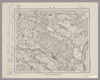
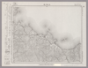
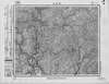
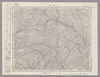
Image from the Map Collections courtesy Stanford University Libraries, licensed under a Creative Commons Attribution-Noncommercial 3.0 Unported License. © Stanford University. 【図幅名】 涌谷 【測量時期】 大正1年測図/昭和8年修正 【発行時期】 昭和10年9月発行 【記号】 石巻13号(共9面) 【測量機関】 大日本帝国陸地測量部 【備考】
Links: Source / Biblio Ref
|
about 2 months ago | 4 control points | |
|
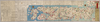
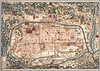
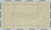
【Courtesy of the C. V. Starr East Asian Library University of California, Berkeley】 Japanese date Meiji 11 1878. In color. Folded. Copperplate print. In Japanese. Oriented with north to the upper right. Relief shown pictorially. Shows distance of roads and sea routes. Includes distance chart, list of inns and shrines, and legend.
Links: Source / Biblio Ref
|
1878 | over 3 years ago | 5 control points |
|
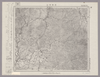
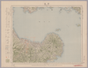
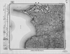
Image from the Map Collections courtesy Stanford University Libraries, licensed under a Creative Commons Attribution-Noncommercial 3.0 Unported License. © Stanford University. 【図幅名】 羽前金山 【測量時期】 大正2年測図/昭和9年修正 【発行時期】 昭和11年10月発行 【記号】 新庄11号(共16面) 【測量機関】 大日本帝国陸地測量部 【備考】
Links: Source / Biblio Ref
|
about 2 months ago | 4 control points | |
|
この地図の作成に当たっては、国土地理院長の承認を得て、同院発行の20万分の1地勢図及び5万分の1地形図を使用した。(承認番号 平30情使、 第1148号)
Links: Source / Biblio Ref
|
1953 | over 5 years ago | 4 control points |
|
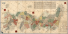
Image from the Map Collections courtesy Stanford University Libraries, licensed under a Creative Commons Attribution-Noncommercial 3.0 Unported License. © Stanford University. 【図幅名】 国上 【測量時期】 大正10年測図/昭和28年応急修正 【発行時期】 昭和37年12月 【記号】 開聞岳4号東部(共11面) 【測量機関】 国土地理院 【備考】 応急修正版
Links: Source / Biblio Ref
|
about 2 months ago | 4 control points | |
|
Links: Source / Biblio Ref
|
2020 | almost 2 years ago | 8 control points |
|
Image from the Map Collections courtesy Stanford University Libraries, licensed under a Creative Commons Attribution-Noncommercial 3.0 Unported License. © Stanford University. 【図幅名】 鶯宿 【測量時期】 大正5年測図/昭和14年修正 【発行時期】 昭和16年5月発行 【記号】 秋田3号(共16面) 【測量機関】 大日本帝国陸地測量部 【備考】
Links: Source / Biblio Ref
|
over 2 years ago | 4 control points | |
|
【Courtesy of the C. V. Starr East Asian Library University of California, Berkeley】 Japanese date Tenpō 3 1832. Folded. Mounted cover title. Wood block print. Oriented with north to the left. In Japanese. Relief shown pictorially. Includes seasonal tides, distance chart and legend.
Links: Source / Biblio Ref
|
1832 | over 3 years ago | 4 control points |
|
Image from the Map Collections courtesy Stanford University Libraries, licensed under a Creative Commons Attribution-Noncommercial 3.0 Unported License. © Stanford University. 【図幅名】 大須 【測量時期】 大正2年測図/昭和8年要部修正 【発行時期】 昭和10年10月発行 【記号】 石巻5号(共9面) 【測量機関】 大日本帝国陸地測量部 【備考】
Links: Source / Biblio Ref
|
about 2 months ago | 4 control points | |
|
【Courtesy of the C. V. Starr East Asian Library University of California, Berkeley】 Japanese date Keiō 2 1866. In color. Folded. Title from: Kyōto zu sōmokuroku /Ōtsuka Takashi. p.66. Wood block print. In Japanese. Relief shown pictorially. Includes distance charts, text, and legend. Local Note EAST; F 55: Title added by hand :Kyō saiken ezu. Monted cover title is missing Subject
Links: Source / Biblio Ref
|
1866 | over 3 years ago | 4 control points |
|
(In 1 layer)
Links: Source / Biblio Ref
|
2020 | over 1 year ago | 8 control points |
|
【Courtesy of the C. V. Starr East Asian Library University of California, Berkeley】 Japanese date Meiji 28 1895. In color. Folded. Lithograph print. In Japanese. Oriented with north to the left. Relief shown by hachures. Includes 1 ancillary map and legend. Includes text and views of tourists attractions on verso.
Links: Source / Biblio Ref
|
1895 | over 3 years ago | 4 control points |
|
Image from the Map Collections courtesy Stanford University Libraries, licensed under a Creative Commons Attribution-Noncommercial 3.0 Unported License. © Stanford University. 【図幅名】 別海 【測量時期】 大正11年測図/昭和19年部分修正測量 【発行時期】 昭和21年11月発行 【記号】 標津12号(共13面) 【測量機関】 内務省地理調査所 【備考】 仮製版 (In 1 layer)
Links: Source / Biblio Ref
|
over 2 years ago | 4 control points | |
|
【Courtesy of the C. V. Starr East Asian Library University of California, Berkeley】 Japanese date Meiji 31 1898. In color. Folded. Title from envelope. Lithograph. In Japanese. Oriented with north to the left. Relief shown pictorially. Includes distance chart and legend.
Links: Source / Biblio Ref
|
1898 | over 3 years ago | 4 control points |
|
Image from the Map Collections courtesy Stanford University Libraries, licensed under a Creative Commons Attribution-Noncommercial 3.0 Unported License. © Stanford University. 【図幅名】 古田 【測量時期】 大正10年測圖 【発行時期】 昭和11年発行 【記号】 大隅列島二号 【測量機関】 陸地測量部・参謀本部 【備考】 軍事極祕(戦地ニ在りテハ軍事祕密トス)
Links: Source / Biblio Ref
|
about 2 months ago | 4 control points | |
|
【Courtesy of the C. V. Starr East Asian Library University of California, Berkeley】 Japanese date Meiji 40 1907. In color. Folded. In Japanese. Relief shown by hachures. 4 insets: Rakugai meishōzu; Heian kozu; Fushimi-chō shigaizu; Ōtsu shigaizu. Includes distance chart, index, list of addresses and legend. Shows views of tourist attractions. Includes text of tourist attractions on verso.
Links: Source / Biblio Ref
|
1907 | over 3 years ago | 4 control points |
|
この地図の作成に当たっては、国土地理院長の承認を得て、同院発行の20万分の1地勢図及び5万分の1地形図を使用した。(承認番号 平30情使、 第1148号) (In 1 layer)
Links: Source / Biblio Ref
|
1947 | over 5 years ago | 4 control points |
|
【Courtesy of the C. V. Starr East Asian Library University of California, Berkeley】 Japanese date Meiji 43 1910. In color. Folded. In Japanese Oriented with north to the left. Relief shown by hachures. 6 insets: Kyōto-fu Kan̕nai chizu.--Kyōto fukin meishō chizu.--Takao oyobi Saga Hozu meishō chizu.--Nara shigai zenzu.--Ōtsu shigai zenzu.--Hieizan fukinzu. Includes distance chart and legend. Includes text views of tourist attractions on verso.
Links: Source / Biblio Ref
|
1910 | over 3 years ago | 4 control points |
|
Image from the Map Collections courtesy Stanford University Libraries, licensed under a Creative Commons Attribution-Noncommercial 3.0 Unported License. © Stanford University. 【図幅名】 日原 【測量時期】 明治32年測図/昭和7年要部修正 【発行時期】 昭和9年8月発行 【記号】 山口1号(共15面) 【測量機関】 大日本帝国陸地測量部 【備考】
Links: Source / Biblio Ref
|
over 2 years ago | 4 control points | |
|
【Courtesy of the C. V. Starr East Asian Library University of California, Berkeley】 Japanese date Meiji 28 1895. Folded. Copperplate print. In Japanese. Oriented with north to the left. Relief shown pictorially. Includes text, distance chart, and legend.
Links: Source / Biblio Ref
|
1895 | over 3 years ago | 4 control points |
|
Image from the Map Collections courtesy Stanford University Libraries, licensed under a Creative Commons Attribution-Noncommercial 3.0 Unported License. © Stanford University. 【図幅名】 鶴岡 【測量時期】 大正2年測図/昭和9年修正 【発行時期】 【記号】 酒田4号(共6面) 【測量機関】 参謀本部 【備考】 秘
Links: Source / Biblio Ref
|
2 months ago | 4 control points | |
|
【Courtesy of the C. V. Starr East Asian Library University of California, Berkeley】 Japanese date Jokyo 4 1687 estimated. In color. Folded. Wood block print. In Japanese. Title added by hand. Relief shown pictorially. Includes distance chart and index
Links: Source / Biblio Ref
|
1687 | over 3 years ago | 4 control points |
|
Image from the Map Collections courtesy Stanford University Libraries, licensed under a Creative Commons Attribution-Noncommercial 3.0 Unported License. © Stanford University. 【図幅名】 鬼首 【測量時期】 大正2年測図/昭和9年修正 【発行時期】 昭和11年1月発行 【記号】 新庄7号(共16面) 【測量機関】 大日本帝国陸地測量部 【備考】
Links: Source / Biblio Ref
|
over 2 years ago | 4 control points | |
|
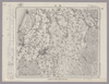
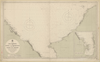
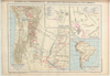
【Courtesy of the C. V. Starr East Asian Library University of California, Berkeley】 Japanese date Meiji 19 1886. In color. Folded. Copperplate print. In Japanese. Oriented with north to the upper right. Relief shown by hachures. Shows distances of roads. 3 insets: Hokkaidō ; Ryūkyū Chūhokubu Shotō ; Ryūkyū Nanbu Shotō. Includes legend.
Links: Source / Biblio Ref
|
1886 | over 3 years ago | 5 control points |
|
Image from the Map Collections courtesy Stanford University Libraries, licensed under a Creative Commons Attribution-Noncommercial 3.0 Unported License. © Stanford University. 【図幅名】 三本松 【測量時期】 明治29年測図の縮図/昭和3年修正、測図の縮図/昭和9年鉄道補入、測図の縮図 【発行時期】 昭和12年3月発行 【記号】 徳島11号(共14面) 【測量機関】 大日本帝国陸地測量部 【備考】
Links: Source / Biblio Ref
|
over 2 years ago | 4 control points | |
|
【Courtesy of the C. V. Starr East Asian Library University of California, Berkeley】 Japanese date Tenpō 5 1834. In color. Folded. Wood block print. Oriented with north to the left. In Japanese. Relief shown pictorially. Drawn by Nakamura Yūrakusai. Includes legend. Title added by hand.
Links: Source / Biblio Ref
|
1834 | over 3 years ago | 4 control points |
|
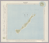
Image from the Map Collections courtesy Stanford University Libraries, licensed under a Creative Commons Attribution-Noncommercial 3.0 Unported License. © Stanford University.
Links: Source / Biblio Ref
|
over 6 years ago | 4 control points | |
|
この地図の作成に当たっては、国土地理院長の承認を得て、同院発行の20万分の1地勢図及び5万分の1地形図を使用した。(承認番号 平30情使、 第1148号)
Links: Source / Biblio Ref
|
1947 | almost 3 years ago | 4 control points |
|
Image from the Map Collections courtesy Stanford University Libraries, licensed under a Creative Commons Attribution-Noncommercial 3.0 Unported License. © Stanford University. 【図幅名】 鹿児島 【測量時期】 大正4年測図の縮図/昭和7年修正、測図の縮図/昭和10年部分修正/昭和28年応急修正 【発行時期】 昭和29年11月発行 【記号】 鹿児島7号(共16面) 【測量機関】 国土地理院 【備考】 応急修正版
Links: Source / Biblio Ref
|
23 days ago | 4 control points | |
|
Links: Source / Biblio Ref
|
2020 | over 1 year ago | 4 control points |
|
Image from the Map Collections courtesy Stanford University Libraries, licensed under a Creative Commons Attribution-Noncommercial 3.0 Unported License. © Stanford University. 【図幅名】 小利別 【測量時期】 大正13年測図 【発行時期】 昭和14年7月発行 【記号】 淕別7号(共16面) 【測量機関】 大日本帝国陸地測量部 【備考】 仮製版 (In 1 layer)
Links: Source / Biblio Ref
|
over 2 years ago | 4 control points | |
|
【Courtesy of the C. V. Starr East Asian Library University of California, Berkeley】 Japanese date Meiji 32 1899. Folded. Copperplate print. In Japanese. Oriented with north to the lower right. Relief shown by hachures. Includes 9 insets: Hokkaidō.--Taiwan zu.--Ryūkyū Chūhokubu Shotō ... et al. Includes views of points of interest, distance chart, and legend. Shows sea routes with distance.
Links: Source / Biblio Ref
|
1899 | over 3 years ago | 5 control points |
|
この地図の作成に当たっては、国土地理院長の承認を得て、同院発行の20万分の1地勢図及び5万分の1地形図を使用した。(承認番号 平30情使、 第1148号)
Links: Source / Biblio Ref
|
1946 | about 2 months ago | 4 control points |
|
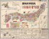
明治の国道図
|
1885 | over 2 years ago | 11 control points |
|
この地図の作成に当たっては、国土地理院長の承認を得て、同院発行の20万分の1地勢図及び5万分の1地形図を使用した。(承認番号 平30情使、 第1148号) (In 1 layer)
Links: Source / Biblio Ref
|
1947 | about 2 months ago | 4 control points |
|
【Courtesy of the C. V. Starr East Asian Library University of California, Berkeley】 Japanese date Kaei 2 1849. In color. Folded. Wood block print. In Japanese. Oriented with north to the upper right. Covers Matsumae to Tsushima and Ryūkyū. Title from: Nihon chizushi / Akioka Takejirō. p.152. Shows longitudes and latitudes and Kuroshio. Includes distance chart and legend. Shows distances of the sea routes. Title on library's envelope.
Links: Source / Biblio Ref
|
1849 | over 3 years ago | 5 control points |
|
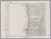
Image from the Map Collections courtesy Stanford University Libraries, licensed under a Creative Commons Attribution-Noncommercial 3.0 Unported License. © Stanford University. 【図幅名】 竹原 【測量時期】 明治31年測図/大正18年修正/昭和7年鉄道補入 【発行時期】 昭和13年4月発行 【記号】 広島2号(共16面) 【測量機関】 大日本帝国陸地測量部 【備考】
Links: Source / Biblio Ref
|
about 2 months ago | 4 control points | |
|
【Courtesy of the C. V. Starr East Asian Library University of California, Berkeley】 Japanese date Meiji 25 1892. In color. Folded. Cover title. Copperplate print. In Japanese. Oriented with north to the upper right. Relief shown by hachures. 13 insets: Hokkaidō no zu.--Chōsenkoku chizu.--Ryūkyū Shotō ... et al. Includes list of prefectures, distance charts, and legend. Title on map: Dai Nihon shinchizu. Includes 1 ancillary map: Sekai no zu.
Links: Source / Biblio Ref
|
1892 | over 3 years ago | 5 control points |
|
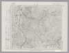
Image from the Map Collections courtesy Stanford University Libraries, licensed under a Creative Commons Attribution-Noncommercial 3.0 Unported License. © Stanford University.
Links: Source / Biblio Ref
|
over 6 years ago | 4 control points | |
|
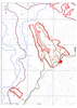
Image from the Map Collections courtesy Stanford University Libraries, licensed under a Creative Commons Attribution-Noncommercial 3.0 Unported License. © Stanford University. 【図幅名】 田山 【測量時期】 大正5年測図/昭和14年修正 【発行時期】 【記号】 弘前4号 【測量機関】 参謀本部 【備考】 秘
Links: Source / Biblio Ref
|
over 2 years ago | 4 control points | |
|
Links: Source / Biblio Ref
|
2021 | over 1 year ago | 4 control points |
|
Image from the Map Collections courtesy Stanford University Libraries, licensed under a Creative Commons Attribution-Noncommercial 3.0 Unported License. © Stanford University. 【図幅名】 江差 【測量時期】 大正6年測図 【発行時期】 大正9年2月発行 【記号】 函館13号(共14面) 【測量機関】 内務省地理調査所 【備考】 (In 1 layer)
Links: Source / Biblio Ref
|
about 2 months ago | 4 control points | |
|
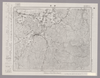
Image from the Map Collections courtesy Stanford University Libraries, licensed under a Creative Commons Attribution-Noncommercial 3.0 Unported License. © Stanford University. 【図幅名】 倉吉 【測量時期】 明治31年測量/昭和7年修正測量 【発行時期】 昭和9年7月発行 【記号】 松江4号 【測量機関】 大日本帝国陸地測量部 【備考】
Links: Source / Biblio Ref
|
6 months ago | 4 control points | |
|
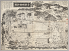
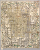
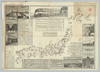
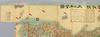
【Courtesy of the C. V. Starr East Asian Library University of California, Berkeley】 Cover title. Copperplate print. In Japanese. Oriented with north to the upper right. Relief shown pictorially. Includes views of points of interest, time table, fare table, freight table, railroad company names, and legend. Detailed views emphasize engineering accomplishments such as bridges, tunnels, power lines, buildings, and railroads. Folded in cover 14 x 20 cm.
Links: Source / Biblio Ref
|
1888 | over 3 years ago | 5 control points |
|
Image from the Map Collections courtesy Stanford University Libraries, licensed under a Creative Commons Attribution-Noncommercial 3.0 Unported License. © Stanford University.
Links: Source / Biblio Ref
|
over 6 years ago | 4 control points | |
|
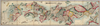
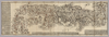
【Courtesy of the C. V. Starr East Asian Library University of California, Berkeley】 1 map : col. ; on sheet 87 x 246 cm., folded to 25 x 18 cm. Wood block print. In Japanese. Oriented with north to the upper right. Relief shown pictorially. Includes 1 ancillary map, list of prefecture, and legend. Extension pasted on the bottom of map. East Asian Library call number Cb 2.
Links: Source / Biblio Ref
|
1874 | over 3 years ago | 4 control points |
|
|
2022 | about 2 years ago | 4 control points |

|
Links: Source / Biblio Ref
|
2021 | almost 3 years ago | 9 control points |
|
|
2022 | almost 2 years ago | 7 control points |
|
【Courtesy of the C. V. Starr East Asian Library University of California, Berkeley】 Cover title. Wood block print. In Japanese. Covers Matsumae to Tsushima. Includes lists of messenger fees. Shows distance of sea routes and roads. Folded to 20 x 8 cm.
Links: Source / Biblio Ref
|
1830 | over 3 years ago | 4 control points |