地図を見る
| 地図 | タイトル | 年 | 前回の更新  |
ステータス |
|---|---|---|---|---|
|
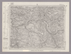
Image from the Map Collections courtesy Stanford University Libraries, licensed under a Creative Commons Attribution-Noncommercial 3.0 Unported License. © Stanford University. 【図幅名】 森 【測量時期】 明治35年測圖/大正15年修正測圖之縮圖/昭和2年要部修正測圖及要部修正測圖之縮圖/昭和7年要部修正測圖 【発行時期】 【記号】 大分十三号 【測量機関】 参謀本部 【備考】 祕
リンク: 出所・参照情報
|
7ヶ月 前 | 4個の基準点 | |
|
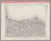
Image from the Map Collections courtesy Stanford University Libraries, licensed under a Creative Commons Attribution-Noncommercial 3.0 Unported License. © Stanford University. 【図幅名】 大分 【測量時期】 明治36年測図/昭和2年第2回修正、測図の縮図/昭和15年部分修正、測図の縮図/昭和23年資料修正 【発行時期】 昭和25年10月発行 【記号】 大分5号 【測量機関】 地理調査所 【備考】
リンク: 出所・参照情報
|
7ヶ月 前 | 4個の基準点 | |
|
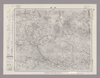
Image from the Map Collections courtesy Stanford University Libraries, licensed under a Creative Commons Attribution-Noncommercial 3.0 Unported License. © Stanford University. 【図幅名】 別府 【測量時期】 明治36年測圖/昭和2年修正測圖 【発行時期】 【記号】 大分九号 【測量機関】 参謀本部 【備考】 祕
リンク: 出所・参照情報
|
7ヶ月 前 | 4個の基準点 | |
|
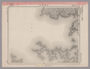
Image from the Map Collections courtesy Stanford University Libraries, licensed under a Creative Commons Attribution-Noncommercial 3.0 Unported License. © Stanford University. 【図幅名】 伊予高山 【測量時期】 明治37年測図/昭和8年修正/昭和20年部分修正 【発行時期】 昭和23年2月発行 【記号】 宇和島9号(共13面) 【測量機関】 地理調査所 【備考】 ( 1枚のレイヤー)
リンク: 出所・参照情報
|
7ヶ月 前 | 4個の基準点 | |
|
Image from the Map Collections courtesy Stanford University Libraries, licensed under a Creative Commons Attribution-Noncommercial 3.0 Unported License. © Stanford University. 【図幅名】 佐賀関 【測量時期】 明治36年測図/昭和2年第2回修正 【発行時期】 昭和21年9月発行 【記号】 大分1号(共16面) 【測量機関】 内務省地理調査所 【備考】
リンク: 出所・参照情報
|
7ヶ月 前 | 4個の基準点 | |
|
Image from the Map Collections courtesy Stanford University Libraries, licensed under a Creative Commons Attribution-Noncommercial 3.0 Unported License. © Stanford University. 【図幅名】 剣山 【測量時期】 明治40年測圖/昭和8年修正測圖 【発行時期】 【記号】 剣山十三号 【測量機関】 参謀本部 【備考】 祕
リンク: 出所・参照情報
|
7ヶ月 前 | 4個の基準点 | |
|
Image from the Map Collections courtesy Stanford University Libraries, licensed under a Creative Commons Attribution-Noncommercial 3.0 Unported License. © Stanford University. 【図幅名】 三段峡 【測量時期】 明治32年測図/昭和7年修正 【発行時期】 昭和10年7月発行 【記号】 広島13号(共10面) 【測量機関】 大日本帝国陸地測量部 【備考】
リンク: 出所・参照情報
|
7ヶ月 前 | 4個の基準点 | |
|
Image from the Map Collections courtesy Stanford University Libraries, licensed under a Creative Commons Attribution-Noncommercial 3.0 Unported License. © Stanford University. 【図幅名】 可部 【測量時期】 明治31年測図の縮図/昭和7年修正、測図の縮図 【発行時期】 昭和10年7月発行 【記号】 広島5号(共10面) 【測量機関】 大日本帝国陸地測量部 【備考】
リンク: 出所・参照情報
|
7ヶ月 前 | 4個の基準点 | |
|
Image from the Map Collections courtesy Stanford University Libraries, licensed under a Creative Commons Attribution-Noncommercial 3.0 Unported License. © Stanford University. 【図幅名】 乃美 【測量時期】 明治31年測図/昭和7年修正 【発行時期】 昭和10年9月発行 【記号】 広島1号(共12面) 【測量機関】 大日本帝国陸地測量部 【備考】
リンク: 出所・参照情報
|
7ヶ月 前 | 4個の基準点 | |

|
Image from the Map Collections courtesy Stanford University Libraries, licensed under a Creative Commons Attribution-Noncommercial 3.0 Unported License. © Stanford University. 【図幅名】 府中 【測量時期】 明治30年測図の縮図/明治31年測量/昭和7年修正、測図の縮図 【発行時期】 昭和10年8月発行 【記号】 岡山及丸亀13号(共16面) 【測量機関】 大日本帝国陸地測量部 【備考】
リンク: 出所・参照情報
|
7ヶ月 前 | 4個の基準点 | |
|
Image from the Map Collections courtesy Stanford University Libraries, licensed under a Creative Commons Attribution-Noncommercial 3.0 Unported License. © Stanford University. 【図幅名】 井原 【測量時期】 明治31年測図/大正14年第2回修正 【発行時期】 【記号】 岡山及丸亀9号(共16面) 【測量機関】 参謀本部 【備考】 秘
リンク: 出所・参照情報
|
7ヶ月 前 | 4個の基準点 | |
|
Image from the Map Collections courtesy Stanford University Libraries, licensed under a Creative Commons Attribution-Noncommercial 3.0 Unported License. © Stanford University. 【図幅名】 玉島 【測量時期】 明治37年測図/大正14年第2回修正 【発行時期】 昭和4年6月発行 【記号】 岡山及丸亀5号(共16面) 【測量機関】 大日本帝国陸地測量部 【備考】
リンク: 出所・参照情報
|
7ヶ月 前 | 4個の基準点 | |
|
Image from the Map Collections courtesy Stanford University Libraries, licensed under a Creative Commons Attribution-Noncommercial 3.0 Unported License. © Stanford University. 【図幅名】 岡山南部 【測量時期】 明治30年測図/大正14年修正 【発行時期】 【記号】 岡山及丸亀1号(共16面) 【測量機関】 参謀本部 【備考】 秘
リンク: 出所・参照情報
|
7ヶ月 前 | 4個の基準点 | |
|
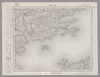
Image from the Map Collections courtesy Stanford University Libraries, licensed under a Creative Commons Attribution-Noncommercial 3.0 Unported License. © Stanford University. 【図幅名】 西大寺 【測量時期】 明治30年測図/大正14年第2回修正/昭和3年部分修正 【発行時期】 【記号】 徳島13号(共14面) 【測量機関】 参謀本部 【備考】 秘
リンク: 出所・参照情報
|
7ヶ月 前 | 4個の基準点 | |
|
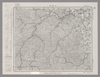
Image from the Map Collections courtesy Stanford University Libraries, licensed under a Creative Commons Attribution-Noncommercial 3.0 Unported License. © Stanford University. 【図幅名】 二本木 【測量時期】 明治25年測図の縮図/昭和12年第2回修正、測図の縮図 【発行時期】 昭和12年11月発行 【記号】 宇治山田9号 【測量機関】 大日本帝国陸地測量部 【備考】
リンク: 出所・参照情報
|
7ヶ月 前 | 4個の基準点 | |
|
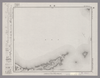
Image from the Map Collections courtesy Stanford University Libraries, licensed under a Creative Commons Attribution-Noncommercial 3.0 Unported License. © Stanford University. 【図幅名】 答志 【測量時期】 明治23年測図/大正9年修正 【発行時期】 大正11年11月発行 【記号】 宇治山田1号(共14面) 【測量機関】 大日本帝国陸地測量部 【備考】
リンク: 出所・参照情報
|
7ヶ月 前 | 4個の基準点 | |
|
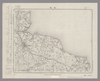
Image from the Map Collections courtesy Stanford University Libraries, licensed under a Creative Commons Attribution-Noncommercial 3.0 Unported License. © Stanford University. 【図幅名】 松阪 【測量時期】 明治25年測図の縮図/昭和12年第2回修正、測図の縮図 【発行時期】 昭和12年10月発行 【記号】 宇治山田5号(共14面) 【測量機関】 大日本帝国陸地測量部 【備考】
リンク: 出所・参照情報
|
7ヶ月 前 | 4個の基準点 | |
|
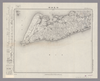
Image from the Map Collections courtesy Stanford University Libraries, licensed under a Creative Commons Attribution-Noncommercial 3.0 Unported License. © Stanford University. 【図幅名】 伊良湖岬 【測量時期】 明治23年測図/昭和15年第2回修正/昭和24年応急修正 【発行時期】 昭和25年10月発行 【記号】 伊良湖岬13号(共3面) 【測量機関】 地理調査所 【備考】 応急修正版
リンク: 出所・参照情報
|
7ヶ月 前 | 4個の基準点 | |
|
Image from the Map Collections courtesy Stanford University Libraries, licensed under a Creative Commons Attribution-Noncommercial 3.0 Unported License. © Stanford University. 【図幅名】 田原 【測量時期】 明治23年測図/昭和15年第2回修正/昭和24年応急修正 【発行時期】 昭和32年5月発行 【記号】 伊良湖岬9号(共3面) 【測量機関】 国土地理院 【備考】 応急修正版
リンク: 出所・参照情報
|
7ヶ月 前 | 4個の基準点 | |
|
Image from the Map Collections courtesy Stanford University Libraries, licensed under a Creative Commons Attribution-Noncommercial 3.0 Unported License. © Stanford University. 【図幅名】 掛塚 【測量時期】 明治22年測図縮図/昭和13年第2回修正、測図の縮図 【発行時期】 昭和15年3月発行 【記号】 伊良湖岬1号(共3面) 【測量機関】 大日本帝国陸地測量部 【備考】
リンク: 出所・参照情報
|
7ヶ月 前 | 4個の基準点 | |
|
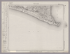
Image from the Map Collections courtesy Stanford University Libraries, licensed under a Creative Commons Attribution-Noncommercial 3.0 Unported License. © Stanford University. 【図幅名】 御前崎 【測量時期】 明治22年測図/大正5年第2回修正/昭和2年鉄道補入 【発行時期】 昭和3年9月発行 【記号】 神子元島13号(共2面) 【測量機関】 大日本帝国陸地測量部 【備考】
リンク: 出所・参照情報
|
7ヶ月 前 | 4個の基準点 | |
|
Image from the Map Collections courtesy Stanford University Libraries, licensed under a Creative Commons Attribution-Noncommercial 3.0 Unported License. © Stanford University. 【図幅名】 泉 【測量時期】 大正11年測図の縮図/昭和10年修正、測図の縮図 【発行時期】 昭和21年11月発行 【記号】 厳原9号北部(共7面) 【測量機関】 地理調査所 【備考】
リンク: 出所・参照情報
|
7ヶ月 前 | 4個の基準点 | |
|
Image from the Map Collections courtesy Stanford University Libraries, licensed under a Creative Commons Attribution-Noncommercial 3.0 Unported License. © Stanford University. 【図幅名】 神子元島 【測量時期】 明治19年測図/大正5年第2回修正 【発行時期】 昭和3年8月発行 【記号】 神子元島1号(共2面) 【測量機関】 大日本帝国陸地測量部 【備考】
リンク: 出所・参照情報
|
7ヶ月 前 | 4個の基準点 | |
|
Image from the Map Collections courtesy Stanford University Libraries, licensed under a Creative Commons Attribution-Noncommercial 3.0 Unported License. © Stanford University. 【図幅名】 見島 【測量時期】 明治32年測図/昭和11年修正 【発行時期】 昭和21年8月発行 【記号】 見島16号(共3面) 【測量機関】 内務省地理調査所 【備考】
リンク: 出所・参照情報
|
7ヶ月 前 | 4個の基準点 | |
|
Image from the Map Collections courtesy Stanford University Libraries, licensed under a Creative Commons Attribution-Noncommercial 3.0 Unported License. © Stanford University. 【図幅名】 益田 【測量時期】 明治32年測圖/昭和7年要部修正測圖 【発行時期】 【記号】 見嶋四号 【測量機関】 参謀本部 【備考】 祕
リンク: 出所・参照情報
|
7ヶ月 前 | 4個の基準点 | |
|
Image from the Map Collections courtesy Stanford University Libraries, licensed under a Creative Commons Attribution-Noncommercial 3.0 Unported License. © Stanford University. 【図幅名】 飯浦 【測量時期】 明治32年測図/昭和7年要部修正 【発行時期】 昭和8年12月発行 【記号】 中津8号(共3面) 【測量機関】 大日本帝国陸地測量部 【備考】
リンク: 出所・参照情報
|
7ヶ月 前 | 4個の基準点 | |
|
Image from the Map Collections courtesy Stanford University Libraries, licensed under a Creative Commons Attribution-Noncommercial 3.0 Unported License. © Stanford University. 【図幅名】 木都賀 【測量時期】 明治32年測圖/昭和7年修正測圖 【発行時期】 【記号】 浜田十六号 【測量機関】 参謀本部 【備考】 祕
リンク: 出所・参照情報
|
7ヶ月 前 | 4個の基準点 | |
|
Image from the Map Collections courtesy Stanford University Libraries, licensed under a Creative Commons Attribution-Noncommercial 3.0 Unported License. © Stanford University. 【図幅名】 三次 【測量時期】 明治31年測図/昭和7年修正 【発行時期】 昭和10年6月発行 【記号】 浜田4号(共15面) 【測量機関】 大日本帝国陸地測量部 【備考】
リンク: 出所・参照情報
|
7ヶ月 前 | 4個の基準点 | |
|
Image from the Map Collections courtesy Stanford University Libraries, licensed under a Creative Commons Attribution-Noncommercial 3.0 Unported License. © Stanford University. 【図幅名】 大朝 【測量時期】 明治32年測図/昭和7年修正 【発行時期】 昭和10年5月発行 【記号】 浜田12号(共15面) 【測量機関】 大日本帝国陸地測量部 【備考】
リンク: 出所・参照情報
|
7ヶ月 前 | 4個の基準点 | |
|
Image from the Map Collections courtesy Stanford University Libraries, licensed under a Creative Commons Attribution-Noncommercial 3.0 Unported License. © Stanford University. 【図幅名】 八重 【測量時期】 明治32年測図/昭和7年修正 【発行時期】 昭和10年6月発行 【記号】 浜田8号(共15面) 【測量機関】 大日本帝国陸地測量部 【備考】
リンク: 出所・参照情報
|
7ヶ月 前 | 4個の基準点 | |
|
Image from the Map Collections courtesy Stanford University Libraries, licensed under a Creative Commons Attribution-Noncommercial 3.0 Unported License. © Stanford University. 【図幅名】 油木 【測量時期】 明治31年測圖/昭和7年要部修正測圖 【発行時期】 【記号】 高梁十二号 【測量機関】 参謀本部 【備考】 祕
リンク: 出所・参照情報
|
7ヶ月 前 | 4個の基準点 | |
|
Image from the Map Collections courtesy Stanford University Libraries, licensed under a Creative Commons Attribution-Noncommercial 3.0 Unported License. © Stanford University. 【図幅名】 上下 【測量時期】 明治31年測圖/昭和7年要部修正測圖 【発行時期】 【記号】 高梁十六号 【測量機関】 参謀本部 【備考】 祕
リンク: 出所・参照情報
|
7ヶ月 前 | 4個の基準点 | |
|
Image from the Map Collections courtesy Stanford University Libraries, licensed under a Creative Commons Attribution-Noncommercial 3.0 Unported License. © Stanford University. 【図幅名】 高梁 【測量時期】 明治29年測圖之縮圖/明治31年測圖/昭和7年要部修正測圖及修正測圖 【発行時期】 【記号】 高梁八号 【測量機関】 参謀本部 【備考】 祕
リンク: 出所・参照情報
|
7ヶ月 前 | 4個の基準点 | |
|
Image from the Map Collections courtesy Stanford University Libraries, licensed under a Creative Commons Attribution-Noncommercial 3.0 Unported License. © Stanford University. 【図幅名】 岡山北部 【測量時期】 明治30年測図/大正12年第2回修正 【発行時期】 昭和4年4月発行 【記号】 高梁4号(共16面) 【測量機関】 大日本帝国陸地測量部 【備考】
リンク: 出所・参照情報
|
7ヶ月 前 | 4個の基準点 | |
|
Image from the Map Collections courtesy Stanford University Libraries, licensed under a Creative Commons Attribution-Noncommercial 3.0 Unported License. © Stanford University. 【図幅名】 和気 【測量時期】 明治28年測図/大正14年第2回修正 【発行時期】 昭和2年12月発行 【記号】 姫路16号(共16面) 【測量機関】 大日本帝国陸地測量部 【備考】
リンク: 出所・参照情報
|
7ヶ月 前 | 4個の基準点 | |
|
Image from the Map Collections courtesy Stanford University Libraries, licensed under a Creative Commons Attribution-Noncommercial 3.0 Unported License. © Stanford University. 【図幅名】 播州赤穂 【測量時期】 明治28年測図/大正5年第2回修正/昭和24年応急修正 【発行時期】 昭和35年9月発行 【記号】 姫路12号(共16面) 【測量機関】 国土地理院 【備考】 応急修正版
リンク: 出所・参照情報
|
7ヶ月 前 | 4個の基準点 | |
|
Image from the Map Collections courtesy Stanford University Libraries, licensed under a Creative Commons Attribution-Noncommercial 3.0 Unported License. © Stanford University. 【図幅名】 高砂 【測量時期】 明治29年測図/大正2年第2回修正 【発行時期】 【記号】 姫路4号(共16面) 【測量機関】 参謀本部 【備考】 秘
リンク: 出所・参照情報
|
7ヶ月 前 | 4個の基準点 | |
|
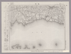
Image from the Map Collections courtesy Stanford University Libraries, licensed under a Creative Commons Attribution-Noncommercial 3.0 Unported License. © Stanford University. 【図幅名】 姫路 【測量時期】 明治26年測図/明治28年測図/大正12年第2回修正/昭和7年鉄道補入/昭和24年応急修正/昭和35年資料修正 【発行時期】 昭和35年6月発行 【記号】 姫路8号 【測量機関】 国土地理院 【備考】
リンク: 出所・参照情報
|
7ヶ月 前 | 4個の基準点 | |
|
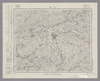
Image from the Map Collections courtesy Stanford University Libraries, licensed under a Creative Commons Attribution-Noncommercial 3.0 Unported License. © Stanford University. 【図幅名】 上野 【測量時期】 明治25年測図の縮図/昭和12年第2回修正 【発行時期】 【記号】 名古屋16号 【測量機関】 参謀本部 【備考】 秘
リンク: 出所・参照情報
|
7ヶ月 前 | 4個の基準点 | |
|
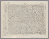
Image from the Map Collections courtesy Stanford University Libraries, licensed under a Creative Commons Attribution-Noncommercial 3.0 Unported License. © Stanford University. 【図幅名】 津西部 【測量時期】 明治25年測図の縮図/昭和12年第2回修正、測図の縮図 【発行時期】 昭和12年10月発行 【記号】 名古屋12号(共16面) 【測量機関】 大日本帝国陸地測量部 【備考】
リンク: 出所・参照情報
|
7ヶ月 前 | 4個の基準点 | |
|
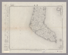
Image from the Map Collections courtesy Stanford University Libraries, licensed under a Creative Commons Attribution-Noncommercial 3.0 Unported License. © Stanford University. 【図幅名】 師崎 【測量時期】 明治23年測図/大正9年修正 【発行時期】 大正12年1月発行 【記号】 名古屋4号(共16面) 【測量機関】 大日本帝国陸地測量部 【備考】
リンク: 出所・参照情報
|
7ヶ月 前 | 4個の基準点 | |
|
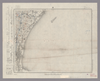
Image from the Map Collections courtesy Stanford University Libraries, licensed under a Creative Commons Attribution-Noncommercial 3.0 Unported License. © Stanford University. 【図幅名】 津東部 【測量時期】 明治23年測図の縮図/昭和12年第2回修正、測図の縮図 【発行時期】 昭和12年10月発行 【記号】 名古屋8号(共16面) 【測量機関】 大日本帝国陸地測量部 【備考】
リンク: 出所・参照情報
|
7ヶ月 前 | 4個の基準点 | |
|
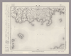
Image from the Map Collections courtesy Stanford University Libraries, licensed under a Creative Commons Attribution-Noncommercial 3.0 Unported License. © Stanford University. 【図幅名】 蒲郡 【測量時期】 明治23年測図/大正7年修正/昭和5年鉄道補入 【発行時期】 【記号】 豊橋16号(共16面) 【測量機関】 参謀本部 【備考】 秘
リンク: 出所・参照情報
|
7ヶ月 前 | 4個の基準点 | |
|
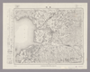
Image from the Map Collections courtesy Stanford University Libraries, licensed under a Creative Commons Attribution-Noncommercial 3.0 Unported License. © Stanford University. 【図幅名】 豊橋 【測量時期】 明治23年測図/大正6年修正/昭和2年鉄道補入 【発行時期】 昭和3年3月発行 【記号】 豊橋12号(共16面) 【測量機関】 大日本帝国陸地測量部 【備考】
リンク: 出所・参照情報
|
7ヶ月 前 | 4個の基準点 | |
|
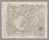
Image from the Map Collections courtesy Stanford University Libraries, licensed under a Creative Commons Attribution-Noncommercial 3.0 Unported License. © Stanford University. 【図幅名】 浜松 【測量時期】 明治23年測図/大正6年修正/昭和2年部分修正/昭和22年資料修正 【発行時期】 昭和22年2月発行 【記号】 豊橋8号(共16面) 【測量機関】 地理調査所 【備考】
リンク: 出所・参照情報
|
7ヶ月 前 | 4個の基準点 | |
|
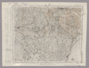
Image from the Map Collections courtesy Stanford University Libraries, licensed under a Creative Commons Attribution-Noncommercial 3.0 Unported License. © Stanford University. 【図幅名】 掛川 【測量時期】 明治22年測図/大正5年第2回修正/昭和5年鉄道補入 【発行時期】 昭和7年2月発行 【記号】 静岡16号(共15面) 【測量機関】 大日本帝国陸地測量部 【備考】
リンク: 出所・参照情報
|
7ヶ月 前 | 4個の基準点 | |
|
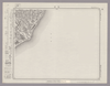
Image from the Map Collections courtesy Stanford University Libraries, licensed under a Creative Commons Attribution-Noncommercial 3.0 Unported License. © Stanford University. 【図幅名】 住吉 【測量時期】 明治21年測量、測図の縮図/昭和15年第2回修正、測図の縮図 【発行時期】 【記号】 静岡12号(共15面) 【測量機関】 参謀本部 【備考】 秘
リンク: 出所・参照情報
|
7ヶ月 前 | 4個の基準点 | |
|
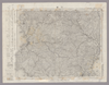
Image from the Map Collections courtesy Stanford University Libraries, licensed under a Creative Commons Attribution-Noncommercial 3.0 Unported License. © Stanford University. 【図幅名】 下田 【測量時期】 明治20年測図/大正15年第2回修正 【発行時期】 【記号】 静岡4号(共15面) 【測量機関】 参謀本部 【備考】 秘
リンク: 出所・参照情報
|
7ヶ月 前 | 4個の基準点 | |
|
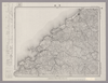
Image from the Map Collections courtesy Stanford University Libraries, licensed under a Creative Commons Attribution-Noncommercial 3.0 Unported License. © Stanford University. 【図幅名】 浜田 【測量時期】 明治32年測圖之縮圖/昭和7年修正測圖及修正測圖之縮圖 【発行時期】 【記号】 浜田十五号 【測量機関】 参謀本部 【備考】 祕
リンク: 出所・参照情報
|
7ヶ月 前 | 4個の基準点 | |
|
Image from the Map Collections courtesy Stanford University Libraries, licensed under a Creative Commons Attribution-Noncommercial 3.0 Unported License. © Stanford University. 【図幅名】 川本 【測量時期】 明治32年測図/昭和7年修正 【発行時期】 昭和10年5月発行 【記号】 浜田11号(共15面) 【測量機関】 大日本帝国陸地測量部 【備考】
リンク: 出所・参照情報
|
7ヶ月 前 | 4個の基準点 |