地図を見る
| 地図 | タイトル | 年 | 前回の更新  |
ステータス |
|---|---|---|---|---|
|
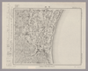
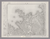
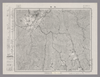
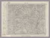
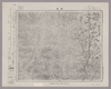
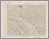
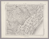
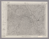
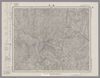
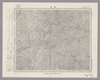
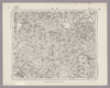
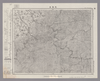
Image from the Map Collections courtesy Stanford University Libraries, licensed under a Creative Commons Attribution-Noncommercial 3.0 Unported License. © Stanford University. 【図幅名】 茂原 【測量時期】 明治36年測図/昭和6年修正 【発行時期】 昭和8年9月発行 【記号】 佐倉12号(共12面) 【測量機関】 大日本帝国陸地測量部 【備考】 ( 1枚のレイヤー)
リンク: 出所・参照情報
|
4ヶ月 前 | 4個の基準点 | |
|
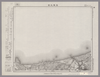
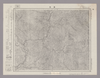
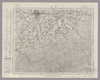
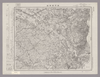
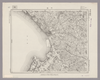
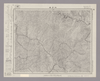
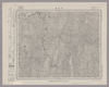
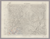
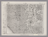
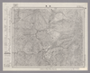
Image from the Map Collections courtesy Stanford University Libraries, licensed under a Creative Commons Attribution-Noncommercial 3.0 Unported License. © Stanford University. 【図幅名】 姉崎 【測量時期】 明治36年測図/昭和6年修正 【発行時期】 昭和16年10月発行 【記号】 佐倉16号(共12面) 【測量機関】 大日本帝国陸地測量部 【備考】 ( 1枚のレイヤー)
リンク: 出所・参照情報
|
4ヶ月 前 | 4個の基準点 | |
|
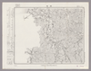
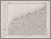
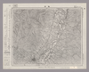
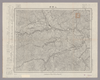
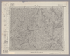
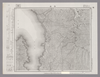
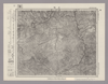
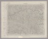
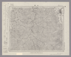
Image from the Map Collections courtesy Stanford University Libraries, licensed under a Creative Commons Attribution-Noncommercial 3.0 Unported License. © Stanford University. 【図幅名】 境 【測量時期】 明治32年測図/昭和9年第2回修正、測図の縮図 【発行時期】 昭和12年5月発行 【記号】 松江15号(共8面) 【測量機関】 大日本帝国陸地測量部 【備考】
リンク: 出所・参照情報
|
4ヶ月 前 | 4個の基準点 | |
|
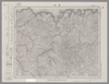
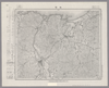
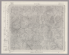
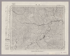
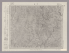
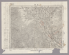
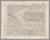
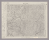
Image from the Map Collections courtesy Stanford University Libraries, licensed under a Creative Commons Attribution-Noncommercial 3.0 Unported License. © Stanford University. 【図幅名】 香住 【測量時期】 明治31年測圖/昭和7年要部修正測圖 【発行時期】 【記号】 鳥取七号 【測量機関】 参謀本部 【備考】 祕
リンク: 出所・参照情報
|
4ヶ月 前 | 4個の基準点 | |
|
Image from the Map Collections courtesy Stanford University Libraries, licensed under a Creative Commons Attribution-Noncommercial 3.0 Unported License. © Stanford University. 【図幅名】 西津 【測量時期】 明治25年測図の縮図/昭和7年第2回修正、測図の縮図 【発行時期】 昭和10年1月発行 【記号】 宮津3号(共12面) 【測量機関】 大日本帝国陸地測量部 【備考】
リンク: 出所・参照情報
|
4ヶ月 前 | 4個の基準点 | |
|
Image from the Map Collections courtesy Stanford University Libraries, licensed under a Creative Commons Attribution-Noncommercial 3.0 Unported License. © Stanford University. 【図幅名】 鳥取北部 【測量時期】 明治30年測図の縮図/昭和7年修正 【発行時期】 昭和9年1月発行 【記号】 鳥取15号(共9面) 【測量機関】 大日本帝国陸地測量部 【備考】
リンク: 出所・参照情報
|
4ヶ月 前 | 4個の基準点 | |
|
Image from the Map Collections courtesy Stanford University Libraries, licensed under a Creative Commons Attribution-Noncommercial 3.0 Unported License. © Stanford University. 【図幅名】 浜坂 【測量時期】 明治30年測圖及測圖之縮圖/明治31年測圖/昭和7年修正測圖及修正測圖之縮圖 【発行時期】 【記号】 鳥取十一号 【測量機関】 参謀本部 【備考】 祕
リンク: 出所・参照情報
|
4ヶ月 前 | 4個の基準点 | |
|
Image from the Map Collections courtesy Stanford University Libraries, licensed under a Creative Commons Attribution-Noncommercial 3.0 Unported License. © Stanford University. 【図幅名】 城崎 【測量時期】 明治31年測圖/昭和7年要部修正測圖 【発行時期】 【記号】 鳥取三号 【測量機関】 参謀本部 【備考】 祕
リンク: 出所・参照情報
|
4ヶ月 前 | 4個の基準点 | |
|
Image from the Map Collections courtesy Stanford University Libraries, licensed under a Creative Commons Attribution-Noncommercial 3.0 Unported License. © Stanford University. 【図幅名】 敦賀 【測量時期】 明治25年測図/明治42年測図の縮図/昭和7年第2回修正、測図の縮図 【発行時期】 昭和9年11月発行 【記号】 岐阜15号(共16面) 【測量機関】 大日本帝国陸地測量部 【備考】 ( 1枚のレイヤー)
リンク: 出所・参照情報
|
4ヶ月 前 | 4個の基準点 | |
|
Image from the Map Collections courtesy Stanford University Libraries, licensed under a Creative Commons Attribution-Noncommercial 3.0 Unported License. © Stanford University. 【図幅名】 横山 【測量時期】 明治42年測圖/昭和8年要部修正測圖 【発行時期】 【記号】 岐阜十一号 【測量機関】 参謀本部 【備考】 祕
リンク: 出所・参照情報
|
4ヶ月 前 | 4個の基準点 | |
|
Image from the Map Collections courtesy Stanford University Libraries, licensed under a Creative Commons Attribution-Noncommercial 3.0 Unported License. © Stanford University. 【図幅名】 美濃町 【測量時期】 明治42年測図/昭和8年要部修正 【発行時期】 昭和11年4月発行 【記号】 岐阜3号(共16面) 【測量機関】 大日本帝国陸地測量部 【備考】
リンク: 出所・参照情報
|
4ヶ月 前 | 4個の基準点 | |
|
Image from the Map Collections courtesy Stanford University Libraries, licensed under a Creative Commons Attribution-Noncommercial 3.0 Unported License. © Stanford University. 【図幅名】 金山 【測量時期】 明治44年測図/昭和8年要部修正 【発行時期】 昭和11年6月発行 【記号】 飯田15号(共16面) 【測量機関】 大日本帝国陸地測量部 【備考】
リンク: 出所・参照情報
|
4ヶ月 前 | 4個の基準点 | |
|
Image from the Map Collections courtesy Stanford University Libraries, licensed under a Creative Commons Attribution-Noncommercial 3.0 Unported License. © Stanford University. 【図幅名】 付知 【測量時期】 明治44年測図/昭和8年要部修正 【発行時期】 昭和11年2月発行 【記号】 飯田11号(共16面) 【測量機関】 大日本帝国陸地測量部 【備考】
リンク: 出所・参照情報
|
4ヶ月 前 | 4個の基準点 | |
|
Image from the Map Collections courtesy Stanford University Libraries, licensed under a Creative Commons Attribution-Noncommercial 3.0 Unported License. © Stanford University. 【図幅名】 妻籠 【測量時期】 明治44年測図/昭和6年修正 【発行時期】 昭和9年4月発行 【記号】 飯田7号(共16面) 【測量機関】 大日本帝国陸地測量部 【備考】
リンク: 出所・参照情報
|
4ヶ月 前 | 4個の基準点 | |
|
Image from the Map Collections courtesy Stanford University Libraries, licensed under a Creative Commons Attribution-Noncommercial 3.0 Unported License. © Stanford University. 【図幅名】 飯田 【測量時期】 明治44年測圖/昭和6年修正測圖 【発行時期】 【記号】 飯田三号 【測量機関】 参謀本部 【備考】 祕
リンク: 出所・参照情報
|
4ヶ月 前 | 4個の基準点 | |
|
Image from the Map Collections courtesy Stanford University Libraries, licensed under a Creative Commons Attribution-Noncommercial 3.0 Unported License. © Stanford University. 【図幅名】 大河原 【測量時期】 明治43年測図/昭和5年修正 【発行時期】 【記号】 甲府15号(共16面) 【測量機関】 参謀本部 【備考】 秘
リンク: 出所・参照情報
|
4ヶ月 前 | 4個の基準点 | |
|
Image from the Map Collections courtesy Stanford University Libraries, licensed under a Creative Commons Attribution-Noncommercial 3.0 Unported License. © Stanford University. 【図幅名】 鰍沢 【測量時期】 明治43年測図/昭和4年修正 【発行時期】 昭和22年2月発行 【記号】 甲府11号(共16面) 【測量機関】 内務省地理調査所 【備考】
リンク: 出所・参照情報
|
4ヶ月 前 | 4個の基準点 | |
|
Image from the Map Collections courtesy Stanford University Libraries, licensed under a Creative Commons Attribution-Noncommercial 3.0 Unported License. © Stanford University. 【図幅名】 甲府 【測量時期】 明治21年測図/昭和4年第3回修正 【発行時期】 昭和21年10月発行 【記号】 甲府7号(共16面) 【測量機関】 内務省地理調査所 【備考】
リンク: 出所・参照情報
|
4ヶ月 前 | 4個の基準点 | |
|
Image from the Map Collections courtesy Stanford University Libraries, licensed under a Creative Commons Attribution-Noncommercial 3.0 Unported License. © Stanford University. 【図幅名】 上野原 【測量時期】 明治21年測図/昭和4年第3回修正 【発行時期】 昭和8年2月発行 【記号】 東京15号 【測量機関】 大日本帝国陸地測量部 【備考】 ( 1枚のレイヤー)
リンク: 出所・参照情報
|
4ヶ月 前 | 4個の基準点 | |
|
Image from the Map Collections courtesy Stanford University Libraries, licensed under a Creative Commons Attribution-Noncommercial 3.0 Unported License. © Stanford University. 【図幅名】 谷村 【測量時期】 明治21年測図/昭和4年第3回修正 【発行時期】 【記号】 甲府3号(共16面) 【測量機関】 参謀本部 【備考】 秘
リンク: 出所・参照情報
|
4ヶ月 前 | 4個の基準点 | |
|
Image from the Map Collections courtesy Stanford University Libraries, licensed under a Creative Commons Attribution-Noncommercial 3.0 Unported License. © Stanford University. 【図幅名】 八王子 【測量時期】 明治39年測図/大正10年修正/昭和2年第2回部分修正/昭和4年鉄道補入 【発行時期】 昭和21年9月発行 【記号】 東京11号(共16面) 【測量機関】 内務省地理調査所 【備考】 ( 1枚のレイヤー)
リンク: 出所・参照情報
|
4ヶ月 前 | 4個の基準点 | |
|
Image from the Map Collections courtesy Stanford University Libraries, licensed under a Creative Commons Attribution-Noncommercial 3.0 Unported License. © Stanford University. 【図幅名】 東京西南部 【測量時期】 明治42年測図/昭和4年第2回修正/昭和7年要部修正 【発行時期】 【記号】 東京7号(共16面) 【測量機関】 参謀本部 【備考】 仮製版 秘 ( 1枚のレイヤー)
リンク: 出所・参照情報
|
4ヶ月 前 | 11個の基準点 | |
|
Image from the Map Collections courtesy Stanford University Libraries, licensed under a Creative Commons Attribution-Noncommercial 3.0 Unported License. © Stanford University. 【図幅名】 塩江 【測量時期】 明治31年測図/昭和7年修正 【発行時期】 昭和9年8月発行 【記号】 鳥取2号(共9面) 【測量機関】 大日本帝国陸地測量部 【備考】
リンク: 出所・参照情報
|
4ヶ月 前 | 4個の基準点 | |
|
Image from the Map Collections courtesy Stanford University Libraries, licensed under a Creative Commons Attribution-Noncommercial 3.0 Unported License. © Stanford University. 【図幅名】 【測量時期】 【発行時期】 【記号】 【測量機関】 【備考】 ( 1枚のレイヤー)
リンク: 出所・参照情報
|
4ヶ月 前 | 4個の基準点 | |
|
Image from the Map Collections courtesy Stanford University Libraries, licensed under a Creative Commons Attribution-Noncommercial 3.0 Unported License. © Stanford University. 【図幅名】 東金 【測量時期】 明治36年測量、測図の縮図/昭和9年第2回修正/昭和19年部分修正 【発行時期】 昭和21年11月発行 【記号】 佐倉11号(共12面) 【測量機関】 内務省地理調査所 【備考】 ( 1枚のレイヤー)
リンク: 出所・参照情報
|
4ヶ月 前 | 4個の基準点 | |
|
Image from the Map Collections courtesy Stanford University Libraries, licensed under a Creative Commons Attribution-Noncommercial 3.0 Unported License. © Stanford University. 【図幅名】 千葉 【測量時期】 明治36年測図/大正10年修正/昭和4年部分修正 【発行時期】 昭和7年2月発行 【記号】 佐倉15号(共12面) 【測量機関】 大日本帝国陸地測量部 【備考】 ( 1枚のレイヤー)
リンク: 出所・参照情報
|
4ヶ月 前 | 4個の基準点 | |
|
Image from the Map Collections courtesy Stanford University Libraries, licensed under a Creative Commons Attribution-Noncommercial 3.0 Unported License. © Stanford University. 【図幅名】 竹波 【測量時期】 明治25年測図の縮図/昭和7年第2回修正、測図の縮図 【発行時期】 昭和9年7月発行 【記号】 宮津2号(共12面) 【測量機関】 大日本帝国陸地測量部 【備考】
リンク: 出所・参照情報
|
4ヶ月 前 | 4個の基準点 | |
|
Image from the Map Collections courtesy Stanford University Libraries, licensed under a Creative Commons Attribution-Noncommercial 3.0 Unported License. © Stanford University. 【図幅名】 冠山 【測量時期】 明治42年測図/昭和8年要部修正 【発行時期】 昭和11年3月発行 【記号】 岐阜10号(共16面) 【測量機関】 大日本帝国陸地測量部 【備考】 ( 1枚のレイヤー)
リンク: 出所・参照情報
|
4ヶ月 前 | 4個の基準点 | |
|
Image from the Map Collections courtesy Stanford University Libraries, licensed under a Creative Commons Attribution-Noncommercial 3.0 Unported License. © Stanford University. 【図幅名】 八幡 【測量時期】 明治42年測図/昭和8年要部修正 【発行時期】 昭和11年5月発行 【記号】 岐阜2号(共16面) 【測量機関】 大日本帝国陸地測量部 【備考】
リンク: 出所・参照情報
|
4ヶ月 前 | 4個の基準点 | |
|
Image from the Map Collections courtesy Stanford University Libraries, licensed under a Creative Commons Attribution-Noncommercial 3.0 Unported License. © Stanford University. 【図幅名】 加子母 【測量時期】 明治44年測図/昭和8年要部修正 【発行時期】 【記号】 飯田10号(共16面) 【測量機関】 参謀本部 【備考】 秘
リンク: 出所・参照情報
|
4ヶ月 前 | 4個の基準点 | |
|
Image from the Map Collections courtesy Stanford University Libraries, licensed under a Creative Commons Attribution-Noncommercial 3.0 Unported License. © Stanford University. 【図幅名】 今庄 【測量時期】 明治25年測図/明治42年測図の縮図/昭和7年第2回修正、測図の縮図 【発行時期】 昭和9年12月発行 【記号】 岐阜14号(共16面) 【測量機関】 大日本帝国陸地測量部 【備考】 ( 1枚のレイヤー)
リンク: 出所・参照情報
|
4ヶ月 前 | 4個の基準点 | |
|
Image from the Map Collections courtesy Stanford University Libraries, licensed under a Creative Commons Attribution-Noncommercial 3.0 Unported License. © Stanford University. 【図幅名】 下呂 【測量時期】 明治44年測図/昭和8年要部修正 【発行時期】 昭和11年1月発行 【記号】 飯田14号(共16面) 【測量機関】 大日本帝国陸地測量部 【備考】
リンク: 出所・参照情報
|
4ヶ月 前 | 4個の基準点 | |
|
Image from the Map Collections courtesy Stanford University Libraries, licensed under a Creative Commons Attribution-Noncommercial 3.0 Unported License. © Stanford University. 【図幅名】 根尾 【測量時期】 明治42年測図/昭和8年要部修正 【発行時期】 昭和11年1月発行 【記号】 岐阜6号(共16面) 【測量機関】 大日本帝国陸地測量部 【備考】
リンク: 出所・参照情報
|
4ヶ月 前 | 4個の基準点 | |
|
Image from the Map Collections courtesy Stanford University Libraries, licensed under a Creative Commons Attribution-Noncommercial 3.0 Unported License. © Stanford University. 【図幅名】 市野瀬 【測量時期】 明治43年測図/昭和5年修正 【発行時期】 【記号】 甲府14号(共16面) 【測量機関】 参謀本部 【備考】 秘
リンク: 出所・参照情報
|
4ヶ月 前 | 4個の基準点 | |
|
Image from the Map Collections courtesy Stanford University Libraries, licensed under a Creative Commons Attribution-Noncommercial 3.0 Unported License. © Stanford University. 【図幅名】 上松 【測量時期】 明治44年測図/昭和6年修正 【発行時期】 【記号】 飯田6号(共16面) 【測量機関】 参謀本部 【備考】 秘
リンク: 出所・参照情報
|
4ヶ月 前 | 4個の基準点 | |
|
Image from the Map Collections courtesy Stanford University Libraries, licensed under a Creative Commons Attribution-Noncommercial 3.0 Unported License. © Stanford University. 【図幅名】 韮崎 【測量時期】 明治43年測圖/昭和4年第二回修正測圖 【発行時期】 【記号】 甲府十号 【測量機関】 参謀本部 【備考】 祕
リンク: 出所・参照情報
|
4ヶ月 前 | 4個の基準点 | |
|
Image from the Map Collections courtesy Stanford University Libraries, licensed under a Creative Commons Attribution-Noncommercial 3.0 Unported License. © Stanford University. 【図幅名】 丹波 【測量時期】 明治43年測図/昭和4年要部修正 【発行時期】 昭和7年9月発行 【記号】 甲府2号(共16面) 【測量機関】 大日本帝国陸地測量部 【備考】
リンク: 出所・参照情報
|
4ヶ月 前 | 4個の基準点 | |
|
Image from the Map Collections courtesy Stanford University Libraries, licensed under a Creative Commons Attribution-Noncommercial 3.0 Unported License. © Stanford University. 【図幅名】 御岳昇仙峡 【測量時期】 明治43年測図/昭和4年要部修正 【発行時期】 【記号】 甲府6号 【測量機関】 参謀本部 【備考】 秘
リンク: 出所・参照情報
|
4ヶ月 前 | 4個の基準点 | |
|
Image from the Map Collections courtesy Stanford University Libraries, licensed under a Creative Commons Attribution-Noncommercial 3.0 Unported License. © Stanford University. 【図幅名】 五日市 【測量時期】 明治40年測図/昭和34年部分修正 【発行時期】 昭和36年8月発行 【記号】 東京14号(共16面) 【測量機関】 国土地理院 【備考】 ( 1枚のレイヤー)
リンク: 出所・参照情報
|
4ヶ月 前 | 4個の基準点 | |
|
Image from the Map Collections courtesy Stanford University Libraries, licensed under a Creative Commons Attribution-Noncommercial 3.0 Unported License. © Stanford University. 【図幅名】 青森 【測量時期】 明治39年測図/大正10年測図/大正12年測図の縮図/昭和12年修正、測図の縮図/昭和34年部分修正 【発行時期】 昭和36年10月発行 【記号】 東京10号(共16面) 【測量機関】 国土地理院 【備考】 ( 1枚のレイヤー)
リンク: 出所・参照情報
|
4ヶ月 前 | 8個の基準点 | |
|
Image from the Map Collections courtesy Stanford University Libraries, licensed under a Creative Commons Attribution-Noncommercial 3.0 Unported License. © Stanford University. 【図幅名】 梅浦 【測量時期】 明治42年測図/昭和5年修正 【発行時期】 昭和8年1月発行 【記号】 宮津1号(共12面) 【測量機関】 大日本帝国陸地測量部 【備考】
リンク: 出所・参照情報
|
4ヶ月 前 | 4個の基準点 | |
|
Image from the Map Collections courtesy Stanford University Libraries, licensed under a Creative Commons Attribution-Noncommercial 3.0 Unported License. © Stanford University. 【図幅名】 八日市場 【測量時期】 明治36年測図/昭和9年第2回修正/昭和19年部分修正 【発行時期】 昭和22年5月発行 【記号】 佐倉6号(共12面) 【測量機関】 内務省地理調査所 【備考】 ( 1枚のレイヤー)
リンク: 出所・参照情報
|
4ヶ月 前 | 4個の基準点 | |
|
Image from the Map Collections courtesy Stanford University Libraries, licensed under a Creative Commons Attribution-Noncommercial 3.0 Unported License. © Stanford University. 【図幅名】 東京東北部 【測量時期】 明治42年測図/大正10年第2回修正/昭和4年測図/昭和7年要部修正 【発行時期】 昭和7年12月発行 【記号】 東京2号 【測量機関】 大日本帝国陸地測量部 【備考】 ( 1枚のレイヤー)
リンク: 出所・参照情報
|
4ヶ月 前 | 4個の基準点 | |
|
Image from the Map Collections courtesy Stanford University Libraries, licensed under a Creative Commons Attribution-Noncommercial 3.0 Unported License. © Stanford University. 【図幅名】 銚子 【測量時期】 明治36年測図/昭和9年第2回修正/昭和19年部分修正/昭和28年応急修正 【発行時期】 昭和30年6月発行 【記号】 千葉2号(共12面) 【測量機関】 国土地理院 【備考】 応急修正版 ( 1枚のレイヤー)
リンク: 出所・参照情報
|
4ヶ月 前 | 4個の基準点 | |
|
Image from the Map Collections courtesy Stanford University Libraries, licensed under a Creative Commons Attribution-Noncommercial 3.0 Unported License. © Stanford University. 【図幅名】 佐倉 【測量時期】 明治36年測図/大正10年修正/昭和4年部分修正 【発行時期】 昭和21年10月発行 【記号】 佐倉14号(共12面) 【測量機関】 内務省地理調査所 【備考】 ( 1枚のレイヤー)
リンク: 出所・参照情報
|
4ヶ月 前 | 4個の基準点 | |
|
Image from the Map Collections courtesy Stanford University Libraries, licensed under a Creative Commons Attribution-Noncommercial 3.0 Unported License. © Stanford University. 【図幅名】 鯖江 【測量時期】 明治42年測図/昭和5年修正/昭和8年要部修正 【発行時期】 昭和8年7月発行 【記号】 岐阜13号(共16面) 【測量機関】 大日本帝国陸地測量部 【備考】 ( 1枚のレイヤー)
リンク: 出所・参照情報
|
4ヶ月 前 | 4個の基準点 | |
|
Image from the Map Collections courtesy Stanford University Libraries, licensed under a Creative Commons Attribution-Noncommercial 3.0 Unported License. © Stanford University. 【図幅名】 大野 【測量時期】 明治42年測図/昭和5年修正/昭和8年要部修正 【発行時期】 昭和8年7月発行 【記号】 岐阜9号(共16面) 【測量機関】 大日本帝国陸地測量部 【備考】
リンク: 出所・参照情報
|
4ヶ月 前 | 4個の基準点 | |
|
Image from the Map Collections courtesy Stanford University Libraries, licensed under a Creative Commons Attribution-Noncommercial 3.0 Unported License. © Stanford University. 【図幅名】 木曽福島 【測量時期】 明治44年測図/昭和6年修正 【発行時期】 【記号】 飯田5号(共16面) 【測量機関】 内務省地理調査所 【備考】 秘
リンク: 出所・参照情報
|
4ヶ月 前 | 4個の基準点 | |
|
Image from the Map Collections courtesy Stanford University Libraries, licensed under a Creative Commons Attribution-Noncommercial 3.0 Unported License. © Stanford University. 【図幅名】 荒島岳 【測量時期】 明治43年測圖/昭和5年要部修正測圖 【発行時期】 【記号】 岐阜五号 【測量機関】 参謀本部 【備考】 祕
リンク: 出所・参照情報
|
4ヶ月 前 | 4個の基準点 | |
|
Image from the Map Collections courtesy Stanford University Libraries, licensed under a Creative Commons Attribution-Noncommercial 3.0 Unported License. © Stanford University. 【図幅名】 白鳥 【測量時期】 明治43年測図/昭和5年修正/昭和8年鉄道補入 【発行時期】 昭和10年3月発行 【記号】 岐阜1号(共16面) 【測量機関】 大日本帝国陸地測量部 【備考】
リンク: 出所・参照情報
|
4ヶ月 前 | 4個の基準点 |