地図を見る
| 地図 | タイトル | 年 | 前回の更新 | ステータス  |
|---|---|---|---|---|
|
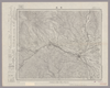
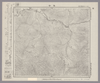
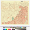
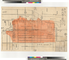
Image from the Map Collections courtesy Stanford University Libraries, licensed under a Creative Commons Attribution-Noncommercial 3.0 Unported License. © Stanford University. 【図幅名】 水戸 【測量時期】 明治36年測図/昭和15年第2回修正、測図の縮図/昭和27年応急修正 【発行時期】 昭和34年6月発行 【記号】 水戸10号(共12面) 【測量機関】 国土地理院 【備考】 応急修正版 ( 1枚のレイヤー)
リンク: 出所・参照情報
|
6ヶ月 前 | 4個の基準点 | |
|
国立国会図書館デジタルコレクション インターネット公開(保護期間満了) ( 2枚のレイヤー)
リンク: 出所・参照情報
|
1854 | 4年弱 前 | 25個の基準点 |
|
Image from the Map Collections courtesy Stanford University Libraries, licensed under a Creative Commons Attribution-Noncommercial 3.0 Unported License. © Stanford University. 【図幅名】 八方岳 【測量時期】 明治33年測圖/昭和6年部分修正測圖 【発行時期】 【記号】 熊本二号 【測量機関】 参謀本部 【備考】 祕
リンク: 出所・参照情報
|
23日 前 | 4個の基準点 | |
|
Image from the Map Collections courtesy Stanford University Libraries, licensed under a Creative Commons Attribution-Noncommercial 3.0 Unported License. © Stanford University. 【図幅名】 佐敷 【測量時期】 明治34年測圖/昭和7年要部修正測圖/昭和10年部分修正測圖 【発行時期】 昭和15年発行 【記号】 八代七号 【測量機関】 大日本帝國陸地測量部 【備考】
リンク: 出所・参照情報
|
約1ヶ月 前 | 4個の基準点 | |
|
Image from the Map Collections courtesy Stanford University Libraries, licensed under a Creative Commons Attribution-Noncommercial 3.0 Unported License. © Stanford University. 【図幅名】 大根占 【測量時期】 明治34年測図/昭和7年要部修正/昭和10年部分修正/昭和20年部分修正/昭和24年資料修正 【発行時期】 昭和24年11月発行 【記号】 開聞岳1号(共7面) 【測量機関】 地理調査所 【備考】
リンク: 出所・参照情報
|
約1ヶ月 前 | 4個の基準点 | |
|
Image from the Map Collections courtesy Stanford University Libraries, licensed under a Creative Commons Attribution-Noncommercial 3.0 Unported License. © Stanford University. 【図幅名】 安波 【測量時期】 大正10年測圖 【発行時期】 大正12年発行 【記号】 沖縄郡島二号 【測量機関】 陸地測量部・参謀本部 【備考】 軍事極祕(戦地ニ在りテハ軍事祕密トス)
リンク: 出所・参照情報
|
2ヶ月 前 | 4個の基準点 | |
|
Image from the Map Collections courtesy Stanford University Libraries, licensed under a Creative Commons Attribution-Noncommercial 3.0 Unported License. © Stanford University. 【図幅名】 邊土名 【測量時期】 大正10年測圖 【発行時期】 大正12年発行 【記号】 沖縄郡島五号 【測量機関】 陸地測量部・参謀本部 【備考】 軍事極祕(戦地ニ在りテハ軍事祕密トス)
リンク: 出所・参照情報
|
2ヶ月 前 | 4個の基準点 | |
|
|
2022 | 約2年 前 | 5個の基準点 |
|
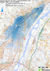
Image from the Map Collections courtesy Stanford University Libraries, licensed under a Creative Commons Attribution-Noncommercial 3.0 Unported License. © Stanford University. 【図幅名】 日光 【測量時期】 大正1年測図/昭和4年修正/昭和8年鉄道補入、測図の縮図 【発行時期】 昭和22年1月発行 【記号】 日光8号(共16面) 【測量機関】 内務省地理調査所 【備考】 ( 1枚のレイヤー)
リンク: 出所・参照情報
|
2ヶ月 前 | 4個の基準点 | |
|
Image from the Map Collections courtesy Stanford University Libraries, licensed under a Creative Commons Attribution-Noncommercial 3.0 Unported License. © Stanford University. 【図幅名】 真壁 【測量時期】 明治38年測図/大正6年修正/昭和4年部分修正 【発行時期】 昭和7年5月発行 【記号】 水戸15号(共12面) 【測量機関】 大日本帝国陸地測量部 【備考】 ( 1枚のレイヤー)
リンク: 出所・参照情報
|
2年以上 前 | 4個の基準点 | |
|
国立国会図書館デジタルコレクション インターネット公開(保護期間満了) ( 2枚のレイヤー)
リンク: 出所・参照情報
|
1853 | 4年弱 前 | 36個の基準点 |
|
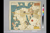
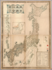
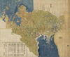
【Courtesy of the C. V. Starr East Asian Library University of California, Berkeley】 Japanese date Meiji 11 1878. In color. Folded. Mounted cover title. Copperplate print. In Japanese. Oriented with north to the upper left. Relief shown by hachures. 5 insets: Chishima Guntō.--Ryūkyū Shotō.--Sakishima Guntō.--Ogasawarajima.--Nihon. Engraved by Yuasa Yoshio. Includes tables of mountains and rivers, preface and legend. Title on map: Dai Nihon yochi zenzu.
リンク: 出所・参照情報
|
1878 | 4年弱 前 | 5個の基準点 |
|
Image from the Map Collections courtesy Stanford University Libraries, licensed under a Creative Commons Attribution-Noncommercial 3.0 Unported License. © Stanford University. 【図幅名】 川越 【測量時期】 明治40年測図/大正12年修正、測図の縮図/昭和14年第2回部分修正及部分修正、測図の縮図 【発行時期】 昭和16年4月発行 【記号】 東京9号(共16面) 【測量機関】 大日本帝国陸地測量部 【備考】 ( 1枚のレイヤー)
リンク: 出所・参照情報
|
2ヶ月 前 | 4個の基準点 | |
|
Image from the Map Collections courtesy Stanford University Libraries, licensed under a Creative Commons Attribution-Noncommercial 3.0 Unported License. © Stanford University. 【図幅名】 熊谷 【測量時期】 明治40年測図/昭和4年修正/昭和9年要部修正/昭和14年部分修正 【発行時期】 昭和15年9月発行 【記号】 宇都宮12号(共16面) 【測量機関】 大日本帝国陸地測量部 【備考】 ( 1枚のレイヤー)
リンク: 出所・参照情報
|
2ヶ月 前 | 4個の基準点 | |
|
Image from the Map Collections courtesy Stanford University Libraries, licensed under a Creative Commons Attribution-Noncommercial 3.0 Unported License. © Stanford University. 【図幅名】 銚子 【測量時期】 明治36年測図/昭和9年第2回修正/昭和19年部分修正/昭和28年応急修正 【発行時期】 昭和30年6月発行 【記号】 千葉2号(共12面) 【測量機関】 国土地理院 【備考】 応急修正版 ( 1枚のレイヤー)
リンク: 出所・参照情報
|
約2ヶ月 前 | 4個の基準点 | |
|
国立国会図書館デジタルコレクション インターネット公開(保護期間満了) ( 2枚のレイヤー)
リンク: 出所・参照情報
|
1853 | 4年弱 前 | 26個の基準点 |
|
Image from the Map Collections courtesy Stanford University Libraries, licensed under a Creative Commons Attribution-Noncommercial 3.0 Unported License. © Stanford University. 【図幅名】 龍野 【測量時期】 明治28年測図/大正12年第2回修正/昭和7年鉄道補入 【発行時期】 【記号】 姫路7号(共16面) 【測量機関】 参謀本部 【備考】 秘
リンク: 出所・参照情報
|
6ヶ月 前 | 4個の基準点 | |
|
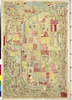
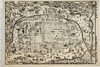
【Courtesy of the C. V. Starr East Asian Library University of California, Berkeley】 1 map : 81 x 167 cm., folded in cover 29 x 22 cm. Title added by hand. Wood block print. In Japanese. Covers Matsumae to Ryukyu and Tsushima. Shows points of interest pictorially. Includes lists of main shrines and place names, seasonal diagrams, distance charts and legend. Shows kokudaka. Relief shown pictorially. East Asian Library call number: Ca4.
リンク: 出所・参照情報
|
1690 | 4年以上 前 | 5個の基準点 |
|
Image from the Map Collections courtesy Stanford University Libraries, licensed under a Creative Commons Attribution-Noncommercial 3.0 Unported License. © Stanford University. 【図幅名】 薫別 【測量時期】 大正13年測圖/昭和7年鐡道補入/昭和19年部分修正測圖 【発行時期】 【記号】 標津十四号 【測量機関】 参謀本部 【備考】 祕 假製版 ( 1枚のレイヤー)
リンク: 出所・参照情報
|
2年以上 前 | 4個の基準点 | |
|
Image from the Map Collections courtesy Stanford University Libraries, licensed under a Creative Commons Attribution-Noncommercial 3.0 Unported License. © Stanford University. 【図幅名】 三里番屋 【測量時期】 大正13年測圖 【発行時期】 【記号】 紋別三号 【測量機関】 参謀本部 【備考】 祕 假製版 ( 1枚のレイヤー)
リンク: 出所・参照情報
|
2年以上 前 | 4個の基準点 | |
|
Image from the Map Collections courtesy Stanford University Libraries, licensed under a Creative Commons Attribution-Noncommercial 3.0 Unported License. © Stanford University. 【図幅名】 愛別 【測量時期】 大正8年測図/昭和3年鉄道補入 【発行時期】 昭和6年10月発行 【記号】 旭川5号(共16面) 【測量機関】 大日本帝国陸地測量部 【備考】 ( 1枚のレイヤー)
リンク: 出所・参照情報
|
2年以上 前 | 4個の基準点 | |
|
Image from the Map Collections courtesy Stanford University Libraries, licensed under a Creative Commons Attribution-Noncommercial 3.0 Unported License. © Stanford University. 【図幅名】 美幌 【測量時期】 大正13年測圖/昭和3年鐡道補入 【発行時期】 【記号】 斜里十四号 【測量機関】 参謀本部 【備考】 祕 假製版 ( 1枚のレイヤー)
リンク: 出所・参照情報
|
2年以上 前 | 4個の基準点 | |
|
リンク: 出所・参照情報
|
2020 | 1年以上 前 | 6個の基準点 |
|
Image from the Map Collections courtesy Stanford University Libraries, licensed under a Creative Commons Attribution-Noncommercial 3.0 Unported License. © Stanford University. 【図幅名】 芽登 【測量時期】 大正9年測図/昭和6年鉄道補入 【発行時期】 昭和8年1月発行 【記号】 帯広9号(共16面) 【測量機関】 大日本帝国陸地測量部 【備考】 ( 1枚のレイヤー)
リンク: 出所・参照情報
|
2年以上 前 | 4個の基準点 | |
|
Image from the Map Collections courtesy Stanford University Libraries, licensed under a Creative Commons Attribution-Noncommercial 3.0 Unported License. © Stanford University. 【図幅名】 落合 【測量時期】 大正8年測圖 【発行時期】 【記号】 夕張岳六号 【測量機関】 参謀本部 【備考】 祕 ( 1枚のレイヤー)
リンク: 出所・参照情報
|
2年以上 前 | 4個の基準点 | |
|
国立国会図書館デジタルコレクション インターネット公開(保護期間満了) ( 2枚のレイヤー)
リンク: 出所・参照情報
|
1852 | 4年弱 前 | 29個の基準点 |
|
|
2019 | 5年弱 前 | 3個の基準点 |
|
Image from the Map Collections courtesy Stanford University Libraries, licensed under a Creative Commons Attribution-Noncommercial 3.0 Unported License. © Stanford University. 【図幅名】 鵡川 【測量時期】 大正8年測圖/昭和10年修正測圖 【発行時期】 【記号】 苫小牧一号 【測量機関】 参謀本部 【備考】 祕 ( 1枚のレイヤー)
リンク: 出所・参照情報
|
2年以上 前 | 4個の基準点 | |
|
( 1枚のレイヤー)
リンク: 出所・参照情報
|
1924 | 1年以上 前 | 4個の基準点 |
|
50%に縮小
|
1944 | 約5年 前 | 13個の基準点 |
|
Image from the Map Collections courtesy Stanford University Libraries, licensed under a Creative Commons Attribution-Noncommercial 3.0 Unported License. © Stanford University. 【図幅名】 韮崎 【測量時期】 明治43年測圖/昭和4年第二回修正測圖 【発行時期】 【記号】 甲府十号 【測量機関】 参謀本部 【備考】 祕
リンク: 出所・参照情報
|
2ヶ月 前 | 4個の基準点 | |
|
JADH0829_kyoto
|
2019 | 約5年 前 | 6個の基準点 |
|
|
1864 | 約5年 前 | 4個の基準点 |
|
|
1823 | 5年以上 前 | 3個の基準点 |
|
【最初期発行】 この地図の作成に当たっては、国土地理院長の承認を得て、同院発行の20万分の1地勢図及び5万分の1地形図を使用した。(承認番号 平30情使、 第1148号)
リンク: 出所・参照情報
|
1936 | 3年弱 前 | 4個の基準点 |
|
【最初期発行】 この地図の作成に当たっては、国土地理院長の承認を得て、同院発行の20万分の1地勢図及び5万分の1地形図を使用した。(承認番号 平30情使、 第1148号)
リンク: 出所・参照情報
|
1916 | 5年以上 前 | 4個の基準点 |
|
【最初期発行】 この地図の作成に当たっては、国土地理院長の承認を得て、同院発行の20万分の1地勢図及び5万分の1地形図を使用した。(承認番号 平30情使、 第1148号)
リンク: 出所・参照情報
|
1914 | 5年以上 前 | 4個の基準点 |
|
|
2022 | 約2年 前 | 5個の基準点 |
|
【最初期発行】 この地図の作成に当たっては、国土地理院長の承認を得て、同院発行の20万分の1地勢図及び5万分の1地形図を使用した。(承認番号 平30情使、 第1148号)
リンク: 出所・参照情報
|
1920 | 5年以上 前 | 4個の基準点 |
|
【最初期発行】 この地図の作成に当たっては、国土地理院長の承認を得て、同院発行の20万分の1地勢図及び5万分の1地形図を使用した。(承認番号 平30情使、 第1148号)
リンク: 出所・参照情報
|
1927 | 5年以上 前 | 4個の基準点 |
|
|
2019 | 5年以上 前 | 4個の基準点 |
|
|
2019 | 5年以上 前 | 5個の基準点 |
|
【最初期発行】 この地図の作成に当たっては、国土地理院長の承認を得て、同院発行の20万分の1地勢図及び5万分の1地形図を使用した。(承認番号 平30情使、 第1148号) ( 1枚のレイヤー)
リンク: 出所・参照情報
|
1904 | 4年以上 前 | 4個の基準点 |
|
岡山大学附属図書館所蔵
池田家文庫絵図T6-38備前岡山地理家宅一枚図
|
1863 | 3年以上 前 | 3個の基準点 |
|
|
2019 | 5年以上 前 | 4個の基準点 |
|
【最初期発行】 この地図の作成に当たっては、国土地理院長の承認を得て、同院発行の20万分の1地勢図及び5万分の1地形図を使用した。(承認番号 平30情使、 第1148号) ( 1枚のレイヤー)
リンク: 出所・参照情報
|
1924 | 2年以上 前 | 4個の基準点 |
|
【最初期発行】 この地図の作成に当たっては、国土地理院長の承認を得て、同院発行の20万分の1地勢図及び5万分の1地形図を使用した。(承認番号 平30情使、 第1148号) ( 1枚のレイヤー)
リンク: 出所・参照情報
|
1924 | 2年以上 前 | 4個の基準点 |
|
リンク: 出所・参照情報
|
2020 | 1年以上 前 | 5個の基準点 |
|
【最初期発行】 この地図の作成に当たっては、国土地理院長の承認を得て、同院発行の20万分の1地勢図及び5万分の1地形図を使用した。(承認番号 平30情使、 第1148号) ( 1枚のレイヤー)
リンク: 出所・参照情報
|
1929 | 5年以上 前 | 4個の基準点 |
|
この地図の作成に当たっては、国土地理院長の承認を得て、同院発行の20万分の1地勢図及び5万分の1地形図を使用した。(承認番号 平30情使、 第1148号)
リンク: 出所・参照情報
|
1947 | 5年以上 前 | 4個の基準点 |