Browse Maps
| map | Title | Year | Last Updated | Status  |
|---|---|---|---|---|
|
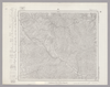
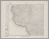
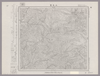
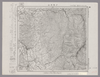
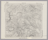
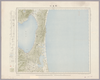
Image from the Map Collections courtesy Stanford University Libraries, licensed under a Creative Commons Attribution-Noncommercial 3.0 Unported License. © Stanford University. 【図幅名】 五所川原 【測量時期】 大正1年測図/昭和5年鉄道補入 【発行時期】 昭和6年8月発行 【記号】 青森12号(共14面) 【測量機関】 大日本帝国陸地測量部 【備考】
Links: Source / Biblio Ref
|
about 2 years ago | 4 control points | |
|
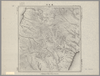
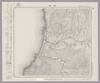
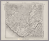
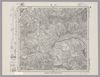
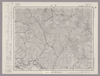
Image from the Map Collections courtesy Stanford University Libraries, licensed under a Creative Commons Attribution-Noncommercial 3.0 Unported License. © Stanford University. 【図幅名】 陸中関 【測量時期】 大正3年測図 【発行時期】 大正6年5月発行 【記号】 八戸8号(共15面) 【測量機関】 大日本帝国陸地測量部 【備考】
Links: Source / Biblio Ref
|
about 2 years ago | 4 control points | |
|
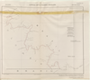
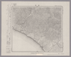
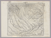
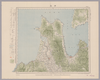
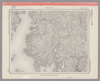
Image from the Map Collections courtesy Stanford University Libraries, licensed under a Creative Commons Attribution-Noncommercial 3.0 Unported License. © Stanford University. 【図幅名】 七戸 【測量時期】 大正3年測図/昭和19年部分修正 【発行時期】 【記号】 辺地16号(共7面) 【測量機関】 内務省地理調査所 【備考】
Links: Source / Biblio Ref
|
about 2 years ago | 4 control points | |
|
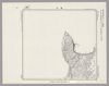
Image from the Map Collections courtesy Stanford University Libraries. This item is in the public domain. There are no restrictions on use.
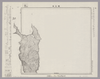
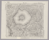
【図幅名】 加熊別【測量時期】 大正3年測圖 【発行時期】大正13年 【記号】 幌筵島六号 【測量機関】 参謀本部 【その他】千島列島 陸地測量部 (In 1 layer)
Links: Source / Biblio Ref
|
1924 | over 1 year ago | 4 control points |
|
Image from the Map Collections courtesy Stanford University Libraries, licensed under a Creative Commons Attribution-Noncommercial 3.0 Unported License. © Stanford University. 【図幅名】 門 【測量時期】 大正3年測図 【発行時期】 大正6年3月発行 【記号】 盛岡5号(共18面) 【測量機関】 大日本帝国陸地測量部 【備考】
Links: Source / Biblio Ref
|
about 2 years ago | 4 control points | |
|
Image from the Map Collections courtesy Stanford University Libraries. This item is in the public domain. There are no restrictions on use.
【図幅名】 速毛川【測量時期】 大正2年測圖 【発行時期】大正13年 【記号】 幌筵島二号 【測量機関】 参謀本部 【その他】千島列島 陸地測量部 (In 1 layer)
Links: Source / Biblio Ref
|
1924 | over 1 year ago | 4 control points |
|
|
8 months ago | 17 control points | |
|
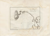
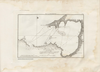
SANTA MARTA. PROYECTO DE LAS NUEVAS OBRAS PORTUARIAS. CORONEL P.R.WARREN. TECNICO HIDRAULICO. DIBUJADO POR LUIS ACEVEDO. PARA ACOMPAÑAR AL INFORME DE SIR. A.GIBB G.B.C G.B. DEL 21 DE ABRIL-32. 2
|
1932 | 8 months ago | 29 control points |
|
|
8 months ago | 4 control points | |
|
Image from the Map Collections courtesy Stanford University Libraries, licensed under a Creative Commons Attribution-Noncommercial 3.0 Unported License. © Stanford University. 【図幅名】 広尾 【測量時期】 大正9年測圖/昭和8年鐡道補入 【発行時期】 【記号】 広尾十一号 【測量機関】 参謀本部 【備考】 祕
Links: Source / Biblio Ref
|
about 2 years ago | 4 control points | |
|
Image from the Map Collections courtesy Stanford University Libraries, licensed under a Creative Commons Attribution-Noncommercial 3.0 Unported License. © Stanford University.
Links: Source / Biblio Ref
|
over 6 years ago | 4 control points | |
|
Links: Source / Biblio Ref
|
1936 | over 3 years ago | 5 control points |
|
Image from the Map Collections courtesy Stanford University Libraries, licensed under a Creative Commons Attribution-Noncommercial 3.0 Unported License. © Stanford University. 【図幅名】 礼文島 【測量時期】 大正12年測図 【発行時期】 昭和21年10月発行 【記号】 宗谷16号(共1面) 【測量機関】 内務省地理調査所 【備考】 (In 1 layer)
Links: Source / Biblio Ref
|
over 5 years ago | 4 control points | |
|
Image from the Map Collections courtesy Stanford University Libraries, licensed under a Creative Commons Attribution-Noncommercial 3.0 Unported License. © Stanford University. 【図幅名】 瀬棚 【測量時期】 大正6年測図/昭和8年鉄道補入 【発行時期】 大正10年4月発行 【記号】 久遠2号(共9面) 【測量機関】 大日本帝国陸地測量部 【備考】 (In 1 layer)
Links: Source / Biblio Ref
|
about 2 years ago | 4 control points | |
|
Image from the Map Collections courtesy Stanford University Libraries, licensed under a Creative Commons Attribution-Noncommercial 3.0 Unported License. © Stanford University. 【図幅名】 楽古岳 【測量時期】 大正9年測圖 【発行時期】 【記号】 広尾十五号 【測量機関】 参謀本部 【備考】 祕 (In 1 layer)
Links: Source / Biblio Ref
|
about 2 years ago | 4 control points | |
|
Image from the Map Collections courtesy Stanford University Libraries, licensed under a Creative Commons Attribution-Noncommercial 3.0 Unported License. © Stanford University. 【図幅名】 幌泉 【測量時期】 大正9年測圖 【発行時期】 【記号】 広尾十六号 【測量機関】 参謀本部 【備考】 祕 (In 1 layer)
Links: Source / Biblio Ref
|
about 2 years ago | 4 control points | |

|
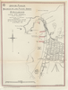
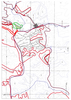
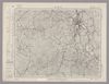
旧川崎地区明細地図 川崎市 1958年度版 川崎市経済地図 P.33「小川町・南町」をもとに作図
|
1958 | about 4 years ago | 5 control points |
|
Image from the Map Collections courtesy Stanford University Libraries, licensed under a Creative Commons Attribution-Noncommercial 3.0 Unported License. © Stanford University. 【図幅名】 豆酘 【測量時期】 大正1年測図の縮図/昭和10年第2回修正、測図の縮図 【発行時期】 昭和22年1月発行 【記号】 厳原16号(共7面) 【測量機関】 内務省地理調査所 【備考】
Links: Source / Biblio Ref
|
about 4 years ago | 4 control points | |
|
Links: Source / Biblio Ref
|
2020 | about 1 year ago | 4 control points |
|
Image from the Map Collections courtesy Stanford University Libraries, licensed under a Creative Commons Attribution-Noncommercial 3.0 Unported License. © Stanford University. 【図幅名】 塩原 【測量時期】 明治42年測図/昭和4年修正 【発行時期】 昭和21年12月発行 【記号】 日光3号 【測量機関】 内務省地理調査所 【備考】
Links: Source / Biblio Ref
|
about 2 years ago | 4 control points | |
|
Image from the Map Collections courtesy Stanford University Libraries, licensed under a Creative Commons Attribution-Noncommercial 3.0 Unported License. © Stanford University. 【図幅名】 今金 【測量時期】 大正6年測圖/昭和8年鐡道補入 【発行時期】 【記号】 室蘭十四号 【測量機関】 参謀本部 【備考】 祕 (In 1 layer)
Links: Source / Biblio Ref
|
about 2 years ago | 4 control points | |
|
Image from the Map Collections courtesy Stanford University Libraries, licensed under a Creative Commons Attribution-Noncommercial 3.0 Unported License. © Stanford University. 【図幅名】 熊石 【測量時期】 大正6年測図 【発行時期】 大正7年11月発行 【記号】 久遠4号(共9面) 【測量機関】 大日本帝国陸地測量部 【備考】 (In 1 layer)
Links: Source / Biblio Ref
|
about 2 years ago | 4 control points | |
|
Links: Source / Biblio Ref
|
2020 | about 1 year ago | 4 control points |
|
|
2022 | over 1 year ago | 7 control points |
|
Links: Source / Biblio Ref
|
2020 | about 1 year ago | 4 control points |
|
Links: Source / Biblio Ref
|
2020 | about 1 year ago | 4 control points |
|
Image from the Map Collections courtesy Stanford University Libraries, licensed under a Creative Commons Attribution-Noncommercial 3.0 Unported License. © Stanford University. 【図幅名】 室蘭 【測量時期】 大正6年測図/昭和19年部分修正(空中写真測図) 【発行時期】 昭和21年11月発行 【記号】 室蘭3号(共14面) 【測量機関】 内務省地理調査所 【備考】 (In 1 layer)
Links: Source / Biblio Ref
|
over 5 years ago | 4 control points | |
|
Image from the Map Collections courtesy Stanford University Libraries, licensed under a Creative Commons Attribution-Noncommercial 3.0 Unported License. © Stanford University. 【図幅名】 太宰府 【測量時期】 明治33年測圖之縮圖/昭和11年修正測圖及第二回修正測圖並修正測圖之縮圖 【発行時期】 【記号】 小倉七号 【測量機関】 参謀本部 【備考】 祕
Links: Source / Biblio Ref
|
about 4 years ago | 4 control points | |
|
Image from the Map Collections courtesy Stanford University Libraries, licensed under a Creative Commons Attribution-Noncommercial 3.0 Unported License. © Stanford University. 【図幅名】 上足寄 【測量時期】 大正9年測圖 【発行時期】 【記号】 陸別四号 【測量機関】 参謀本部 【備考】 祕 (In 1 layer)
Links: Source / Biblio Ref
|
about 2 years ago | 4 control points | |
|
Image from the Map Collections courtesy Stanford University Libraries, licensed under a Creative Commons Attribution-Noncommercial 3.0 Unported License. © Stanford University. 【図幅名】 稚内 【測量時期】 大正12年測図/昭和3年測図、昭和4年鉄道補入 【発行時期】 昭和21年10月発行 【記号】 宗谷8号(共4面) 【測量機関】 内務省地理調査所 【備考】 (In 1 layer)
Links: Source / Biblio Ref
|
about 2 years ago | 4 control points | |
|
Image from the Map Collections courtesy Stanford University Libraries, licensed under a Creative Commons Attribution-Noncommercial 3.0 Unported License. © Stanford University. 【図幅名】 下下方 【測量時期】 大正8年測圖/昭和3年鐡道補入 【発行時期】 【記号】 浦河十号 【測量機関】 参謀本部 【備考】 祕 (In 1 layer)
Links: Source / Biblio Ref
|
about 2 years ago | 4 control points | |
|
Image from the Map Collections courtesy Stanford University Libraries, licensed under a Creative Commons Attribution-Noncommercial 3.0 Unported License. © Stanford University. 【図幅名】 中標津 【測量時期】 大正13年測圖/昭和7年鐡道補入 【発行時期】 【記号】 斜里三号 【測量機関】 参謀本部 【備考】 祕 假製版 (In 1 layer)
Links: Source / Biblio Ref
|
about 2 years ago | 4 control points | |
|
|
2022 | over 1 year ago | 10 control points |
|
Image from the Map Collections courtesy Stanford University Libraries, licensed under a Creative Commons Attribution-Noncommercial 3.0 Unported License. © Stanford University. 【図幅名】 夕張炭山 【測量時期】 大正5年測図/昭和10年修正改版 【発行時期】 【記号】 札幌2号(共16面) 【測量機関】 参謀本部 【備考】 秘 (In 1 layer)
Links: Source / Biblio Ref
|
about 2 years ago | 4 control points | |
|
Image from the Map Collections courtesy Stanford University Libraries, licensed under a Creative Commons Attribution-Noncommercial 3.0 Unported License. © Stanford University. 【図幅名】 仁木 【測量時期】 大正6年測圖 【発行時期】 【記号】 岩内二号 【測量機関】 参謀本部 【備考】 祕 (In 1 layer)
Links: Source / Biblio Ref
|
about 2 years ago | 4 control points | |
|
Image from the Map Collections courtesy Stanford University Libraries, licensed under a Creative Commons Attribution-Noncommercial 3.0 Unported License. © Stanford University.
Links: Source / Biblio Ref
|
over 6 years ago | 4 control points | |
|
Image from the Map Collections courtesy Stanford University Libraries, licensed under a Creative Commons Attribution-Noncommercial 3.0 Unported License. © Stanford University. 【図幅名】 虻田 【測量時期】 大正6年測図/昭和6年鉄道補入 【発行時期】 昭和7年9月発行 【記号】 室蘭1号(共14面) 【測量機関】 大日本帝国陸地測量部 【備考】 (In 1 layer)
Links: Source / Biblio Ref
|
about 2 years ago | 4 control points | |
|
Image from the Map Collections courtesy Stanford University Libraries, licensed under a Creative Commons Attribution-Noncommercial 3.0 Unported License. © Stanford University. 【図幅名】 大夕張 【測量時期】 大正8年測図 【発行時期】 大正10年6月発行 【記号】 夕張獄14号(共16面) 【測量機関】 大日本帝国陸地測量部 【備考】 (In 1 layer)
Links: Source / Biblio Ref
|
about 2 years ago | 4 control points | |
|
Image from the Map Collections courtesy Stanford University Libraries, licensed under a Creative Commons Attribution-Noncommercial 3.0 Unported License. © Stanford University. 【図幅名】 長万部 【測量時期】 大正6年測図/昭和3年鉄道補入 【発行時期】 昭和5年9月発行 【記号】 室蘭9号(共14面) 【測量機関】 大日本帝国陸地測量部 【備考】 (In 1 layer)
Links: Source / Biblio Ref
|
about 2 years ago | 4 control points | |
|
Image from the Map Collections courtesy Stanford University Libraries, licensed under a Creative Commons Attribution-Noncommercial 3.0 Unported License. © Stanford University. 【図幅名】 石狩金山 【測量時期】 大正8年測圖 【発行時期】 【記号】 夕張岳十号 【測量機関】 参謀本部 【備考】 祕 (In 1 layer)
Links: Source / Biblio Ref
|
about 2 years ago | 4 control points | |
|
Image from the Map Collections courtesy Stanford University Libraries, licensed under a Creative Commons Attribution-Noncommercial 3.0 Unported License. © Stanford University. 【図幅名】 大楽毛 【測量時期】 大正11年測図/昭和3年鉄道補入 【発行時期】 昭和5年4月発行 【記号】 釧路10号(共12面) 【測量機関】 大日本帝国陸地測量部 【備考】 仮製版 (In 1 layer)
Links: Source / Biblio Ref
|
about 2 years ago | 4 control points | |
|
Image from the Map Collections courtesy Stanford University Libraries, licensed under a Creative Commons Attribution-Noncommercial 3.0 Unported License. © Stanford University. 【図幅名】 徳舜暼 【測量時期】 大正6年測図の縮図/昭和10年修正、測図の縮図 【発行時期】 昭和12年4月発行 【記号】 苫小牧13号(共5面) 【測量機関】 大日本帝国陸地測量部 【備考】
Links: Source / Biblio Ref
|
about 2 years ago | 4 control points | |
|
Image from the Map Collections courtesy Stanford University Libraries, licensed under a Creative Commons Attribution-Noncommercial 3.0 Unported License. © Stanford University. 【図幅名】 吉井 【測量時期】 明治33年測圖/昭和11年修正測圖 【発行時期】 昭和13年発行 【記号】 小倉四号 【測量機関】 大日本帝國陸地測量部 【備考】
Links: Source / Biblio Ref
|
about 4 years ago | 4 control points | |
|
Image from the Map Collections courtesy Stanford University Libraries, licensed under a Creative Commons Attribution-Noncommercial 3.0 Unported License. © Stanford University. 【図幅名】 雄冬 【測量時期】 大正8年測圖 【発行時期】 【記号】 留萌十号 【測量機関】 参謀本部 【備考】 祕 (In 1 layer)
Links: Source / Biblio Ref
|
over 5 years ago | 4 control points | |
|
Image from the Map Collections courtesy Stanford University Libraries, licensed under a Creative Commons Attribution-Noncommercial 3.0 Unported License. © Stanford University. 【図幅名】 佐世保 【測量時期】 明治33年測図の縮図/大正13年修正、測図の縮図/昭和20年部分修正 【発行時期】 昭和23年3月発行 【記号】 長崎5号(共15面) 【測量機関】 地理調査所 【備考】
Links: Source / Biblio Ref
|
about 4 years ago | 4 control points | |
|
Image from the Map Collections courtesy Stanford University Libraries, licensed under a Creative Commons Attribution-Noncommercial 3.0 Unported License. © Stanford University.
Links: Source / Biblio Ref
|
over 6 years ago | 4 control points | |
|
Image from the Map Collections courtesy Stanford University Libraries, licensed under a Creative Commons Attribution-Noncommercial 3.0 Unported License. © Stanford University. 【図幅名】 根室北部 【測量時期】 大正11年測図/昭和19年部分修正測量 【発行時期】 昭和21年5月発行 【記号】 標津8号(共13面) 【測量機関】 内務省地理調査所 【備考】 仮製版 軍事極秘 (In 1 layer)
Links: Source / Biblio Ref
|
over 4 years ago | 4 control points | |
|
Image from the Map Collections courtesy Stanford University Libraries, licensed under a Creative Commons Attribution-Noncommercial 3.0 Unported License. © Stanford University. 【図幅名】 野付牛 【測量時期】 大正13年測圖 【発行時期】 【記号】 陸別二号 【測量機関】 参謀本部 【備考】 祕 (In 1 layer)
Links: Source / Biblio Ref
|
about 2 years ago | 4 control points | |
|
Image from the Map Collections courtesy Stanford University Libraries, licensed under a Creative Commons Attribution-Noncommercial 3.0 Unported License. © Stanford University. 【図幅名】 計根別 【測量時期】 大正11年測圖/昭和17年修正/昭和19年部分修正測圖 【発行時期】 【記号】 斜里四号 【測量機関】 参謀本部 【備考】 軍事祕密(戦地ニ限リ極祕) (In 1 layer)
Links: Source / Biblio Ref
|
about 2 years ago | 4 control points | |
|
|
1854 | over 6 years ago | 4 control points |