Browse Maps
| map | Title | Year | Last Updated | Status  |
|---|---|---|---|---|
|
|
2023 | about 1 year ago | 5 control points |
|
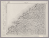
Image from the Map Collections courtesy Stanford University Libraries, licensed under a Creative Commons Attribution-Noncommercial 3.0 Unported License. © Stanford University.
Links: Source / Biblio Ref
|
over 6 years ago | 4 control points | |
|
Links: Source / Biblio Ref
|
2020 | about 1 year ago | 4 control points |
|
|
over 6 years ago | 3 control points | |
|
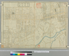
Image from the Map Collections courtesy Stanford University Libraries, licensed under a Creative Commons Attribution-Noncommercial 3.0 Unported License. © Stanford University. 【図幅名】 浜田 【測量時期】 明治32年測圖之縮圖/昭和7年修正測圖及修正測圖之縮圖 【発行時期】 【記号】 浜田十五号 【測量機関】 参謀本部 【備考】 祕
Links: Source / Biblio Ref
|
about 1 year ago | 4 control points | |
|
Links: Source / Biblio Ref
|
1851 | about 6 years ago | 4 control points |
|
|
2023 | about 1 year ago | 5 control points |
|
Links: Source / Biblio Ref
|
2020 | over 3 years ago | 3 control points |
|
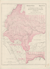
Image from the Map Collections courtesy Stanford University Libraries, licensed under a Creative Commons Attribution-Noncommercial 3.0 Unported License. © Stanford University. 【図幅名】 伊予鹿島 【測量時期】 明治37年測図/昭和8年修正/昭和20年部分修正 【発行時期】 昭和23年2月発行 【記号】 宇和島11号(共13面) 【測量機関】 地理調査所 【備考】 (In 1 layer)
Links: Source / Biblio Ref
|
5 months ago | 4 control points | |
|
Links: Source / Biblio Ref
|
2020 | over 1 year ago | 11 control points |
|
Links: Source / Biblio Ref
|
2020 | about 1 year ago | 4 control points |
|
Links: Source / Biblio Ref
|
2020 | over 1 year ago | 5 control points |
|
|
2023 | about 1 year ago | 6 control points |
|
Image from the Map Collections courtesy Stanford University Libraries, licensed under a Creative Commons Attribution-Noncommercial 3.0 Unported License. © Stanford University. 【図幅名】 保戸島 【測量時期】 明治38年測図/昭和2年修正/昭和20年部分修正 【発行時期】 昭和21年5月発行 【記号】 宇和島14号(共13面) 【測量機関】 地理調査所 【備考】
Links: Source / Biblio Ref
|
about 4 years ago | 4 control points | |
|
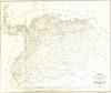
Image from the Map Collections courtesy Stanford University Libraries, licensed under a Creative Commons Attribution-Noncommercial 3.0 Unported License. © Stanford University. 【図幅名】 川本 【測量時期】 明治32年測図/昭和7年修正 【発行時期】 昭和10年5月発行 【記号】 浜田11号(共15面) 【測量機関】 大日本帝国陸地測量部 【備考】
Links: Source / Biblio Ref
|
about 1 year ago | 4 control points | |
|
Image from the Map Collections courtesy Stanford University Libraries, licensed under a Creative Commons Attribution-Noncommercial 3.0 Unported License. © Stanford University. 【図幅名】 土浦 【測量時期】 明治38年測図/昭和4年修正 【発行時期】 昭和7年4月発行 【記号】 水戸16号(共12面) 【測量機関】 大日本帝国陸地測量部 【備考】 (In 1 layer)
Links: Source / Biblio Ref
|
about 2 years ago | 4 control points | |
|
|
2023 | about 1 year ago | 11 control points |
|
Links: Source / Biblio Ref
|
2020 | over 1 year ago | 17 control points |
|
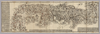
【Courtesy of the C. V. Starr East Asian Library University of California, Berkeley】 Mounted cover title. Hand col. wood block print. In Japanese. Relief shown pictorially. Includes distance chart and index. Folded in cover 25 x 17 cm. East Asian Library call number: F7.
Links: Source / Biblio Ref
|
1739 | about 1 year ago | 4 control points |
|
Image from the Map Collections courtesy Stanford University Libraries, licensed under a Creative Commons Attribution-Noncommercial 3.0 Unported License. © Stanford University. 【図幅名】 白龍 【測量時期】 大正10年及大正12年測圖/昭和8年鐡道補入 【発行時期】 【記号】 陸別十三号 【測量機関】 参謀本部 【備考】 祕 假製版 (In 1 layer)
Links: Source / Biblio Ref
|
about 2 years ago | 4 control points | |
|
|
2023 | about 1 year ago | 9 control points |
|
|
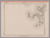
1863 | over 6 years ago | 4 control points |
|
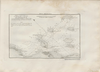
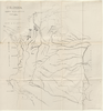
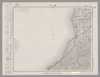
RIO MAGDALENA. PROTECCIÓN DE BARRANCA BERMEJA PARA ACOMPAÑAR AL INFORME DE SIR. A.GIBB G.B.C G.B. 14 DE JULIO DE 1930. PLANO Nº11
|
1930 | 8 months ago | 32 control points |
|
Image from the Map Collections courtesy Stanford University Libraries, licensed under a Creative Commons Attribution-Noncommercial 3.0 Unported License. © Stanford University.
Links: Source / Biblio Ref
|
over 6 years ago | 4 control points | |
|
【Courtesy of the C. V. Starr East Asian Library University of California, Berkeley】 Cover title. Wood block print. In Japanese. Covers Matsumae to Tsushima. Includes lists of messenger fees. Shows distance of sea routes and roads. Folded to 20 x 8 cm.
Links: Source / Biblio Ref
|
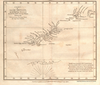
1830 | over 3 years ago | 4 control points |
|
Image from the Map Collections courtesy Stanford University Libraries, licensed under a Creative Commons Attribution-Noncommercial 3.0 Unported License. © Stanford University. 【図幅名】 和食 【測量時期】 明治40年測圖/昭和8年修正測圖 【発行時期】 【記号】 剣山九号 【測量機関】 参謀本部 【備考】 祕
Links: Source / Biblio Ref
|
about 2 years ago | 4 control points | |
|
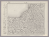
Image from the Map Collections courtesy Stanford University Libraries, licensed under a Creative Commons Attribution-Noncommercial 3.0 Unported License. © Stanford University. 【図幅名】 郡中 【測量時期】 明治36年測図の縮図/昭和3年修正、測図の縮図/昭和7年鉄道補入 【発行時期】 昭和9年4月発行 【記号】 松山6号(共15面) 【測量機関】 大日本帝国陸地測量部 【備考】 (In 1 layer)
Links: Source / Biblio Ref
|
5 months ago | 4 control points | |
|
Image from the Map Collections courtesy Stanford University Libraries, licensed under a Creative Commons Attribution-Noncommercial 3.0 Unported License. © Stanford University. 【図幅名】 魚津 【測量時期】 明治44年測図/昭和5年修正 【発行時期】 昭和8年11月発行 【記号】 富山12号(共11面) 【測量機関】 大日本帝国陸地測量部 【備考】 (In 1 layer)
Links: Source / Biblio Ref
|
about 2 years ago | 4 control points | |
|
Image from the Map Collections courtesy Stanford University Libraries, licensed under a Creative Commons Attribution-Noncommercial 3.0 Unported License. © Stanford University. 【図幅名】 大洲 【測量時期】 明治37年測図/昭和8年修正 【発行時期】 昭和11年7月発行 【記号】 松山7号(共15面) 【測量機関】 大日本帝国陸地測量部 【備考】 (In 1 layer)
Links: Source / Biblio Ref
|
5 months ago | 4 control points | |
|
Image from the Map Collections courtesy Stanford University Libraries, licensed under a Creative Commons Attribution-Noncommercial 3.0 Unported License. © Stanford University. 【図幅名】 小値賀島 【測量時期】 明治36年測図/昭和11年修正/昭和13年測図の縮図 【発行時期】 昭和21年11月発行 【記号】 長崎13号(共15面) 【測量機関】 地理調査所 【備考】
Links: Source / Biblio Ref
|
about 4 years ago | 4 control points | |
|
この地図の作成に当たっては、国土地理院長の承認を得て、同院発行の20万分の1地勢図及び5万分の1地形図を使用した。(承認番号 平30情使、 第1148号)
Links: Source / Biblio Ref
|
1947 | over 5 years ago | 4 control points |
|
Image from the Map Collections courtesy Stanford University Libraries, licensed under a Creative Commons Attribution-Noncommercial 3.0 Unported License. © Stanford University. 【図幅名】 今庄 【測量時期】 明治25年測図/明治42年測図の縮図/昭和7年第2回修正、測図の縮図 【発行時期】 昭和9年12月発行 【記号】 岐阜14号(共16面) 【測量機関】 大日本帝国陸地測量部 【備考】 (In 1 layer)
Links: Source / Biblio Ref
|
about 2 years ago | 4 control points | |
|
この地図の作成に当たっては、国土地理院長の承認を得て、同院発行の20万分の1地勢図及び5万分の1地形図を使用した。(承認番号 平30情使、 第1148号)
Links: Source / Biblio Ref
|
1947 | about 1 year ago | 4 control points |
|
Image from the Map Collections courtesy Stanford University Libraries, licensed under a Creative Commons Attribution-Noncommercial 3.0 Unported License. © Stanford University. 【図幅名】 立山 【測量時期】 大正元年測圖/昭和5年修正測圖(地上寫真測量併用) 【発行時期】 【記号】 高山五号 【測量機関】 参謀本部 【備考】 祕
Links: Source / Biblio Ref
|
about 2 years ago | 4 control points | |
|
Image from the Map Collections courtesy Stanford University Libraries, licensed under a Creative Commons Attribution-Noncommercial 3.0 Unported License. © Stanford University. 【図幅名】 三瓶山 【測量時期】 明治32年測図/昭和7年修正 【発行時期】 昭和10年5月発行 【記号】 浜田6号(共15面) 【測量機関】 大日本帝国陸地測量部 【備考】
Links: Source / Biblio Ref
|
about 1 year ago | 4 control points | |
|
【Courtesy of the C. V. Starr East Asian Library University of California, Berkeley】 Lithograph print. In Japanese. Oriented wit north to the left. Relief shown pictorially. Inlcudes legend.
Links: Source / Biblio Ref
|
1895 | over 3 years ago | 4 control points |
|
|
2023 | about 1 year ago | 3 control points |
|
Image from the Map Collections courtesy Stanford University Libraries, licensed under a Creative Commons Attribution-Noncommercial 3.0 Unported License. © Stanford University. 【図幅名】 水俣 【測量時期】 明治34年測圖/昭和7年要部修正測圖/昭和10年部分修正測圖 【発行時期】 【記号】 八代十一号 【測量機関】 参謀本部 【備考】 祕
Links: Source / Biblio Ref
|
about 4 years ago | 4 control points | |
|
Image from the Map Collections courtesy Stanford University Libraries, licensed under a Creative Commons Attribution-Noncommercial 3.0 Unported License. © Stanford University. 【図幅名】 赤名 【測量時期】 明治32年測圖/昭和7年修正測圖 【発行時期】 【記号】 浜田七号 【測量機関】 参謀本部 【備考】 祕
Links: Source / Biblio Ref
|
about 1 year ago | 4 control points | |
|
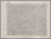
Image from the Map Collections courtesy Stanford University Libraries, licensed under a Creative Commons Attribution-Noncommercial 3.0 Unported License. © Stanford University. 【図幅名】 【測量時期】 【発行時期】 【記号】 【測量機関】 【備考】
Links: Source / Biblio Ref
|
about 2 years ago | 4 control points | |
|
shelfmark: Maps 149.e.230
License: Public Domain
江戸後期写 Manuscript, early 19th century. Acquired 22 July 1868. Ex-Siebold.
Links: Source / Biblio Ref
|
about 1 year ago | 4 control points | |
|
【最初期発行】 この地図の作成に当たっては、国土地理院長の承認を得て、同院発行の20万分の1地勢図及び5万分の1地形図を使用した。(承認番号 平30情使、 第1148号) (In 1 layer)
Links: Source / Biblio Ref
|
1920 | about 4 years ago | 4 control points |
|
shelfmark: Maps 38.c.216
License: Public Domain
天保14 *無刊記。外題「(富士見十三州)輿地之全図」。江戸湾に「御台場」なし。凡例末を入れ木して「故名焉」と改む。 Xylograph.
Links: Source / Biblio Ref
|
1843 | over 2 years ago | 22 control points |
|
Image from the Map Collections courtesy Stanford University Libraries, licensed under a Creative Commons Attribution-Noncommercial 3.0 Unported License. © Stanford University. 【図幅名】 飛騨古川 【測量時期】 大正1年測図/昭和5年要部修正 【発行時期】 昭和7年9月発行 【記号】 高山15号(共16面) 【測量機関】 大日本帝国陸地測量部 【備考】
Links: Source / Biblio Ref
|
about 2 years ago | 4 control points | |
|
shelfmark: Maps 24.b.212
License: Public Domain
江戸後期写 *浜松助郷村名等を明記す。藩政用の図力。 Manuscript, early 19th century.
Links: Source / Biblio Ref
|
over 3 years ago | 14 control points | |
|
Image from the Map Collections courtesy Stanford University Libraries, licensed under a Creative Commons Attribution-Noncommercial 3.0 Unported License. © Stanford University. 【図幅名】 水海道 【測量時期】 明治40年測図/昭和4年修正/昭和35年部分修正 【発行時期】 【記号】 宇都宮4号(共16面) 【測量機関】 国土地理院 【備考】 (In 1 layer)
Links: Source / Biblio Ref
|
about 2 years ago | 4 control points | |
|
shelfmark: Maps 9.b.25
License: Public Domain
天保14 *多色刷り。無刊記。外題「(富士見十三州)輿地之全図」。凡例末を入れ木して「故名焉」と改む。 Xylograph
Links: Source / Biblio Ref
|
1843 | over 3 years ago | 13 control points |
|
Links: Source / Biblio Ref
|
2020 | over 1 year ago | 9 control points |
|
Image from the Map Collections courtesy Stanford University Libraries. This item is in the public domain. There are no restrictions on use.
【図幅名】 武魯頓灣 【測量時期】 大正5年測圖 【発行時期】昭和11年 【記号】 新知島七号 【測量機関】 参謀本部 【その他】千島列島 陸地測量部 (In 1 layer)
Links: Source / Biblio Ref
|
1936 | 12 months ago | 14 control points |
|
Image from the Map Collections courtesy Stanford University Libraries, licensed under a Creative Commons Attribution-Noncommercial 3.0 Unported License. © Stanford University. 【図幅名】 北方 【測量時期】 大正1年測図/昭和9年修正 【発行時期】 昭和10年8月発行 【記号】 西郷15号(共4面) 【測量機関】 大日本帝国陸地測量部 【備考】
Links: Source / Biblio Ref
|
about 2 years ago | 4 control points |