Browse Maps
| map | Title  |
Year | Last Updated | Status |
|---|---|---|---|---|
|
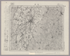
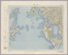
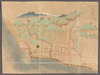
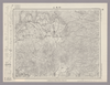
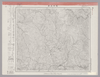
Image from the Map Collections courtesy Stanford University Libraries, licensed under a Creative Commons Attribution-Noncommercial 3.0 Unported License. © Stanford University. 【図幅名】 長岡 【測量時期】 明治44年測図/昭和6年修正 【発行時期】 【記号】 長岡4号(共11面) 【測量機関】 参謀本部 【備考】 秘
Links: Source / Biblio Ref
|
about 2 years ago | 4 control points | |
|
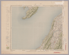
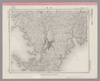
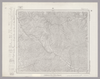
Image from the Map Collections courtesy Stanford University Libraries, licensed under a Creative Commons Attribution-Noncommercial 3.0 Unported License. © Stanford University.
Links: Source / Biblio Ref
|
over 6 years ago | 4 control points | |
|
この地図の作成に当たっては、国土地理院長の承認を得て、同院発行の20万分の1地勢図及び5万分の1地形図を使用した。(承認番号 平30情使、 第1148号)
Links: Source / Biblio Ref
|
1947 | over 5 years ago | 4 control points |
|
【最初期発行】 この地図の作成に当たっては、国土地理院長の承認を得て、同院発行の20万分の1地勢図及び5万分の1地形図を使用した。(承認番号 平30情使、 第1148号)
Links: Source / Biblio Ref
|
1912 | over 5 years ago | 4 control points |
|
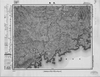
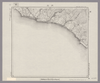
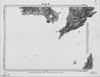
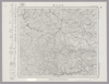
Image from the Map Collections courtesy Stanford University Libraries, licensed under a Creative Commons Attribution-Noncommercial 3.0 Unported License. © Stanford University. 【図幅名】 長崎 【測量時期】 明治34年測図/大正13年修正/昭和7年鉄道補入、測図の縮図 【発行時期】 昭和21年10月発行 【記号】 長崎4号(共15面) 【測量機関】 内務省地理調査所 【備考】
Links: Source / Biblio Ref
|
about 4 years ago | 4 control points | |
|
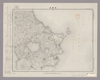
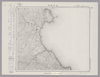
Image from the Map Collections courtesy Stanford University Libraries, licensed under a Creative Commons Attribution-Noncommercial 3.0 Unported License. © Stanford University. 【図幅名】 三重 【測量時期】 明治34年測図/大正13年修正/昭和20年部分修正 【発行時期】 昭和23年2月発行 【記号】 長崎8号(共15面) 【測量機関】 地理調査所 【備考】 仮製版
Links: Source / Biblio Ref
|
about 4 years ago | 4 control points | |
|
shelfmark: Maps 197.d.42
License: Public Domain
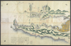
延享2 *手彩色。Modyによれば図題は「新刊長崎之図」。(刊記)延享二乙丑歳仲秋吉旦/応林□育之□作図/八_堂主人/御絵図所林治左衛門開板/文化五戊辰年岩崎氏求板/京都書林吉田屋佐兵衛」(下線部は入れ木)。 Xylograph. Acquired 22 July 1868. Ex-Siebold. Beans 1.33, Mody, plate 38.
Links: Source / Biblio Ref
|
over 4 years ago | Unrectified | |
|
shelfmark: Maps 63055.3
License: Public Domain
慶応2 *多色刷り。外題「(瓊浦)居留場絵図」。(刊記書肆)版元/長崎本石灰町、鄰華堂。蔵書印「長崎/西古川町中島氏」。 Manuscript, early 19th century. Acquired 22 July 1868. Ex-Siebold.
Links: Source / Biblio Ref
|
1866 | over 4 years ago | Unrectified |
|
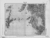
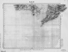
Image from the Map Collections courtesy Stanford University Libraries, licensed under a Creative Commons Attribution-Noncommercial 3.0 Unported License. © Stanford University.
Links: Source / Biblio Ref
|
over 6 years ago | 4 control points | |
|
shelfmark: 16084.d.1
License: Public Domain
幕末写 *大浦の築地に「異國舘」とあり。
Links: Source / Biblio Ref
|
over 4 years ago | Unrectified | |
|
shelfmark: Or.75.g.25
License: Public Domain
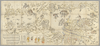
江戸前期刊 *ケンペル旧蔵。 *無刊記。ケンペル自筆書入あり。 Xylograph; Gardner, #565; Mody, plate 26??? five people at bottom middle, then at left Nagasaki chosu, then at left again Nihon yori ikoku e Mody's title is Nagasaki oezu
Links: Source / Biblio Ref
|
over 4 years ago | Unrectified | |
|
shelfmark: Maps *63405.6
License: Public Domain
幕末 *図中に朱筆「イギリス/魯船_場」とあり。 Manuscript, mid 19th century. Acquired November 2000.
Links: Source / Biblio Ref
|
over 4 years ago | Unrectified | |
|
shelfmark: Maps *63135.4
License: Public Domain
江戸後期写 *手彩色。記載事項なし。城郭のみ。大英図書館蔵『長門府中』(Maps *63100.12)と同筆。
Links: Source / Biblio Ref
|
over 4 years ago | Unrectified | |
|
Image from the Map Collections courtesy Stanford University Libraries, licensed under a Creative Commons Attribution-Noncommercial 3.0 Unported License. © Stanford University. 【図幅名】 長沼 【測量時期】 明治42年測図/昭和4年修正/昭和7年測図の縮図 【発行時期】 【記号】 白河13号(共17面) 【測量機関】 参謀本部 【備考】 秘
Links: Source / Biblio Ref
|
about 2 years ago | 4 control points | |
|
Image from the Map Collections courtesy Stanford University Libraries, licensed under a Creative Commons Attribution-Noncommercial 3.0 Unported License. © Stanford University. 【図幅名】 近江長浜 【測量時期】 明治39年測図/大正9年修正 【発行時期】 大正12年11月発行 【記号】 岐阜12号(共16面) 【測量機関】 大日本帝国陸地測量部 【備考】 (In 1 layer)
Links: Source / Biblio Ref
|
about 2 months ago | 4 control points | |
|
この地図の作成に当たっては、国土地理院長の承認を得て、同院発行の20万分の1地勢図及び5万分の1地形図を使用した。(承認番号 平30情使、 第1148号)
Links: Source / Biblio Ref
|
1947 | over 5 years ago | 4 control points |
|
【最初期発行】 この地図の作成に当たっては、国土地理院長の承認を得て、同院発行の20万分の1地勢図及び5万分の1地形図を使用した。(承認番号 平30情使、 第1148号) (In 1 layer)
Links: Source / Biblio Ref
|
1920 | almost 4 years ago | 4 control points |
|
Image from the Map Collections courtesy Stanford University Libraries, licensed under a Creative Commons Attribution-Noncommercial 3.0 Unported License. © Stanford University. 【図幅名】 長野 【測量時期】 大正1年測図/昭和12年第2回修正 【発行時期】 【記号】 長野13号 【測量機関】 参謀本部 【備考】 秘
Links: Source / Biblio Ref
|
about 2 years ago | 4 control points | |
|
shelfmark: Maps 149.e.249
License: Public Domain
江戸後期写 Manuscript, early 19th century. Acquired 22 July 1868. Ex-Siebold.
Links: Source / Biblio Ref
|
over 4 years ago | Unrectified | |
|
Image from the Map Collections courtesy Stanford University Libraries, licensed under a Creative Commons Attribution-Noncommercial 3.0 Unported License. © Stanford University. 【図幅名】 長門峡 【測量時期】 明治32年測図/昭和2年修正 【発行時期】 昭和6年7月発行 【記号】 山口7号(共15面) 【測量機関】 大日本帝国陸地測量部 【備考】
Links: Source / Biblio Ref
|
about 2 years ago | 4 control points | |
|
shelfmark: Maps *63100.12
License: Public Domain
江戸後期 *手彩色。記載事項は「籠」「宮」「寺」「正八幡」のみ。大英図書館蔵『長州萩』(Maps *63135.4)と同筆。 Xylograph.
Links: Source / Biblio Ref
|
over 4 years ago | Unrectified | |
|
Image from the Map Collections courtesy Stanford University Libraries, licensed under a Creative Commons Attribution-Noncommercial 3.0 Unported License. © Stanford University. 【図幅名】 門 【測量時期】 大正3年測図 【発行時期】 大正6年3月発行 【記号】 盛岡5号(共18面) 【測量機関】 大日本帝国陸地測量部 【備考】
Links: Source / Biblio Ref
|
about 2 years ago | 4 control points | |
|
Image from the Map Collections courtesy Stanford University Libraries, licensed under a Creative Commons Attribution-Noncommercial 3.0 Unported License. © Stanford University. 【図幅名】 門別 【測量時期】 大正8年測圖/昭和3年鐡道補入 【発行時期】 【記号】 浦河十四号 【測量機関】 参謀本部 【備考】 祕 (In 1 layer)
Links: Source / Biblio Ref
|
about 2 years ago | 4 control points | |
|
【最初期発行】 この地図の作成に当たっては、国土地理院長の承認を得て、同院発行の20万分の1地勢図及び5万分の1地形図を使用した。(承認番号 平30情使、 第1148号)
Links: Source / Biblio Ref
|
1912 | over 5 years ago | 4 control points |
|
この地図の作成に当たっては、国土地理院長の承認を得て、同院発行の20万分の1地勢図及び5万分の1地形図を使用した。(承認番号 平30情使、 第1148号)
Links: Source / Biblio Ref
|
1947 | over 5 years ago | 4 control points |
|
Image from the Map Collections courtesy Stanford University Libraries, licensed under a Creative Commons Attribution-Noncommercial 3.0 Unported License. © Stanford University. 【図幅名】 開聞岳 【測量時期】 明治34年測圖/昭和7年要部修正測圖/昭和10年部分修正測圖 【発行時期】 【記号】 開聞岳五号 【測量機関】 参謀本部 【備考】 祕
Links: Source / Biblio Ref
|
about 4 years ago | 4 control points | |
|
Image from the Map Collections courtesy Stanford University Libraries, licensed under a Creative Commons Attribution-Noncommercial 3.0 Unported License. © Stanford University. 【図幅名】 関 【測量時期】 明治41年測図/昭和6年要部修正 【発行時期】 昭和8年1月発行 【記号】 福島9号(共18面) 【測量機関】 大日本帝国陸地測量部 【備考】
Links: Source / Biblio Ref
|
about 2 years ago | 4 control points | |
|
Image from the Map Collections courtesy Stanford University Libraries, licensed under a Creative Commons Attribution-Noncommercial 3.0 Unported License. © Stanford University. 【図幅名】 関山峠 【測量時期】 明治34年測図/昭和6年修正 【発行時期】 昭和7年2月発行 【記号】 仙台6号(共16面) 【測量機関】 大日本帝国陸地測量部 【備考】
Links: Source / Biblio Ref
|
about 2 years ago | 4 control points | |
|
shelfmark: Maps 962.6
License: Public Domain
文化5 *二色刷り。無刊記。 Xylograph. Acquired 22 July 1868. Ex-Siebold.
Links: Source / Biblio Ref
|
1808 | over 4 years ago | Unrectified |

|
Image from the Map Collections courtesy Stanford University Libraries, licensed under a Creative Commons Attribution-Noncommercial 3.0 Unported License. © Stanford University. 【図幅名】 防府 【測量時期】 明治32年測図/昭和2年修正 【発行時期】 昭和13年7月発行 【記号】 山口8号(共15面) 【測量機関】 大日本帝国陸地測量部 【備考】
Links: Source / Biblio Ref
|
about 2 years ago | 4 control points | |
|
Image from the Map Collections courtesy Stanford University Libraries, licensed under a Creative Commons Attribution-Noncommercial 3.0 Unported License. © Stanford University. 【図幅名】 阿久根 【測量時期】 明治34年測圖/昭和7年要部修正測圖/昭和10年部分修正測圖 【発行時期】 昭和12年発行 【記号】 八代十六号 【測量機関】 大日本帝國陸地測量部 【備考】
Links: Source / Biblio Ref
|
about 4 years ago | 4 control points | |
|
Image from the Map Collections courtesy Stanford University Libraries, licensed under a Creative Commons Attribution-Noncommercial 3.0 Unported License. © Stanford University. 【図幅名】 阿仁合 【測量時期】 大正5年測図 【発行時期】 昭和16年4月発行 【記号】 秋田9号(共16面) 【測量機関】 大日本帝国陸地測量部 【備考】
Links: Source / Biblio Ref
|
about 2 years ago | 4 control points | |
|
Image from the Map Collections courtesy Stanford University Libraries, licensed under a Creative Commons Attribution-Noncommercial 3.0 Unported License. © Stanford University. 【図幅名】 舌幸 【測量時期】 大正10年測図/昭和3年鉄道補入 【発行時期】 昭和5年3月発行 【記号】 釧路14号(共12面) 【測量機関】 大日本帝国陸地測量部 【備考】 (In 1 layer)
Links: Source / Biblio Ref
|
about 2 years ago | 4 control points | |
|
この地図の作成に当たっては、国土地理院長の承認を得て、同院発行の20万分の1地勢図及び5万分の1地形図を使用した。(承認番号 平30情使、 第1148号)
Links: Source / Biblio Ref
|
1946 | over 5 years ago | 4 control points |
|
この地図の作成に当たっては、国土地理院長の承認を得て、同院発行の20万分の1地勢図及び5万分の1地形図を使用した。(承認番号 平30情使、 第1148号)
Links: Source / Biblio Ref
|
1946 | over 5 years ago | 4 control points |
|
Image from the Map Collections courtesy Stanford University Libraries, licensed under a Creative Commons Attribution-Noncommercial 3.0 Unported License. © Stanford University. 【図幅名】 阿波富岡 【測量時期】 明治40年測図/昭和9年第2回修正、測図の縮図 【発行時期】 【記号】 剣山5号(共11面) 【測量機関】 陸地測量部 【備考】 秘
Links: Source / Biblio Ref
|
about 2 years ago | 4 control points | |
|
この地図の作成に当たっては、国土地理院長の承認を得て、同院発行の20万分の1地勢図及び5万分の1地形図を使用した。(承認番号 平30情使、 第1148号)
Links: Source / Biblio Ref
|
1947 | over 5 years ago | 4 control points |
|
Image from the Map Collections courtesy Stanford University Libraries, licensed under a Creative Commons Attribution-Noncommercial 3.0 Unported License. © Stanford University. 【図幅名】 阿蘇山 【測量時期】 明治35年測圖/昭和7年第二回修正測圖 【発行時期】 【記号】 大分十五号 【測量機関】 参謀本部 【備考】 祕
Links: Source / Biblio Ref
|
about 4 years ago | 4 control points | |
|
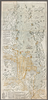
Image from the Map Collections courtesy Stanford University Libraries, licensed under a Creative Commons Attribution-Noncommercial 3.0 Unported License. © Stanford University.
Links: Source / Biblio Ref
|
over 6 years ago | 4 control points | |
|
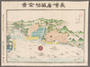
Image from the Map Collections courtesy Stanford University Libraries. This item is in the public domain. There are no restrictions on use.
【図幅名】 阿頼度嶋北部【測量時期】 大正2年測圖 【発行時期】大正13年 【記号】 千島列島十一号 【測量機関】 参謀本部 【その他】千島列島 陸地測量部 (In 1 layer)
Links: Source / Biblio Ref
|
1924 | over 1 year ago | 5 control points |
|
Image from the Map Collections courtesy Stanford University Libraries. This item is in the public domain. There are no restrictions on use.
【図幅名】 阿頼度嶋南部【測量時期】 大正2年測圖 【発行時期】大正13年 【記号】 阿頼度嶋八号【測量機関】 参謀本部 【その他】千島列島 陸地測量部 (In 1 layer)
Links: Source / Biblio Ref
|
1924 | over 1 year ago | 4 control points |
|
Image from the Map Collections courtesy Stanford University Libraries, licensed under a Creative Commons Attribution-Noncommercial 3.0 Unported License. © Stanford University. 【図幅名】 陸中大原 【測量時期】 大正2年測図/昭和8年修正 【発行時期】 昭和11年3月発行 【記号】 一関10号(共14面) 【測量機関】 大日本帝国陸地測量部 【備考】
Links: Source / Biblio Ref
|
about 2 years ago | 4 control points | |
|
Image from the Map Collections courtesy Stanford University Libraries, licensed under a Creative Commons Attribution-Noncommercial 3.0 Unported License. © Stanford University. 【図幅名】 階上岳 【測量時期】 大正3年測図/大正14年鉄道補入 【発行時期】 昭和2年1月発行 【記号】 八戸6号(共15面) 【測量機関】 大日本帝国陸地測量部 【備考】
Links: Source / Biblio Ref
|
about 2 years ago | 4 control points | |
|
Image from the Map Collections courtesy Stanford University Libraries, licensed under a Creative Commons Attribution-Noncommercial 3.0 Unported License. © Stanford University. 【図幅名】 陸中野田 【測量時期】 大正3年測図 【発行時期】 大正6年4月発行 【記号】 八戸4号(共15面) 【測量機関】 大日本帝国陸地測量部 【備考】
Links: Source / Biblio Ref
|
about 2 years ago | 4 control points | |
|
Image from the Map Collections courtesy Stanford University Libraries, licensed under a Creative Commons Attribution-Noncommercial 3.0 Unported License. © Stanford University. 【図幅名】 陸中関 【測量時期】 大正3年測図 【発行時期】 大正6年5月発行 【記号】 八戸8号(共15面) 【測量機関】 大日本帝国陸地測量部 【備考】
Links: Source / Biblio Ref
|
about 2 years ago | 4 control points | |
|
この地図の作成に当たっては、国土地理院長の承認を得て、同院発行の20万分の1地勢図及び5万分の1地形図を使用した。(承認番号 平30情使、 第1148号)
Links: Source / Biblio Ref
|
1946 | over 5 years ago | 4 control points |
|
shelfmark: Maps 629872
License: Public Domain
幕末刊 *無刊記。多色刷り。外題「(陸奥出羽)国郡行程全図(付越後半国)」。 Xylograph. Acquired 20 December 1878.
Links: Source / Biblio Ref
|
over 4 years ago | Unrectified | |
|
shelfmark: 16114.d.18
License: Public Domain
幕末刊 *無刊記。多色刷り。外題「(陸奥出羽)国郡行程全図(付越後半国)」。 Xylograph. Kawase p. 206.
Links: Source / Biblio Ref
|
over 4 years ago | Unrectified | |
|
この地図の作成に当たっては、国土地理院長の承認を得て、同院発行の20万分の1地勢図及び5万分の1地形図を使用した。(承認番号 平30情使、 第1148号)
Links: Source / Biblio Ref
|
1946 | over 5 years ago | 4 control points |
|
Image from the Map Collections courtesy Stanford University Libraries, licensed under a Creative Commons Attribution-Noncommercial 3.0 Unported License. © Stanford University. 【図幅名】 陸奥横浜 【測量時期】 大正3年測図/大正14年鉄道補入 【発行時期】 【記号】 辺地10号(共5面) 【測量機関】 大日本帝国陸地測量部 【備考】
Links: Source / Biblio Ref
|
over 5 years ago | 4 control points |