Browse Maps
| map | Title | Year | Last Updated | Status  |
|---|---|---|---|---|
|
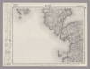
Image from the Map Collections courtesy Stanford University Libraries, licensed under a Creative Commons Attribution-Noncommercial 3.0 Unported License. © Stanford University.
Links: Source / Biblio Ref
|
over 6 years ago | 4 control points | |
|
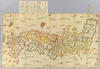
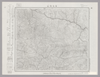
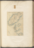
【Courtesy of the C. V. Starr East Asian Library University of California, Berkeley】 1 map : hand col. ; 61 x 109 cm., folded to 17 x 15 cm., in envelope 31 x 21 cm. Wood block print. In Japanese. Covers Matsumae to Tsushima, Iojima, Ryukyu, and Hachijojima. Title added by hand. Shows distance of sea routes. Includes legend. East Asian Library call number Ca_21.
Links: Source / Biblio Ref
|
1730 | over 3 years ago | 5 control points |
|
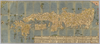
Image from the Map Collections courtesy Stanford University Libraries, licensed under a Creative Commons Attribution-Noncommercial 3.0 Unported License. © Stanford University. 【図幅名】 二神島 【測量時期】 大正12年測図の縮図/昭和10年修正、測図の縮図 【発行時期】 昭和21年11月発行 【記号】 唐津7号(共8面) 【測量機関】 内務省地理調査所 【備考】
Links: Source / Biblio Ref
|
30 days ago | 4 control points | |
|
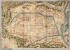
【Courtesy of the C. V. Starr East Asian Library University of California, Berkeley】 1 map: hand col.; on sheet 71 x 163 cm., folded in cover 24 x 14 cm. Mounted cover title. Wood block print. In Japanese. Covers Matsumae to Tsushima and Ryukyu. Includes text and legend. Shows the distance of sea routes. Alternate Title: Nihonkoku oezu. East Asian Library call number Ca 43.
Links: Source / Biblio Ref
|
1685 | over 3 years ago | 5 control points |
|
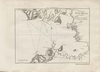
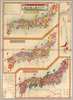
【Courtesy of the C. V. Starr East Asian Library University of California, Berkeley】 Col. map.
Links: Source / Biblio Ref
|
1895 | over 3 years ago | 4 control points |
|
【Courtesy of the C. V. Starr East Asian Library University of California, Berkeley】 1 map : col. ; 107 x 72 cm., folded in cover 28 x 14 cm. In Japanese. Relief shown by hachures. Shows distance of sea routes. Includes 10 insets and legend. East Asian Library call number Bc 22.
Links: Source / Biblio Ref
|
1910 | over 3 years ago | 4 control points |
|
【Courtesy of the C. V. Starr East Asian Library University of California, Berkeley】 Col. map.
Links: Source / Biblio Ref
|
1895 | over 3 years ago | 4 control points |
|
【Courtesy of the C. V. Starr East Asian Library University of California, Berkeley】 1 map : hand col. ; 60 x 107 cm., folded in cover 21 x 15 cm. Notes Mounted cover title. Wood block print. In Japanese. Covers Matsumae to Tsushima, Tojima, Ryukyu, and Hachijojima. Shows distance of sea routes. Includes legend. East Asian Library call number Ca 19.
Links: Source / Biblio Ref
|
1730 | over 3 years ago | 5 control points |
|
Image from the Map Collections courtesy Stanford University Libraries, licensed under a Creative Commons Attribution-Noncommercial 3.0 Unported License. © Stanford University. 【図幅名】 魚島 【測量時期】 明治31年測図 【発行時期】 明治36年12月発行 【記号】 岡山及丸亀11号(共16面) 【測量機関】 大日本帝国陸地測量部 【備考】
Links: Source / Biblio Ref
|
30 days ago | 4 control points | |
|
【Courtesy of the C. V. Starr East Asian Library University of California, Berkeley】 Description 1 map : col. ; on sheet 86 x 136 cm., folded in cover 29 x 17 cm. Mounted cover title. Wood block print. In Japanese. Oriented with north to the upper right. Preface by Shiba Ritsuzan. Engraved by Inoue Jihe. Covers Matsumae to Tsushima, and Okinoerabujima. Shows latitude and longitude, distance of sea routes, and Kuroshio. Includes legend and text by the author. East Asian Library call number Ca 29.
Links: Source / Biblio Ref
|
1840 | over 3 years ago | 5 control points |
|
|
1918 | over 3 years ago | 3 control points |
|
Links: Source / Biblio Ref
|
2020 | over 1 year ago | 10 control points |
|
Image from the Map Collections courtesy Stanford University Libraries, licensed under a Creative Commons Attribution-Noncommercial 3.0 Unported License. © Stanford University. 【図幅名】 幾春別岳 【測量時期】 大正8年測圖 【発行時期】 【記号】 夕張岳十三号 【測量機関】 参謀本部 【備考】 祕 (In 1 layer)
Links: Source / Biblio Ref
|
over 2 years ago | 4 control points | |
|
この地図の作成に当たっては、国土地理院長の承認を得て、同院発行の20万分の1地勢図及び5万分の1地形図を使用した。(承認番号 平30情使、 第1148号)
Links: Source / Biblio Ref
|
1948 | 30 days ago | 4 control points |
|
【Courtesy of the C. V. Starr East Asian Library University of California, Berkeley】 Japanese date Hōei 7 1710. In color. Folded. Wood block print. In Japanese. Relief shown pictorially. Includes distance chart and index.
Links: Source / Biblio Ref
|
1710 | over 3 years ago | 4 control points |
|
Links: Source / Biblio Ref
|
2021 | almost 3 years ago | 9 control points |
|
Image from the Map Collections courtesy Stanford University Libraries, licensed under a Creative Commons Attribution-Noncommercial 3.0 Unported License. © Stanford University. 【図幅名】 上支湧別 【測量時期】 大正10年及大正13年測圖 【発行時期】 【記号】 陸別十四号 【測量機関】 参謀本部 【備考】 祕 假製版 (In 1 layer)
Links: Source / Biblio Ref
|
over 2 years ago | 4 control points | |
|
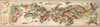
【Courtesy of the C. V. Starr East Asian Library University of California, Berkeley】 1 map : hand col. ; 85 x 140 cm., folded to 29 x 17 cm. Mounted cover title. Wood block print. In Japanese. Covers Matsumae to Tsushima, Yakushima, and Hachijojima. Oriented with north to the upper right. Preface by Shibano Ritsuzan. Engraved by Inoue Jihe. Shows longitude and latitude. Includes legend, distance chart of sea routes, and explanation of Kuroshio and tides. East Asian Library call number Ca 17.1.
Links: Source / Biblio Ref
|
1811 | over 3 years ago | 5 control points |
|
Links: Source / Biblio Ref
|
2020 | almost 2 years ago | 10 control points |
|
【Courtesy of the C. V. Starr East Asian Library University of California, Berkeley】 Japanese date Meiji 36 1903. Folded. Title on envelope: Eibun Kyōto jissoku shinchizu = Kyoto new atlas. In Japanese and English. Oriented with north to the upper right. Relief shown by hachures. Includes legend.
Links: Source / Biblio Ref
|
1903 | over 3 years ago | 4 control points |
|
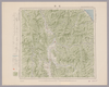
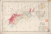
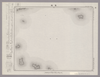
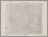
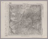
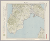
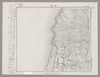
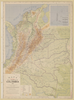
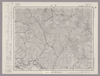
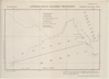
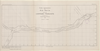
Image from the Map Collections courtesy Stanford University Libraries, licensed under a Creative Commons Attribution-Noncommercial 3.0 Unported License. © Stanford University.
Links: Source / Biblio Ref
|
over 6 years ago | 4 control points | |
|
Links: Source / Biblio Ref
|
2020 | almost 3 years ago | 4 control points |
|
Links: Source / Biblio Ref
|
2020 | over 3 years ago | 20 control points |
|
【Courtesy of the C. V. Starr East Asian Library University of California, Berkeley】 Mounted cover title. Copperplate print. In Japanese. Orientation varies. Relief shown pictorially. Includes 2 insets, list of capitals and legend. Hand tinted in color. Folded to 19 x 8 cm.
Links: Source / Biblio Ref
|
1888 | over 3 years ago | 5 control points |
|
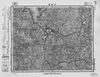
Image from the Map Collections courtesy Stanford University Libraries, licensed under a Creative Commons Attribution-Noncommercial 3.0 Unported License. © Stanford University. 【図幅名】 吹浦 【測量時期】 大正2年測図/昭和9年修正 【発行時期】 昭和11年9月発行 【記号】 酒田2号(共6面) 【測量機関】 大日本帝国陸地測量部 【備考】
Links: Source / Biblio Ref
|
about 2 months ago | 4 control points | |
|
【Courtesy of the C. V. Starr East Asian Library University of California, Berkeley】 1 map : col. ; 101 x 183 cm., folded to 27 x 19 cm. Title added by hand. Wood block print. In Japanese. Oriented with north to the upper right. Covers Matsumae to Okinoerabujima, Tsushima and Ogasawara. Shows the distance of sea routes and Kuroshio. Includes legend. Alternate Title: Dai Nihon kokugun yochi rotei zenzu. East Asian Library call number Ca 34.
Links: Source / Biblio Ref
|
1852 | over 3 years ago | 5 control points |
|
Image from the Map Collections courtesy Stanford University Libraries, licensed under a Creative Commons Attribution-Noncommercial 3.0 Unported License. © Stanford University. 【図幅名】 阿久根 【測量時期】 明治34年測圖/昭和7年要部修正測圖/昭和10年部分修正測圖 【発行時期】 昭和12年発行 【記号】 八代十六号 【測量機関】 大日本帝國陸地測量部 【備考】
Links: Source / Biblio Ref
|
23 days ago | 4 control points | |
|
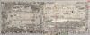
【Courtesy of the C. V. Starr East Asian Library University of California, Berkeley】 Japanese date Meiji 28 1895. In color. Folded. Title on envelope: Kaisei jissoku Dai Nihon shinchizu : fu shinryōchi Taiwan chizu. In Japanese. Oriented with north to the upper right. Relief shown by hachures. Includes 6 insets: Manshū Shinkoku.--Hokkaidō.--Shinryōchi Taiwan zenzu ... et al.. Includes list of district names, charts of mountains and rivers, and legend. Shows sea routes with distances.
Links: Source / Biblio Ref
|
1895 | over 3 years ago | 4 control points |
|
Links: Source / Biblio Ref
|
2021 | almost 2 years ago | 12 control points |
|
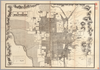
【Courtesy of the C. V. Starr East Asian Library University of California, Berkeley】 Japanese date Genroku 3 1690 estimated. Folded. Mounted cover title. Wood block print. In Japanese. Relief shown pictorially. Includes index. Title on map :Shinpan Heianjō narabini Rakugai no zu. Copyright by Honʼya Riemon.
Links: Source / Biblio Ref
|
1690 | over 3 years ago | 4 control points |
|
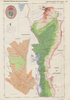
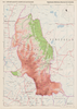
【Courtesy of the C. V. Starr East Asian Library University of California, Berkeley】 1 map : col. ; 116 x 73 cm., folded in cover 21 x 21 cm. In Japanese. Relief shown by contours and spot heights. Includes 1 inset and legend. East Asian Library call number: Cb132.2.
Links: Source / Biblio Ref
|
1890 | over 3 years ago | 4 control points |
|
【Courtesy of the C. V. Starr East Asian Library University of California, Berkeley】 Japanese date Meiji 34 1901. In color. Folded. Lithograph. In Japanese. Relief shown by hachures and pictorially. 2 insets: Kyōto-fu Yamashiro Fushimi-chō; Shiga-ken Ōmi Ōtsu-shi. Includes legend.
Links: Source / Biblio Ref
|
1901 | over 3 years ago | 4 control points |
|
Image from the Map Collections courtesy Stanford University Libraries, licensed under a Creative Commons Attribution-Noncommercial 3.0 Unported License. © Stanford University. 【図幅名】 速池峰山 【測量時期】 大正5年測図/昭和6年鉄道補入 【発行時期】 昭和8年1月発行 【記号】 盛岡11号(共18面) 【測量機関】 大日本帝国陸地測量部 【備考】
Links: Source / Biblio Ref
|
over 2 years ago | 4 control points | |
|
【Courtesy of the C. V. Starr East Asian Library University of California, Berkeley】 Japanese date Bunkyū 3 1863. Folded. Mounted cover title. Wood block print. Oriented with north to the left. In Japanese. Relief shown pictorially. Includes legend. Engraved by Nakamura Katsunosuke.
Links: Source / Biblio Ref
|
1863 | over 3 years ago | 4 control points |
|
Links: Source / Biblio Ref
|
1936 | over 3 years ago | 5 control points |
|
この地図の作成に当たっては、国土地理院長の承認を得て、同院発行の20万分の1地勢図及び5万分の1地形図を使用した。(承認番号 平30情使、 第1148号)
Links: Source / Biblio Ref
|
1953 | over 5 years ago | 4 control points |
|
Image from the Map Collections courtesy Stanford University Libraries, licensed under a Creative Commons Attribution-Noncommercial 3.0 Unported License. © Stanford University. 【図幅名】 吉井 【測量時期】 明治33年測圖/昭和11年修正測圖 【発行時期】 昭和13年発行 【記号】 小倉四号 【測量機関】 大日本帝國陸地測量部 【備考】
Links: Source / Biblio Ref
|
15 days ago | 4 control points | |
|
【Courtesy of the C. V. Starr East Asian Library University of California, Berkeley】 Japanese date Tenmei 7 1787. In color. Folded. Mounted cover title. Wood block print. In Japanese. Oriented with north to the right. Relief shown pictorially. Includes legend. Shows the western part of Lake Biwa.
Links: Source / Biblio Ref
|
1878 | over 3 years ago | 4 control points |
|
|
1854 | over 6 years ago | 4 control points |
|
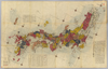
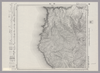
【Courtesy of the C. V. Starr East Asian Library University of California, Berkeley】 Japanese date Meiji 10 1877. In color. Folded. 3 maps on one sheet.Copperplate print. In Japanese. Oriented with north to the upper right. Relief shown by hachures. Contents: Kokugun kubunzu ; Fuken kankatsu saibansho kukaizu ; Zenkoku chimei sansen meisaizu. 2 insets: Ryūkyū Shotō zu ; Ogasawara zentō zu. 1 ancillary map: Hokkaidō oyobi Chishima Zentō zu. Includes charts of mountains and rivers , preface and legend.
Links: Source / Biblio Ref
|
1877 | over 3 years ago | 4 control points |
|
|
10 months ago | 19 control points | |
|
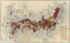
【Courtesy of the C. V. Starr East Asian Library University of California, Berkeley】 Japanese date Meiji 31 1898. In color. Folded. In Japanese. Oriented with north to the upper right. Shows distances of roads and sea routes. Includes 4 insets: Taiwan zenzu.--Hokkaidō.--Ogasawarajima Guntō ... et al. Includes legend.
Links: Source / Biblio Ref
|
1898 | over 3 years ago | 4 control points |
|
Image from the Map Collections courtesy Stanford University Libraries, licensed under a Creative Commons Attribution-Noncommercial 3.0 Unported License. © Stanford University. 【図幅名】 余別 【測量時期】 大正6年測図 【発行時期】 大正8年2月発行 【記号】 岩内9号(共15面) 【測量機関】 大日本帝国陸地測量部 【備考】 (In 1 layer)
Links: Source / Biblio Ref
|
about 2 months ago | 4 control points | |
|
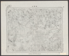
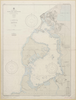
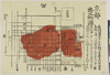
shelfmark: Maps 149.e.220
License: Public Domain
江戸後期写 Manuscript, early 19th century. Acquired 22 July 1868. Ex-Siebold.
Links: Source / Biblio Ref
|
over 3 years ago | 12 control points | |
|
|
1924 | 10 months ago | 5 control points |
|
【Courtesy of the C. V. Starr East Asian Library University of California, Berkeley】 Japanese date Meiji 19 1886. In color. Folded. Copperplate print. In Japanese. Oriented with north to the upper right. Relief shown by hachures. Shows distances of roads. 3 insets: Hokkaidō ; Ryūkyū Chūhokubu Shotō ; Ryūkyū Nanbu Shotō. Includes legend.
Links: Source / Biblio Ref
|
1886 | over 3 years ago | 5 control points |
|
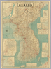
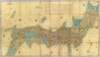
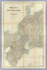
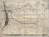
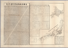
Image from the Map Collections courtesy Stanford University Libraries, licensed under a Creative Commons Attribution-Noncommercial 3.0 Unported License. © Stanford University.
Links: Source / Biblio Ref
|
over 6 years ago | 4 control points | |
|
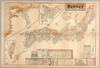
【Courtesy of the C. V. Starr East Asian Library University of California, Berkeley】 Japanese date Meiji 28 1895. Folded. Cover title. Copperplate print. In Japanese. Oriented with north to the left. Releif shown pictorially. Includes 1 ancillary map: Sosui senro oyobi Rakutō ichiranzu. Includes distance chart and legend. Shows treasures in a temple. Title on map: Kaisei shinkoku Kyōto shigai zenzu. Shows views of tourist attractions.
Links: Source / Biblio Ref
|
1985 | over 3 years ago | 4 control points |
|
(In 3 layers)
|
almost 7 years ago | 4 control points | |
|
【Courtesy of the C. V. Starr East Asian Library University of California, Berkeley】 Japanese date Meiji 23 1890. Folded. Copperplate print. In Japanese. Relief shown pictorially. Includes distance chart and legend. Shows views of tourist attractions.
Links: Source / Biblio Ref
|
1890 | over 3 years ago | 4 control points |